More From Contributor

£8.99
A collection of classic children`s stories from the world`s best-loved children`s author, Enid Blyton. School life has never been so splendid. Jolly hockey sticks! It`s the twins` first year at St Clare`s
- that means three terms of adventures in the same volume for the first time! The Twins at St Clare`s
- Pat & Isabel O` Sullivan plan to give everyone at their new school a few surprises. But it`s them who are in for a shock... The O` Sullivan Twins
- Pat & Isabel are determined to work hard this term. But it`s just so tempting to play a few tricks on Mam`zelle... Summer Term at St Clare`s. New girl Carlotta has a secret past! What will happen when sneaky Prudence tells the rest of the class? Watch out! There`s trouble at St Clare`s! Enid Blyton is arguably the most famous children`s author of all time, thanks to series such as The Wishing-Chair, The Faraway Tree-, The Mysteries, The Famous Five & The Secret Seven. Her school stories
- including the St Clare`s & Malory Towers series are the perfect books for girls who are experiencing their own adventure at school.


...
Archived Product
£12.99
This 100k (60 mile) walk was opened in 1996 & has rapidly increased in popularity. Visiting a number of places closely associated with St Cuthbert's life, the journey is full of historical interest & natural beauty. It can be tackled in its entirety, or sections can be walked separately, making an ideal day or weekend outing. Today's pilgrims link Melrose in the Scottish Borders with the Holy Island causeway at Beal. In the right conditions, the path across the sand here makes a superb finale to the walk. This completely revised edition of the Official Guide adds a new link to Berwick-upon-Tweed as an option at the end of the route. It is illustrated in full colour with photographs throughout & OS strip maps at the opening of each section. Full of information about the historical & natural features of the route, the guide also covers appropriate equipment for walkers, way-marking, car parking, accommodation & the Country Code. ...
Archived Product
£11.99
St Cuthbert`s Way, a 100km /62 miles trail from Melrose Abbey in the Scottish Borders to the Holy Island of Lindisfarne, presented by Rucksack Readers in handy A5 size, spiral-bound, waterproof guide with mapping at 1:100, 000. Coverage

Includes::
a high-level option over the Cheviot Hills. The guide provides general advice on when to go, availability of accommodation, etc, &

Includes::
notes on the region’s pilgrimages, history, habitats & wildlife, etc. Detailed route descriptions, arranged in daily stages, are preceded by a summary of each section of the route giving distance, terrain, grade, & availability of food & drink. The guide is illustrated with numerous colour photos. The guide shows the route highlighted on fold-out flap of the cover at 1:100, 000. The map has altitude colouring to show the topography & also indicates various facilities & places of interest. No geographical coordinates for GPS users are provided. To see other titles in this series please click on the series link.


...
Archived Product
£9.99
St Cuthbert`s Way runs from Melrose in the Scottish borders to Lindisfarne, Holy Isl&, off the coast of Northumberl&. This new Pilgrims` Companion presents information essential for walking the Way, a field guide to places of interest along the route, an introduction to St Cuthbert & his time, songs, meditations & stories together with ideas & resources for a contemporary pilgrimage experience. ...
Archived Product
£13.95
St. Cuthbert`s Way, a 100km / 62.5 mile route from Melrose in the Scottish Borders through the Northumberland National Park to the Holly Island of Lindisfarne, presented at 1:40, 000 on a GPS compatible, light, waterproof & tear-resistant map from Harvey Map Services. The route is shown on six panels, with additional small street plans of Melrose, Wooler & Holy Isl&. Map legend & the accompanying notes plus additional tourist information are also in French & German. Maps in the Harvey’s series covering Great Britain’s national trails & other long-distance footpaths are printed on light, waterproof & tear-resistant synthetic paper & cover the routes at 1:40, 000 or 1:60, 000. Topography is shown by contours at 15m intervals, with additional spot heights plus colouring and/or graphics to provide a very detailed picture of the terrain (boulder fields, scree, crags, etc) & vegetation / land use (pastures, moorl&, woodlands, etc). In Scotland peaks & hills classified as Munros, Corbetts & Donalds are marked. The overprint for the long-distance trail shows sections on local or main roads (highlighting danger points), on tracks, & on footpaths, indicating intermittent or not visible paths. The maps also show other right of way paths, including permissive paths & bridleways. Symbols indicate various facilities & accommodation options (including campsites & youth hostels), pubs & refreshments, food shops, banks, information points, etc, both along the route itself & in the nearby locations. All maps are GPS compatible, with the British National Grid overprinted on each panel. The maps also include useful contact details & general advice. To see other titles in this series please click on the series link. ...
Archived Product
£14.99
Map No. 157, St David's & Haverfordwest / Tyddewi a Hwlffordd 1818-1923 (3-map set), in the Cassini Historical Series of old Ordnance Survey mapping of England & Wales at 1:50, 000 in a format designed to offer a convenient comparison with the present day coverage from the OS, & most locations in three different editions. Old historical maps have been combined so that the sheet lines correspond to the current Landranger series & reproduced with the scale changed from one inch to one mile to 1:50, 000. Most locations are covered by three separate maps, showing how the area has changed over the decades, with selected major cities also presented in a fourth edition. Old Series: the first detailed survey mapping dating for most areas from the first half of the 19th century, in black & white & with relief shown by hachuring. Revised New Series from 1880s/1900s, with some colouring & a mixture of hachuring & contour lines. Popular Edition from the inter-war years, with contour lines & colouring to indicate woodlands, parks, etc. New Popular Edition from the late 1940s, reproduced in the Cassini series for the major cities. Each map

Includes::
notes on the development of Ordnance Survey & the various series produced by them. For those interested in maps & cartography in general, the Cassini series also provides a fascinating insight into how Ordnance Survey cartographic style has developed over a period of over 100 years. Coverage in this title

Includes::
present day Pembroke/ Penfro, Milford Haven/ Aberdaugleddau, Goodwick/ Wdig, Fishguard/ Abergwaun, Scleddau, Mathry, Croes-goch, Hayscastle, Letterston, Wolf


...
Archived Product
£7.99
Map No. 157, St David's & Haverfordwest / Tyddewi a Hwlffordd 1922-1923, in the Cassini Historical Series of old Ordnance Survey mapping of England & Wales at 1:50, 000 in a format designed to offer a convenient comparison with the present day coverage from the OS, & most locations in three different editions. Old historical maps have been combined so that the sheet lines correspond to the current Landranger series & reproduced with the scale changed from one inch to one mile to 1:50, 000. Most locations are covered by three separate maps, showing how the area has changed over the decades, with selected major cities also presented in a fourth edition. Old Series: the first detailed survey mapping dating for most areas from the first half of the 19th century, in black & white & with relief shown by hachuring. Revised New Series from 1880s/1900s, with some colouring & a mixture of hachuring & contour lines. Popular Edition from the inter-war years, with contour lines & colouring to indicate woodlands, parks, etc. New Popular Edition from the late 1940s, reproduced in the Cassini series for the major cities. Each map

Includes::
notes on the development of Ordnance Survey & the various series produced by them. For those interested in maps & cartography in general, the Cassini series also provides a fascinating insight into how Ordnance Survey cartographic style has developed over a period of over 100 years. Coverage in this title

Includes::
present day Pembroke/ Penfro, Milford Haven/ Aberdaugleddau, Goodwick/ Wdig, Fishguard/ Abergwaun, Scleddau, Mathry, Croes-goch, Hayscastle, Letterston, Wolf


...
Archived Product
£10.39
Map No. 157, St David's & Haverfordwest / Tyddewi a Hwlffordd, in a waterproof & tear-resistant version of the Ordnance Survey Landranger series at 1:50, 000, including Pembroke/ Penfro, Milford Haven/ Aberdaugleddau, Goodwick/ Wdig, Fishguard/ Abergwaun, Scleddau, Mathry, Croes-goch, Hayscastle, Letterston, Wolf ...
Archived Product
£9.09
Map No. 157, St David's & Haverfordwest / Tyddewi a Hwlffordd, in the waterproof & tear-resistant OS Active version of the Ordnance Survey Landranger series at 1:50, 000, including Pembroke/ Penfro, Milford Haven/ Aberdaugleddau, Goodwick/ Wdig, Fishguard/ Abergwaun, Scleddau, Mathry, Croes-goch, Hayscastle, Letterston, Wolf ...
Archived Product
£14.99
Pembrokeshire Coast National Park between Pembroke in the south & Fishguard in the north including St Davids, & with coverage extending inland beyond Haverfordwest, on a waterproof & tear-resistant OS Active version of map No. 157 from the Ordnance Survey’s Landranger series at 1:50, 000, with contoured & GPS compatible topographic mapping plus tourist information.MOBILE DOWNLOADS: As well as the physical edition of the map, each Landranger title now

Includes::
a code for downloading after purchase its digital version onto your smartphone or tablet for viewing on the OS smartphone app.OS LANDRANGER SERIES: to see the list of all the titles in the OS Landranger series, both paper & waterproof versions, please click on the series link. Maps in the Landranger series provide plenty of recreational & tourist information, indicating the traditional public right of way paths (except in Scotland where different laws apply), including bridleways & byways restricted or open to motorized traffic. National Trails & selected other long-distance paths are marked, as well as on-road & traffic-free cycle routes with their National/ Regional Cycle Network numbers. National Trust/ National Trust for Scotland & Forestry Commission land is clearly marked, indicating open or restricted access. A range of symbols highlights camping & caravanning sites, youth hostels, tourist information offices & visitors’ centres, parking & picnicking places, World Heritage sites, sport & recreational facilities, etc. The maps provide detailed presentation of topography with contours at 10m intervals, numerous spot heights & additional colouring and/or graphics for different types of woodlands, orchards or parkl&, rock features including scree & cliffs, water features inland & along the sea shore with marshl&, dunes, s&, mud, shingle & the high water mark. All the standard information expected of survey mapping at this scale is included: finely graded road network, railway lines with stations, cuttings, embankments, etc; individual isolated buildings; archaeological & historical sites, etc. For GPS users the British National Grid is shown at 1km intervals, with latitude & longitude given by margin ticks at 1` & cross hairs on the map at 5`. Each map covers an area of 40 x 40km, (approx. 25 x 25 miles).

...
Archived Product

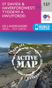
St David's And Haverfordwest / Tyddewi A Hwlffordd

Map No. 157, St David's and Haverfordwest / Tyddewi a Hwlffordd, in the Ordnance Survey Landranger series at 1:50, 000, including Pembroke/Penfro, Milford Haven/Aberdaugleddau, Goodwick/Wdig, Fishguard/Abergwaun, Scleddau, Mathry, Croes-goch, Hayscastle, Letterston, Wolf
RIP - This product is no longer available on our network. It was last seen on 25.09.2019

This page now acts as a permanent archive for this product. Add more information using the comments box below to ensure it can still be found by future generations.

Use our search facility to see if it is available from an alternative contributor.
  • Availability: Out Of Stock
  • Supplier: Stanfords
  • SKU: 9780319231036
Availability: In Stock
£5.59

Product Description

Map No. 157, St David's & Haverfordwest / Tyddewi a Hwlffordd, in the Ordnance Survey Landranger series at 1:50, 000, including Pembroke/ Penfro, Milford Haven/ Aberdaugleddau, Goodwick/ Wdig, Fishguard/ Abergwaun, Scleddau, Mathry, Croes-goch, Hayscastle, Letterston, Wolf

Reviews/Comments

Add New

Price History

Vouchers

No voucher codes found.
Do you know a voucher code for this product or supplier? Add it to Insights for others to use.

Facebook

Jargon Buster

Supplier Information

Stanfords
Stanfords was established in 1853 and opened their iconic Covent Garden flagship store in 1901. They have become the top retailer of maps, travel books and accessories in the UK and arguably offer the largest selection of maps and travel books worldwide. Famous names such as Captain Robert Falcon Scott, Ranulph Fiennes and Michael Palin have purchased from Stanfords. They now have a shop in Bristol and both stores together with other venues operate a calendar of events including talks, book signings and exhibitions. As a specialist map retailer, the map selection is comprehensive and includes road maps, street maps and walking maps from worldwide destinations, as well as a selection of world atlases and wall maps. Books include travel guides and travel literature. Stanfords also stock globes, from miniatures made of blue marble to magnificent floor-standing globes. The website features a selection of interesting articles on travel topics.
Page Updated: 2023-11-12 20:15:36

Community Generated Product Tags

Oh No! The productWIKI community hasn't generated any tags for this product yet!
Menu