More From Contributor
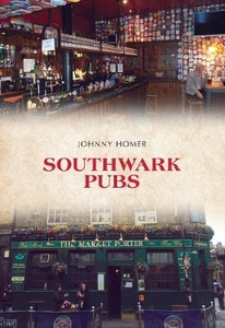
£3.50
Southport North in 1909 in a fascinating series of reproductions of old Ordnance Survey plans in the Alan Godfrey Editions, ideal for anyone interested in the history of their neighbourhood or family. The map covers the northern part of Southport, extending from Hesketh Park northward to Lytham Road, & from Lathom Road eastward to Manor Road. Features include Hesketh Golf Links, Marshside, Homeopathic cottage hospital, Chase Heys, Emmanuel church, Bank Nook, tramways, Rockley House Hydro, stretch of Southport-Preston railway, etc. Hesketh Park is the most dominant feature & there are many detached villas. A selection of street directory entries is on the reverse. About the Alan Godfrey Editions of the 25” OS Series: Selected towns in Great Britain & Ireland are covered by maps showing the extent of urban development in the last decades of the 19th & early 20th century. The plans have been taken from the Ordnance Survey mapping & reprinted at about 15 inches to one mile (1:4, 340). On the reverse most maps have historical notes & many also include extracts from contemporary directories. Most maps cover about one mile (1.6kms) north/south, one & a half miles (2.4kms) across; adjoining sheets can be combined to provide wider coverage.FOR MORE INFORMATION & A COMPLETE LIST OF ALL AVAILABLE TITLES PLEASE CLICK ON THE SERIES LINK. ...
Archived Product
£3.95
Southport Street Atlas at 1:15, 840 / 4 to a mile, in an indexed, glove box size paperback format, with national grid referencing. Street atlas covers Southport, Formby, Ormskirk, Skelmersdale, Ainsdale, Aughton, Burscough, Hightown, Ince Blundell, Up Holland & Woodvale. Motorways, A roads, B roads, dual carriageways, one way streets, pedestrianized/restricted access roads & car parks are shown. The run of street numbers on A & B roads is also indicated. Tracks & footpaths are mapped, as are selected cycleways, railways, stations, level crossings & rail bridges. Colour coding distinguishes land use, e.g. shopping centre, educational establishment or industrial building. Post offices, churches, tourist information centres & emergency services are located, as are public toilets with & without disabled access. Post town & postcode boundaries are demarcated & the atlas is indexed by street name & places of particular interest. Current edition of this atlas
- 2008
...
Archived Product
£4.50
Southport, Formby, Ormskirk & Skelmersdale Street Atlas from the Geographers` A-Z Map Company in a paperback format slightly smaller than A5. Map scale is 1:15, 840 (4” to a mile). Coverage

Includes::
Ainsdale, Aughton, Burscough, Hightown, Ince Blundell, Up Holland & Woodvale. Current edition of this title was published in 2012. To see other titles in this series of A-Z street atlases of towns & cities please click on the series link. A-Z also publish a series of County Street Atlases
- for a list of titles in that series please search for SI00000917.A-Z street atlases present motorways plus A & B roads highlighted by colouring & shown with route numbers. One way or restricted access streets & car parks are marked, as are in more recently published titles locations of speed cameras. Also shown are selected cycleway routes. Where appropriate, A & B roads are annotated with selected house numbers for easier identification of addresses. Railway lines are shown with stations & level crossings. Colouring indicates different types of buildings: educational, hospitals & healthcare, industrial, leisure & recreational, shopping centres & markets, public buildings, & places of interest. Symbols mark locations of facilities usually indicated on street mapping: post offices, emergency services, public toilets, etc. Also marked are postcode & local authority boundaries. Each page has the lines & coordinates of the British National Grid. The indexes list streets, places & areas, hospitals, industrial estates, blocks of flats on housing estates, railway stations, & selected places o interest; the latter are printed in contrasting colouring to make them easier to find.


...
Archived Product
£3.50
Southsea in 1896 in a fascinating series of reproductions of old Ordnance Survey plans in the Alan Godfrey Editions, ideal for anyone interested in the history of their neighbourhood or family. Portsmouth is covered by a block of six maps. This map is double-sided for maximum coverage. The main map covers most of Southsea with parts of Portsmouth. Coverage extends from Kings Terrace & Landport Terrace eastward to Highland Road Cemetery, & from Abingdon Road southward to Clarence Parade. Features include Havelock Ward, St Paul Ward, Southsea Branch railway with East Southsea station, tramways, St Jude`s church, St Bartholomew`s church, Havelock Park area, Jews Burial Ground, Craneswater Park area, St Paul`s church, etc. On the reverse is the adjacent sheet 83.16 extending coverage south to include South Parade Pier & Southsea Common. Also included are street directory entries for Clarence Parade, Clarence Road, Clarendon Road, Eldon Street, Elm Grove, Livingstone Road, Palmerston Road & South Parade. About the Alan Godfrey Editions of the 25” OS Series Selected towns in Great Britain & Ireland are covered by maps showing the extent of urban development in the last decades of the 19th & early 20th century. The plans have been taken from the Ordnance Survey mapping & reprinted at about 15 inches to one mile (1:4, 340). On the reverse most maps have historical notes & many also include extracts from contemporary directories. Most maps cover about one mile (1.6kms) north/south, one & a half miles (2.4kms) across; adjoining sheets can be combined to provide wider coverage.FOR MORE INFORMATION & A COMPLETE LIST OF ALL AVAILABLE TITLES PLEASE CLICK ON THE SERIES LINK. ...
Archived Product
£15.95
There has been a renaissance in Southwark. Once a part of London virtually unknown outside of its own population & enthusiasts for London's history, the daring Millennium Bridge, the new Globe Theatre & Tate Modern mean it is now thronged with visitors with a great deal to see. Southwark was the City for London's oldest suburb & home to essential industry. It was also the location of the flowering of English theatre with the opening of the Globe & Rose theatres, & it boasts a magnificent Cathedral, an ancient food market & a surviving galleried coaching inn. ...
Archived Product
£13.99
Southwest with the southern Rockies at 1:1, 000, 000 in a series of indexed touring road maps of USA from Hallwag, with each title conveniently covering a large region & providing enlargements of most visited areas, city maps & other useful tourist information. Enlargements cover the conurbations around Las Vegas, Phoenix, Tucson, Salt Lake City, Denver, El Paso & Albuquerque, plus maps of six national parks: Rocky Mountains, Grand Canyon, Zion, Bryce Canyon, Canyonlands & Arches. The map is part of Hallwag’s series covering USA at 1:1, 000, 000. The series has been revised from its earlier version & now uses cartography from Hema which provides an excellent combination of information about the terrain, the road network & places of interest. The base map has effective but unobtrusive relief shading with plenty of names of mountain ranges, peaks (heights in feet), deserts, etc. Colouring prominently highlights national or state parks, forests & other protected areas, as well as Indian Reservations & military zones. Road network clearly shows road numbers, indicates free & toll highways with locations of services, & gives driving distances on interstate & primary routes. The maps also show Amtrak railway lines with stations, local airports, state borders & time zone boundaries. An extensive range of symbols indicate various places of tourist interest. Each map is indexed & for GPS navigation has latitude & longitude lines drawn at 30’ intervals. Each title also

Includes::
enlargements of most visited areas – please see individual descriptions for more information – & useful tourist information such as metric conversion tables, traffic signs, phone numbers/websites for many organizations including recommended accommodations, etc. Map legends & all the text include English.

...
Archived Product
£11.99
Southwest Achterhoek on a waterproof, tear-resistant, GPS compatible walking map at 1:25, 000 from Trage Paden, in a series of maps with extensive overprint for long-distance & local walking routes. GPS waypoints & route profiles are available for download from the publisher’s website. Contours used in this map series vary between 2, 5 to 5m according to the terrain, with 5m interval predominantly used for hilly areas. Varied colouring show different types of landscape: woods, vineyards, fields etc. An overprint highlights both the national long-distance walking routes & the shorter local circular trails, each clearly identified by a code and/or an abbreviation of its name. Recommended starting points for walks are designated by a symbol. Cycle lanes are visibly marked with a bike symbol; roads with heavy traffic are clearly indicated. Symbols indicate various facilities, such as railway & bus stations, coffee shops, campsites, country restaurants/bars, sport & leisure facilities. Maps have the lines of the Dutch National Grid for measuring distances & for determining location using GPS device & they are printed on weather resistant & tear-resistant paper. Each map covers an area of Approx. 25 x 26 km & the map legend is in Dutch only. The map is presented in an elegant cardboard case. To see all the titles in this series please click on the series link. ...
Archived Product
£10.99
The southern part of the Canadian Rockies, including the Banff & Jasper National Parks on a touring map from Gem Trek, supplementing their more detailed hiking & recreational maps of this part of Canada. The map has a base showing the region’s network of rivers & lakes, with elevation indicated by peaks with their heights in feet. National parks & numerous provincial parks or other protected areas are highlighted, with additional colouring for glaciers. Road network

Includes::
gravel roads & indicates driving distances on main routes. Railway lines & local airports are also included. A range of symbols highlight campgrounds, lodges or chalets, guest ranches, sport & recreational facilities, & various tourist attractions. The map has latitude & longitude lines at intervals of 1°. Also provided is a distance table.

...
Archived Product
£7.99
A useful cross-border map for touring the area from Vancouver or Seattle. The map extends eastwards to just beyond the Colombia River (Nelson û Spokane) & south to Mt Rainer. Tourist information

Includes::
national & provincial parks, recreational facilities such as ski areas & golf courses, campgrounds, etc.

...
Archived Product
£15.99
Southwest China in the Countries, Regions & Cities series from Rough Guides; comprehensively detailed guidebooks specifically designed for independent travellers & serving a range of worldwide destinations. Widely recognised for their free editorial style, Rough Guide authors are allowed to express their personal opinions on a range of subjects. Although sometimes controversial, this editorial stance allows readers to experience more detailed & personal takes on each destination, a feature often more limited in other guidebooks. Cultural & historical nuances are explored in significant depth throughout the text & descriptions on the ambience of individual settings alongside personal recommendations, particularly in cities, are notably prevalent. Each Rough Guide in the Countries, Regions & Cities series has a similar layout. A ...
Archived Product

Southwark Pubs

Southwark is one of London`s oldest and most intriguing neighbourhoods; a hotbed of culture and commerce that has played a major part in the development of the capital. Its streets were familiar to Shakespeare and Dickens, both of whom surely drank, schemed and dreamed in the many inns and taverns that abounded. This is where Chaucer`s pilgrims began their long march to Canterbury, and many centuries later it was a major terminus for the many coaches that served the south of England. Four hundred years ago Londoners flocked to the area to watch the latest Shakespeare play at the Globe, or perhaps to visit one of the area`s numerous brothels. Bear-baiting and dogfighting were popular attractions, too.People still pour into the area, although these days in search of more innocent
pleasures such as high art at the Tate Modern, the foodie haven that is Borough Market or to catch a performance at the recreated Globe on Bankside. The one thing that has remained the same across the centuries is the diversity and quality of the area`s many pubs. Southwark Pubs offers an historical guide to some of the borough`s most fascinating hostelries, from London`s last surviving galleried coaching inn to the Thameside tavern that waved the Pilgrim Fathers off on their first voyage to America. There is a drop of liquid London history for the lover of ale and anecdote alike.
RIP - This product is no longer available on our network. It was last seen on 25.09.2019

This page now acts as a permanent archive for this product. Add more information using the comments box below to ensure it can still be found by future generations.

Use our search facility to see if it is available from an alternative contributor.
  • External links may include paid for promotion
  • Availability: Out Of Stock
  • Supplier: Stanfords
  • SKU: 9781445668185
Availability: In Stock
£14.99

Product Description

Southwark is one of London`s oldest & most intriguing neighbourhoods; a hotbed of culture & commerce that has played a major part in the development of the capital. Its streets were familiar to Shakespeare & Dickens, both of whom surely drank, schemed & dreamed in the many inns & taverns that abounded. This is where Chaucer`s pilgrims began their long march to Canterbury, & many centuries later it was a major terminus for the many coaches that served the south of Engl&. Four hundred years ago Londoners flocked to the area to watch the latest Shakespeare play at the Globe, or perhaps to visit one of the area`s numerous brothels. Bear-baiting & dogfighting were popular attractions, too. People still pour into the area, although these days in search of more innocent pleasures such as high art at the Tate Modern, the foodie haven that is Borough Market or to catch a performance at the recreated Globe on Bankside. The one thing that has remained the same across the centuries is the diversity & quality of the area`s many pubs. Southwark Pubs offers an historical guide to some of the borough`s most fascinating hostelries, from London`s last surviving galleried coaching inn to the Thameside tavern that waved the Pilgrim Fathers off on their first voyage to America. There is a drop of liquid London history for the lover of ale & anecdote alike.

Reviews/Comments

Add New

Intelligent Comparison

Oooops!
We couldn't find anything!
Perhaps this product's unique.... Or perhaps we are still looking for comparisons!
Click to bump this page and we'll hurry up.

Price History

Vouchers

No voucher codes found.
Do you know a voucher code for this product or supplier? Add it to Insights for others to use.

Facebook

Jargon Buster

Liquid - A state of matter - fluid form
Watch - A small clock designed to be worn on a person
England - A country within the United Kingdom.
History - Anything that happens in the past. An acedemic subject.
Quality - An object that has quality is superior in function and finish than a less quality object.
Popular - Something that is admired and liked by many people.
Performance - When someone is presenting a form of entertainment, also how well someone is doing within a role.

Supplier Information

Stanfords
Stanfords was established in 1853 and opened their iconic Covent Garden flagship store in 1901. They have become the top retailer of maps, travel books and accessories in the UK and arguably offer the largest selection of maps and travel books worldwide. Famous names such as Captain Robert Falcon Scott, Ranulph Fiennes and Michael Palin have purchased from Stanfords. They now have a shop in Bristol and both stores together with other venues operate a calendar of events including talks, book signings and exhibitions. As a specialist map retailer, the map selection is comprehensive and includes road maps, street maps and walking maps from worldwide destinations, as well as a selection of world atlases and wall maps. Books include travel guides and travel literature. Stanfords also stock globes, from miniatures made of blue marble to magnificent floor-standing globes. The website features a selection of interesting articles on travel topics.
Page Updated: 2023-11-12 20:15:36

Community Generated Product Tags

Oh No! The productWIKI community hasn't generated any tags for this product yet!
Menu