
 United Kingdom
 France
 Germany
 Netherlands
 Sweden
 USA
USA
 Italy
Italy
 Spain
Spain
More From Contributor


South West Coast Path
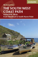
The South West Coast Path (SWCP) is Britain`s longest waymarked trail, measuring a staggering 630 miles (1015km), from Minehead on the Somerset Coast, right round Devon and Cornwall and back to Poole harbour in Dorset.Although the route is long, it is described step-by-step here and should be accessible for any well-prepared backpacker, with days varying from fairly easy to difficult and always dependent on the weather conditions, which can make cliff top walking dangerous.This epic route takes in Exmoor National Park, several designated Areas of Outstanding National Beauty and the Jurassic Coast World Heritage Site. No other stretch of coastline compares for scenic splendour, historical sites and availability of refreshments, accommodation and public transport, making it easy to
split the SWCP into week or weekend-long sections.Written by prolific outdoor writer Paddy Dillon, this guide provides a wealth of detailed knowledge to help tackle this immense route with confidence, with lots of information for planning a trek, including public transport links, accommodation and facilities along the way. Also described is the 17-mile South Dorset Ridgeway, from West Bexington to Osmington Mills, which can be used as a scenic way to shave 42 miles off the total distance.
split the SWCP into week or weekend-long sections.Written by prolific outdoor writer Paddy Dillon, this guide provides a wealth of detailed knowledge to help tackle this immense route with confidence, with lots of information for planning a trek, including public transport links, accommodation and facilities along the way. Also described is the 17-mile South Dorset Ridgeway, from West Bexington to Osmington Mills, which can be used as a scenic way to shave 42 miles off the total distance.

Product Description
Reviews/Comments
Add New
Vouchers
No voucher codes found.
Do you know a voucher code for this product or supplier? Add it to Insights for others to use.
Do you know a voucher code for this product or supplier? Add it to Insights for others to use.
 Denmark