More From Contributor
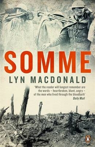
£7.99
This remarkable novel, winner of the Commonwealth Writers` Prize, tells the story of three women, each of them far from where they came, all of whom are still searching for somewhere that can be called home. Maysa returns to the house that was her grandparents` when she was a child, in a village high on the slopes of Mount Lebanon. Aida, who has long since left the country of her birth, returns in search of the Palestinian refugee who was a second father to her when she was a child. & Salwa, now an old woman, recalls her life from her hospital bed, surrounded by her family but still, in some sense, far from home. ...
Archived Product
£12.99
Somiedo Natural Park, a popular hiking area of the Cordillera Cantabrica lying between the two Camino de Santiago routes across northern Spain, presented on a hiking map at 1:60, 000 from Adrados Ediciones, with an enlargement at 1:30, 000 for its central part. The main map at 1:60, 000 is centred Approx. on Pola de Somiedo & covers the whole of the park, extending south to the route joining Villablino, Cabrillanes & San Emiliano. The map has contours at 40m intervals with altitude colouring & relief sharing. Numerous peaks & other topographical features are named. Hiking routes are highlighted & symbols mark campsites, mountain refuges, viewpoints, climbing areas & locations of petrol stations. On the reverse the central part of the park is shown at 1:30, 000 with the excellent cartography used in the publishers’ coverage of the Picos de Europa. Contours are at 10, intervals with additional graphic relief for exposed rocky faces. Both maps have a UTM grid. Also included are a geological/geomorphologic & a vegetation map of the park area & extensive notes on its geology, climate, fauna & flora, etc. Map legend & all the text are in Spanish only. To see the list of other hiking maps from Adrados Ediciones please click on the series link. ...
Archived Product
£8.25
Somiedo Natural Park, a popular hiking area of Cordillera Cantabrica, lying between the two Camino de Santiago routes across northern Spain, presented on a hiking map at 1:60, 000 from Adrados Ediciones, with an enlargement at 1:30, 000 for its central part. The main map at 1:60, 000 is centred Approx. on Pola de Somiedo & covers the whole of the park, extending south to the route joining Villablino, Cabrillanes & San Emiliano. The map has contours at 40m intervals with altitude colouring & relief sharing. Numerous peaks & other topographical features are named. Hiking routes are highlighted & symbols mark campsites, mountain refuges, viewpoints, climbing areas & locations of petrol stations. On the reverse the central part of the park is shown at 1:30, 000 with the excellent cartography used in the publishers ...
Archived Product
£6.95
Somiedo Natural Park, a popular hiking area of Cordillera Cantabrica, lying between the two Camino de Santiago routes across northern Spain, presented on a hiking map at 1:60, 000 from Adrados Ediciones, with an enlargement at 1:30, 000 for its central part. The main map at 1:60, 000 is centred Approx. on Pola de Somiedo & covers the whole of the park, extending south to the route joining Villablino, Cabrillanes & San Emiliano. The map has contours at 40m intervals with altitude colouring & relief sharing. Numerous peaks & other topographical features are named. Hiking routes are highlighted & symbols mark campsites, mountain refuges, viewpoints, climbing areas & locations of petrol stations. On the reverse the central part of the park is shown at 1:30, 000 with the excellent cartography used in the publishers ...
Archived Product
£14.95
Waterproof & tear-resistant map covering the Somiedo Natural Park, a popular hiking area of Cordillera Cantabrica, lying between the two Camino de Santiago routes across northern Spain. The park is presented at 1:60, 000, with an enlargement at 1:30, 000 for its central part. The main map at 1:60, 000 is centred Approx. on Pola de Somiedo & covers the whole of the park, extending south to the route joining Villablino, Cabrillanes & San Emiliano. The map has contours at 40m intervals with altitude colouring & relief sharing. Numerous peaks & other topographical features are named. Hiking routes are highlighted & symbols mark campsites, mountain refuges, viewpoints, climbing areas & locations of petrol stations. On the reverse the central part of the park is shown at 1:30, 000 with the excellent cartography used in the publishers ...
Archived Product
£7.50
The first of a series of reproductions from the most successful series of battlefield guides produced during the inter war years, this Michelin guide to the Somme battlefield & Anglo-French operations in the region during 1916-17 will prove as relevant & interesting to visitors now as it did when first published. Based on authentic army sources, the initial thirty pages of this reproduced historical guide provide an overview of the offensive, aims, theory & tactics used & the role played by each division during the different phases of attack. Following this, a generously illustrated guide to the battlefield itself covers both French & British operations, with black-&-white photographs accompanying maps & text, & a particular focus on the area of Albert-Bapaume-Peronne & the Somme valley, taking in all the battles in which the BEF was involved during the four & a half month long campaign. Since no alterations of any kind have been made to the text & every attempt has been made to reproduce the guides in their original form, eagle-eyed readers may spot mistakes (on the second page Gough is mistakenly referred to as commanding Second Army instead of Fifth), but overall this first in a series of reproduction volumes is of continuing practical & informative use, not merely of historical interest. ...
Archived Product
£9.99
` The best new narrative of the battle thus far, reflecting his gifts for fluent prose & moving"ations.` Max Hastings, Sunday Times No conflict better encapsulates all that went wrong on the Western Front during World War I than the Battle of the Somme in 1916. The tragic loss of life & stoic endurance by troops who walked towards their death is an iconic image
- but this critically-acclaimed bestseller, on the four months of battle, shows the extent to which the Allied armies were in fact able to break through the German front lines again & again. In eight years of research, Hugh Sebag-Montefiore -- the author of Dunkirk -- has found extraordinary new material from Australians, New Zealanders, Canadians, & the British
- from heartbreaking diaries & letters to hitherto unseen Red Cross files
- recounting their experiences amid the horror of war. It has been hailed as the best book about the battle, which, though not an Allied victory, was the beginning of the slide towards German defeat.


...
Archived Product
£25.00
No conflict better encapsulates all that went wrong on the Western Front than the Battle of the Somme in 1916. The tragic loss of life & stoic endurance by troops who walked towards their death is an iconic image which will be hard to ignore during the centennial year. Despite this, this book shows the extent to which the Allied armies were in fact able repeatedly to break through the German front lines. By focusing on the first-hand experiences of both Allied & enemy soldiers, the author weaves a remarkable portrait of life at the Front. ...
Archived Product
£11.50
Topographic survey of France at 1:25, 000 in IGN`s excellent TOP25 / Série Bleue series. All the maps are GPS compatible, with a 1km UTM grid plus latitude & longitude lines at 5’ intervals. Contours are at 5m intervals except for mountainous areas where the maps have contours at 10m intervals, vividly enhanced by hill shading & graphics for rocky terrain. Colouring with graphics indicates different types of vegetation or land use (deciduous or coniferous forests, moors, orchards, vineyards, etc). PLEASE NOTE: coverage of France at this scale is currently being revised – the format & the presentation of each title are indicated by the letters at the end of its Sheet Reference number (e.g. 0416ET, 3531ETR, 1923SB, etc.)MAPS WITH FULL TOURIST OVERPRINT & AN ENGLISH MAP LEGEND: all TOP25 maps & the SB editions of Série Bleue have an overprint highlighting waymarked walking trails including long-distance GR routes &, where appropriate, ski routes. Symbols indicate campsites, gîtes d’etape, refuges, equestrian centres & other recreational facilities or sites, tourist information centres, cultural heritage, etc. Towns & locations of particular interest are highlighted.- ET or OT = single-sided TOP25 map covering approx. 29x 21 km / 18x 13 miles.- ETR or OTR = waterproof & tear resistant TOP25 map covering the same area as the corresponding ET or OT number, but double-sided, printed on a smaller size sheet with a good overlap between the sides.- SB = Série Bleue map with full tourist overprint; these maps, first introduced in summer 2014, each cover approx. 29x 24km / 18x 15 miles.SÉRIE BLEUE maps with numbers ending in E (Est) or O (Ouest): most editions now indicate the GR routes, but do not show any other tourist information. Map legend is in French only. Each map covers approx. 14x 20km / 9x 12 miles. ...
Archived Product
£12.99
Topographic survey of France at 1:25, 000 in IGN`s excellent TOP25 / Série Bleue series. All the maps are GPS compatible, with a 1km UTM grid plus latitude & longitude lines at 5’ intervals. Contours are at 5m intervals except for mountainous areas where the maps have contours at 10m intervals, vividly enhanced by hill shading & graphics for rocky terrain. Colouring with graphics indicates different types of vegetation or land use (deciduous or coniferous forests, moors, orchards, vineyards, etc). PLEASE NOTE: coverage of France at this scale is currently being revised – the format & the presentation of each title are indicated by the letters at the end of its Sheet Reference number (e.g. 0416ET, 3531ETR, 1923SB, etc.)MAPS WITH FULL TOURIST OVERPRINT & AN ENGLISH MAP LEGEND: all TOP25 maps & the SB editions of Série Bleue have an overprint highlighting waymarked walking trails including long-distance GR routes &, where appropriate, ski routes. Symbols indicate campsites, gîtes d’etape, refuges, equestrian centres & other recreational facilities or sites, tourist information centres, cultural heritage, etc. Towns & locations of particular interest are highlighted.- ET or OT = single-sided TOP25 map covering approx. 29x 21 km / 18x 13 miles.- ETR or OTR = waterproof & tear resistant TOP25 map covering the same area as the corresponding ET or OT number, but double-sided, printed on a smaller size sheet with a good overlap between the sides.- SB = Série Bleue map with full tourist overprint; these maps, first introduced in summer 2014, each cover approx. 29x 24km / 18x 15 miles.SÉRIE BLEUE maps with numbers ending in E (Est) or O (Ouest): most editions now indicate the GR routes, but do not show any other tourist information. Map legend is in French only. Each map covers approx. 14x 20km / 9x 12 miles. ...
Archived Product

Somme

`There was hardly a household in the land`, writes Lyn Macdonald, `there was no trade, occupation, profession or community, which was not represented in the thousands of innocent enthusiasts who made up the ranks of Kitchener`s Army before the Battle of the Somme...` The year 1916 was one of the great turning-points in British history: as the youthful hopes of a generation were crushed in a desperate struggle to survive, and traditional attitudes to authority were destroyed for ever. On paper, few battles have ever been so meticulously planned. Yet while there were good political reasons to launch a joint offensive with a French Army demoralized by huge casualties at Verdun, the raw troops on the ground knew nothing of that. A hundred and fifty thousand were killed in the punishing
shellfire, the endless ordeal of attack and counter-attack; twice that number were left maimed or wounded. Here, almost for the first time, Lyn Macdonald lets the men who were there give their own testimony. Their stories are vivid, harrowing, sometimes terrifying - yet shot through with humour, immense courage and an astonishing spirit of resilience.”What the reader will longest remember are the words - heartbroken, blunt, angry - of the men who lived through the bloodbath.. .a worthy addition to the literature of the Great War...” (Daily Mail). Over the past twenty years Lyn Macdonald has established a popular reputation as an author and historian of the First World War. Her books are based on the accounts of eyewitnesses and survivors, told in their own words, and cast a
unique light on the First World War. Most are published by Penguin.
RIP - This product is no longer available on our network. It was last seen on 25.09.2019

This page now acts as a permanent archive for this product. Add more information using the comments box below to ensure it can still be found by future generations.

Use our search facility to see if it is available from an alternative contributor.
  • External links may include paid for promotion
  • Availability: Out Of Stock
  • Supplier: Stanfords
  • SKU: 9780241952382
Availability: In Stock
£9.99

Product Description

` There was hardly a household in the land`, writes Lyn Macdonald, `there was no trade, occupation, profession or community, which was not represented in the thousands of innocent enthusiasts who made up the ranks of Kitchener`s Army before the Battle of the Somme...` The year 1916 was one of the great turning-points in British history: as the youthful hopes of a generation were crushed in a desperate struggle to survive, & traditional attitudes to authority were destroyed for ever. On paper, few battles have ever been so meticulously planned. Yet while there were good political reasons to launch a joint offensive with a French Army demoralized by huge casualties at Verdun, the raw troops on the ground knew nothing of that. A hundred & fifty thousand were killed in the punishing shellfire, the endless ordeal of attack & counter-attack; twice that number were left maimed or wounded. Here, almost for the first time, Lyn Macdonald lets the men who were there give their own testimony. Their stories are vivid, harrowing, sometimes terrifying
- yet shot through with humour, immense courage & an astonishing spirit of resilience.” What the reader will longest remember are the words
- heartbroken, blunt, angry
- of the men who lived through the bloodbath.. .a worthy addition to the literature of the Great War...” (Daily Mail). Over the past twenty years Lyn Macdonald has established a popular reputation as an author & historian of the First World War. Her books are based on the accounts of eyewitnesses & survivors, told in their own words, & cast a unique light on the First World War. Most are published by Penguin.

Reviews/Comments

Add New

Intelligent Comparison

Oooops!
We couldn't find anything!
Perhaps this product's unique.... Or perhaps we are still looking for comparisons!
Click to bump this page and we'll hurry up.

Price History

Vouchers

No voucher codes found.
Do you know a voucher code for this product or supplier? Add it to Insights for others to use.

Facebook

Jargon Buster

Paper - A thin sheet mainly used for writing. Available in a variety of colours. Made mainly from wood pulp.
Humour - Something either verbal of physical that provides amusement and can provoke laughter
Mail - Or post is a service for transmitting physical objects or letters between locations
History - Anything that happens in the past. An acedemic subject.
World - A physical grouping, commonly used to describe earth and everything associated with ti
Year - The time it takes the planet earth to orbit the sun. This takes around 365.25 days.
Raw - Unprocessed state. Something that is raw has not been processed.
Traditional - Something that has become the same through a period of time and thus repeated.
Traditional - Something that has been around for a while and is repeated regularly.
Popular - Something that is admired and liked by many people.
Year - 365 days (366 days in a leap year), the time taken for planet earth to make one full revolution around the sun.

Supplier Information

Stanfords
Stanfords was established in 1853 and opened their iconic Covent Garden flagship store in 1901. They have become the top retailer of maps, travel books and accessories in the UK and arguably offer the largest selection of maps and travel books worldwide. Famous names such as Captain Robert Falcon Scott, Ranulph Fiennes and Michael Palin have purchased from Stanfords. They now have a shop in Bristol and both stores together with other venues operate a calendar of events including talks, book signings and exhibitions. As a specialist map retailer, the map selection is comprehensive and includes road maps, street maps and walking maps from worldwide destinations, as well as a selection of world atlases and wall maps. Books include travel guides and travel literature. Stanfords also stock globes, from miniatures made of blue marble to magnificent floor-standing globes. The website features a selection of interesting articles on travel topics.
Page Updated: 2023-11-12 20:15:36

Community Generated Product Tags

Oh No! The productWIKI community hasn't generated any tags for this product yet!
Menu