More From Contributor
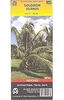
£16.99
This essential visual guide to Solo: A Star Wars Story explores the world of young Han Solo in unparalleled detail. An authoritative companion to the latest Star Wars movie, Solo: A Star Wars Story The Official Guide features the fascinating planets, vehicles, & aliens that Han Solo encounters on his early adventures. Explore key characters, locations & props in captivating detail with extensive production photography & see the iconic Millennium Falcon as it`s never been seen before, in an exclusive cross-section artwork by Richard Chasemore. ...
Archived Product
£7.99
This fun Han Solo sticker book contains more than 1000 colorful stickers, & is full of Star Wars facts from the new movie, Solo: A Star Wars Story. Kids will love joining young Han aboard the Millennium Falcon for many thrilling adventures. Solo: A Star Wars Story Ultimate Sticker Collection is illustrated with action-packed images from the movie, accompanied by fun, easy-to-read reference text. Join the heroes & villains as they plan missions, explore new planets, perform daring escapes, & pilot superfast starships. ...
Archived Product
£16.99
Many of us cook for one on a regular basis
- isn`t it time we became more selfish in the kitchen? Celebrating the joy of self-reliance
...
Archived Product
£6.99
Solomon Crocodile & his friend Mortimer are bored. They want to find some fun, but what can they do? Tree-climbing is tricky, chasing lizards doesn`t end well & flying turns out to be a lot harder than it looks. But then they spot the biggest hippo in the river. Just imagine the splash he`d make if two naughty crocodiles were to surprise him! But Solomon & Mortimer are about to get a whole lot more than they bargained for.. . Sure to delight fans of the original Solomon Crocodile, which has sold over 100, 000 copies worldwide, Solomon & Mortimer is a warm, funny & charming tale from the Kate Greenaway Medal winning Catherine Rayner, which young children will ask for again & again. ...
Archived Product
£14.99
HIS PAST IS UNKNOWN. HIS FUTURE UNWRITTEN. WHO IS SOLOMON CREED? The first in an electrifying new thriller series from Sunday Times bestselling author, Simon Toyne. Perfect for fans of Lee Child, & I AM PILGRIM, by Terry Hayes. A plane crashes in the Arizona desert. One lone figure emerges alive from the wreckage. He has no memory of his past, & no idea of his future. He only knows he must save a man. But how do you save someone who is already dead? ...
Archived Product
£9.99
Clear reference map of the Solomon Islands with relief portrayed by elevation tinting & insets showing Guadalcanal at 1:625, 00 & Honiara city at 1:9, 000. Road details include minor roads & tracks. A series of symbols indicates airports, points of interest, accommodation, diving sites, caves, shipwrecks & beaches. Latitude & longitude lines are drawn at 1° intervals.

Includes::
a index of place names & short tourist information on each isl&.

...
Archived Product
£10.99
Echoing the experiences of Robert Louis Stevenson
- who spent several years in the South Pacific
- here is the story of a contemporary

...
Archived Product
£9.99
When Mary Abacus dies, she leaves her business empire in the hands of the warring Solomon family. Hawk Solomon is determined to bring together both sides of the tribe
- but it is the new generation who must fight to change the future. Solomons are pitted against Solomons as the families are locked in a bitter struggle that crosses battlefields & continents to reach a powerful conclusion. Solomon`s Song is a novel of courage & betrayal in which Bryce Courtenay tells the story of Australia`s journey to nationhood.
...
Archived Product
£6.95
Topographic coverage of mainland Spain at 1:50, 000 in the MTN50 (Mapa Topográfico Nacional) series from the Centro Nacional de Información Geografica, the country’s civilian survey organization. The maps have contours at 20m intervals, enhanced by relief shading, plus colouring and/or graphics to show different types of terrain, vegetation or land use. Boundaries of national parks & other protected areas are marked. In addition to all the usual information featured on topographic mapping at this scale, detailed presentation of the road & rail networks, rural tracks & paths, etc, the maps also show campsites & mountain refuges. On more recent editions some GRs, the official long-distance hiking routes, are also marked (although not as clearly as on hiking maps from other publishers). Each map covers 29.5x 18.5 km (with adjustments in the border or coastal areas). The maps have a 1-km UTM grid, plus margin ticks for latitude & longitude at 1` intervals. Map legend is in Spanish only.HOW TO CHOOSE THE RIGHT 50K MAP: all the titles in CNIG’s 200K Provincial Road Maps series at 1:200, 000 are overprinted with the grid for the 1:50, 000 maps & can be used to see the area covered by each 50K title. TO SEE THE LIST OF TITLES IN THIS SERIES PLEASE CLICK ON THE SERIES LINK.PLEASE NOTE
- MAP TITLES: the grids shown on our website serve both the civilian & the military 1:50, 000 topographic series. Although the areas covered by maps in both series are identical (apart from some border or coastal sheets), occasionally map titles differ – only one title is shown on the grid, usually the military one. In Galicia, the Basque country & in the Catalan speaking areas the tendency now is to use local place names rather than the often better known Castilian ones. Where possible, both versions are included in our titles. Map titles listed on our website are based on information received by us at the time of publication, but sometimes maps arrive showing a completely different title! As long as the map number is as ordered, the correct map has been supplied.
...
Archived Product
£19.99
Solothurn region at 1:60, 000 in Kümmerly + Frey’s series of cycling maps published in co-operation with the Association for Transport & Environment & showing the official “ Cycling in Switzerland” routes. The aim of the series is to present a network of routes with as few problems as possible caused by motor traffic. The maps have a detailed base, with contours plus graphic relief & shading providing an excellent representation of the terrain. Routes are classified according to the density of motorized traffic, the difficulty of the terrain, & road restrictions. Unsurfaced roads are indicated, gradient marks show steep inclines, & local danger spots are highlighted. The maps show facilities for transporting cycles by train, bus, ferries, mountain railways, chair lifts, & cable cars. Border crossings indicate those open only to hikers & cyclist during daylight hours. Bike rental facilities are marked & towns with special bicycle-friendly accommodation are highlighted. Other tourist information

Includes::
various types of accommodations (campsites, youth hostels, “ Friends of Nature” houses, etc), viewpoints, picnic sites, swimming pools, & places of interest. Each title covers an area of Approx. 60 x 42 km (37 x 26 miles). The maps have a 1km grid for GPS users, with latitude & longitude shown as margin ticks. Map legend

Includes::
English. On the reverse, an index of towns & villages also lists names of geographical features such as mountains, alpine passes, glaciers, etc. Also included is general information on the country’s long-distance cycling routes & on transporting bikes by train (text

Includes::
English).


...
Archived Product

Solomon Islands

Solomon Islands at 1:1, 000, 000 on an indexed map from Hema, with an enlargement of Guadalcanal, a plan of Haniara, plus extensive tourist information including a map of US and Japanese WWII wreck sites off Guadalcanal.On one side is a map of the Solomon Islands at 1:1, 000, 000 with insets extending the coverage to include the Santa Cruz islands, Stewart Islands and the Indispensable Reefs. A separate inset presents Guadalcanal in greater detail at 1:415, 000 approx. Altitude colouring indicates the topography, with local settlements and roads. Numerous small islands are named. Markers prominently highlight locations of main tourist accommodation across the group. The map shows the group
RIP - This product is no longer available on our network. It was last seen on 25.09.2019

This page now acts as a permanent archive for this product. Add more information using the comments box below to ensure it can still be found by future generations.

Use our search facility to see if it is available from an alternative contributor.
  • Availability: Out Of Stock
  • Supplier: Stanfords
  • SKU: 9781865004006
Availability: In Stock
£7.95

Product Description

Solomon Islands at 1:1, 000, 000 on an indexed map from Hema, with an enlargement of Guadalcanal, a plan of Haniara, plus extensive tourist information including a map of US & Japanese WWII wreck sites off Guadalcanal. On one side is a map of the Solomon Islands at 1:1, 000, 000 with insets extending the coverage to include the Santa Cruz islands, Stewart Islands & the Indispensable Reefs. A separate inset presents Guadalcanal in greater detail at 1:415, 000 approx. Altitude colouring indicates the topography, with local settlements & roads. Numerous small islands are named. Markers prominently highlight locations of main tourist accommodation across the group. The map shows the group

Reviews/Comments

Add New

Price History

Vouchers

No voucher codes found.
Do you know a voucher code for this product or supplier? Add it to Insights for others to use.

Facebook

Jargon Buster

Santa - Also known as Santa Claus is a legendary figure believed to bring gifts to good children on the night of Christmas Eve / Christmas Day
Small - something that takes up less space than normal.
Altitude - Something that can be quite high in relation to sea or ground level.
Accommodation - A room in which someone can live in, for example in a hotel

Supplier Information

Stanfords
Stanfords was established in 1853 and opened their iconic Covent Garden flagship store in 1901. They have become the top retailer of maps, travel books and accessories in the UK and arguably offer the largest selection of maps and travel books worldwide. Famous names such as Captain Robert Falcon Scott, Ranulph Fiennes and Michael Palin have purchased from Stanfords. They now have a shop in Bristol and both stores together with other venues operate a calendar of events including talks, book signings and exhibitions. As a specialist map retailer, the map selection is comprehensive and includes road maps, street maps and walking maps from worldwide destinations, as well as a selection of world atlases and wall maps. Books include travel guides and travel literature. Stanfords also stock globes, from miniatures made of blue marble to magnificent floor-standing globes. The website features a selection of interesting articles on travel topics.
Page Updated: 2023-11-12 20:15:36

Community Generated Product Tags

Oh No! The productWIKI community hasn't generated any tags for this product yet!
Menu