More From Contributor

£11.99
Walking is one of Britain`s favourite leisure activities, & this fantastic walking guide to Snowdonia features a variety of mapped walks to suit all abilities. The book features all the practical detail you need, accompanied by fascinating background reading on the history & wildlife of the area, as well as other local points of interest. All walks are annotated with local points of interest & places to stop for refreshments & every walk is given a summary of distance, time, gradient, level of difficulty, type of surface & access, landscape, dog friendliness, parking & public toilets. ...
Archived Product
£14.95
Day Walks in Snowdonia is the seventh title in Vertebrate Publishing`s series of compact & portable hill walking guidebooks. This book showcases 20 circular routes, between 5.5 & 12 miles (9km & 19km) in length, suitable for hill walkers of all abilities. in addition included in a Bonus Section are two of the UK`s classic scrambles: The Bochlwyd Horseshoe & The Snowdon Horseshoe. The routes are split into three areas
- Northern Snowdonia, Central Snowdonia & Southern Snowdonia
- & include walks to the most iconic & beautiful peaks in the National Park, including; Snowdon, Y Glyderau, the Carneddau peaks, Moel Siabod, Cnicht, the Rhinogs, & Cadair Idris. The author of this guidebook, Tom Hutton, is a Wales local, keen hill walker & outdoors journalist. This is Tom`s second book with Vertebrate Publishing, following the successful & popular Wales Mountain Biking
- Beicio Mynydd Cymru. Each route in this guide is described with easy-to-follow directions & details of distance, navigation information, refreshment stops & public transport information, & is plotted on clear & easy to use Ordnance Survey 1:25, 000 mapping. Also included is a detailed Appendix.


...
Archived Product
£12.99
Pathfinder (R) Snowdonia covering Bont Newydd, Aber & Tal-y-lln. This selection offers interest, regional variety & balance of routes in Snowdonia providing the best walks in the area. From an easy stroll along in Aber Falls to the much more challenging walk up the summit of Cnicht, this volume contains something for everyone. Covering walks through the whole of Snowdonia both popular & little know scenic routes including Tryfan, Beddgelert & Barmouth Bay. -See walk locations by Looking Inside Inside: -28 great walks in Snowdonia from 2 to 10 miles -Clear, large scale Ordnance Survey route maps -GPS reference for all Snowdonia waypoints -Where to park, good pubs & places of interest en route -All routes have been fully researched & written by expert outdoor writers -Beautiful photography of scenes from the walks Pathfinder (R) Guides are Britain`s best loved walking guides. Made with durable covers, they are the perfect companion for countryside walks throughout Britain. Each title features circular walks with easy-to-follow route descriptions, large-scale Ordnance Survey route maps & GPS waypoints. With over 70 titles in the series, they offer essential information for walkers throughout the country. Contents* Aber Falls* Cwm Pennant* Precipice Walk* Ceunant Cynfal* Tal-y-Llyn Lake* Capel Curig* Penmaenpool & the Mawddach Trail* Llyn y Gader & Beddgelert Forest* Lledr Valley* Gwydyr Forest & Trefriw* Coed-y-brenin* Vale of Ffestiniog* Cregennen Lakes* Tanygrisiau & Rhosydd* Tryfan* Moel Hebog* Drum & Llyn Anafon* Pont Scethin* Cnicht* Carnedd Llywelyn* Gwydyr Forest & the Swallow Falls* Nanmor Valley & Aberglaslyn* Aran Benllyn* Moel Eilio* Snowdon (Yr Wyddfa)* Cadair Idris* Glyder Fach & Glyder Fawr* Y Llethr & Moelfre ...
Archived Product
£11.99
The story of the Snowdonia National Park & the Society, dedicated to conserving & enhancing its unique landscape, is one which will fascinate & inform those who live & work within it as well as being of interest to visitors, be they picnickers or sightseers or committed hill walkers, climbers, canoeists & mountain bikers. This book commemorates the fortieth anniversary of the Snowdonia Society & is a record of its sometimes turbulent history & the ever-changing but still inspiring landscape of the National Park. Created in 1951, the Snowdonia National Park is a landscape of rugged grandeur, great natural diversity & cultural associations going back thousands of years. The vision of its founders was that this very special region should be protected from harmful development for all time. From the beginning, however, there were problems? Out of these difficulties grew the idea of an independent society dedicated to conserving & enhancing the landscape. Today the Snowdonia Society has a membership of over 2, 500 & has a close working relationship with both the Snowdonia National Park Authority & the Council for National Parks. This lively narrative chronicles the story of the Snowdonia Society ? its successes & failures, its internal conflict & the personalities involved ? as well as discussing the wider issues which have affected this unique landscape over the last forty years. This lavishly illustrated book will appeal to anyone who loves the rugged landscape of Snowdonia, published in dual language text of English & Welsh. ...
Archived Product
£7.99
Snowdonia in the Short Walks guide series, produced in association with Ordnance Survey & published by Crimson; comprising a range of walking guides to popular British destinations. Each title

Includes::
20 varied walks that are suitable for walkers of all ages & abilities & is accompanied by detailed Explorer 1:25, 000 Ordnance Survey mapping with colour-coded marked routes. The guides are structured in three main sections with different levels of difficulty- short & easy walks, those of modest length that may include uphill walking & more challenging routes that may be longer & over more rugged terrain- covering a total of 20 walks. Each walk has a mini summary & an information box with details of starting points, distance, approximate time, parking & any individual route features. There is also information on refreshments, local transport & public toilets en route. Appendices provide further useful information on walking safety, GPS, the Countryside Code, local organisations & Ordnance Survey maps.

...
Archived Product
£7.95
Snowdonia at 1:25, 000 in a series of handy A5 size Adventure Atlases from Geographers` A-Z Map Company with cartography from the Ordnance Survey’s Explorer series. Coverage

Includes::
Snowdon, Glynder Fawr, Carnedd Llewelyn, Betws-y-Coed, Llanrwst, Dolwyddelan, Blaenau Ffestiniog, Llan Ffestibiog, Porthmadog, Beddgelert, Llanberis, Bathesda, part of the Snowdonia National Park, etc. To see other titles in this series please click on the series link.A-Z Adventure Atlases have cartography of the Ordnance Survey’s Explorer maps & provide plenty of recreational & tourist information, indicating traditional public rights of way paths, including bridleways & byways restricted or open to motorized traffic. Also shown are other routes with public access, including permissive footpaths & bridleways. Special marking indicates National Trails, Long-distance Routes & Recreational Routes, & for cyclists the maps show traffic-free routes & the National Cycle Network. A wide range of symbols highlights locations of special tourist interest: camping & caravanning sites, youth hostels, information offices & visitors’ centres, parking & picnicking places, historic buildings (indicating where appropriate National Trust, English Heritage, or Cadw), sites for various recreational pursuits, country pubs, public toilets, etc. The mapping provides detailed presentation of the topography with contours at 5 or 10m intervals, numerous spot heights & colouring and/or graphics for different types of terrain or vegetation. Additional colouring shows access l&, including areas managed by the National Trust, Forestry Commission & Woodland Trust. All the standard information expected of high quality survey mapping at this scale is included: finely graded road network, railway lines with stations, cuttings or embankments, individual isolated buildings, etc. For GPS each page as a 1-km British National Grid. Each atlas has an index which

Includes::
geographical features, nature reserves, youth hostels, car parks, etc, & provides additional notes on safety & security when walking, plus QR codes for obtaining by mobile phone information about local weather, danger areas, mountain rescue, map reading, OS National Grid coordinates, etc.


...
Archived Product
£6.99
Snowdonia & Anglesey Cycling Country Lanes Map at 1:126, 720 (1” to 2 miles) from Goldeneye in their series covering popular regions of England & Wales on waterproof & tear-resistant, double-sided cycling maps designed to highlight a selection of recommended cycle routes on country lanes & off-road. An overprint highlights the Sustrans National Cycle Network & regional routes, 17 cycling circuits recommended by the publishers, & 4 traffic-free family routes. The routes are listed in an information panel with distances & brief descriptions. Also listed are 9 local cycle hire facilities. The map shows camping & caravan sites, youth hostels, & numerous other places of interest. Current edition of this title was published in 2006. Maps in the Goldeneye Cycling Country Lanes series use altitude colouring to show the topography, with spot heights & plenty of names of geographical features such as moors, hills, etc. Road network

Includes::
local country tracks & railway lines are shown with stations. All the maps highlight recommended cycle routes but, as series is currently being revised, presentation and/or classification of the routes varies
- please refer to the individual descriptions. Symbols highlight locations of various facilities, such as campsites or caravan parks, & a wide selection of places of interest. Unless indicated to the contrary in the individual description, the maps are indexed & have no GPS coordinates.


...
Archived Product
£5.99
In North Wales, the Celtic past never seems far away. From Snowdon, the highest peak in Wales, to Victorian seaside resorts, this part of Wales retains a feeling of being culturally different from the rest of the UK. Footprint Focus provides invaluable information on transport, accommodation, eating & entertainment to ensure that your trip

Includes::
the best of this individual region of Wales. Essentials section with useful advice on getting to & around Snowdonia & North Wales. Comprehensive, up-to-date listings of where to eat, sleep & seek adventure.

Includes::
information on tour operators & activities, from buying pottery in the quirky village of Portmeirion to donning your walking boots & waterproofs. Detailed maps for Snowdonia & North Wales. Slim enough to fit in your pocket. With detailed information on all the main sights, plus many lesser-known attractions, Footprint Focus Snowdonia & North Wales provides concise & comprehensive coverage of one of the most interesting regions of the UK.


...
Archived Product
£7.99
Ideal for on-the-spot use, Great Breaks Snowdonia & North Wales makes the perfect companion for both first-time & repeat visitors. The North Wales` Top 10 section is designed to help you get the most out of your trip to the region, from castles & vintage railways to the Italianate village of Portmeirion &, of course, Mount Snowdon itself. Nine carefully planned walks & tours take you on a journey through rugged mountains & along sweeping coastlines, past copper, slate & gold mines & lively market towns. All routes are timed & accompanied by easy-to-follow maps with detailed information on transport & where to find the best locally produced food, plus fascinating facts & tips. Accommodation listings cover everything from family-friendly B& Bs & self-catering cottages to stylish boutique hotels. Containing beautiful full-colour photography & invaluable information, Great Breaks Snowdonia & North Wales is the ultimate guide to this beautiful corner of Wales. ...
Archived Product
£18.99
Snowdonia North at 1:40, 000 in a series of maps printed on waterproof fabric, from Splash Maps, designed for outdoor adventures & featuring contours, walking & riding trails, & the National Grid. The map designed for mountain bikers, walkers & riders, comes with a cloth pouch & a non permanent marker, one can use to trace a particular route. The marker will easily wipe clean when the map is washed. The map data from Ordnance Survey & Open Street Map,

Includes::
contours at 60m intervals, & colouring distinguishing build up areas & woodlands; contours & spot heights render the terrain & rivers & tidal waters are identified. Walking & riding paths & tracks, free & restricted byway & bridle paths are all clearly marked as well as boundaries of national parks. Symbols locate the Splash Maps

...
Archived Product

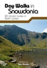
Snowdonia - Top 10 Walks Series Hill Walks & Easy Summits

One of a series of books for Snowdonia in the popular Top 10 Walks series. Handy, pocket-sized, full colour walking guides written by experts, with Ordnance Survey mapping.This attractive guide gives walkers ten of the finest walks on the lower hills of the Snowdonia National Park. With clear information, an overview and introduction for each walk, eye-grabbing panoramic photographs, and interpretation of points of interest along the way, these guides set a new standard in clarity and ease-of-use.Featured walks include: Tal y Fan, Yr Eifl, Moel Eilio, Mynydd Mawr, Mynydd Sygun, Penamnen Horseshoe, Creigiau Gleision, Maesglase, Tyrrau Mawr and Waun-oer.Carl Rogers is well known for his guide books to North Wales and Snowdonia. He is a publisher and magazine editor and is also
a member of the Outdoor Writers & Photographers Guild.
RIP - This product is no longer available on our network. It was last seen on 25.09.2019

This page now acts as a permanent archive for this product. Add more information using the comments box below to ensure it can still be found by future generations.

Use our search facility to see if it is available from an alternative contributor.
  • Availability: Out Of Stock
  • Supplier: Stanfords
  • SKU: 9781902512280
Availability: In Stock
£5.99

Product Description

One of a series of books for Snowdonia in the popular Top 10 Walks series. Handy, pocket-sized, full colour walking guides written by experts, with Ordnance Survey mapping. This attractive guide gives walkers ten of the finest walks on the lower hills of the Snowdonia National Park. With clear information, an overview & introduction for each walk, eye-grabbing panoramic photographs, & interpretation of points of interest along the way, these guides set a new standard in clarity & ease-of-use. Featured walks include: Tal y Fan, Yr Eifl, Moel Eilio, Mynydd Mawr, Mynydd Sygun, Penamnen Horseshoe, Creigiau Gleision, Maesglase, Tyrrau Mawr & Waun-oer. Carl Rogers is well known for his guide books to North Wales & Snowdonia. He is a publisher & magazine editor & is also a member of the Outdoor Writers & Photographers Guild.

Reviews/Comments

Add New

Intelligent Comparison

Oooops!
We couldn't find anything!
Perhaps this product's unique.... Or perhaps we are still looking for comparisons!
Click to bump this page and we'll hurry up.

Price History

Vouchers

No voucher codes found.
Do you know a voucher code for this product or supplier? Add it to Insights for others to use.

Facebook

Jargon Buster

Eye - An organ which detects light
Colour - The categorised spectrum of light visable to humans
Set - a group of items usually related to one another. Some objects cannot function without the complete set of items.
Popular - Something that is admired and liked by many people.
Pocket - A bag shaped insert in clothing used to carry items
Fan - A piece of equipment that has blades that rotate to cool the air, can be installed within other equipment,

Supplier Information

Stanfords
Stanfords was established in 1853 and opened their iconic Covent Garden flagship store in 1901. They have become the top retailer of maps, travel books and accessories in the UK and arguably offer the largest selection of maps and travel books worldwide. Famous names such as Captain Robert Falcon Scott, Ranulph Fiennes and Michael Palin have purchased from Stanfords. They now have a shop in Bristol and both stores together with other venues operate a calendar of events including talks, book signings and exhibitions. As a specialist map retailer, the map selection is comprehensive and includes road maps, street maps and walking maps from worldwide destinations, as well as a selection of world atlases and wall maps. Books include travel guides and travel literature. Stanfords also stock globes, from miniatures made of blue marble to magnificent floor-standing globes. The website features a selection of interesting articles on travel topics.
Page Updated: 2023-11-12 20:15:36

Community Generated Product Tags

Oh No! The productWIKI community hasn't generated any tags for this product yet!
Menu