
 United Kingdom
 France
 Germany
 Netherlands
 Sweden
 USA
USA
 Italy
Italy
 Spain
Spain
More From Contributor


Slough 1897
Slough in 1897 in a fascinating series of reproductions of old Ordnance Survey plans in the Alan Godfrey Editions, ideal for anyone interested in the history of their neighbourhood or family. The map covers the still growing town of Slough, which had developed from a village after the opening of the GWR. Features include the railway with station, engine shed and junctions towards Windsor; Royal Hotel, North Star Hotel, Gotha Iron Works, High Street, William Street, Windsor Road, Mackenzie Street, St Mary`s church, Eton Union Workhouse, Royal Nurseries, etc. Coverage extends south to Victoria Terrace and east to Aldin House or St Bernards Convent and a small portion of the new development, Langley New Town. John Betjeman would definitely not invite “friendly bombs” to fall
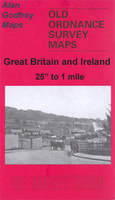
on this Slough! The Slough entry from Bennett`s Business Directory is on the reverse. Together with maps covering Windsor and Eton, this title forms a block of four maps.About the Alan Godfrey Editions of the 25” OS Series:Selected towns in Great Britain and Ireland are covered by maps showing the extent of urban development in the last decades of the 19th and early 20th century. The plans have been taken from the Ordnance Survey mapping and reprinted at about 15 inches to one mile (1:4, 340). On the reverse most maps have historical notes and many also include extracts from contemporary directories. Most maps cover about one mile (1.6kms) north/south, one and a half miles (2.4kms) across; adjoining sheets can be combined to provide wider coverage.FOR MORE INFORMATION AND A COMPLETE
LIST OF ALL AVAILABLE TITLES PLEASE CLICK ON THE SERIES LINK.

Product Description
Reviews/Comments
Add New
Vouchers
No voucher codes found.
Do you know a voucher code for this product or supplier? Add it to Insights for others to use.
Do you know a voucher code for this product or supplier? Add it to Insights for others to use.
 Denmark