More From Contributor

£8.99
Skegness, Alford, Spilsby, Chapel St Leonards & Wainfleet All Saints area on a detailed topographic & GPS compatible map No. 274, paper version, from the Ordnance Survey’s 1:25, 000 Explorer series.MOBILE DOWNLOADS: this title & all the other OS Explorer maps include a code for downloading after purchase the digital version onto your smartphone or tablet for viewing on the OS smartphone app.OS EXPLORER SERIES: to see the list of all the titles in the OS Explorer series, both paper & waterproof versions, please click on the series link. The Explorer series, Ordnance Survey’s most detailed maps recommended for anyone enjoying outdoor activities, provides topographic coverage of Great Britain at 1:25, 000 on GPS compatible maps with hiking trails, cycling routes & extensive tourist information. Each printed map is available either on paper or as a waterproof & tear-resistant OS Active Map, as indicated in its title. Britain’s National Parks & other areas of particular tourist interest are presented on often double-sided OL (Outdoor Leisure) maps, whilst most standard format Explorers cover an area of 30 x 20km (approx. 19 x 12 miles). All three versions (paper, waterproof & digital) are the same & provide plenty of recreational & tourist information, indicating the traditional public right of way paths (except in Scotland where different laws apply), including bridleways & byways. National Trails & other long-distance paths are marked, as well as permissive footpaths or bridleways & on-road or traffic-free cycle routes with, where appropriate, their National/ Regional Cycle Network numbers. Boundaries of access land are clearly marked. A wide range of symbols provides additional tourist information, highlighting camping & caravanning sites, information offices & visitors’ centres, parking & picnicking places, country pubs, sport & recreational facilities including cycle hire locations & mountain biking trails, historic buildings & museums, etc. Exceptionally clear presentation of the landscape is provided by contours at 5m or in the uplands at 10m intervals, with additional spot heights plus colouring and/or graphics for different types of woodlands, orchards, heath, marshl&, scree or boulders, & other topographic features. For GPS users the maps have British National Grid lines at 1km intervals, with latitude & longitude given by margin ticks at 1`. Clearly laid out map legend

Includes::
French & German translations for the tourist information symbols.

...
Archived Product
£11.19
Laminated waterproof edition of a detailed topographic map from the Ordnance Survey Explorer series, covering Chapel St Leonards & Wainfleet All Saints. Edition A1 with minor changes; Publication date April 2011 About this series: These highly detailed maps show all the administrative boundaries, settlements as small as isolated farms, the road network down to unfenced roads & country tracks, & field boundaries (hedges & drystone walls) which make navigation across the countryside much easier. Steep gradients on roads are indicated. Various landmarks, e.g. powerlines, archaeological sites, windmills, churches & lighthouses are shown & additional graphics indicate natural terrain features such as cliffs, scree, mud & vegetation variations. The contour interval is 5 metres in the lower parts of the country & 10 metres in the uplands, & spot heights are marked. Each map covers an area of 30 x 20km (i.e. approx. 19 x 12 miles), with some double-sided maps covering more, as indicated in the individual descriptions. The maps are fully GPS compatible, with the National Grid shown at 1km intervals & latitude & longitude indicated by margin ticks at 1'. The Explorer series has replaced the earlier, green-cover Pathfinder maps. The Explorer series is now complete & covers all of Engl&, Wales & Scotl&. Some sheets for popular areas like the National Parks are still branded as Outdoor Leisure (OL) maps, but are now included in this series as the cartography is the same as that in the Explorer Maps. The Explorer maps offer a substantial improvement on the Pathfinder series, with greater use of colour, larger area per map, & stronger emphasis on information for ramblers & tourists. This series is ideal for walking & other outdoor pursuits & each map shows a large amount of information for ramblers & tourists. Public rights of way are shown (except in Scotland), together with other routes with public access: National Trails & Recreational Paths, permitted paths & bridleways, & selected cycle routes. Open access land created under the Countryside & Rights of Way Act 2000 is marked. Tourist information

Includes::
caravan & camp sites, Park & Ride locations, recreation/leisure/sport centres, museums, historic buildings, English Heritage & National Trust sites, rural pubs, etc. The map legend is in English only, except for the tourist information content which is also in French & German.

...
Archived Product
£14.99
Skeiðarársandur, map no. 24, in the topographic survey of Iceland at 1:100, 000 published by Mál og menning, with excellent, vivid presentation of the terrain, footpaths & bridleways, campsites, etc. The maps have contours at 20m intervals, enhanced by bold relief shading plus colouring and/or graphics to show glaciers, lava fields, sands & mudflats, as well as to distinguish land with vegetation cover from the more sparsely covered terrain. The series provides a splendid presentation of the country’s topography, with large amount of detail & over 43, 000 place names. Road network indicates gravel roads &

Includes::
country tracks. Also marked are local footpaths, clear to see with their distinctive colouring, & bridleways. Symbols shows campsites, tourist huts or shelters, emergency shelters, summer houses, river fords, golf courses & swimming pools, hydro-electric or thermal power stations, local airports, etc, & detail such as individual farms, abandoned farms or ruins, sheepfolds, etc. Each map covers an area of 84 x 67km (53 x 42 miles approx.) & has latitude & longitude lines drawn at intervals of 2’ & 5’ respectively. Map legend

Includes::
English, German & French. To see the other titles in this series please click on the series link.


...
Archived Product
£23.99
Skein Vest
- Grenland area in Norway in a series of GPS compatible recreational maps at 1:25, 000 with cartography based on the
...
Archived Product
£3.25
This is a beautiful & unique wrapping paper featuring the human skeletal system from Cavallini & Co. measuring 51x 71 cm (20”x 28”). It is printed on thick quality Italian laid paper stock. The beautiful print & quality of the paper makes it absolutely ideal for wrapping special presents as well as framing & other creative purposes. ...
Archived Product
£16.99
Sverigeserien is an outdoor map series consisting of 116 sheets with coverage of southern & central Sweden & the northern coastline. The map is suitable for outdoor activities such as hiking, excursions, trail running, hunting, fishing, riding, cycling, mountain biking, paddling, skating & much more. Every sheet covers an area of 45x 68km. These topographical maps in scale 1:50 000 contain all the information needed for outdoor activities: Terrain information, hiking trails, illuminated tracks, camping, shelters, golf courses, leisure baths, historical remains, roads in different categories, railway lines & much more. Easy to read topography with contour lines, vertical interval 5 m. Sverigeserien is a high-quality map series & is durable for frequent use! Updated content with map data from Lantmäteriet (National Land Survey of Sweden) & printed on Polyart which is water & tear resistant. This means that the map can be folded repeatedly without breaking & can withstand the challenging weather in Sweden during both winter & summer. Legend is in Swedish, English & German. ...
Archived Product
£16.99
Topographic survey of Sweden at 1:100, 000, the Vägkartan, from the Lantmäteriet, covering most of the country in 79 double-sided maps. Please note: the mountainous regions of central & northern Sweden are not covered by this series but presented in a separate “ Fjällkartan
- Mountain Map” series also listed on our website. Each 1:100, 000 topographic survey map covers an area of 75 x 80km. The maps have contours at 10 metre intervals, plus relief shading & colouring for different types of landscape: open l&, forests, alvar, marshes, etc. Boundaries of national parks & nature reserves, areas prohibited to cross-country vehicles, & restricted entry military zones are marked. The maps indicate privately maintained local roads, cycle paths with wind shelters, footpaths, etc, & include all other information expected of topographic survey at this scale. The maps have a 2-km UTM grid, plus latitude & longitude lines 10’ intervals. Map legend

Includes::
English. For coverage of the country’s most visited hiking areas in central & northern Sweden please see Lantmäteriet’s Mountain Map series, listed separately on our website.


...
Archived Product
£16.99
Topographic survey of Sweden at 1:50, 000, the Terrängkartan, from the Lantmäteriet, covering most of the country in 244 double-sided maps. Please note: the mountainous regions of central & northern Sweden are not covered by this series but presented in a separate “ Fjällkartan
- Mountain Map” series also listed on our website. Each 1:50, 000 topographic survey map covers an area of 37.5 x 40km. The maps have contours at 5 metre intervals, plus relief shading & graphics for rocky outcrops & boulders. Further graphics and/or colouring show different types of land use or vegetation (forests, arable l&, orchards, marshes, peat bogs, etc). An unusual feature of this survey is the colouring indicating buildings below or above two storeys high & “leisure/holiday homes”. The maps indicate privately maintained roads & include all other information expected of topographic survey at this scale. The maps have a 1-km UTM grid, plus latitude & longitude lines 5’ intervals. Map legend

Includes::
English. For coverage of the country’s most visited hiking areas in central & northern Sweden please see Lantmäteriet’s Mountain Map series, listed separately on our website.


...
Archived Product
£7.99
When a move to a new house coincides with his baby sister`s illness, Michael`s world seems suddenly lonely & uncertain. Then, one Sunday afternoon, he stumbles into the old, ramshackle garage of his new home, & finds something magical. A strange creature
- part owl, part angel, a being who needs Michael`s help if he is to survive. With his new friend Mina, Michael nourishes Skellig back to health, while his baby sister languishes in the hospital. But Skellig is far more than he at first appears, & as he helps Michael breathe life into his tiny sister, Michael`s world changes for ever.. . Skellig won the Carnegie Medal & the Whitbread Children`s Book Award & is now a major Sky 1 feature film, starring Tim Roth & John Simm. David Almond is also winner of the 2010 Hans Christian Andersen award. This newly jacketed edition celebrates 15 years of this multi-award-winning novel & is available from 5th September 2013.
...
Archived Product
£2.95
Skelmersdale in 1907 in a fascinating series of reproductions of old Ordnance Survey plans in the Alan Godfrey Editions, ideal for anyone interested in the history of their neighbourhood or family. Selected towns in Great Britain & Ireland are covered by maps showing the extent of urban development in the last decades of the 19th & early 20th century. In this title: the map covers the west Lancashire town of Skelmersdale, now a ' New Town' but in 1907 a rather scattered village. Most of the village is covered & features include the LYR Skelmersdale Branch with station, White Moss Crossing Halt, mineral railway to collieries, White Moss Collieries, Lower White Moss Colliery, Market Hall, Merdale Factory, Victoria Colliery, St Paul's church, St Richard's RC church, Town Hall, Moss Side Brick Works, farms, old shafts, Sandy Lane etc. A 1918 directory of Skelmersdale is included on the reverse About the Alan Godfrey Editions of the 25 ...
Archived Product

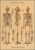
Skeletons: The Extraordinary Form And Function Of Bones

Bone is one of the most extraordinary materials in the natural world - flexible and strong, available in a number of types and densities. Yet we only absorb quite how amazing it is when we look at the range of different jobs it can do, from supporting and shaping a huge and heavy mammal like an elephant to enabling a bat to fly. And looking into the distant past, scientists know what they know about the dinosaurs and their descendents from their fossilized bones, extraordinary reminders of how different our world used to be. Skeletons takes the virtuoso engravings of the nineteenth and early twentieth centuries and marries them with a contemporary and readable text that brings them right up to date, creating an appealing mix of scientific eye candy and cutting-edge scholarship.
RIP - This product is no longer available on our network. It was last seen on 25.09.2019

This page now acts as a permanent archive for this product. Add more information using the comments box below to ensure it can still be found by future generations.

Use our search facility to see if it is available from an alternative contributor.
  • Availability: Out Of Stock
  • Supplier: Stanfords
  • SKU: 9781782404026
Availability: In Stock
£14.99

Product Description

Bone is one of the most extraordinary materials in the natural world
- flexible & strong, available in a number of types & densities. Yet we only absorb quite how amazing it is when we look at the range of different jobs it can do, from supporting & shaping a huge & heavy mammal like an elephant to enabling a bat to fly. & looking into the distant past, scientists know what they know about the dinosaurs & their descendents from their fossilized bones, extraordinary reminders of how different our world used to be. Skeletons takes the virtuoso engravings of the nineteenth & early twentieth centuries & marries them with a contemporary & readable text that brings them right up to date, creating an appealing mix of scientific eye candy & cutting-edge scholarship.

Reviews/Comments

Add New

Intelligent Comparison

Oooops!
We couldn't find anything!
Perhaps this product's unique.... Or perhaps we are still looking for comparisons!
Click to bump this page and we'll hurry up.

Price History

Vouchers

No voucher codes found.
Do you know a voucher code for this product or supplier? Add it to Insights for others to use.

Facebook

Jargon Buster

Contemporary - Modern era design
Elephant - A large land mammal found in Africa and Asia
Contemporary - A design reference to indicate post war modern design
Eye - An organ which detects light
Date - A day on a calendar
Date - A social activity whith a current or potential partner
strong - A descriptive word for an item that has physical strength
World - A physical grouping, commonly used to describe earth and everything associated with ti
heavy - A concept of weight indicating an item may require some effort to lift or move
edge - Enhanced data rates for GSM evolution also known as enhanced GPRS. A mobile phone technology with improved data transmission rates.
edge - The point at which two surfaces meet
cutting - The seperation of an object usually using a cutting tool such as a knife
Natural - not manmade
Contemporary - An object that is living in the same time.

Supplier Information

Stanfords
Stanfords was established in 1853 and opened their iconic Covent Garden flagship store in 1901. They have become the top retailer of maps, travel books and accessories in the UK and arguably offer the largest selection of maps and travel books worldwide. Famous names such as Captain Robert Falcon Scott, Ranulph Fiennes and Michael Palin have purchased from Stanfords. They now have a shop in Bristol and both stores together with other venues operate a calendar of events including talks, book signings and exhibitions. As a specialist map retailer, the map selection is comprehensive and includes road maps, street maps and walking maps from worldwide destinations, as well as a selection of world atlases and wall maps. Books include travel guides and travel literature. Stanfords also stock globes, from miniatures made of blue marble to magnificent floor-standing globes. The website features a selection of interesting articles on travel topics.
Page Updated: 2023-11-12 20:15:36

Community Generated Product Tags

Oh No! The productWIKI community hasn't generated any tags for this product yet!
Menu