
 United Kingdom
 France
 Germany
 Netherlands
 Sweden
 USA
USA
 Italy
Italy
 Spain
Spain
More From Contributor


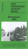

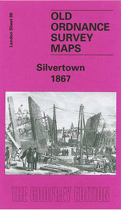
Silvertown 1867
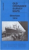
Silvertown in 1867 in a fascinating series of reproductions of old Ordnance Survey plans in the Alan Godfrey Editions, ideal for anyone interested in the history of their neighbourhood or family. Three versions have been published for this area around and to the south of the Royal Victoria Dock including the many wharves of Silvertown; just the waterfront of the south shore of the Thames is shown, including Angerstein`s Wharf. The 1867 map shows the area at an early stage, with the Victoria Dock quite recently opened (in 1855), the graving dock, also Silvertown works of the India Rubber Gutta Percha Co and St Mark`s church. The 1893 and 1914 maps show much more development with the Odam`s Wharf, Clyde Wharf, Hall`s Wharf, Plaistow Wharf, Manhattan Wharf, Prince Regent`s Wharf,
and Tay Wharf, also various works or factories: the sugar refineries of Henry Tate and Abram Lyle whose firms merged in 1921, at Crescent Wharf the chemical works of Brunner Mond, later an explosives works which exploded in 1917. Other features include North Woolwich Road and many warehouses, railway sidings, and a few cramped streets of terraces.About the Alan Godfrey Editions of the 25” OS Series:Selected towns in Great Britain and Ireland are covered by maps showing the extent of urban development in the last decades of the 19th and early 20th century. The plans have been taken from the Ordnance Survey mapping and reprinted at about 15 inches to one mile (1:4, 340). On the reverse most maps have historical notes and many also include extracts from contemporary directories. Most
maps cover about one mile (1.6kms) north/south, one and a half miles (2.4kms) across; adjoining sheets can be combined to provide wider coverage.FOR MORE INFORMATION AND A COMPLETE LIST OF ALL AVAILABLE TITLES PLEASE CLICK ON THE SERIES LINK.

Product Description
Reviews/Comments
Add New
Intelligent Comparison
Archived Product
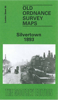
Silvertown 1893 Stanfords
£3.50
Archived Product
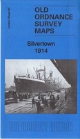
Silvertown 1914 Stanfords
£3.50
Vouchers
No voucher codes found.
Do you know a voucher code for this product or supplier? Add it to Insights for others to use.
Do you know a voucher code for this product or supplier? Add it to Insights for others to use.
 Denmark