More From Contributor
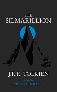
£35.00
The unique character of the 19th century Lan Na culture of Northern Thailand is seen in its sumptuous textiles & court dress reflecting a diverse cultural heritage. Susan Conway situates this textile history within the context of the complex marital & political alliances of the time. ...
Archived Product
£12.99
Topographic survey of France at 1:25, 000 in IGN`s excellent TOP25 / Série Bleue series. All the maps are GPS compatible, with a 1km UTM grid plus latitude & longitude lines at 5’ intervals. Contours are at 5m intervals except for mountainous areas where the maps have contours at 10m intervals, vividly enhanced by hill shading & graphics for rocky terrain. Colouring with graphics indicates different types of vegetation or land use (deciduous or coniferous forests, moors, orchards, vineyards, etc). PLEASE NOTE: coverage of France at this scale is currently being revised – the format & the presentation of each title are indicated by the letters at the end of its Sheet Reference number (e.g. 0416ET, 3531ETR, 1923SB, etc.)MAPS WITH FULL TOURIST OVERPRINT & AN ENGLISH MAP LEGEND: all TOP25 maps & the SB editions of Série Bleue have an overprint highlighting waymarked walking trails including long-distance GR routes &, where appropriate, ski routes. Symbols indicate campsites, gîtes d’etape, refuges, equestrian centres & other recreational facilities or sites, tourist information centres, cultural heritage, etc. Towns & locations of particular interest are highlighted.- ET or OT = single-sided TOP25 map covering approx. 29x 21 km / 18x 13 miles.- ETR or OTR = waterproof & tear resistant TOP25 map covering the same area as the corresponding ET or OT number, but double-sided, printed on a smaller size sheet with a good overlap between the sides.- SB = Série Bleue map with full tourist overprint; these maps, first introduced in summer 2014, each cover approx. 29x 24km / 18x 15 miles.SÉRIE BLEUE maps with numbers ending in E (Est) or O (Ouest): most editions now indicate the GR routes, but do not show any other tourist information. Map legend is in French only. Each map covers approx. 14x 20km / 9x 12 miles. ...
Archived Product
£2.95
Silloth & Port Carlisle in 1923 in a fascinating series of reproductions of old Ordnance Survey plans in the Alan Godfrey Editions, ideal for anyone interested in the history of their neighbourhood or family. Selected towns in Great Britain & Ireland are covered by maps showing the extent of urban development in the last decades of the 19th & early 20th century. In this title: this detailed map covers the port & resort of Silloth, created in the mid- 19th century. The railway opened in 1856 to serve a new Cumbrian port, with a steam packet to Liverpool, & a resort quickly followed. A new dock was built in 1885, after the first one had suddenly collapsed. The map covers the town & dock, including the Marshall Dock, New Dock, railway station & sidings (with track layout), Convalescent Institution, pier, Christ Church, Criffel Street & handful of streets leading off it, The Green, West Silloth. On the reverse is a large section of sheet 15.05 covering the earlier port town of Port Carlisle, where a seagoing canal was opened in the 1820s. This was later replaced by a railway, with an initial steam train service which became horse drawn until the 20th century. The map shows most of this tiny village (it never progressed into a town), including the station. About the Alan Godfrey Editions of the 25 ...
Archived Product
£3.50
Silloth & Port Carlisle in 1923 in a fascinating series of reproductions of old Ordnance Survey plans in the Alan Godfrey Editions, ideal for anyone interested in the history of their neighbourhood or family. The map covers the port & resort of Silloth, created in the mid-19th century. The railway opened in 1856 to serve a new Cumbrian port, with a steam packet to Liverpool, & a resort quickly followed. A new dock was built in 1885, after the first one had suddenly collapsed. The map covers the town & dock, including the Marshall Dock, New Dock, railway station & sidings, Convalescent Institution, pier, Christ Church, Criffel Street & handful of streets leading off it, The Green, West Silloth, etc. On the reverse is a large section of sheet 15.05 covering the earlier port town of Port Carlisle, where a seagoing canal was opened in the 1820s. This was later replaced by a railway, with an initial steam train service which became horse drawn until the 20th century. The map shows most of this tiny village including its station. About the Alan Godfrey Editions of the 25” OS Series: Selected towns in Great Britain & Ireland are covered by maps showing the extent of urban development in the last decades of the 19th & early 20th century. The plans have been taken from the Ordnance Survey mapping & reprinted at about 15 inches to one mile (1:4, 340). On the reverse most maps have historical notes & many also include extracts from contemporary directories. Most maps cover about one mile (1.6kms) north/south, one & a half miles (2.4kms) across; adjoining sheets can be combined to provide wider coverage.FOR MORE INFORMATION & A COMPLETE LIST OF ALL AVAILABLE TITLES PLEASE CLICK ON THE SERIES LINK. ...
Archived Product
£10.99
Charming, funny, beautifully illustrated this is an hilarious picture book that will resonate with dog lovers, both adults & children, as they read it together. It is full of visual jokes & it comes complete with a fold-out poster When Lily looks out of her bedroom window, she gets the best surprise ever
- a doggy! But this is no normal doggy, this is actually an escaped bear. Lily`s adventure with doggy is told through a poster Lily has made, advertising that she`s found a lost dog. Sadly a zookeeper comes to collect Doggy. But the next day, Lily has another fantastic surprise & Lily`s sadness turns to joy as she sees`kitty` an escaped tiger in her garden.
...
Archived Product
£16.99
At the foot of a chalk hill a stream rises in a silent copse, & is soon lost under the car parks & streets of the town its waters once gave life to. Captivated by the fate of this forgotten stream Charles Rangeley-Wilson sets out one winter's day to uncover its story. Distilled into the timeless passage of the river's flow, buried under the pavements that cover meadow, marsh & hill he finds dreamers & visionaries, a chronicle of paradises lost or never found, men who shaped the land & its history: the Jacobean maverick with an Arcadian irrigation dream, the sanitary inspector planning social emancipation, the libertine aristocrat who drew naked women in ornate lakes & flower beds. In Silt Road miller's riot, chairmakers die of fever, men dream of fish. In this moving elegy to a disappearing natural world Charles Rangeley-Wilson brings the history of the English landscape vividly to life. ...
Archived Product
£9.99
At the foot of a chalk hill a stream rises in a silent copse, & is soon lost under the car parks & streets of the town its waters once gave life to. Captivated by the fate of this forgotten stream Charles Rangeley-Wilson sets out one winter`s day to uncover its story. Distilled into the timeless passage of the river`s flow, buried under the pavements that cover meadow, marsh & hill he finds dreamers & visionaries, a chronicle of paradises lost or never found, men who shaped the land & its history: the Jacobean maverick with an Arcadian irrigation dream, the sanitary inspector planning social emancipation, the libertine aristocrat who drew naked women in ornate lakes & flower beds. In Silt Road miller`s riot, chairmakers die of fever, men dream of fish. In this moving elegy to a disappearing natural world Charles Rangeley-Wilson brings the history of the English landscape vividly to life. ...
Archived Product
£30.00
This is a celebration of trees in Britain, with the focus principally on the native species. It brings together numerous topics, with chapters concerning their evolution, their sociological, economic & cultural influences on man, the diversity of manifestations within individual species, & the interrelationships between the various species. There is fascinating material on trees in myth & legend, on the herbal & medicinal uses of trees, on woodland crafts & industries, & on tree planting, conservation & management. It is highly readable, full of accurate & scholarly information, & profusely & splendidly illustrated with hundreds of new photographs & archive illustrations. ...
Archived Product
£9.99
- 1 x Hi-Power white LED
- provide visibility for 180 degrees- Large & easy to access on/off button
- easy to operate even when

...
Archived Product
£24.99
This Silva pedometer is compact, lightweight, easy to use & comes in new colours: black body with the product name & logotype in orange. The built-in filter function prevents recording unwanted occasional movement during a walk or a jog. The belt clip secures the pedometer to the belt/trousers in the best possible way & for safety reasons the ex pedometer is also equipped with a lanyard which will prevent accidental loss. The pedometer uses a pendulum to register steps. When in motion, the pendulum gives off a clicking sound. Treat your pedometer carefully: it is not shock- or waterproof. Its functions include:- counting number of steps ...
Archived Product

Silmarillion

Designed to take fans of The Hobbit and The Lord of the Rings deeper into the myths and legends of Middle-earth The Silmarillion is an account of the Elder Days, of the First Age of Tolkien`s world. It is the ancient drama to which the characters in The Lord of the Rings look back, and in whose events some of them such as Elrond and Galadriel took part. The tales of The Silmarillion are set in an age when Morgoth, the first Dark Lord, dwelt in Middle-Earth, and the High Elves made war upon him for the recovery of the Silmarils, the jewels containing the pure light of Valinor. Included in the book are several shorter works. The Ainulindale is a myth of the Creation and in the Valaquenta the nature and powers of each of the gods is described. The Akallabeth recounts the downfall of the
great island kingdom of Numenor at the end of the Second Age and Of the Rings of Power tells of the great events at the end of the Third Age, as narrated in The Lord of the Rings.
RIP - This product is no longer available on our network. It was last seen on 25.09.2019

This page now acts as a permanent archive for this product. Add more information using the comments box below to ensure it can still be found by future generations.

Use our search facility to see if it is available from an alternative contributor.
  • External links may include paid for promotion
  • Availability: Out Of Stock
  • Supplier: Stanfords
  • SKU: 9780261102736
Availability: In Stock
£7.99

Product Description

Designed to take fans of The Hobbit & The Lord of the Rings deeper into the myths & legends of Middle-earth The Silmarillion is an account of the Elder Days, of the First Age of Tolkien`s world. It is the ancient drama to which the characters in The Lord of the Rings look back, & in whose events some of them such as Elrond & Galadriel took part. The tales of The Silmarillion are set in an age when Morgoth, the first Dark Lord, dwelt in Middle-Earth, & the High Elves made war upon him for the recovery of the Silmarils, the jewels containing the pure light of Valinor. Included in the book are several shorter works. The Ainulindale is a myth of the Creation & in the Valaquenta the nature & powers of each of the gods is described. The Akallabeth recounts the downfall of the great island kingdom of Numenor at the end of the Second Age & Of the Rings of Power tells of the great events at the end of the Third Age, as narrated in The Lord of the Rings.

Reviews/Comments

Add New

Intelligent Comparison

Oooops!
We couldn't find anything!
Perhaps this product's unique.... Or perhaps we are still looking for comparisons!
Click to bump this page and we'll hurry up.

Price History

Vouchers

No voucher codes found.
Do you know a voucher code for this product or supplier? Add it to Insights for others to use.

Facebook

Jargon Buster

Dark - A colour which absorbs visable ligt so apears less light than objects that reflect light
World - A physical grouping, commonly used to describe earth and everything associated with ti
Earth - A planet third from the sun. Similar size to Venus but rich in water and complex life.
Set - a group of items usually related to one another. Some objects cannot function without the complete set of items.

Supplier Information

Stanfords
Stanfords was established in 1853 and opened their iconic Covent Garden flagship store in 1901. They have become the top retailer of maps, travel books and accessories in the UK and arguably offer the largest selection of maps and travel books worldwide. Famous names such as Captain Robert Falcon Scott, Ranulph Fiennes and Michael Palin have purchased from Stanfords. They now have a shop in Bristol and both stores together with other venues operate a calendar of events including talks, book signings and exhibitions. As a specialist map retailer, the map selection is comprehensive and includes road maps, street maps and walking maps from worldwide destinations, as well as a selection of world atlases and wall maps. Books include travel guides and travel literature. Stanfords also stock globes, from miniatures made of blue marble to magnificent floor-standing globes. The website features a selection of interesting articles on travel topics.
Page Updated: 2023-11-12 20:15:36

Community Generated Product Tags

Oh No! The productWIKI community hasn't generated any tags for this product yet!
Menu