More From Contributor

£10.99
Siena on an indexed street plan at 1:8, 000 from Litografia Artistica Cartografica in their Globalmap imprint, with a detailed enlargement of the city’s historic heart at 1:4, 500. 77 monuments including historic buildings & churches, cultural or educational institutions, & important municipal buildings or facilities are numbered & listed next to the plans, with the principal sights shown on the enlargement by drawings of the buildings. Car parks in & around the city centre are prominently marked. Litografia Artistica Cartografica (LAC) are Italy’s leading publishers of street plans with an extensive range of titles. Where appropriate, the plans include an enlargement showing the historic centre in greater detail. On each plan monuments including historic buildings & churches, archaeological sites, cultural or educational institutions, & important municipal buildings or facilities are numbered & listed next to the plan. Unless indicated to the contrary in the individual description, one way streets are not marked. Street index is on the reverse. ...
Archived Product
£7.99
Siena & Southern Tuscany in the Footprint Focus Guides, which are targeted at cities, regions & countries worldwide that have no, or very limited, coverage from other publishers. Widely recognised for their reliability & independent writing style, Footprint Focus guides all have the same layout. Smaller than their sister Handbooks, the Focus guides are intended to streamline the information contained so that you have more of what you need, without losing Footprint ...
Archived Product
£7.95
Map No. 661, Siena
- Chianti
- Colline Senesi, from Kompass in a series of walking maps of selected areas of Italy at 1:50,

...
Archived Product
£11.95
Siena
- Volterra
- Massa Marittima
- Rocca Strada map at 1:50, 000 from Kompass, printed on durable, waterproof & tear-resistant


...
Archived Product
£10.99
One of the titles in a series of local road maps based on the Italian topographic survey, with more place names than on other map series, especially of natural features such as mountains, mountain passes, etc. Although most maps have a contoured base, this does not always offer the presentation of the terrain expected of such cartography. The maps do show more minor local roads than the other series, if with rather limited road classification. Some maps include plans of local towns. No geographical co-ordinates are shown. Map legend

Includes::
English. Those not familiar with the area may find it advisable to use these maps only in conjunction with the TCI 1:200, 000 series or other similar maps, which are easier to use as the main reference. This title

Includes::
a street plan of Siena.


...
Archived Product
£6.50
Central Siena on a detailed, indexed plan at 1:5, 000 highlighting many of its famous monuments by small drawings. Coverage extends beyond the old city walls, particularly to the south & west to include the railway station. The index has a list of 74 monuments including historic buildings & churches, cultural or educational institutions, & important municipal buildings or facilities, several of which are prominently marked on the map. One way street are not indicated, but car parks are marked. Street index is on the reverse. ...
Archived Product
£12.99
Siena Province at 1:150, 000 in a series of handy size provincial road maps from Litografia Artistica Cartografica (LAC) with more minor local roads & country tracks than can be found on most regional maps from other publishers. This title is now available in a digitally produced edition.LAC’s provincial series is gradually being changed to a new style of digitally derived cartography, so presentation of adjoining titles may vary. All the maps have hill shading to represent the general relief with spot heights for selected peaks, & show a few more local roads & rough tracks than the other road map series. Intermediate road distances are indicated. Regional, provincial & communal borders are marked, & railways, funiculars, airports, sea ferry links & campsites are shown. The legend is in Italian only. The new, digitally produced editions are indexed & have enhanced, more finely drawn cartography: the hill-shading is less bold, motorway service areas are marked, natural parks are highlighted & an expanded range of symbols indicates various landmarks & sites, e.g. antiquities, churches, etc. Two styles of the new cartography are produced, differing only in the colour of the predominant background shading: grey or yellow/green. Some of the new editions include geographical coordinates for the map corners. The index of localities is on the reverse. To see all the titles in this series please click on the series link. ...
Archived Product
£17.99
The 1:50 000 topographic map gives a more general picture of the ground features than a basic map. It shows settlements, houses, roads, cultivated areas, waterways, cutting areas, mires, rock exposures, & relief. One map sheet covers an area of 30 x 40 km & one centimetre corresponds to 500 metres on the ground. The 1:50, 000 topographic map is also an ideal complement to nautical charts as it provides useful information about the land areas adjacent to waterways. For example, all Finnish sea areas are covered by 1:50 000 topographic map sheets. ...
Archived Product
£11.50
Sierra Almijara, directly north of Nerja, on a contoured & GPS compatible map at 1:25, 000 from Miguel Angel Torres Delgado with cartography based on the Spanish topographic survey. The map covers the eastern part of Parque Natural de las Sierras Tejeda & Almijara, extending along the coast from Nerja to La Herradura, plus Approx. 14km inl&. The landscape is shown by contour lines at 10m & colouring for woodlands. Please note: the 10m contour lines are printed rather faintly in some parts of the map, where the 100m lines give better indications of the topography. Local footpaths are cross-referenced to a list of 108 routes, each listed with its length. The map has a 1-km UTM grid, Map legend is in Spanish only.PLEASE NOTE: Current edition of this title was prepared in 2001, so the road network along the coast may not be up-to date. The adjoining part of the Parque Natural de las Sierras Tejeda & Almijara, the area north-west of this map, is covered by the publishers ...
Archived Product
£7.95
Sierra Blanca & Sierra de Canucha, just north of Marbella, on a detailed topographic map at 1:25, 000 from Bio Gea Ediciones with 40 hiking trails, nature watching sites, plus extensive information about local birds. The map is an extract from Spain civilian topographic survey at 1:25, 000 covering & area from Ist ...
Archived Product

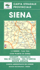
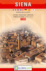
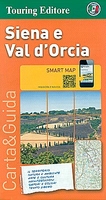
Siena And Val D’Orcia TCI Smart Map

Siena and Val d’Orcia region of Tuscany on a light, waterproof and tear resistant map at 1:175, 000 from the Touring Club Italiano with publishers’ recommendations for best sights, street plans of Siena, Montalcino and Pienza, plus extensive text, all in Italian only, with more suggestions on how to get the best of the region.Coverage extends from Pogginonsi and Radda in Chaini north of Siena to Pitigliano. Cartography is from TCI’s excellent regional series at 1:200, 000, enlarged here to 1:175, 000 and with an additional overprint to highlight the 12 recommended sights in the region. Eight of Siena’s principal sights are highlighted on the street plan of town. Also provided are street plans of Montalcino and Pienza, plus plans of the Benedictine Abbey of Monte Oliveto
Maggiore and Bernardo Rossellino’s buildings and Pienza.The reverse side provides extensive notes about the region, its cultural and historical heritage, gastronomy, landscape, leisure activities, etc. Map legend and all the text are in ITALIAN only.To see the list of titles in this series please click on the series link.
RIP - This product is no longer available on our network. It was last seen on 25.09.2019

This page now acts as a permanent archive for this product. Add more information using the comments box below to ensure it can still be found by future generations.

Use our search facility to see if it is available from an alternative contributor.
  • Availability: Out Of Stock
  • Supplier: Stanfords
  • SKU: 9788836560066
Availability: In Stock
£8.99

Product Description

Siena & Val d’ Orcia region of Tuscany on a light, waterproof & tear resistant map at 1:175, 000 from the Touring Club Italiano with publishers’ recommendations for best sights, street plans of Siena, Montalcino & Pienza, plus extensive text, all in Italian only, with more suggestions on how to get the best of the region. Coverage extends from Pogginonsi & Radda in Chaini north of Siena to Pitigliano. Cartography is from TCI’s excellent regional series at 1:200, 000, enlarged here to 1:175, 000 & with an additional overprint to highlight the 12 recommended sights in the region. Eight of Siena’s principal sights are highlighted on the street plan of town. Also provided are street plans of Montalcino & Pienza, plus plans of the Benedictine Abbey of Monte Oliveto Maggiore & Bernardo Rossellino’s buildings & Pienza. The reverse side provides extensive notes about the region, its cultural & historical heritage, gastronomy, landscape, leisure activities, etc. Map legend & all the text are in ITALIAN only. To see the list of titles in this series please click on the series link.

Reviews/Comments

Add New

Intelligent Comparison

Oooops!
We couldn't find anything!
Perhaps this product's unique.... Or perhaps we are still looking for comparisons!
Click to bump this page and we'll hurry up.

Price History

Vouchers

No voucher codes found.
Do you know a voucher code for this product or supplier? Add it to Insights for others to use.

Facebook

Jargon Buster

Italian - A word used ot descibe something from Italy
Waterproof - Resistant to water, usualy specified by depth in metres
Resistant - Something that can repel against something.
Regional - An adjective to describe a set geographic area.

Supplier Information

Stanfords
Stanfords was established in 1853 and opened their iconic Covent Garden flagship store in 1901. They have become the top retailer of maps, travel books and accessories in the UK and arguably offer the largest selection of maps and travel books worldwide. Famous names such as Captain Robert Falcon Scott, Ranulph Fiennes and Michael Palin have purchased from Stanfords. They now have a shop in Bristol and both stores together with other venues operate a calendar of events including talks, book signings and exhibitions. As a specialist map retailer, the map selection is comprehensive and includes road maps, street maps and walking maps from worldwide destinations, as well as a selection of world atlases and wall maps. Books include travel guides and travel literature. Stanfords also stock globes, from miniatures made of blue marble to magnificent floor-standing globes. The website features a selection of interesting articles on travel topics.
Page Updated: 2023-11-12 20:15:36

Community Generated Product Tags

Oh No! The productWIKI community hasn't generated any tags for this product yet!
Menu