More From Contributor
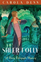
£7.99
On his twenty-fifth birthday, Leo Vincey opens the silver casket that his father has left to him. It contains a letter recounting the legend of a white sorceress who rules an African tribe & of his father's quest to find this remote race. To find out for himself if the story is true, Leo & his companions set sail for Zanzibar. There, he is brought face to face with Ayesha, She-who-must-be-obeyed: dictator, femme fatale, tyrant & beauty. She has been waiting for centuries for the true descendant of Kallikrates, her murdered lover, to arrive, & arrive he does
- in an unexpected form. Blending breathtaking adventure with a brooding sense of mystery & menace, She is a story of romance, exploration discovery & heroism that has lost none of its power to enthrall.
...
Archived Product
£8.99
When Emma Brockes was ten years old, her mother said ` One day I will tell you the story of my life & you will be amazed.` Growing up in a tranquil English village, Emma knew very little of her mother`s life before her. She knew Paula had grown up in South Africa & had seven siblings. She had been told stories about deadly snakes & hailstones the size of golf balls. There was mention, once, of a trial. But most of the past was a mystery. When her mother dies of cancer, Emma
- by then a successful journalist at the Guardian
- is free to investigate the untold story. Her search begins in the Colindale library but then takes her to South Africa, to the extended family she has never met & their accounts of a childhood so different to her own. She encounters versions of the life her mother chose to leave behind
- & realises what a gift her mother gave her. Part investigation, part travelogue, part elegy, She Left Me the Gun is a gripping, funny & clear-eyed account of a writer`s search for her mother`s story.


...
Archived Product
£10.99
In medieval Engl&, man was the ruler of woman, & the King was the ruler of all. How, then, could royal power lie in female hands? In She-Wolves, celebrated historian, Helen Castor, tells the dramatic & fascinating stories of four exceptional women who, while never reigning queens, held great power: Matilda, Eleanor of Aquitaine, Isabella of France & Margaret of Anjou. These were women who paved the way for Jane Grey, Mary Tudor & Elizabeth I
- the Tudor queens who finally confronted what it meant to be a female monarch.
...
Archived Product
£6.99
Throughout southern Africa, shebeens are where jokes are born, news is embellished & exchanged. They are unique vantage points where men go after a day`s work, both to escape from the troubled world around them & to observe & comment on it. In Shebeen Tales, Zimbabwe`s leading author offers a view of his country not from the privileged & insulated perspective of a well-heeled visitor, but that of the ordinary person who, with the help of dry wit & illegal beer, pokes fun at the rich & mighty. Struggling against madcap motorists, pompous bureaucrats & the other woes of life in the city, the man in the shebeen sees modern Africa as it really is, not as press releases or tourist brochures would have us believe. Hove looks straight in the eye of a society suffering from AIDS, drought & economic hardship, but does not succumb to despair. With a wry sense of humour, he celebrates a people who live life to the full, laugh & sing, tell tall tales — whatever is thrown at them. In new pieces written for this edition, he discusses the vexed issue of homosexuality in Zimbabwe & also casts an amused eye at President Mugabe`s wedding. ...
Archived Product
£4.99
The Sheep Foldable Shopping Bag, comes as a compact & colourful pouch in the shape of a fox & unfolds into a tote bag with delicate decorative print. Very lightweight, the little sheep can fit into any handbag & be ready to use as an alternative to a plastic bag. The Sheep Foldable Shopping Bag is ideal for when you pop out to get your lunch or a few items from the shops. ...
Archived Product
£3.50
Sheerness in 1931 in a fascinating series of reproductions of old Ordnance Survey plans in the Alan Godfrey Editions, ideal for anyone interested in the history of their neighbourhood or family. The map covers most of central Sheerness, stretching from the Goods station & St Paul`s church eastward to Seager Road, & from Maple Street northward to the Thames. Features include Ravelin Bridge, Blue Town, Mile Town, Marine Town, railway terminus, The Moat, Holy Trinity church, Cheyney Rock, Ordnance Marshes, Bastions etc. On the reverse is part of adjacent sheet 13.05 covering Sheerness Pier (although this is taken from the earlier, less detailed 1910 version). About the Alan Godfrey Editions of the 25” OS Series Selected towns in Great Britain & Ireland are covered by maps showing the extent of urban development in the last decades of the 19th & early 20th century. The plans have been taken from the Ordnance Survey mapping & reprinted at about 15 inches to one mile (1:4, 340). On the reverse most maps have historical notes & many also include extracts from contemporary directories. Most maps cover about one mile (1.6kms) north/south, one & a half miles (2.4kms) across; adjoining sheets can be combined to provide wider coverage.FOR MORE INFORMATION & A COMPLETE LIST OF ALL AVAILABLE TITLES PLEASE CLICK ON THE SERIES LINK. ...
Archived Product
£6.39
A detailed topographic map of Sheffield & Barnsley from the Ordnance Survey Explorer series, covering Rotherham. Edition A2; Publication date December 2008 About this series: These highly detailed maps show all the administrative boundaries, settlements as small as isolated farms, the road network down to unfenced roads & country tracks, & field boundaries (hedges & drystone walls) which make navigation across the countryside much easier. Steep gradients on roads are indicated. Various landmarks, e.g. powerlines, archaeological sites, windmills, churches & lighthouses are shown & additional graphics indicate natural terrain features such as cliffs, scree, mud & vegetation variations. The contour interval is 5 metres in the lower parts of the country & 10 metres in the uplands, & spot heights are marked. Each map covers an area of 30 x 20km (i.e. approx. 19 x 12 miles), with some double-sided maps covering more, as indicated in the individual descriptions. The maps are fully GPS compatible, with the National Grid shown at 1km intervals & latitude & longitude indicated by margin ticks at 1'. The Explorer series has replaced the earlier, green-cover Pathfinder maps. The Explorer series is now complete & covers all of Engl&, Wales & Scotl&. Some sheets for popular areas like the National Parks are still branded as Outdoor Leisure (OL) maps, but are now included in this series as the cartography is the same as that in the Explorer Maps. The Explorer maps offer a substantial improvement on the Pathfinder series, with greater use of colour, larger area per map, & stronger emphasis on information for ramblers & tourists. This series is ideal for walking & other outdoor pursuits & each map shows a large amount of information for ramblers & tourists. Public rights of way are shown (except in Scotland), together with other routes with public access: National Trails & Recreational Paths, permitted paths & bridleways, & selected cycle routes. Open access land created under the Countryside & Rights of Way Act 2000 is marked. Tourist information

Includes::
caravan & camp sites, Park & Ride locations, recreation/leisure/sport centres, museums, historic buildings, English Heritage & National Trust sites, rural pubs, etc. The map legend is in English only, except for the tourist information content which is also in French & German.

...
Archived Product
£14.99
Sheffield, Barnsley & Rotherham area on a detailed topographic & GPS compatible map No. 278, waterproof version, from the Ordnance Survey’s 1:25, 000 Explorer series. MOBILE DOWNLOADS: this title & all the other OS Explorer maps include a code for downloading after purchase the digital version onto your smartphone or tablet for viewing on the OS smartphone app.OS EXPLORER SERIES: to see the list of all the titles in the OS Explorer series, both paper & waterproof versions, please click on the series link. The Explorer series, Ordnance Survey’s most detailed maps recommended for anyone enjoying outdoor activities, provides topographic coverage of Great Britain at 1:25, 000 on GPS compatible maps with hiking trails, cycling routes & extensive tourist information. Each printed map is available either on paper or as a waterproof & tear-resistant OS Active Map, as indicated in its title. Britain’s National Parks & other areas of particular tourist interest are presented on often double-sided OL (Outdoor Leisure) maps, whilst most standard format Explorers cover an area of 30 x 20km (approx. 19 x 12 miles). All three versions (paper, waterproof & digital) are the same & provide plenty of recreational & tourist information, indicating the traditional public right of way paths (except in Scotland where different laws apply), including bridleways & byways. National Trails & other long-distance paths are marked, as well as permissive footpaths or bridleways & on-road or traffic-free cycle routes with, where appropriate, their National/ Regional Cycle Network numbers. Boundaries of access land are clearly marked. A wide range of symbols provides additional tourist information, highlighting camping & caravanning sites, information offices & visitors’ centres, parking & picnicking places, country pubs, sport & recreational facilities including cycle hire locations & mountain biking trails, historic buildings & museums, etc. Exceptionally clear presentation of the landscape is provided by contours at 5m or in the uplands at 10m intervals, with additional spot heights plus colouring and/or graphics for different types of woodlands, orchards, heath, marshl&, scree or boulders, & other topographic features. For GPS users the maps have British National Grid lines at 1km intervals, with latitude & longitude given by margin ticks at 1`. Clearly laid out map legend

Includes::
French & German translations for the tourist information symbols.

...
Archived Product
£8.99
Sheffield, Barnsley & Rotherham area on a detailed topographic & GPS compatible map No. 278, paper version, from the Ordnance Survey’s 1:25, 000 Explorer series.MOBILE DOWNLOADS: this title & all the other OS Explorer maps include a code for downloading after purchase the digital version onto your smartphone or tablet for viewing on the OS smartphone app.OS EXPLORER SERIES: to see the list of all the titles in the OS Explorer series, both paper & waterproof versions, please click on the series link. The Explorer series, Ordnance Survey’s most detailed maps recommended for anyone enjoying outdoor activities, provides topographic coverage of Great Britain at 1:25, 000 on GPS compatible maps with hiking trails, cycling routes & extensive tourist information. Each printed map is available either on paper or as a waterproof & tear-resistant OS Active Map, as indicated in its title. Britain’s National Parks & other areas of particular tourist interest are presented on often double-sided OL (Outdoor Leisure) maps, whilst most standard format Explorers cover an area of 30 x 20km (approx. 19 x 12 miles). All three versions (paper, waterproof & digital) are the same & provide plenty of recreational & tourist information, indicating the traditional public right of way paths (except in Scotland where different laws apply), including bridleways & byways. National Trails & other long-distance paths are marked, as well as permissive footpaths or bridleways & on-road or traffic-free cycle routes with, where appropriate, their National/ Regional Cycle Network numbers. Boundaries of access land are clearly marked. A wide range of symbols provides additional tourist information, highlighting camping & caravanning sites, information offices & visitors’ centres, parking & picnicking places, country pubs, sport & recreational facilities including cycle hire locations & mountain biking trails, historic buildings & museums, etc. Exceptionally clear presentation of the landscape is provided by contours at 5m or in the uplands at 10m intervals, with additional spot heights plus colouring and/or graphics for different types of woodlands, orchards, heath, marshl&, scree or boulders, & other topographic features. For GPS users the maps have British National Grid lines at 1km intervals, with latitude & longitude given by margin ticks at 1`. Clearly laid out map legend

Includes::
French & German translations for the tourist information symbols.

...
Archived Product
£11.19
Laminated waterproof edition of a detailed topographic map of Sheffield & Barnsley from the Ordnance Survey Explorer series, covering Rotherham. Edition A2; Publication date December 2008 About this series: These highly detailed maps show all the administrative boundaries, settlements as small as isolated farms, the road network down to unfenced roads & country tracks, & field boundaries (hedges & drystone walls) which make navigation across the countryside much easier. Steep gradients on roads are indicated. Various landmarks, e.g. powerlines, archaeological sites, windmills, churches & lighthouses are shown & additional graphics indicate natural terrain features such as cliffs, scree, mud & vegetation variations. The contour interval is 5 metres in the lower parts of the country & 10 metres in the uplands, & spot heights are marked. Each map covers an area of 30 x 20km (i.e. approx. 19 x 12 miles), with some double-sided maps covering more, as indicated in the individual descriptions. The maps are fully GPS compatible, with the National Grid shown at 1km intervals & latitude & longitude indicated by margin ticks at 1'. The Explorer series has replaced the earlier, green-cover Pathfinder maps. The Explorer series is now complete & covers all of Engl&, Wales & Scotl&. Some sheets for popular areas like the National Parks are still branded as Outdoor Leisure (OL) maps, but are now included in this series as the cartography is the same as that in the Explorer Maps. The Explorer maps offer a substantial improvement on the Pathfinder series, with greater use of colour, larger area per map, & stronger emphasis on information for ramblers & tourists. This series is ideal for walking & other outdoor pursuits & each map shows a large amount of information for ramblers & tourists. Public rights of way are shown (except in Scotland), together with other routes with public access: National Trails & Recreational Paths, permitted paths & bridleways, & selected cycle routes. Open access land created under the Countryside & Rights of Way Act 2000 is marked. Tourist information

Includes::
caravan & camp sites, Park & Ride locations, recreation/leisure/sport centres, museums, historic buildings, English Heritage & National Trust sites, rural pubs, etc. The map legend is in English only, except for the tourist information content which is also in French & German.

...
Archived Product

Sheer Folly

In March of 1926, Daisy Dalrymple Fletcher and her friend Lucy head off for several days at stately home reputed to have the best grotto in the country. Working on a book of architectural follies they plan to research and photograph it. Leaving her husband and young twins behind, Daisy is expecting a productive weekend at Appsworth Hall, with the only potential difficulty being keeping Lucy from offending the current owner, a manufacturer of plumbing products. Alas, it`s not to be quite so simple. At the home, they find themselves faced with a curious assortment of people including the abominable, tactless Lord Rydal, who is rumored to be having an affair with one of the guests while at the same time in ardent and artless pursuit of the hand in marriage of another. When the grotto
explodes with Lord Rydal in it, it`s not a question of who would do it - as most who`ve met him would be sorely tempted - but who actually did do it.
RIP - This product is no longer available on our network. It was last seen on 25.09.2019

This page now acts as a permanent archive for this product. Add more information using the comments box below to ensure it can still be found by future generations.

Use our search facility to see if it is available from an alternative contributor.
  • Availability: Out Of Stock
  • Supplier: Stanfords
  • SKU: 9781849011211
Availability: In Stock
£6.99

Product Description

In March of 1926, Daisy Dalrymple Fletcher & her friend Lucy head off for several days at stately home reputed to have the best grotto in the country. Working on a book of architectural follies they plan to research & photograph it. Leaving her husband & young twins behind, Daisy is expecting a productive weekend at Appsworth Hall, with the only potential difficulty being keeping Lucy from offending the current owner, a manufacturer of plumbing products. Alas, it`s not to be quite so simple. At the home, they find themselves faced with a curious assortment of people including the abominable, tactless Lord Rydal, who is rumored to be having an affair with one of the guests while at the same time in ardent & artless pursuit of the hand in marriage of another. When the grotto explodes with Lord Rydal in it, it`s not a question of who would do it
- as most who`ve met him would be sorely tempted
- but who actually did do it.

Reviews/Comments

Add New

Intelligent Comparison

Oooops!
We couldn't find anything!
Perhaps this product's unique.... Or perhaps we are still looking for comparisons!
Click to bump this page and we'll hurry up.

Price History

Vouchers

No voucher codes found.
Do you know a voucher code for this product or supplier? Add it to Insights for others to use.

Facebook

Jargon Buster

Hand - A part of the body at the end of the arm
Hand - A pointer which indicates time on a clock face
Simple - Basic, easy no difficulty in understanding.
Home - A place of permanent residence for families.
Hall - A room at the inside of an entrance of a house.
Head - The upper part of a body typically separated by the neck.

Supplier Information

Stanfords
Stanfords was established in 1853 and opened their iconic Covent Garden flagship store in 1901. They have become the top retailer of maps, travel books and accessories in the UK and arguably offer the largest selection of maps and travel books worldwide. Famous names such as Captain Robert Falcon Scott, Ranulph Fiennes and Michael Palin have purchased from Stanfords. They now have a shop in Bristol and both stores together with other venues operate a calendar of events including talks, book signings and exhibitions. As a specialist map retailer, the map selection is comprehensive and includes road maps, street maps and walking maps from worldwide destinations, as well as a selection of world atlases and wall maps. Books include travel guides and travel literature. Stanfords also stock globes, from miniatures made of blue marble to magnificent floor-standing globes. The website features a selection of interesting articles on travel topics.
Page Updated: 2023-11-12 20:15:36

Community Generated Product Tags

Oh No! The productWIKI community hasn't generated any tags for this product yet!
Menu