More From Contributor

£10.95
Serengeti National Park at 1:400, 000 on a map from Veronica Roodt Publications presenting the area on a base derived from satellite imagery. Extra panels provide additional information for visitors including numerous enlargements. On one side is a map of the whole park showing its network of roads & tracks for viewing animals. A panel provides GPS waypoints for 60 junctions & driving distances are marked. Symbols indicate locations of lodges, ranger posts, campsites, picnic sites, look-out points, etc. Also marked are locations of fuel supplies. The map is accompanied by a diagram showing migratory routes in the Serengeti Ecosystem. On the reverse seven panels provide enlargements of Serengeti ...
Archived Product
£12.99
Serengeti National Park in a series of brightly coloured maps of Tanzania’s national parks & conservation areas in Maco Editions` characteristic h&-drawn style of cartography. The maps include plenty of tourist information & enlargements for the most visited areas & hiking routes, with many titles providing a vivid picture of the changes to the terrain & vegetation during the dry & the wet seasons. The maps are illustrated in the margins with beautiful drawings of local flora and/or fauna & animal footprints for easy identification.* In this title:* one side the park is drawn during the dry season, with enlargements for the Seronera & Lobo areas, indicating various types of terrain & vegetation: gorges, rivers & dried river beds, soda lakes, hippo pools, woodl&, different types of grassl&, etc. The map shows local roads & seasonal tracks, entry gates, park lodges & campsites. No geographical coordinates are given. On the reverse side the park is presented in the wet season, indicating changes in the terrain & vegetation. A series of insets show patterns of animal migration in the region month by month. The map is illustrated with numerous beautiful drawings of local trees with examples of their leaves or small branches for easy identification. Also included are drawings of footprints of animals found in the park, from porcupines & dikdiks, to hippos & elephants. ...
Archived Product
£12.95
Serengeti National Park plus the adjoining protected areas of Northern Tanzania & across the border in Kenya, covering the whole of the Greater Serengeti Ecosystem, on a large, detailed map with enlargements & extensive informative text on various aspects of the area, produced by Harvey in cooperation with the Frankfurt Zoological Society, Tanzania National Parks & other environmental & academic organization. On one side the main map at 1:250, 000 covers the Serengeti National Park, Ngorongoro Conservation Area, Liliondo Game Controlled Area, & three more game reverses within Tanzania: Ikorongo, Grumeti & Maswa. Coverage extends across the border with Kenya to include the Masai Mara National Reserve, plus the adjoining Masai Group Ranches: Siana & parts of Koyaki & Olkinyie. The map has contours at 100m intervals with colouring to indicate different types of vegetation: grassl&, savannah, open & dense woodl&. Permanent or seasonal rivers, lakes & pools, marshes & kopjes are shown & symbols mark locations of entrance gates, airstrips, lodges & campsites, ranger posts, tourist information centres & fuels supplies. On local roads & seasonal tracks intermediate distances are marked. The map has a UTM grid, plus latitude & longitude margin ticks at 30’ intervals. On the reverse are enlargements at 1:125, 000 of two parts of the Serengeti National Park: the Grumeti River area & the central part around Seronera & Moru. Numerous panels, illustrated with colour photos, deal with various aspects of the Serengeti
- Mara ecosystem: topography & geology, kopjes, history & people, climate, fauna & flora, etc.
...
Archived Product
£25.00
In these terrific action photos of wildlife on the African savannah in the Serengeti & the Massai Mara, Anup Shah reveals these creatures as never seen before, using remote hidden cameras that have been planted across the plains. This is life on the plains in all its dynamism, cruelty & vitality, the circle of life in action. Readers will find themselves literally face to face with hyenas as they feed on a kill, with elephants communing in a watering hold, playful lion cubs, wildebeests leaping across a ravine, inquisitive monkeys who have discovered the camera & gaze directly into the lens & cheetahs peering back under their tails towards the camera. Many of these animals have actually noticed the camera, mostly by the sound of it clicking away & their interest is clearly piqued; they`re certainly not accustomed to encounters with a camera on the ground of their home turf. This is primarily a visual journey through the African plains, but captions written by the author will impart interesting facts about the animals, as well as any activity of interest that may have occurred while the photo was being taken. ...
Archived Product
£8.99
It would have been churlish to have refused his invitation to accompany him on a trip to `forage for hidden treasures`. If the truth be known, I secretly couldn`t resist the novelty of passing time with a bloke called Serge Bastarde. When John decamps to France to start up as an antiques dealer, he doesn`t count on meeting Serge Bastarde. The lovable rogue & brocanteur offers to teach John the tricks of the trade in return for help in a series of unscrupulous schemes. As the pair trawl through markets & farmhouses, they con hearty lunches from old peasants & get into scrapes with priceless collectibles. Filled with eccentric characters & unlikely adventures, this is a hilarious romp through the real rural France. ...
Archived Product
£40.00
Chilean photographer Sergio Larrain (1931-2012) published very few books during his lifetime, but perhaps the most feted among them was Valparaiso. He photographed this Chilean seaport throughout his career, but it was in the early 1960s, when he returned to his homeland after travelling the world for many years as a Magnum photographer, that it became a focus for his attention. He saw it as `a rather sordid yet romantic city`, standing between the Andes & the Pacific Ocean, falling into a slow decline as its trading importance faded away, yet still retaining hints of beauty & magic. Now published in English for the first time with an introduction by Agnes Sire as well as a specially written text by Nobel laureate Pablo Neruda, this new edition of Valparaiso is based on a layout that Larrain designed in 1993, in response to the original French edition of 1991. It also

Includes::
a selection of previously unpublished photographs taken between 1952 & 1992, expanding the original 36 images to a total of 120. This intimate book features handwritten notes & texts by the artist himself, allowing us to share his singular vision of the world & its moments of grace.

...
Archived Product
£9.95
Serifos at 1:20, 000 on a contoured, GPS compatible hiking map published by Terrain Cartography group together with Skai Maps, & printed on light, waterproof & tear-resistant Polyart plastic paper, with extensive tourist information. Topography is very well presented by contours, enhanced by spot heights, subtle relief shading & additional altitude colouring. Contour interval, unless indicated below to the contrary, is 20m. National parks & other protected areas are marked. All place names are shown in both Greek & Latin alphabet. The maps have a UTM grid, plus latitude & longitude margin ticks. Hiking trails are graded between main routes & narrow trails. A wide range of symbols indicate various places of interest & recreational facilities, with main sights clearly highlighted. Most titles distinguish between sandy & pebble beaches; some also indicate beaches with natural shade and/or the type of sea bed. Road network is very clearly graded according to width & the type of surface, distinguishing between good & rough dirt roads. Distances are marked on most small local roads, as well as locations of petrol stations and/or tyre repair workshops. Scenic routes are highlighted. Each map also shows which ports are served by ferry services. Many titles include a street plan of the island ...
Archived Product
£7.50
Road Edition maps are produced in co-operation with the Hellenic Army Geographical Service, the national survey organisation. The maps have contours with colour altitude tints. All the place names are shown in both Greek & Roman script. Road classification distinguishes between unsurfaced roads of good & poor quality. Tourist information

Includes::
scenic routes, petrol stations, archaeological sites, campsites, beaches, etc. Brief descriptions, in Greek & English, illustrate some of the interesting aspects of each isl&. Map legend

Includes::
English. On the reverse, there are lists of various types of accommodation from hotels to private rooms. Please note: deliveries from Road Editions are not very reliable. For titles currently not in stock it may be advisable to choose a map from another publisher.


...
Archived Product
£6.99
The island of Serifos in the Cyclades on light, a waterproof & tear-resistant, contoured & GPS compatible map at 1:17, 000 from Anavasi, with on the reverse a special map to highlight & annotate nine recommended hiking trails. Landscape is vividly shown by contours at 20m with altitude colouring, hill shading & spot heights. The map indicates dirt roads in poor condition & difficult tracks, with distances marked on many local routes, plus locations of petrol stations & tyre repair facilities. Also marked are stops of the local bus service. Country paths distinguish between wide & well defined or narrow and/or poorly defined routes. Symbols show hotels & campsites, places of interest including beaches, archaeological sites, etc. All place names are in both Greek & Latin alphabets. The map has a 1km UTM grid plus latitude/longitude margin ticks & crosshairs at 1’. On the reverse is a simplified map of the island at the same scale, designed to show prominently road access to recommended hiking trails, annotated with useful notes & tips. Map legend & the text include English. To see which other Greek islands are covered by maps from Anavasi, please click on the series link. ...
Archived Product
£9.99
Serifos at 1:20, 000 on a contoured, GPS compatible hiking map published by Terrain Cartography group together with Skai Maps, & printed on light, waterproof & tear-resistant Polyart plastic paper, with extensive tourist information. Topography is very well presented by contours, enhanced by spot heights, subtle relief shading & additional altitude colouring. Contour interval, unless indicated below to the contrary, is 20m. National parks & other protected areas are marked. All place names are shown in both Greek & Latin alphabet. The maps have a UTM grid, plus latitude & longitude margin ticks. Hiking trails are graded between main routes & narrow trails. A wide range of symbols indicate various places of interest & recreational facilities, with main sights clearly highlighted. Most titles distinguish between sandy & pebble beaches; some also indicate beaches with natural shade and/or the type of sea bed. Road network is very clearly graded according to width & the type of surface, distinguishing between good & rough dirt roads. Distances are marked on most small local roads, as well as locations of petrol stations and/or tyre repair workshops. Scenic routes are highlighted. Each map also shows which ports are served by ferry services. Many titles include a street plan of the island’s main town, with colouring clearly showing various tourist facilities. The reverse side of each title is covered by general information about the isl&, illustrated with colour photos. Many titles also include brief descriptions of recommended hiking trails.* Map legend & all the text include English.** In this title:* descriptions of 15 selected hiking trails. ...
Archived Product

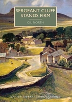
Sergeant Cluff Stands Firm

`He could feel it in the blackness, a difference in atmosphere, a sense of evil, of things hidden.`Amy Snowden, in middle age, has long since settled into a lonely life in the Yorkshire town of Gunnarshaw, until - to her neighbours` surprise - she suddenly marries a much younger man. Months later, Amy is found dead - apparently by her own hand - and her husband, Wright, has disappeared.Sergeant Caleb Cluff - silent, watchful, a man at home in the bleak moorland landscape of Gunnarshaw - must find the truth about the couple`s unlikely marriage, and solve the riddle of Amy`s death.This novel, originally published in 1960, is the first in the series of Sergeant Cluff detective stories that were televised in the 1960s but have long been neglected. This new edition is published in
the centenary year of the author`s birth.
RIP - This product is no longer available on our network. It was last seen on 25.09.2019

This page now acts as a permanent archive for this product. Add more information using the comments box below to ensure it can still be found by future generations.

Use our search facility to see if it is available from an alternative contributor.
  • External links may include paid for promotion
  • Availability: Out Of Stock
  • Supplier: Stanfords
  • SKU: 9780712356466
Availability: In Stock
£7.99

Product Description

` He could feel it in the blackness, a difference in atmosphere, a sense of evil, of things hidden.` Amy Snowden, in middle age, has long since settled into a lonely life in the Yorkshire town of Gunnarshaw, until
- to her neighbours` surprise
- she suddenly marries a much younger man. Months later, Amy is found dead
- apparently by her own hand
- & her husb&, Wright, has disappeared. Sergeant Caleb Cluff
- silent, watchful, a man at home in the bleak moorland landscape of Gunnarshaw
- must find the truth about the couple`s unlikely marriage, & solve the riddle of Amy`s death. This novel, originally published in 1960, is the first in the series of Sergeant Cluff detective stories that were televised in the 1960s but have long been neglected. This new edition is published in the centenary year of the author`s birth.

Reviews/Comments

Add New

Intelligent Comparison

Oooops!
We couldn't find anything!
Perhaps this product's unique.... Or perhaps we are still looking for comparisons!
Click to bump this page and we'll hurry up.

Price History

Vouchers

No voucher codes found.
Do you know a voucher code for this product or supplier? Add it to Insights for others to use.

Facebook

Jargon Buster

Hand - A part of the body at the end of the arm
Hand - A pointer which indicates time on a clock face
Year - The time it takes the planet earth to orbit the sun. This takes around 365.25 days.
Home - A place of permanent residence for families.
Year - 365 days (366 days in a leap year), the time taken for planet earth to make one full revolution around the sun.

Supplier Information

Stanfords
Stanfords was established in 1853 and opened their iconic Covent Garden flagship store in 1901. They have become the top retailer of maps, travel books and accessories in the UK and arguably offer the largest selection of maps and travel books worldwide. Famous names such as Captain Robert Falcon Scott, Ranulph Fiennes and Michael Palin have purchased from Stanfords. They now have a shop in Bristol and both stores together with other venues operate a calendar of events including talks, book signings and exhibitions. As a specialist map retailer, the map selection is comprehensive and includes road maps, street maps and walking maps from worldwide destinations, as well as a selection of world atlases and wall maps. Books include travel guides and travel literature. Stanfords also stock globes, from miniatures made of blue marble to magnificent floor-standing globes. The website features a selection of interesting articles on travel topics.
Page Updated: 2023-11-12 20:15:36

Community Generated Product Tags

Oh No! The productWIKI community hasn't generated any tags for this product yet!
Menu