More From Contributor
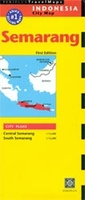
£40.00
Official Mexican Hydrographic Office charts (SEMAR
- Secretaría de Marina Armada de México) offer a great range of scales for ports
...
Archived Product
£40.00
Official Mexican Hydrographic Office charts (SEMAR
- Secretaría de Marina Armada de México) offer a great range of scales for ports
...
Archived Product
£40.00
Official Mexican Hydrographic Office charts (SEMAR
- Secretaría de Marina Armada de México) offer a great range of scales for ports
...
Archived Product
£40.00
Official Mexican Hydrographic Office charts (SEMAR
- Secretaría de Marina Armada de México) offer a great range of scales for ports
...
Archived Product
£40.00
Official Mexican Hydrographic Office charts (SEMAR
- Secretaría de Marina Armada de México) offer a great range of scales for ports
...
Archived Product
£12.99
Map No. 1325, Sembrancher, in the topographic survey of Switzerland at 1:25, 000 from Bundesamt für Landestopographie (swisstopo), covering the whole country on 247 small format sheets, with special larger maps published for popular regions including some titles now available in hiking versions. Highly regarded for their superb use of graphic relief & hill shading, the maps give an almost 3-D picture of Switzerland`s mountainous terrain. Contours are at 10 m intervals, with 20m intervals in the mountainous areas. All the maps have a 1-km grid for Swiss national coordinates (datum CH 1903). * Small format sheets (Nos. 1011
- 1374)* Map legend in the language of the area covered by the map. Additional margin ticks show latitude & longitude in steps of 2`. The area covered by each map is 17 x 12 km (11 x 7 miles approx). * Special larger sheets (Nos. from 2501 onwards) – STANDARD editions:* No map legend is included but a separate leaflet can be provided instead. The area covered by each map is 25 x 17 km (15 x 11 miles approx).* Special larger sheets (Nos. from 2501 onwards) – HIKING editions:* An overprint highlights hiking, mountain & alpine paths, including regional & national long-distance trails. The maps also show bus routes with bus stops, plus inns in remote locations. The area covered by each map is 25 x 17 km (15 x 11 miles approx).
...
Archived Product
£14.99
Semi invisible man is a fascinating biography of the writer Norman Lewis by author Julian Evans. Norman Lewis was the best not-famous writer of his generation, & a better writer than almost all who were. From the 1950s to the 1990s, he wrote books that have survived better than all but a handful of novels. For twenty years Lewis spied for the British government, raced Bugattis before the war, lived in Ibiza after it, & was a crack shot, flamboyant host, & businessman with Mafia connections. Julian Evans’ portrait is a fascinating personal account of a suburban fugitive & adventurer; a writer of unsurpassed humour, wisdom & compassion for the ridiculous; the Defoe of our times. ...
Archived Product
£285.00
Solid cherry board with a French distressed finish. Game board on a small pedestal. As each marble is hand cut & polished size may vary as much as +2mm or 3mm. Multi colored. The game of Solitaire is reputed to have been invented by a nobleman confined in the Bastille prison during the early years of the French Revolution. The game is played with 36 marbles. The object is to eliminate all but one marble, which should ideally end up in the center of the game board. If we do not have this item in stock we will order it for you from our supplier. Delivery generally takes 3 weeks within the UK. For overseas delivery queries please email sales@stanfords.co.uk ...
Archived Product
£9.99
Semmering
- Rax
- Schneeberg – Schneealpe area of eastern Austria presented at 1:50, 000 in a series of contoured & GPS compatible

...
Archived Product
£12.99
Topographic survey of France at 1:25, 000 in IGN`s excellent TOP25 / Série Bleue series. All the maps are GPS compatible, with a 1km UTM grid plus latitude & longitude lines at 5’ intervals. Contours are at 5m intervals except for mountainous areas where the maps have contours at 10m intervals, vividly enhanced by hill shading & graphics for rocky terrain. Colouring with graphics indicates different types of vegetation or land use (deciduous or coniferous forests, moors, orchards, vineyards, etc). PLEASE NOTE: coverage of France at this scale is currently being revised – the format & the presentation of each title are indicated by the letters at the end of its Sheet Reference number (e.g. 0416ET, 3531ETR, 1923SB, etc.)MAPS WITH FULL TOURIST OVERPRINT & AN ENGLISH MAP LEGEND: all TOP25 maps & the SB editions of Série Bleue have an overprint highlighting waymarked walking trails including long-distance GR routes &, where appropriate, ski routes. Symbols indicate campsites, gîtes d’etape, refuges, equestrian centres & other recreational facilities or sites, tourist information centres, cultural heritage, etc. Towns & locations of particular interest are highlighted.- ET or OT = single-sided TOP25 map covering approx. 29x 21 km / 18x 13 miles.- ETR or OTR = waterproof & tear resistant TOP25 map covering the same area as the corresponding ET or OT number, but double-sided, printed on a smaller size sheet with a good overlap between the sides.- SB = Série Bleue map with full tourist overprint; these maps, first introduced in summer 2014, each cover approx. 29x 24km / 18x 15 miles.SÉRIE BLEUE maps with numbers ending in E (Est) or O (Ouest): most editions now indicate the GR routes, but do not show any other tourist information. Map legend is in French only. Each map covers approx. 14x 20km / 9x 12 miles. ...
Archived Product

Semarang

The town of Semerang on Java at 1:15, 000 on a double-sided street plan from the Singapore based Periplus, highlighting tourist accommodation and places of interest. On one side are the city’s central districts, including the airport, with coverage extended further south on the reverse.The plan indicates main traffic arteries and highlights locations of numerous hotels, restaurants, banks, travel agencies, etc. as well as various services and facilities. The street index is thematic, also listing neighbourhoods, places of interest, hotels and restaurants, shopping centres, etc.
RIP - This product is no longer available on our network. It was last seen on 25.09.2019

This page now acts as a permanent archive for this product. Add more information using the comments box below to ensure it can still be found by future generations.

Use our search facility to see if it is available from an alternative contributor.
  • External links may include paid for promotion
  • Availability: Out Of Stock
  • Supplier: Stanfords
  • SKU: 9780794603632
Availability: In Stock
£7.99

Product Description

The town of Semerang on Java at 1:15, 000 on a double-sided street plan from the Singapore based Periplus, highlighting tourist accommodation & places of interest. On one side are the city’s central districts, including the airport, with coverage extended further south on the reverse. The plan indicates main traffic arteries & highlights locations of numerous hotels, restaurants, banks, travel agencies, etc. as well as various services & facilities. The street index is thematic, also listing neighbourhoods, places of interest, hotels & restaurants, shopping centres, etc.

Reviews/Comments

Add New

Intelligent Comparison

Oooops!
We couldn't find anything!
Perhaps this product's unique.... Or perhaps we are still looking for comparisons!
Click to bump this page and we'll hurry up.

Price History

Vouchers

No voucher codes found.
Do you know a voucher code for this product or supplier? Add it to Insights for others to use.

Facebook

Jargon Buster

Accommodation - A room in which someone can live in, for example in a hotel

Supplier Information

Stanfords
Stanfords was established in 1853 and opened their iconic Covent Garden flagship store in 1901. They have become the top retailer of maps, travel books and accessories in the UK and arguably offer the largest selection of maps and travel books worldwide. Famous names such as Captain Robert Falcon Scott, Ranulph Fiennes and Michael Palin have purchased from Stanfords. They now have a shop in Bristol and both stores together with other venues operate a calendar of events including talks, book signings and exhibitions. As a specialist map retailer, the map selection is comprehensive and includes road maps, street maps and walking maps from worldwide destinations, as well as a selection of world atlases and wall maps. Books include travel guides and travel literature. Stanfords also stock globes, from miniatures made of blue marble to magnificent floor-standing globes. The website features a selection of interesting articles on travel topics.
Page Updated: 2023-11-12 20:15:36

Community Generated Product Tags

Oh No! The productWIKI community hasn't generated any tags for this product yet!
Menu