More From Contributor

£26.00
Jamie gets the nation cooking clever, shopping smart & wasting less with his new cookbook, Save with Jamie. This year, I`ve got the message loud & clear that as everyone comes under bigger & bigger financial pressure, they want help to cook tasty, nutritious food on a budget
- so this book was born completely out of public dem&. Save with Jamie draws on knowledge & cooking skills to help you make better choices, showing you how to buy economically & efficiently, get the most out of your ingredients, save time & prevent food waste. & there`s no compromise
- I`m talking big flavours, comfort food that makes you happy, & colourful, optimistic dishes. Our biggest luxury is knowledge, whether times are hard or not, so get kitchen smart & smash the recession. Jamie Oliver started cooking at his parents` pub, The Cricketers, in Clavering, Essex, at the age of eight. His television & publishing career began in 1999 with The Naked Chef series. Since then he has set up Fifteen restaurant in London, changed school dinners in the UK & revolutionized home cooking. His charity, The Jamie Oliver Foundation, seeks to improve people`s lives through food. He writes for publications in the UK & around the world, including his own Jamie Magazine. Jamie lives in London & Essex with his wife Jools & their children.

...
Archived Product
£12.99
Topographic survey of France at 1:25, 000 in IGN`s excellent TOP25 / Série Bleue series. All the maps are GPS compatible, with a 1km UTM grid plus latitude & longitude lines at 5’ intervals. Contours are at 5m intervals except for mountainous areas where the maps have contours at 10m intervals, vividly enhanced by hill shading & graphics for rocky terrain. Colouring with graphics indicates different types of vegetation or land use (deciduous or coniferous forests, moors, orchards, vineyards, etc). PLEASE NOTE: coverage of France at this scale is currently being revised – the format & the presentation of each title are indicated by the letters at the end of its Sheet Reference number (e.g. 0416ET, 3531ETR, 1923SB, etc.)MAPS WITH FULL TOURIST OVERPRINT & AN ENGLISH MAP LEGEND: all TOP25 maps & the SB editions of Série Bleue have an overprint highlighting waymarked walking trails including long-distance GR routes &, where appropriate, ski routes. Symbols indicate campsites, gîtes d’etape, refuges, equestrian centres & other recreational facilities or sites, tourist information centres, cultural heritage, etc. Towns & locations of particular interest are highlighted.- ET or OT = single-sided TOP25 map covering approx. 29x 21 km / 18x 13 miles.- ETR or OTR = waterproof & tear resistant TOP25 map covering the same area as the corresponding ET or OT number, but double-sided, printed on a smaller size sheet with a good overlap between the sides.- SB = Série Bleue map with full tourist overprint; these maps, first introduced in summer 2014, each cover approx. 29x 24km / 18x 15 miles.SÉRIE BLEUE maps with numbers ending in E (Est) or O (Ouest): most editions now indicate the GR routes, but do not show any other tourist information. Map legend is in French only. Each map covers approx. 14x 20km / 9x 12 miles. ...
Archived Product
£18.99
Topographic survey of France at 1:25, 000 in IGN`s excellent TOP25 / Série Bleue series. All the maps are GPS compatible, with a 1km UTM grid plus latitude & longitude lines at 5’ intervals. Contours are at 5m intervals except for mountainous areas where the maps have contours at 10m intervals, vividly enhanced by hill shading & graphics for rocky terrain. Colouring with graphics indicates different types of vegetation or land use (deciduous or coniferous forests, moors, orchards, vineyards, etc). PLEASE NOTE: coverage of France at this scale is currently being revised – the format & the presentation of each title are indicated by the letters at the end of its Sheet Reference number (e.g. 0416ET, 3531ETR, 1923SB, etc.)MAPS WITH FULL TOURIST OVERPRINT & AN ENGLISH MAP LEGEND: all TOP25 maps & the SB editions of Série Bleue have an overprint highlighting waymarked walking trails including long-distance GR routes &, where appropriate, ski routes. Symbols indicate campsites, gîtes d’etape, refuges, equestrian centres & other recreational facilities or sites, tourist information centres, cultural heritage, etc. Towns & locations of particular interest are highlighted.- ET or OT = single-sided TOP25 map covering approx. 29x 21 km / 18x 13 miles.- ETR or OTR = waterproof & tear resistant TOP25 map covering the same area as the corresponding ET or OT number, but double-sided, printed on a smaller size sheet with a good overlap between the sides.- SB = Série Bleue map with full tourist overprint; these maps, first introduced in summer 2014, each cover approx. 29x 24km / 18x 15 miles.SÉRIE BLEUE maps with numbers ending in E (Est) or O (Ouest): most editions now indicate the GR routes, but do not show any other tourist information. Map legend is in French only. Each map covers approx. 14x 20km / 9x 12 miles. ...
Archived Product
£12.99
Topographic survey of France at 1:25, 000 in IGN`s excellent TOP25 / Série Bleue series. All the maps are GPS compatible, with a 1km UTM grid plus latitude & longitude lines at 5’ intervals. Contours are at 5m intervals except for mountainous areas where the maps have contours at 10m intervals, vividly enhanced by hill shading & graphics for rocky terrain. Colouring with graphics indicates different types of vegetation or land use (deciduous or coniferous forests, moors, orchards, vineyards, etc). PLEASE NOTE: coverage of France at this scale is currently being revised – the format & the presentation of each title are indicated by the letters at the end of its Sheet Reference number (e.g. 0416ET, 3531ETR, 1923SB, etc.)MAPS WITH FULL TOURIST OVERPRINT & AN ENGLISH MAP LEGEND: all TOP25 maps & the SB editions of Série Bleue have an overprint highlighting waymarked walking trails including long-distance GR routes &, where appropriate, ski routes. Symbols indicate campsites, gîtes d’etape, refuges, equestrian centres & other recreational facilities or sites, tourist information centres, cultural heritage, etc. Towns & locations of particular interest are highlighted.- ET or OT = single-sided TOP25 map covering approx. 29x 21 km / 18x 13 miles.- ETR or OTR = waterproof & tear resistant TOP25 map covering the same area as the corresponding ET or OT number, but double-sided, printed on a smaller size sheet with a good overlap between the sides.- SB = Série Bleue map with full tourist overprint; these maps, first introduced in summer 2014, each cover approx. 29x 24km / 18x 15 miles.SÉRIE BLEUE maps with numbers ending in E (Est) or O (Ouest): most editions now indicate the GR routes, but do not show any other tourist information. Map legend is in French only. Each map covers approx. 14x 20km / 9x 12 miles. ...
Archived Product
£16.99
The Friends of Friendless Churches exist to save beautiful & historic places of worship from demolition or degradation. Founded in 1957 by the devout journalist & author Ivor Bulmer-Thomas, the Friends now own thirty-eight former places of worship, half in Engl&, half in Wales, which they preserve, undertake repair on where necessary & make accessible as peaceful spaces to visitors & the local community. This book, with a Preface by Sir Simon Jenkins & a Foreword by HRH The Prince of Wales, details all thirty eight buildings, with photographs that touchingly record these former churches & celebrate the work of the Friends. Included are a short history of the Friends of Friendless Churches, a glossary of terms, & information on visiting the churches. ...
Archived Product
£20.00
On the eve of the 1943 invasion of Italy, just weeks before Allied bombs nearly destroyed Leonardo da Vinci`s Last Supper in Milan, General Dwight Eisenhower empowered a new kind of soldier to protect mankind`s greatest cultural treasures. In May 1944, two unlikely American heroes
- an artist & a scholar
- embarked from Naples on the treasure hunt of a lifetime, tracking billions of dollars of stolen art, including works by Donatello, Titian, Caravaggio & Botticelli. As the Germans blew up the historic bridges of Florence & Allied air raids threatened Michelangelo`s David, a heretofore-unknown SS general held the art hostage while negotiating a secret Nazi surrender with American spies. A gripping narrative that will appeal to fans of history, art, travel & adventure, Saving Italy takes us from the battlefields of Monte Cassino to the Vatican & behind closed doors with the great Allied & Axis leaders: Roosevelt, Eisenhower & Churchill; Hitler, Goring & Himmler.

...
Archived Product
£9.99
Frost can be fatal to a fledgling wine business.. .gorgeous glitter with a high price tag. On a winter`s day it is beautiful, but on a spring day after bud burst it spells devastation. For Sean & Caro Feely, a couple whose love affair with wine & France has taken them through financial & physical struggle to create their organic vineyard, it could spell the end. Until they receive an unexpected call that could save their skins... This book is about life, love & taking risks, while transforming a piece of land into a flourishing vineyard & making a new life in France. ...
Archived Product
£8.99
Benjamin Franklin conceived of it. Sir Arthur Conan Doyle endorsed it. Winston Churchill campaigned for it. Kaiser Wilhelm first employed it. Woodrow Wilson & Franklin Roosevelt went to war with it. Every spring, the clocks go forward, & every autumn they go back. ” Saving the Daylight” explores for the first time the contentious, & often entertaining, story of this deceptively simple attempt to regulate the sunlight hours. Throughout its surprisingly controversial history, DST has been claimed to impact a wide variety of diverse & often unexpected areas, including agricultural practices, the reporting of sports scores, street crime, voter turnout & many other, sometime unexpected aspects of daily life. The book brings together the historical, political, & technical aspects of the fascinating story behind the movement for DST, with many lighter & offbeat anecdotes. ...
Archived Product
£25.00
The WWF was established in 1961 spurred by the efforts of Max Nicholson, head of Britain's Nature Conservancy Council, naturalist Peter Scott, & a series of articles written in the Observer by Julian Huxley, former head of UNESCO. This book tells the story of the WWF's battle to save the world's wildlife, the work it has done to protect everything from tigers to marine life &, of course, pandas, as well as its campaigns to promote sustainable development & combat climate change. The author has access to the private papers of Prince Philip & Prince Bernhard of the Netherlands, each of whom served as WWF president for 15 years & the book is lavishly illustrated throughout with exceptional photographs by world-famous wildlife & nature photographers. Also included are the earliest photographs taken of pandas in the wild & works produced for the WWF by such artists as Peter Blake & Tracy Emin. This richly illustrated book encapsulates all the magnificence of the world's wildlife
- & why it must be treasured & preserved.
...
Archived Product
£17.99
The 1:50 000 topographic map gives a more general picture of the ground features than a basic map. It shows settlements, houses, roads, cultivated areas, waterways, cutting areas, mires, rock exposures, & relief. One map sheet covers an area of 30 x 40 km & one centimetre corresponds to 500 metres on the ground. The 1:50, 000 topographic map is also an ideal complement to nautical charts as it provides useful information about the land areas adjacent to waterways. For example, all Finnish sea areas are covered by 1:50 000 topographic map sheets. ...
Archived Product

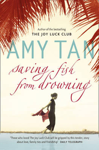
Saving Fish From Drowning

Saving Fish from Drowning by Amy Tan is a novel about the seductions of Shangri-La, about being lost and being found, about losing your guide and carrying on regardless, and awaiting a saviour. All of this is woven into a backdrop of vibrant colours, smells, tastes and landscapes. Businesswoman, patron of the arts and socialite Bibi Chen has been killed in mysterious circumstances. Her death may or may not be linked to the disappearance of eleven American tourists in southern Burma who are ‘following Buddha’s footprints’ on a trip dreamt up by Bibi. The group decide that the death of their guide should not stop them setting forth…but it isn’t long before they stumble into difficulty with wary tribes and the military junta, all with Bibi watching.
RIP - This product is no longer available on our network. It was last seen on 25.09.2019

This page now acts as a permanent archive for this product. Add more information using the comments box below to ensure it can still be found by future generations.

Use our search facility to see if it is available from an alternative contributor.
  • External links may include paid for promotion
  • Availability: Out Of Stock
  • Supplier: Stanfords
  • SKU: 9780007216161
Availability: In Stock
£8.99

Product Description

Saving Fish from Drowning by Amy Tan is a novel about the seductions of Shangri-La, about being lost & being found, about losing your guide & carrying on regardless, & awaiting a saviour. All of this is woven into a backdrop of vibrant colours, smells, tastes & landscapes. Businesswoman, patron of the arts & socialite Bibi Chen has been killed in mysterious circumstances. Her death may or may not be linked to the disappearance of eleven American tourists in southern Burma who are ‘following Buddha’s footprints’ on a trip dreamt up by Bibi. The group decide that the death of their guide should not stop them setting forth…but it isn’t long before they stumble into difficulty with wary tribes & the military junta, all with Bibi watching.

Reviews/Comments

Add New

Intelligent Comparison

Oooops!
We couldn't find anything!
Perhaps this product's unique.... Or perhaps we are still looking for comparisons!
Click to bump this page and we'll hurry up.

Price History

Vouchers

No voucher codes found.
Do you know a voucher code for this product or supplier? Add it to Insights for others to use.

Facebook

Jargon Buster

Fish - A creature that lives in water. A fish uses gills to breath unlike mammals

Supplier Information

Stanfords
Stanfords was established in 1853 and opened their iconic Covent Garden flagship store in 1901. They have become the top retailer of maps, travel books and accessories in the UK and arguably offer the largest selection of maps and travel books worldwide. Famous names such as Captain Robert Falcon Scott, Ranulph Fiennes and Michael Palin have purchased from Stanfords. They now have a shop in Bristol and both stores together with other venues operate a calendar of events including talks, book signings and exhibitions. As a specialist map retailer, the map selection is comprehensive and includes road maps, street maps and walking maps from worldwide destinations, as well as a selection of world atlases and wall maps. Books include travel guides and travel literature. Stanfords also stock globes, from miniatures made of blue marble to magnificent floor-standing globes. The website features a selection of interesting articles on travel topics.
Page Updated: 2023-11-12 20:15:36

Community Generated Product Tags

Oh No! The productWIKI community hasn't generated any tags for this product yet!
Menu