More From Contributor

£13.99
Selvaggio Blue, a 45km long route along the western coast of Sardinia, considered as one of the finest but most difficult hiking & climbing trails in the Mediterranean, on a detailed, double-sided map at 1:15, 000 from Edizioni Enrico Spanu with vivid presentation of the terrain, GPS coordinates, plus stage-by stage descriptions. Contours at 25m intervals, enhanced by shading & graphic relief plus numerous spot heights, provide an exceptionally vivid picture of the difficult terrain covered by the route. The overprint indicates difficult parts of the trail & sections which require climbing, as well as exits from the route. Several points in each stage are cross-referenced to detailed & informative, bilingual English / Italian route descriptions. Symbols show locations of nearby hotels, camping sites, mountain refuges, restaurants & car parks. The map has a 1km UTM grid, latitude & longitude margin ticks at 1’ intervals, plus a list of several GPS waypoints for each of the four stages. Map legend & all the text include English. ...
Archived Product
£6.99
The Arbatax to Ussasai section of Sardinia’s Trenino Verde tourist railway line, run with vintage diesel & steam engines, on a detailed, contoured & GPS compatible map at 1:40, 000 from Edizioni Abies. Topography is shown by contours at 20m intervals, with additional colouring for woodlands & maquis (macchia) shrubl&. The route of the Trenino Verde is prominently marked & shown with stations, optional stops, bridges or viaducts, tunnels & other interesting engineering features. The map also highlights local hiking trails, viewpoints, interesting natural sites, nuraghe, churches, museums, etc, as well as locations with hotels, agriturismo accommodation on farms, & B& Bs. The map has a 1-km UTM grid. Map legend

Includes::
English. On the reverse are lists of local accommodation options with contact details, plus notes about interesting localities & their traditional festivities, etc. The text is in Italian, German & English.PLEASE NOTE: this title is available either separately or as part of a set of three or four maps. To see other titles in this series please click on the series link.

...
Archived Product
£6.99
The Ussasai to Nurri section of Sardinia’s Trenino Verde tourist railway line, run with vintage diesel & steam engines, on a detailed, contoured & GPS compatible map at 1:40, 000 from Edizioni Abies. Topography is shown by contours at 20m intervals, with additional colouring for woodlands & maquis (macchia) shrubl&. The route of the Trenino Verde is prominently marked & shown with stations, optional stops, bridges or viaducts, tunnels & other interesting engineering features. The map also highlights local hiking trails, viewpoints, interesting natural sites, nuraghe, churches, museums, etc, as well as locations with hotels, agriturismo accommodation on farms, & B& Bs. The map has a 1-km UTM grid. Map legend

Includes::
English. On the reverse are lists of local accommodation options with contact details, plus notes about interesting localities & their traditional festivities, etc. The text is in Italian, German & English. PLEASE NOTE: this title is available either separately or as part of a set of three or four maps. To see other titles in this series please click on the series link.

...
Archived Product
£12.99
A set of three maps at 1:40, 000 from the Edizioni Abies series covering Sardinia’s Trenino Verde tourist railway line, run with vintage diesel & steam engines. The maps in this set cover the stages 1 to 3: Arbatax to Ussassai, Ussassai to Nurri, & Nurri to Mandas plus Gesico to Nurallao. Topography is shown by contours at 20m intervals, with additional colouring for woodlands & maquis (macchia) shrubl&. The route of the Trenino Verde is prominently marked & shown with stations, optional stops, bridges or viaducts, tunnels & other interesting engineering features. The maps also highlights local hiking trails, viewpoints, interesting natural sites, nuraghe, churches, museums, etc, as well as locations with hotels, agriturismo accommodation on farms, & B& Bs. Each map has a 1-km UTM grid. Map legend

Includes::
English. On the reverse are lists of local accommodation options with contact details, plus notes about interesting localities & their traditional festivities, etc. The text is in Italian, German & English. PLEASE NOTE: each of the maps in this set is also available either separately or as part of a set of four maps with one additional title. To see other titles in this series please click on the series link.

...
Archived Product
£6.99
Nurri to Mandas & Gesico to Nurallao sections of Sardinia’s Trenino Verde tourist railway line, run with vintage diesel & steam engines, on a detailed, contoured & GPS compatible map at 1:40, 000 from Edizioni Abies. Topography is shown by contours at 20m intervals, with additional colouring for woodlands & maquis (macchia) shrubl&. The route of the Trenino Verde is prominently marked & shown with stations, optional stops, bridges or viaducts, tunnels & other interesting engineering features. The map also highlights local hiking trails, viewpoints, interesting natural sites, nuraghe, churches, museums, etc, as well as locations with hotels, agriturismo accommodation on farms, & B& Bs. The map has a 1-km UTM grid. Map legend

Includes::
English. On the reverse are lists of local accommodation options with contact details, plus notes about interesting localities & their traditional festivities, etc. The text is in Italian, German & English. PLEASE NOTE: this title is available either separately or as part of a set of three or four maps. To see other titles in this series please click on the series link.

...
Archived Product
£6.99
The Nurallao to Sorgono section of Sardinia’s Trenino Verde tourist railway line, run with vintage diesel & steam engines, on a detailed, contoured & GPS compatible map at 1:40, 000 from Edizioni Abies. Topography is shown by contours at 20m intervals, with additional colouring for woodlands & maquis (macchia) shrubl&. The route of the Trenino Verde is prominently marked & shown with stations, optional stops, bridges or viaducts, tunnels & other interesting engineering features. The map also highlights local hiking trails, viewpoints, interesting natural sites, nuraghe, churches, museums, etc, as well as locations with hotels, agriturismo accommodation on farms, & B& Bs. The map has a 1-km UTM grid. Map legend

Includes::
English. On the reverse are lists of local accommodation options with contact details, plus notes about interesting localities & their traditional festivities, etc. The text is in Italian, German & English. PLEASE NOTE: this title is available either separately or as part of a set of four maps. To see other titles in this series please click on the series link.

...
Archived Product
£12.99
Sardona, map No. 247, in the standard topographic survey of Switzerland at 1:50, 000 from Swisstopo, i.e. without the special overprint highlighting walking trails, local bus stops, etc, presented in Swisstopo’s hiking editions of the 50K survey. Highly regarded for their superb use of graphic relief & hill shading, the maps give an almost 3-D picture of Switzerland`s mountainous terrain. Contours are at 20m intervals. All the maps have a 1-km grid with the Swiss national coordinates. This standard version of the 50K survey covers the whole country on 78 small format sheets, with special larger format maps published for several popular tourist destinations. Small format sheets cover an area of 35 x 24 km (21 x 15 miles approx) & have map legend in the language of the area covered by the map. The special larger sheets cover 50 x 35 km (31 x 22 miles approx) & have no map legend, but a separate leaflet can be provided instead.PLEASE NOTE: the hiking editions of the 1:50, 000 Swisstopo survey are listed on our website in a separate series. ...
Archived Product
£18.99
Sardona area, map No. 247T, at 1:50, 000 in a special hiking edition of the country’s topographic survey, published by Swisstopo in cooperation with the Swiss Hiking Federation. Cartography, identical to the standard version of the survey, is highly regarded for its superb use of graphic relief & hill shading to provide an almost 3-D picture of Switzerland`s mountainous terrain. Contours are at 20m intervals. An overprint highlights routes maintained by the SHF, distinguishing between hiking routes, mountain routes requiring proper footwear, & alpine routes where equipment is needed. Paths which are part of the national or regional network of long-distance hiking routes are specially marked & in the more recent editions are annotated with their official numbers. The maps show mountain huts, refuges & in remote areas also inns, plus roads with bus service & the positions of bus stops. All the maps have a 1-km grid of the Swiss national coordinates. For a list of all the titles in this series, please click on the series link. ...
Archived Product
£22.99
Detailed ski map at 1:50, 000 from Swisstopo, the country’s national survey organization, showing routes for skiing and/or snowboarding, access by public transport, recommended itineraries, lists of mountain huts, etc. The series uses the cartography of Switzerland’s topographic survey, with additional colouring to show slopes steeper than 30°. An overprint highlights ski routes, indicating suggested direction, difficult passages & sections which must be covered on foot. Also marked are areas where it is forbidden to leave the routes shown on the map. The maps also highlight roads with bus routes, indicating individual bus stops, show ski lifts & funiculars, plus mark locations of refuges or other mountain accommodation. Each title has the Swiss national grid at intervals of 1km, plus latitude & longitude margin ticks at 1’. Some titles cover a larger area, with a part of an adjoining sheet printed on the reverse of the main map as indicated on our series grid. Where appropriate, ski information extends across the border to France & Italy. On the reverse are itineraries of routes recommended by the Swiss Alpine Club, indicating the degree of difficulty, plus lists of alpine huts with contact details. Map legend for the overprint

Includes::
English. The text about the routes & accommodation is in the main language of the area covered by the map. To see the list of all the titles in this series please click on the series link.

...
Archived Product
£26.99
Sardona Tectonic Arena, a UNESCO World Heritage Site, on map No. 5080T at 1:50, 000 in a special hiking edition of Switzerland’s topographic survey, with a geological map of the region & additional highlighting for the area’s 53 especially interesting natural sites plus for 41 other locations including museums & various institutions. Coverage extends from Glarus in the west to Flums, Sargans & Chur on the Rhine, with Flims on the bottom edge of the map. On the reverse is a geological map of the region at 1:200, 000, descriptions of the 53 special natural sites, plus a photo showing the extent of the Glarus thrust (Glarner Hauptüberschiebung). Map legend is in German, French & Italian; all the text on the reverse side is in German only. The map, published by Swisstopo in cooperation with the Swiss Hiking Federation has cartography identical to the standard version of the survey, highly regarded for its superb use of graphic relief & hill shading to provide an almost 3-D picture of Switzerland`s mountainous terrain. Contours are at 20m intervals. An overprint highlights routes maintained by the SHF, distinguishing between hiking routes, mountain routes requiring proper footwear, & alpine routes where equipment is needed. Paths which are part of the national or regional network of long-distance hiking routes are specially marked & in the more recent editions are annotated with their official numbers. The maps show mountain huts, refuges & in remote areas also inns, plus roads with bus service & the positions of bus stops. All the maps have a 1-km grid of the Swiss national coordinates. For a list of all the titles in this series, please click on the series link. ...
Archived Product

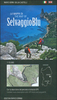
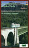
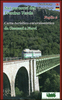
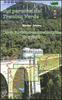
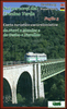
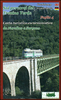
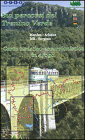
Sardinia`s Trenino Verde Route 4-Map Set

A set of four maps at 1:40, 000 from the Edizioni Abies series covering Sardinia’s Trenino Verde tourist railway line, run with vintage diesel and steam engines. The maps in this set cover stages 1 to 4: Arbatax to Ussassai, Ussassai to Nurri, Nurri to Mandas plus Gesico to Nurallao, and Nurallao to Sorgono. Topography is shown by contours at 20m intervals, with additional colouring for woodlands and maquis (macchia) shrubland. The route of the Trenino Verde is prominently marked and shown with stations, optional stops, bridges or viaducts, tunnels and other interesting engineering features. The maps also highlights local hiking trails, viewpoints, interesting natural sites, nuraghe, churches, museums, etc, as well as locations with hotels, agriturismo accommodation on
farms, and B&Bs. Each map has a 1-km UTM grid. Map legend includes English.On the reverse are lists of local accommodation options with contact details, plus notes about interesting localities and their traditional festivities, etc. The text is in Italian, German and English. PLEASE NOTE: each of the maps in this set is also available either separately or as part of a set of three maps without the Nurallao to Sorgono section. To see other titles in this series please click on the series link.
RIP - This product is no longer available on our network. It was last seen on 25.09.2019

This page now acts as a permanent archive for this product. Add more information using the comments box below to ensure it can still be found by future generations.

Use our search facility to see if it is available from an alternative contributor.
  • Availability: Out Of Stock
  • Supplier: Stanfords
  • SKU: 9788898551026
Availability: In Stock
£14.99

Product Description

A set of four maps at 1:40, 000 from the Edizioni Abies series covering Sardinia’s Trenino Verde tourist railway line, run with vintage diesel & steam engines. The maps in this set cover stages 1 to 4: Arbatax to Ussassai, Ussassai to Nurri, Nurri to Mandas plus Gesico to Nurallao, & Nurallao to Sorgono. Topography is shown by contours at 20m intervals, with additional colouring for woodlands & maquis (macchia) shrubl&. The route of the Trenino Verde is prominently marked & shown with stations, optional stops, bridges or viaducts, tunnels & other interesting engineering features. The maps also highlights local hiking trails, viewpoints, interesting natural sites, nuraghe, churches, museums, etc, as well as locations with hotels, agriturismo accommodation on farms, & B& Bs. Each map has a 1-km UTM grid. Map legend

Includes::
English. On the reverse are lists of local accommodation options with contact details, plus notes about interesting localities & their traditional festivities, etc. The text is in Italian, German & English. PLEASE NOTE: each of the maps in this set is also available either separately or as part of a set of three maps without the Nurallao to Sorgono section. To see other titles in this series please click on the series link.

Reviews/Comments

Add New

Intelligent Comparison

Oooops!
We couldn't find anything!
Perhaps this product's unique.... Or perhaps we are still looking for comparisons!
Click to bump this page and we'll hurry up.

Price History

Vouchers

No voucher codes found.
Do you know a voucher code for this product or supplier? Add it to Insights for others to use.

Facebook

Jargon Buster

Hiking - An outdoor activity envolving walking in nature
Italian - A word used ot descibe something from Italy
Diesel - A fuel used in internal combustion engines
Diesel - An Italian clothing brand. Founded in 1978
Steam - Steam - water in gas form, water vapour. Commonly seen coming from a kettle
Set - a group of items usually related to one another. Some objects cannot function without the complete set of items.
Natural - not manmade
Km - Kilometre. A unit of measurement equal to 1000 metres.
Traditional - Something that has become the same through a period of time and thus repeated.
Traditional - Something that has been around for a while and is repeated regularly.
Accommodation - A room in which someone can live in, for example in a hotel
Vintage - An older product that has become more quirky with time.

Supplier Information

Stanfords
Stanfords was established in 1853 and opened their iconic Covent Garden flagship store in 1901. They have become the top retailer of maps, travel books and accessories in the UK and arguably offer the largest selection of maps and travel books worldwide. Famous names such as Captain Robert Falcon Scott, Ranulph Fiennes and Michael Palin have purchased from Stanfords. They now have a shop in Bristol and both stores together with other venues operate a calendar of events including talks, book signings and exhibitions. As a specialist map retailer, the map selection is comprehensive and includes road maps, street maps and walking maps from worldwide destinations, as well as a selection of world atlases and wall maps. Books include travel guides and travel literature. Stanfords also stock globes, from miniatures made of blue marble to magnificent floor-standing globes. The website features a selection of interesting articles on travel topics.
Page Updated: 2023-11-12 20:15:36

Community Generated Product Tags

Oh No! The productWIKI community hasn't generated any tags for this product yet!
Menu