More From Contributor

£13.99
Local surfer & writer Ian Anderson offers an insider`s view of San Diego, from surfing at San Onofre State Beach to exploring the expansive San Diego Zoo. Ian

Includes::
great trip ideas such as ” On a Mission, ” a tour of the city`s historical sights, & ” Surf & Turf, ” covering recreational opportunities in & out of the water. Packed with information on dining, transportation, & accommodations, Moon San Diego has lots of options for a range of travel budgets. With advice on where to sample the city`s local craft beers & hike in Mission Trails Regional Park, Moon San Diego gives travellers the tools they need to create a more personal & memorable experience. This full-colour guide

Includes::
vibrant photos & helpful maps.


...
Archived Product
£9.99
San Diego is home to miles of beaches, Balboa Park, a world-famous zoo & some of the US`s most expensive homes & resorts. Yet the city also houses a few things that aren`t actively promoted by the visitor`s bureau
- a number of America`s most corrupt politicians, border-related crimes, terrorists & the occasional earthquake. A noir feast! The San Diego of the past & the present offers the book`s contributors a rich selection of settings, from the cross on Mount Soledad to the piers of Ocean Beach.
...
Archived Product
£3.99
San Diego Pop-Out Map from Compass Maps in a series designed to provide street plans in a handy format to fit neatly all but the smallest pockets, with, additional useful maps & enlargements, etc. The title’s two cover flaps open up to reveal two maps showing Greater San Diego, plus enlargements for the downtown area & for Balboa Park with the Zoo. Both maps highlight numerous sights & cultural institutions, etc. The San Diego maps also show recommended hotels & restaurants, & are indexed for streets & places of interest. Additional maps on the cover flaps show street plans of central La Jolla, Mission Bay Park & Tijuana across the border in Mexico. ...
Archived Product
£4.99
This work features a revolutionary new design for pocket-sized travel guides. Open the cover & discover a remarkable new design! It contains 2 popout maps & a comprehensive fully illustrated 64 page guide of San Diego. & it works like magic! The map & guide of the city are fully cross-referenced for instant, effortless navigation, making this the easiest guidebook you will ever use. Well-written text covers sights, shopping, entertainment, food, practical information & where to stay. With durable flexibound, stunning laminated covers, the popout cityguide is excellent value for your money for your trip to San Diego. ...
Archived Product
£6.50
San Diego in California on an indexed street plan from Rand Mc Nally in their extensive range of maps covering cities in the United States. Insets provide a more detailed street plan of downtown San Diego, plus a road map of San Diego & vicinity. Communities covered by this map include Chula Vista, Coronado, Cottonwood, El Cajon, Imperial Beach, Indian Springs, La Jolla, La Mesa, Lemon Grove, National City, Spring Valley & Sunnyside. Rand Mc Nally street plans provide coverage of cities with their outer suburbs, clearly indicating main traffic arteries: highways (distinguishing between free & toll access), plus primary & secondary routes. Road numbers and/or names are clearly displayed & exit numbers are indicated. Locations of service & rest areas are marked & one way streets are shown. Longer streets are annotated with block numbers for easier identification of addresses. The maps show railway, bus &, where appropriate, metro stations. A range of symbols indicate various places of interest including cultural & academic institutions, various municipal facilities, golf courses, etc. The plans have extensive street indexes, supplemented by lists of points of interest, parks & recreational areas, shopping malls, stations, schools, etc. ...
Archived Product
£17.99
Topographic mapping from Mexico’s national survey agency, Instituto Nacional de Estadística, Geografía e Informática. The maps have contours at 20m intervals with relief shading & indicate various types of terrain & vegetation, e.g. dense vegetation, cultivated areas, swamps, sand dunes, salt pans, etc. UTM grid is at 10km intervals, with latitude & longitude shown by margin ticks at intervals of 5`. Map legend is in Spanish only. To see the other titles in this series please click on the series link. ...
Archived Product
£6.95
Topographic coverage of mainland Spain at 1:50, 000 in the MTN50 (Mapa Topográfico Nacional) series from the Centro Nacional de Información Geografica, the country’s civilian survey organization. The maps have contours at 20m intervals, enhanced by relief shading, plus colouring and/or graphics to show different types of terrain, vegetation or land use. Boundaries of national parks & other protected areas are marked. In addition to all the usual information featured on topographic mapping at this scale, detailed presentation of the road & rail networks, rural tracks & paths, etc, the maps also show campsites & mountain refuges. On more recent editions some GRs, the official long-distance hiking routes, are also marked (although not as clearly as on hiking maps from other publishers). Each map covers 29.5x 18.5 km (with adjustments in the border or coastal areas). The maps have a 1-km UTM grid, plus margin ticks for latitude & longitude at 1` intervals. Map legend is in Spanish only.HOW TO CHOOSE THE RIGHT 50K MAP: all the titles in CNIG’s 200K Provincial Road Maps series at 1:200, 000 are overprinted with the grid for the 1:50, 000 maps & can be used to see the area covered by each 50K title. TO SEE THE LIST OF TITLES IN THIS SERIES PLEASE CLICK ON THE SERIES LINK.PLEASE NOTE
- MAP TITLES: the grids shown on our website serve both the civilian & the military 1:50, 000 topographic series. Although the areas covered by maps in both series are identical (apart from some border or coastal sheets), occasionally map titles differ – only one title is shown on the grid, usually the military one. In Galicia, the Basque country & in the Catalan speaking areas the tendency now is to use local place names rather than the often better known Castilian ones. Where possible, both versions are included in our titles. Map titles listed on our website are based on information received by us at the time of publication, but sometimes maps arrive showing a completely different title! As long as the map number is as ordered, the correct map has been supplied.
...
Archived Product
£6.50
Topographic coverage of mainland Spain at 1:25, 000 published by the Centro Nacional de Información Geograficá, the country’s civilian survey organization. The maps have contours at 10m intervals & colouring and/or graphics to show different types of vegetation or land use. Boundaries of national parks & other protected areas are marked. In addition to all the usual information shown on topographic maps at this scale, detailed presentation of the road & rail networks, rural tracks & paths, etc, the maps also show campsites. The maps have a 1-km UTM grid, with margin ticks for latitude & longitude at 1` intervals. Map legend is in Spanish only.PLEASE NOTE: our grid for the whole of Spain is in preparation
- in the meantime, for areas other than those shown on the attached grid please use CNIG’s topographic survey at 1:50, 000 by searching for ‘SI00000832’. Each 25K map covers one quarter of the corresponding 50K map, with the numbering system: I = NW quarter, II = NE quarter, III = SW quarter & IV = SE quarter. CNIG maps in the Provincial Road Maps series at 1:200, 000 are overprinted with the grid for the 1:50, 000 survey & can be used to see the area covered by each 50K or 25K title in more detail. To see the list of titles in this series please click on the series grid
- for map numbers not yet listed on our website please contact us by email.

...
Archived Product
£6.50
San Fernando Valley, Burbank, Glendale in California on an indexed street plan from Rand Mc Nally in their extensive range of maps covering cities in the United States. Insets provide a more detailed street plan of downtown Los Angeles, plus a road map of Los Angeles & vicinity. Communities covered by this map include Chatsworth, Encino, La Ca ...
Archived Product

San Diego, San Jacinto Wilderness & Anza-Borrego Desert Area

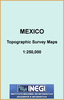
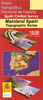
Very fine quality raster mapping, with adjustable height shading. Other features include:-::Customizeable::zoomable::georeferenced::GPS compatable::generate elevation profiles::calculate distances::seamless::indexed::stackable with other maps::built in database.
RIP - This product is no longer available on our network. It was last seen on 25.09.2019

This page now acts as a permanent archive for this product. Add more information using the comments box below to ensure it can still be found by future generations.

Use our search facility to see if it is available from an alternative contributor.
  • Availability: Out Of Stock
  • Supplier: Stanfords
  • SKU: XL00000106270
Availability: In Stock
£51.50

Product Description

Very fine quality raster mapping, with adjustable height shading. Other features include:-:: Customizeable::zoomable::georeferenced::GPS compatable::generate elevation profiles::calculate distances::seamless::indexed::stackable with other maps::built in database.

Reviews/Comments

Add New

Intelligent Comparison

Oooops!
We couldn't find anything!
Perhaps this product's unique.... Or perhaps we are still looking for comparisons!
Click to bump this page and we'll hurry up.

Price History

Vouchers

No voucher codes found.
Do you know a voucher code for this product or supplier? Add it to Insights for others to use.

Facebook

Jargon Buster

GPS - Global Positioning System - Global position using satellites
Quality - An object that has quality is superior in function and finish than a less quality object.
Adjustable - Something that can be changed or slightly modified to fit.
Adjustable - Something that can be changed in order to fit better.

Supplier Information

Stanfords
Stanfords was established in 1853 and opened their iconic Covent Garden flagship store in 1901. They have become the top retailer of maps, travel books and accessories in the UK and arguably offer the largest selection of maps and travel books worldwide. Famous names such as Captain Robert Falcon Scott, Ranulph Fiennes and Michael Palin have purchased from Stanfords. They now have a shop in Bristol and both stores together with other venues operate a calendar of events including talks, book signings and exhibitions. As a specialist map retailer, the map selection is comprehensive and includes road maps, street maps and walking maps from worldwide destinations, as well as a selection of world atlases and wall maps. Books include travel guides and travel literature. Stanfords also stock globes, from miniatures made of blue marble to magnificent floor-standing globes. The website features a selection of interesting articles on travel topics.
Page Updated: 2023-11-12 20:15:36

Community Generated Product Tags

Oh No! The productWIKI community hasn't generated any tags for this product yet!
Menu