More From Contributor

£5.50
A double-sided map showing the country of Samoa at about 1:190, 000 scale on one side & American Samoa at about 1:75, 000 on the other. The map uses little colour but is still easy to follow. Hills are shown by shading, & many roads, tracks & villages are marked. The map is indexed &

Includes::
town plans of Apia & Fagatogo.

...
Archived Product
£7.95
Colourful but basic map of the country of Samoa. Height of land is shown roughly by shades of colour, & main roads & main settlements are shown. An index is included on the map. On the reverse are a street map of Apia & tourist information about the country. Please note that this map does not include American Samoa. ...
Archived Product
£10.39
Samoa & Tonga in the Countries & Regions series from Lonely Planet, market-leading comprehensive guides aimed at independent travellers & serving a large range of international destinations. Frank & informal in style, the guides explore an extensive range of sights, activities, accommodation, restaurants & nightlife & are designed for practical use while travelling on the road. Written & researched by a team of experts, each book is independent in its recommendations & suggestions, often offering individual takes on individual destinations. Widely recognised for their reliability, each Lonely Planet country & region guide has the same layout. Introductory sections profile the destination with individual chapters on particular highlights, getting started, (including when to go) itineraries, history, culture, arts, food & drink & the environment. Each guide is organised geographically by region, with individual sections detailing an extensive range of sights, places of interest, attractions, restaurants, nightlife, accommodation & any local activities. The guides have detailed explanations of historical context where relevant. There is also practical guidance on ...
Archived Product
£12.99
Topographic survey of France at 1:25, 000 in IGN`s excellent TOP25 / Série Bleue series. All the maps are GPS compatible, with a 1km UTM grid plus latitude & longitude lines at 5’ intervals. Contours are at 5m intervals except for mountainous areas where the maps have contours at 10m intervals, vividly enhanced by hill shading & graphics for rocky terrain. Colouring with graphics indicates different types of vegetation or land use (deciduous or coniferous forests, moors, orchards, vineyards, etc). PLEASE NOTE: coverage of France at this scale is currently being revised – the format & the presentation of each title are indicated by the letters at the end of its Sheet Reference number (e.g. 0416ET, 3531ETR, 1923SB, etc.)MAPS WITH FULL TOURIST OVERPRINT & AN ENGLISH MAP LEGEND: all TOP25 maps & the SB editions of Série Bleue have an overprint highlighting waymarked walking trails including long-distance GR routes &, where appropriate, ski routes. Symbols indicate campsites, gîtes d’etape, refuges, equestrian centres & other recreational facilities or sites, tourist information centres, cultural heritage, etc. Towns & locations of particular interest are highlighted.- ET or OT = single-sided TOP25 map covering approx. 29x 21 km / 18x 13 miles.- ETR or OTR = waterproof & tear resistant TOP25 map covering the same area as the corresponding ET or OT number, but double-sided, printed on a smaller size sheet with a good overlap between the sides.- SB = Série Bleue map with full tourist overprint; these maps, first introduced in summer 2014, each cover approx. 29x 24km / 18x 15 miles.SÉRIE BLEUE maps with numbers ending in E (Est) or O (Ouest): most editions now indicate the GR routes, but do not show any other tourist information. Map legend is in French only. Each map covers approx. 14x 20km / 9x 12 miles. ...
Archived Product
£18.99
Topographic survey of France at 1:25, 000 in IGN`s excellent TOP25 / Série Bleue series. All the maps are GPS compatible, with a 1km UTM grid plus latitude & longitude lines at 5’ intervals. Contours are at 5m intervals except for mountainous areas where the maps have contours at 10m intervals, vividly enhanced by hill shading & graphics for rocky terrain. Colouring with graphics indicates different types of vegetation or land use (deciduous or coniferous forests, moors, orchards, vineyards, etc). PLEASE NOTE: coverage of France at this scale is currently being revised – the format & the presentation of each title are indicated by the letters at the end of its Sheet Reference number (e.g. 0416ET, 3531ETR, 1923SB, etc.) MAPS WITH FULL TOURIST OVERPRINT & AN ENGLISH MAP LEGEND: all TOP25 maps & the SB editions of Série Bleue have an overprint highlighting waymarked walking trails including long-distance GR routes &, where appropriate, ski routes. Symbols indicate campsites, gîtes d’etape, refuges, equestrian centres & other recreational facilities or sites, tourist information centres, cultural heritage, etc. Towns & locations of particular interest are highlighted.
- ET or OT = single-sided TOP25 map covering approx. 29x 21 km / 18x 13 miles.
- ETR or OTR = waterproof & tear resistant TOP25 map covering the same area as the corresponding ET or OT number, but double-sided, printed on a smaller size sheet with a good overlap between the sides.
- SB = Série Bleue map with full tourist overprint; these maps, first introduced in summer 2014, each cover approx. 29x 24km / 18x 15 miles. SÉRIE BLEUE maps with numbers ending in E (Est) or O (Ouest): most editions now indicate the GR routes, but do not show any other tourist information. Map legend is in French only. Each map covers approx. 14x 20km / 9x 12 miles.


...
Archived Product
£10.95
Samos at 1:50, 000 with Icaria, Thimena, Fourni, Patmos, Leipsoi & Arkoi at 1:100, 000, from Kompass, with & tourist overprint highlighting walking trails, places of interest & various facilities plus plans of the islands’ main towns & sites. The map is printed on sturdy, waterproof & tear-resistant synthetic paper. Topography of the islands is shown by contours at 100m intervals, spot heights & subtle relief shading. Road network

Includes::
local roads & cart tracks, with driving distances given on main routes. The map also shows ferry connections. Symbols mark various places of interest including youth hostels & campsites, sport & recreational facilities, beaches, archeological sites, etc. All place names are in Greek & Latin alphabets. For hikers, an overprint highlights recommended trails, indicating steep & difficult sections. The map has a 2-km UTM grid. Map legend

Includes::
English. Also provided are street plans of Samos/ Vathi, Karlovassi, Pythagorio & Kokkari highlighting tourist accommodation & various facilities & sights, plus plans of two sites: the temple of Hera at Heraion & the Monastery of Saint John the Theologian on Patmos. A small map shows the whole of the Aegen with ferry connection with the mainland & between the islands.


...
Archived Product
£16.99
Samos, Patmos, Ikaria, Kalymnos & Six Neighbouring Islands guidebook in the Walking the Greek Islands series from Dieter Graf. The guide describes 50 of the best old walking trails all with updated GPS data. With this guide you can discover the rich history, culture, architecture & natural beauty of Samos & its neighbouring islands. The book

Includes::
detailed maps, GPS data & route photos for better orientation, along with lots of interesting facts worth knowing about the islands.

...
Archived Product
£10.99
Samos at 1;50, 000 on an easy to read map from Freytag & Berndt with place names printed in larger size than found on other maps of the isl&. The map also covers Patmos & proves a basic street plan of Samos Town. The map has relief shading & contours to show the islands topography. Road network

Includes::
selected local tracks & gives distances on main routes. Large icons highlight various places of interest. All place names are given in both Greek & Latin alphabet. The map has no geographical coordinates & is not indexed. Map legend

Includes::
English. Also provided is plan of Samos Town, naming main streets & showing various sights.


...
Archived Product
£16.99
Samos island is a hiker’s paradise with hundreds of kilometres of forest trails & cobbled paths crossing through a beautiful countryside. This guide takes you through traditional villages & monasteries, mountain tops & impressive ridges, remote beaches & ancient ruins. Through 32 well-designed hikes for both the casual stroller & the adventurous hiker, this hiking guidebook aims to help you discover the most authentic face of Samos isl&. ...
Archived Product
£9.99
Samos at 1:50, 000 on a contoured, GPS compatible hiking map published by Terrain Cartography group together with Skai Maps, & printed on light, waterproof & tear-resistant Polyart plastic paper, with extensive tourist information. Topography is very well presented by contours, enhanced by spot heights, subtle relief shading & additional altitude colouring. Contour interval, unless indicated below to the contrary, is 20m. National parks & other protected areas are marked. All place names are shown in both Greek & Latin alphabet. The maps have a UTM grid, plus latitude & longitude margin ticks. Hiking trails are graded between main routes & narrow trails. A wide range of symbols indicate various places of interest & recreational facilities, with main sights clearly highlighted. Most titles distinguish between sandy & pebble beaches; some also indicate beaches with natural shade and/or the type of sea bed. Road network is very clearly graded according to width & the type of surface, distinguishing between good & rough dirt roads. Distances are marked on most small local roads, as well as locations of petrol stations and/or tyre repair workshops. Scenic routes are highlighted. Each map also shows which ports are served by ferry services. Many titles include a street plan of the island’s main town, with colouring clearly showing various tourist facilities. The reverse side of each title is covered by general information about the isl&, illustrated with colour photos. Many titles also include brief descriptions of recommended hiking trails.* Map legend & all the text include English.** In this title:*contour interval is 100m. The map

Includes::
a street plan of Samos Town at 1:4, 000, plus descriptions of six hiking trails.

...
Archived Product

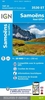
Samokov - Borovets With The Rila Mountains

Street plans of Samokov and Borovets, plus a contoured map of part of the Rila National Park showing waymarked hiking routes, a panorama map with ski runs in Borovets, and English langugage information on hotels, etc.On one side is a street plan of Samokov at 1:9, 500 annotated with symbols showing various facilities. Street names are in Cyrillic, with main ones also in Latin alphabet. Street index is in Cyryllic only. Map legend and accompanying notes about the town, plus an extensive directory of various services including hotels, restautants, etc, all include English.On the reverse is a street plan of Borovets at 1:6, 000 showing locations of the resort’s various tourist facilities, cable and chair lift stations, etc. Also provided is a detailed contoured map at 1:40, 000
of the surrounding area including the northern part of the Rila National Park. The map highlights waymarked hiking routes, mountain shelters, etc. A panorama map show ski runs on the slopes south of Borovets, grading the routes according the degree of difficulty. Also included is a list of hotels in Borovets. Map legends and all the text include English.
RIP - This product is no longer available on our network. It was last seen on 25.09.2019

This page now acts as a permanent archive for this product. Add more information using the comments box below to ensure it can still be found by future generations.

Use our search facility to see if it is available from an alternative contributor.
  • Availability: Out Of Stock
  • Supplier: Stanfords
  • SKU: 9789546511362
Availability: In Stock
£5.99

Product Description

Street plans of Samokov & Borovets, plus a contoured map of part of the Rila National Park showing waymarked hiking routes, a panorama map with ski runs in Borovets, & English langugage information on hotels, etc. On one side is a street plan of Samokov at 1:9, 500 annotated with symbols showing various facilities. Street names are in Cyrillic, with main ones also in Latin alphabet. Street index is in Cyryllic only. Map legend & accompanying notes about the town, plus an extensive directory of various services including hotels, restautants, etc, all include English. On the reverse is a street plan of Borovets at 1:6, 000 showing locations of the resort’s various tourist facilities, cable & chair lift stations, etc. Also provided is a detailed contoured map at 1:40, 000 of the surrounding area including the northern part of the Rila National Park. The map highlights waymarked hiking routes, mountain shelters, etc. A panorama map show ski runs on the slopes south of Borovets, grading the routes according the degree of difficulty. Also included is a list of hotels in Borovets. Map legends & all the text include English.

Reviews/Comments

Add New

Intelligent Comparison

Oooops!
We couldn't find anything!
Perhaps this product's unique.... Or perhaps we are still looking for comparisons!
Click to bump this page and we'll hurry up.

Price History

Vouchers

No voucher codes found.
Do you know a voucher code for this product or supplier? Add it to Insights for others to use.

Facebook

Jargon Buster

Hiking - An outdoor activity envolving walking in nature
Cable - A series of wires bonded to form a single thread
Degree - An angle measurement, also can be the measurement of an extent that something happens, can also relate to an university academic measurement.
degree - The extremity of something or the angle. Can also relate to a university achievement.

Supplier Information

Stanfords
Stanfords was established in 1853 and opened their iconic Covent Garden flagship store in 1901. They have become the top retailer of maps, travel books and accessories in the UK and arguably offer the largest selection of maps and travel books worldwide. Famous names such as Captain Robert Falcon Scott, Ranulph Fiennes and Michael Palin have purchased from Stanfords. They now have a shop in Bristol and both stores together with other venues operate a calendar of events including talks, book signings and exhibitions. As a specialist map retailer, the map selection is comprehensive and includes road maps, street maps and walking maps from worldwide destinations, as well as a selection of world atlases and wall maps. Books include travel guides and travel literature. Stanfords also stock globes, from miniatures made of blue marble to magnificent floor-standing globes. The website features a selection of interesting articles on travel topics.
Page Updated: 2023-11-12 20:15:36

Community Generated Product Tags

Oh No! The productWIKI community hasn't generated any tags for this product yet!
Menu