More From Contributor
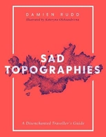
£19.95
Sacred Sites of Burma, Myth & Folklore in an Evolving Spiritual Realm, by Donald M. Stadtner, is an exploration of the many facets of Buddhism: art, archaeology, history & belief. With 348 pages, 482 colour illustration & 12 maps & plans, Stadtner helps uncover the development of the myths surrounding sacred places such as Yangon & the Mon State, Pagan & Mandalay, & areas around Inle Lake. The Buddhist tales recounted in this book, describing the founding & origins of these astonishing sites, represent almost the sole source of evidence of their fame & sacredness. This is an invaluable book for anyone interested in the history & development of Buddhism & its many aspects. ...
Archived Product
£45.00
From St. Peter`s Basilica in Rome to Notre-Dame in Paris, Christian churches represent some of our most significant architectural achievements, designed to evoke wonder & awe. Offering unprecedented access to a collection of revered religious landmarks, photographer Guillaume de Laubier takes readers on a stunning architectural tour. Sacred Spaces showcases breathtaking photographs of extraordinary churches & cathedrals, revealing original, illuminating views of icons, such as la Sagrada Familia in Barcelona, while also shedding light on lesser-known sites, such as Saint Basil`s Cathedral in Moscow. Whether Catholic, Protestant, or Orthodox; made from wood, stone, concrete, or glass; Roman, Gothic, Baroque, or modern, the places of worship featured in this richly produced volume present an extraordinary overview of our architectural & cultural history. ...
Archived Product
£50.00
More than twenty mosques & tombs were built from the fifteenth to the early seventeenth centuries in Istanbul, Bursa, Edirne & Uskudar. They are the products of a bold, daring & refined civilisation at the height of its power. The photographs in Sacred Spaces are a testament to the exquisite taste & sophistication of Ottoman architecture. All these buildings & complexes reflect the spirit & social values of an entire society, as well as their taste & artistic ideals. The photographs pay tribute not only to a splendid array of mosques from different times & places but to the men & women who built them & to the faithful who still gather in their midst. ...
Archived Product
£7.99
Monika is driven to succeed as a doctor
- but cannot allow herself any personal happiness. Maj-Britt is desperate to be left alone
...
Archived Product
£3.50
Sacriston in 1897 in a fascinating series of reproductions of old Ordnance Survey plans in the Alan Godfrey Editions, ideal for anyone interested in the history of their neighbourhood or family. The map is double-sided. The main map covers an area from the village centre & Front Street eastward to Nettlesworth & Kimblesworth. Features include Sacriston Colliery (in top left corner), St Peter`s church, Sacriston Colliery Inn, Findonhill Quarry, Barrashill Wood, Hobbletrot Quarry, etc. On the reverse a large extract from sheet 19.07 takes coverage further west to include the colliery coke ovens, Charlaw Colliery, wagonway, Fulforth Wood & Laverick Hall. A directory of Sacriston in 1890 is also provided. About the Alan Godfrey Editions of the 25” OS Series: Selected towns in Great Britain & Ireland are covered by maps showing the extent of urban development in the last decades of the 19th & early 20th century. The plans have been taken from the Ordnance Survey mapping & reprinted at about 15 inches to one mile (1:4, 340). On the reverse most maps have historical notes & many also include extracts from contemporary directories. Most maps cover about one mile (1.6kms) north/south, one & a half miles (2.4kms) across; adjoining sheets can be combined to provide wider coverage.FOR MORE INFORMATION & A COMPLETE LIST OF ALL AVAILABLE TITLES PLEASE CLICK ON THE SERIES LINK. ...
Archived Product
£12.99
Detailed topographic survey map of the southern half of the isl&, from Sohoa southwards. The cartography is of the same precise & highly detailed standard as that in IGN`s Serie Bleue map series for France. Communications & topographic features & landmarks are clearly represented & relief is shown by contours at 10m intervals. GR routes, information centres, & reserve boundaries are marked. A variety of landscape types are distinguished eg. forest, plantation, market gardening, also offshore coral reefs. Latitude & longitude are shown at 5` intervals & a UTM grid is also drawn over the map. ...
Archived Product
£14.99
This journal features over the top gold embellishment combined with the look of an old leather journal that has been lovingly used for at least a century. It is made from paper & thick cardboard & the back cover comes up to wrap itself on the front cover with the help of an invisible magnet, thus protecting the pages inside. It has 144 ruled pages, a memento pouch, & a red ribbon marker. 18x 23cm. ...
Archived Product
£11.99
This journal features over the top gold embellishment combined with the look of an old leather journal that has been lovingly used for at least a century. It is made from paper & thick cardboard & the back cover comes up to wrap itself on the front cover with the help of an invisible magnet, thus protecting the pages inside. It has 144 blank pages, a memento pouch, & a red ribbon marker. 13x 18cm. ...
Archived Product
£3.99
The Finger Puppets set

Includes::
4 colourful paper Safari Animals to transform your fingers into puppets!

...
Archived Product
£25.00
Among the sunburned yellow grass of the savannah, two lion cubs play under the indolent gaze of their father, while a short distance away, a pack of hyenas fights over a gazelle carcass. Presenting a realistic, unflinching look at life on the African savannah, this fascinating volume from acclaimed naturalists Christine & Michel Denis-Huot reveals the many faces of this beautiful & challenging habitat. Capturing moments of peaceful harmony & episodes of harsh reality, these exceptional images offer readers a uniquely personal, up-close perspective on life in one of the most intriguing & complex habitats in the world. The Denis-Huots bring to this book the same depth of information & sense of respect & admiration for African wildlife that made their recent publication, Lords of the Savannah, so compelling. With their firsthand knowledge of the African savannah & ability to capture on film moments we would never ordinarily witness, they are uniquely equipped to chronicle the circle of life in a truly wild world. Accompanying hundreds of photographs, the engaging text provides the latest finding on the habits & habitats of the denizens of the savannah, & expresses the authors' fascination with life in wildest Africa. ...
Archived Product

Sad Topographies

Sad Topographies is the first ever atlas of deperssing toponyms. Covering all continents, Damien Rudd explores the world`s depressing place names and explore their etymology. The stories behind these sad topographies are interwoven narratives of history, landscape, exploration, mythology, local folklore and misadventure. From Disappointment Island in the Southern Ocean to Calamity Lake in Minnesota, you can head up to All Alone in West Yorkshire, or if you`re feeling more adventurous why not pay a visit to Crazy Woman Creek.Sad Topographies navigates the terrains of historical fact and imaginative fiction, filling in the gaps where some of the etymologies have been lost over time in this collection of beautifully-illustrated maps. Poetic and dark-humoured, it`s a celebration of
our sad and melancholic cultural landscapes. Containing stunning illustrations and a bespoke design, this is perfect for fans of Stories in the Stars or The Atlas of Remote Islands. Damien Rudd is the founder of the hugely popular Instagram account @sadtopographies.
RIP - This product is no longer available on our network. It was last seen on 25.09.2019

This page now acts as a permanent archive for this product. Add more information using the comments box below to ensure it can still be found by future generations.

Use our search facility to see if it is available from an alternative contributor.
  • External links may include paid for promotion
  • Availability: Out Of Stock
  • Supplier: Stanfords
  • SKU: 9781471169298
Availability: In Stock
£20.00

Product Description

Sad Topographies is the first ever atlas of deperssing toponyms. Covering all continents, Damien Rudd explores the world`s depressing place names & explore their etymology. The stories behind these sad topographies are interwoven narratives of history, landscape, exploration, mythology, local folklore & misadventure. From Disappointment Island in the Southern Ocean to Calamity Lake in Minnesota, you can head up to All Alone in West Yorkshire, or if you`re feeling more adventurous why not pay a visit to Crazy Woman Creek. Sad Topographies navigates the terrains of historical fact & imaginative fiction, filling in the gaps where some of the etymologies have been lost over time in this collection of beautifully-illustrated maps. Poetic & dark-humoured, it`s a celebration of our sad & melancholic cultural landscapes. Containing stunning illustrations & a bespoke design, this is perfect for fans of Stories in the Stars or The Atlas of Remote Islands. Damien Rudd is the founder of the hugely popular Instagram account @sadtopographies.

Reviews/Comments

Add New

Intelligent Comparison

Oooops!
We couldn't find anything!
Perhaps this product's unique.... Or perhaps we are still looking for comparisons!
Click to bump this page and we'll hurry up.

Price History

Vouchers

No voucher codes found.
Do you know a voucher code for this product or supplier? Add it to Insights for others to use.

Facebook

Jargon Buster

Dark - A colour which absorbs visable ligt so apears less light than objects that reflect light
History - Anything that happens in the past. An acedemic subject.
World - A physical grouping, commonly used to describe earth and everything associated with ti
illustrations - Pictures typically in books and newspapers.
Popular - Something that is admired and liked by many people.
Design - A drawing or styles that shows the look and functionality of something before its made.
Head - The upper part of a body typically separated by the neck.

Supplier Information

Stanfords
Stanfords was established in 1853 and opened their iconic Covent Garden flagship store in 1901. They have become the top retailer of maps, travel books and accessories in the UK and arguably offer the largest selection of maps and travel books worldwide. Famous names such as Captain Robert Falcon Scott, Ranulph Fiennes and Michael Palin have purchased from Stanfords. They now have a shop in Bristol and both stores together with other venues operate a calendar of events including talks, book signings and exhibitions. As a specialist map retailer, the map selection is comprehensive and includes road maps, street maps and walking maps from worldwide destinations, as well as a selection of world atlases and wall maps. Books include travel guides and travel literature. Stanfords also stock globes, from miniatures made of blue marble to magnificent floor-standing globes. The website features a selection of interesting articles on travel topics.
Page Updated: 2023-11-12 20:15:36

Community Generated Product Tags

Oh No! The productWIKI community hasn't generated any tags for this product yet!
Menu