
 United Kingdom
 France
 Germany
 Netherlands
 Sweden
 USA
USA
 Italy
Italy
 Spain
Spain
More From Contributor


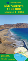
São Vicente - Mindelo
São Vicente Island in the Cape Verde Archipelago on a detailed map at 1:35, 000 with recommendations for 20 hiking trails, plus on the reverse side an indexed street plan of the island’s main town of Mindelo.The map of São Vicente shows the island’s topography by contours at 100m intervals, with altitude colouring and numerous spot heights. Classification of road network indicates improved roads and tracks. Local footpaths show which routes are waymarked; 20 locations are cross-referenced to a list of trails showing the degree of difficulty, approximate duration, etc. Symbols indicate locations of diving sites and medical facilities. The map has latitude and longitude grid at 1’ intervals.The most of the reverse side is taken by an indexed street plan of Mindelo at 1:7, 500.
Map legend and the text include English.
Map legend and the text include English.

Product Description
Reviews/Comments
Add New
Vouchers
No voucher codes found.
Do you know a voucher code for this product or supplier? Add it to Insights for others to use.
Do you know a voucher code for this product or supplier? Add it to Insights for others to use.
 Denmark