More From Contributor
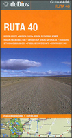
£9.99
Through the centuries, Russia has swung between successful expansionism, catastrophic collapse & spectacular recovery. This illuminating history traces these cycles from the late Neolithic age to Ivan the Terrible & Catherine the Great, & from the height of Communism to the truncated Russian Federation of today. The narrative takes in the magnificent cities of Kiev, Moscow & St Petersburg, & stretches to Alaska in the east, to the Black Sea & the Ottoman Empire in the south, to the Baltic in the west & to the Arctic Ocean in the north, asking what the future holds for Russia & her neighbours. ...
Archived Product
£12.99
” In Russia`s War”, Richard Overy re-creates the Soviet Union`s apocalyptic struggle against Germany from the point of view both of the troops & of the ordinary civilians. In the course of human history there has probably been no more terrible place than Eastern Europe in 1941-5. Estimates of total Soviet military & civilian deaths in the period now stand at more than 25 million. For many around the world, it was Russia`s persistance & steadfast will during this time that gave the Allies the foothold to win the war; whilst Operation Barbarossa was failing against the Russians, the Allies were able to re-group, re-arm & fight back. This is an enthralling account of the Soviet side of the war & is highly recommended. ...
Archived Product
£8.99
Russka is a vast tapestry of a novel in which serf & master, Cossack & Tsar, priest & Jew are brought together in a family saga which unrolls through centuries of history to reveal that most impenetrable & mysterious of lands... Russia. Through the life of a little town east of Moscow in the Russian heartl&, Edward Rutherfurd creates a sweeping family saga from the baffling contradictions of Russia`s culture & her people
- bleak yet exotic, brutal but romantic; a land of ritual riddled with superstitious fears. From Russia`s dawn & the cruel Tartar invasions to Ivan the Terrible & the wild Cossacks, from Peter, Catherine & the days of ` War & Peace` to the drama of the Revolution & the extraordinary events of today
- here is Russia`s story in a spellbinding novel...history recreated with breathtaking detail & passion.

...
Archived Product
£29.99
Map No. 2526, Rustenburg, in South Africa’s official topographic survey at 1:250, 000 from the country’s national survey organization, the Chief Directorate of Surveys & Mapping. The maps have altitude colouring & contours at 50m or 100m intervals, depending on the map edition, plus spot heights. Deserts, marshes, dry pans, perennial & seasonal water features, etc, as well as protected areas are shown. The maps present the country’s road & rail networks & include the usual information expected on topographic mapping at this scale, although in more rapidly developing areas road information may not necessarily be up to date. Also indicated are magisterial district & provincial boundaries. Latitude & longitude values are shown in the margins at 5` intervals together with South African grid co-ordinates. Typically, each sheet covers an area of one degree of latitude & two degrees of longitude. The projection used is Gauss Conformal. The legend is in English & Afrikaans. ...
Archived Product
£1.99
The Emergency Rain Poncho by Rex International is the perfect accessory to take with you when going out cycling. It is so compact & lightweight it can easily fit in any tiny pocket. Meant for single use, with careful handling it may be re-used. Be prepared for the English weather with the Rex International’s pocket Emergency Rain Poncho. ...
Archived Product
£13.95
Ruta de los Jesuitas: Puerto Montt
- Bariloche in a series of touring & trekking maps of Chile & the neighbouring regions of Argentina.
...
Archived Product
£12.99
The Hidden Lakes (Ruta dels Estanys Amagats) Hiking Circuit, a 97km route across the Cerdanya region of the Spanish Pyrenees & Andorra, presented at 1:40, 000 on a contoured & GPS compatible map from Editorial Alpina, with contact details of mountain refuges. The map has contours at 20m intervals, enhanced by relief shading. The Hidden Lakes circuit is prominently highlighted, with symbols indicating mountain refuges, campsites & other accommodation, both along the route itself & in the local villages. Also marked are various other facilities & places of interest including climbing & caving sites, car parks & locations of petrol stations, etc. The map has a UTM grid. Map legend

Includes::
English. Accompanying booklet with the route description is in Spanish & Catalan only. To see the list of all the maps from Editorial Alpina covering long-distance hiking routes please click on the series link.

...
Archived Product
£6.95
Topographic coverage of mainland Spain at 1:50, 000 in the MTN50 (Mapa Topográfico Nacional) series from the Centro Nacional de Información Geografica, the country’s civilian survey organization. The maps have contours at 20m intervals, enhanced by relief shading, plus colouring and/or graphics to show different types of terrain, vegetation or land use. Boundaries of national parks & other protected areas are marked. In addition to all the usual information featured on topographic mapping at this scale, detailed presentation of the road & rail networks, rural tracks & paths, etc, the maps also show campsites & mountain refuges. On more recent editions some GRs, the official long-distance hiking routes, are also marked (although not as clearly as on hiking maps from other publishers). Each map covers 29.5x 18.5 km (with adjustments in the border or coastal areas). The maps have a 1-km UTM grid, plus margin ticks for latitude & longitude at 1` intervals. Map legend is in Spanish only.HOW TO CHOOSE THE RIGHT 50K MAP: all the titles in CNIG’s 200K Provincial Road Maps series at 1:200, 000 are overprinted with the grid for the 1:50, 000 maps & can be used to see the area covered by each 50K title. TO SEE THE LIST OF TITLES IN THIS SERIES PLEASE CLICK ON THE SERIES LINK.PLEASE NOTE
- MAP TITLES: the grids shown on our website serve both the civilian & the military 1:50, 000 topographic series. Although the areas covered by maps in both series are identical (apart from some border or coastal sheets), occasionally map titles differ – only one title is shown on the grid, usually the military one. In Galicia, the Basque country & in the Catalan speaking areas the tendency now is to use local place names rather than the often better known Castilian ones. Where possible, both versions are included in our titles. Map titles listed on our website are based on information received by us at the time of publication, but sometimes maps arrive showing a completely different title! As long as the map number is as ordered, the correct map has been supplied.
...
Archived Product
£6.50
Topographic coverage of mainland Spain at 1:25, 000 published by the Centro Nacional de Información Geograficá, the country’s civilian survey organization. The maps have contours at 10m intervals & colouring and/or graphics to show different types of vegetation or land use. Boundaries of national parks & other protected areas are marked. In addition to all the usual information shown on topographic maps at this scale, detailed presentation of the road & rail networks, rural tracks & paths, etc, the maps also show campsites. The maps have a 1-km UTM grid, with margin ticks for latitude & longitude at 1` intervals. Map legend is in Spanish only.PLEASE NOTE: our grid for the whole of Spain is in preparation
- in the meantime, for areas other than those shown on the attached grid please use CNIG’s topographic survey at 1:50, 000 by searching for ‘SI00000832’. Each 25K map covers one quarter of the corresponding 50K map, with the numbering system: I = NW quarter, II = NE quarter, III = SW quarter & IV = SE quarter. CNIG maps in the Provincial Road Maps series at 1:200, 000 are overprinted with the grid for the 1:50, 000 survey & can be used to see the area covered by each 50K or 25K title in more detail. To see the list of titles in this series please click on the series grid
- for map numbers not yet listed on our website please contact us by email.

...
Archived Product
£14.99
The concept behind the Ruth & Martin`s Album Club blog is simple: Make people listen to a classic rock album they`ve never heard before. Make them listen to it two more times. Get them to explain why they never bothered with it before. Then ask them to review it. What began as a simple whim quickly grew in popularity, & now Ruth & Martin`s Album Club has featured some remarkable guests: Ian Rankin on Madonna`s Madonna. Chris Addison on Marvin Gaye`s What`s Going On. Brian Koppelman on The Smiths` Meat is Murder. JK Rowling on the Violent Femmes` Violent Femmes. Bonnie Greer on The Beach Boys` Pet Sounds. Martin Carr on Paul Mc Cartney`s Ram. Brian Bilston on Neil Young`s Harvest. Anita Rani on The Strokes` Is This It. Richard Osman on Roxy Music`s For Your Pleasure. & many, many more. Each entry features an introduction to each album by blog creator Martin Fitzgerald. What follows are delightful, humorous & insightful contributions from each guest as they have an album forced upon them &
- for better or worse
- they discover some of the world`s favourite music. Ruth & Martin`s Album Club is a compilation of some of the blog`s greatest hits as well as some exclusive material that has never appeared anywhere before. Throughout, we get an insight into why some people opt out of some music, & what happens when you force them to opt in.

...
Archived Product

Ruta 40 De Dios

Ruta 40, Argentina’s longest road running from the Bolivian border along the Andes to Cabo Virgenes (Cape Virgins) on the Atlantic side of the Magellan Straights presented by the Buenos Aires based de Dios on a tourist map highlighting 100 places of interest, each one cross-referenced to a brief description in Spanish.The route is presented on two overlapping panels; the map extends eastwards from the Andes to provide coverage of a large section of Argentina including the whole of Patagonia. Road network clearly shows road numbers of main regional routes and includes selected local roads. Locations of petrol stations are marked. Topography is indicated by colouring for national parks and other protected areas. 100 places of interest are prominently highlighted, both directly on Ruta
40 and within reach of the highway; 44 sites in the section north of or around Mendoza, plus 56 further south, mainly around San Martin de los Andes, Bariloche and the Los Glaciares National Park. Colour-coding of their markers indicates interesting towns, charming villages, touring circuits, natural sites, ski centres, and archaeological sites. Map legend and the descriptions, may accompanied by colour photos, are in Spanish only.
RIP - This product is no longer available on our network. It was last seen on 25.09.2019

This page now acts as a permanent archive for this product. Add more information using the comments box below to ensure it can still be found by future generations.

Use our search facility to see if it is available from an alternative contributor.
  • External links may include paid for promotion
  • Availability: Out Of Stock
  • Supplier: Stanfords
  • SKU: 9789871551910
Availability: In Stock
£11.99

Product Description

Ruta 40, Argentina’s longest road running from the Bolivian border along the Andes to Cabo Virgenes (Cape Virgins) on the Atlantic side of the Magellan Straights presented by the Buenos Aires based de Dios on a tourist map highlighting 100 places of interest, each one cross-referenced to a brief description in Spanish. The route is presented on two overlapping panels; the map extends eastwards from the Andes to provide coverage of a large section of Argentina including the whole of Patagonia. Road network clearly shows road numbers of main regional routes &

Includes::
selected local roads. Locations of petrol stations are marked. Topography is indicated by colouring for national parks & other protected areas. 100 places of interest are prominently highlighted, both directly on Ruta 40 & within reach of the highway; 44 sites in the section north of or around Mendoza, plus 56 further south, mainly around San Martin de los Andes, Bariloche & the Los Glaciares National Park. Colour-coding of their markers indicates interesting towns, charming villages, touring circuits, natural sites, ski centres, & archaeological sites. Map legend & the descriptions, may accompanied by colour photos, are in Spanish only.

Reviews/Comments

Add New

Intelligent Comparison

Oooops!
We couldn't find anything!
Perhaps this product's unique.... Or perhaps we are still looking for comparisons!
Click to bump this page and we'll hurry up.

Price History

Vouchers

No voucher codes found.
Do you know a voucher code for this product or supplier? Add it to Insights for others to use.

Facebook

Jargon Buster

Spanish - The main language spoken in Spain and Latin America.
Argentina - A country in South America.
Colour - The categorised spectrum of light visable to humans
running - A sport or hobbie of moving rapidly on foot. Can also refer to the running of equipment or run time refering to the length of time an applicance can run or the quiet running of an applicance.
Natural - not manmade
Network - A link and communication between things. Often computers or people.
Large - something that takes up more space than normal.
Road - a manmade lane or a path that is used to speed up travel.
Regional - An adjective to describe a set geographic area.

Supplier Information

Stanfords
Stanfords was established in 1853 and opened their iconic Covent Garden flagship store in 1901. They have become the top retailer of maps, travel books and accessories in the UK and arguably offer the largest selection of maps and travel books worldwide. Famous names such as Captain Robert Falcon Scott, Ranulph Fiennes and Michael Palin have purchased from Stanfords. They now have a shop in Bristol and both stores together with other venues operate a calendar of events including talks, book signings and exhibitions. As a specialist map retailer, the map selection is comprehensive and includes road maps, street maps and walking maps from worldwide destinations, as well as a selection of world atlases and wall maps. Books include travel guides and travel literature. Stanfords also stock globes, from miniatures made of blue marble to magnificent floor-standing globes. The website features a selection of interesting articles on travel topics.
Page Updated: 2023-11-12 20:15:36

Community Generated Product Tags

Oh No! The productWIKI community hasn't generated any tags for this product yet!
Menu