More From Contributor
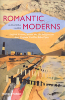
£5.99
This is a fascinating new sticker book full of scenes from Ancient Roman times to fill with stickers. From gladiators fighting in the Colosseum, a bustling Roman army camp filled with soldiers, an extravagant banquet in a senator`s house, to domestic scenes of Romans going about their daily business, this book will not only entertain, but educate too. ...
Archived Product
£4.99
The Romans & Dinosaurs live together in a huge glass dome called Romasauria. They race their rocket chariot & feast on Moon-Cow until their very existence is threatened by a giant asteriod. Will the Romans & Dinosaurs be able to come up with a cunning plan to save Romasauria in time? Add your own drawings to the crazy world of Romasauria. ...
Archived Product
£9.99
Roman Britain was created not by impersonal historical forces, but by men & women, each driven by ambition, aspiration & passion. The Romans Who Shaped Britain explores the narrative of Britannia through the lives of its emperors, commanders, governors, officials & rebels. This rich cast of characters

Includes::
some, such as Caesar, Agricola & Boudica, who may be familiar; & others, such as Carausius, Magnentius or Valentinus, who deserve to be more so. Their lives & actions are set against the backdrop of an evolving landscape, in which Iron Age shrines were being replaced by marble temples, industrial-scale factories & granaries were springing up across the countryside & a triumphal arch towered into the Kent sky to mark Rome`s domination. Fast-moving, vivid & compelling, The Romans Who Shaped Britain, by setting out the story as a single narrative, above all reminds us of the truly epic nature of the history of Britannia.

...
Archived Product
£12.99
Topographic survey of France at 1:25, 000 in IGN`s excellent TOP25 / Série Bleue series. All the maps are GPS compatible, with a 1km UTM grid plus latitude & longitude lines at 5’ intervals. Contours are at 5m intervals except for mountainous areas where the maps have contours at 10m intervals, vividly enhanced by hill shading & graphics for rocky terrain. Colouring with graphics indicates different types of vegetation or land use (deciduous or coniferous forests, moors, orchards, vineyards, etc). PLEASE NOTE: coverage of France at this scale is currently being revised – the format & the presentation of each title are indicated by the letters at the end of its Sheet Reference number (e.g. 0416ET, 3531ETR, 1923SB, etc.)MAPS WITH FULL TOURIST OVERPRINT & AN ENGLISH MAP LEGEND: all TOP25 maps & the SB editions of Série Bleue have an overprint highlighting waymarked walking trails including long-distance GR routes &, where appropriate, ski routes. Symbols indicate campsites, gîtes d’etape, refuges, equestrian centres & other recreational facilities or sites, tourist information centres, cultural heritage, etc. Towns & locations of particular interest are highlighted.- ET or OT = single-sided TOP25 map covering approx. 29x 21 km / 18x 13 miles.- ETR or OTR = waterproof & tear resistant TOP25 map covering the same area as the corresponding ET or OT number, but double-sided, printed on a smaller size sheet with a good overlap between the sides.- SB = Série Bleue map with full tourist overprint; these maps, first introduced in summer 2014, each cover approx. 29x 24km / 18x 15 miles.SÉRIE BLEUE maps with numbers ending in E (Est) or O (Ouest): most editions now indicate the GR routes, but do not show any other tourist information. Map legend is in French only. Each map covers approx. 14x 20km / 9x 12 miles. ...
Archived Product
£12.99
Map No. 1055, Romanshorn, in the topographic survey of Switzerland at 1:25, 000 from Bundesamt für Landestopographie (swisstopo), covering the whole country on 247 small format sheets, with special larger maps published for popular regions including some titles now available in hiking versions. Highly regarded for their superb use of graphic relief & hill shading, the maps give an almost 3-D picture of Switzerland`s mountainous terrain. Contours are at 10 m intervals, with 20m intervals in the mountainous areas. All the maps have a 1-km grid for Swiss national coordinates (datum CH 1903). * Small format sheets (Nos. 1011
- 1374)* Map legend in the language of the area covered by the map. Additional margin ticks show latitude & longitude in steps of 2`. The area covered by each map is 17 x 12 km (11 x 7 miles approx). * Special larger sheets (Nos. from 2501 onwards) – STANDARD editions:* No map legend is included but a separate leaflet can be provided instead. The area covered by each map is 25 x 17 km (15 x 11 miles approx).* Special larger sheets (Nos. from 2501 onwards) – HIKING editions:* An overprint highlights hiking, mountain & alpine paths, including regional & national long-distance trails. The maps also show bus routes with bus stops, plus inns in remote locations. The area covered by each map is 25 x 17 km (15 x 11 miles approx).
...
Archived Product
£16.95
While the battles for modern art & society were being fought in France & Spain, it has seemed a betrayal that John Betjeman & John Piper were in love with a provincial world of old churches & tea-shops. In this multi-awardwinning book now available in paperback Alexandra Harris tells a different story. In the 1930s & 1940s, artists & writers explored what it meant to be alive in Engl&. Eclectically, passionately, wittily, they showed that the modern need not be at war with the past. Constructivists & conservatives could work together, & even the Bauhaus emigre, Laszlo Moholy-Nagy, was beguiled into taking photographs for Betjemans nostalgic Oxford University Chest. This modern English renaissance was shared by writers, painters, gardeners, architects, critics, tourists & composers. John Piper, Virginia Woolf, Florence White, Christopher Tunnard, Evelyn Waugh, E. M. Forster & the Sitwells are part of the story, along with Bill Brandt, Graham Sutherl&, Eric Ravilious & Cecil Beaton. ...
Archived Product
£15.99
The Romantische Straße, a 370-km long route across Bavaria from Würzburg to Füssen & the famous fairy tale castle of Neuschweinstein in the German Alps, presented by the Verlag Esterbauer in guide with maps at 1:75, 000 showing the route & its variants. Extensive information is conveyed by symbols, indicating road surface, campsites & other accommodation, repair workshops, recreational facilities, places of interest, etc. A list of various types of accommodation facilities is included. From the Danube to Füssen the Romantische Straße follows the same route as Via Claudia Augusta (covered in a separate Bikeline guide) which then crosses the German & the Austrian Alps into the Italian South Tyrol leading either to Venice or to Verona & the Po.IMPORTANT
- PLEASE NOTE BEFORE ORDERING
- ALL THE TEXT IN THIS TITLE IS GERMAN ONLY. MAP LEGEND

Includes::
ENGLISH (please see our sample image) & the information provided on the maps is sufficient to use this title without any knowledge of German.ABOUT THE BIKELINE SERIES: all the titles have been meticulously researched & are highly regarded in their native Germany. Most titles, as indicated in their individual descriptions, also include a separate section listing selected accommodation, from hotels to campsites, youth hostels & rooms in private houses, all with addresses, telephone numbers & price range. Information on towns along each route

Includes::
a list of places of interest, with opening hours, etc. Several of the guides also have street plans. To see the list of other titles in the Bikeline series please click on the series link.


...
Archived Product
£4.99
Central Rome at 1:10, 400 on a laminated, waterproof & tear-resistant street plan from the AA with on the reverse a mini guide to the city highlighting its top 25 sights, recommendations for eating out, shopping & entertainment, plus general tourist information. The plan covers just the central district of the city with its main sights, extending westwards from the Termini railway station & the Basilica of San Giovanni in Laterano across the Tiber to the Vatican, Trastevere district & Villa Doria Pamphilj; north/south the coverage is from Villa Borghese Park to Terme di Caracalla. Recommended sights are highlighted & other places of interest are prominently marked. The map also shows selected car parks. Metro stations are not marked on the map itself but diagram of the city ...
Archived Product
£7.95
Central Rome on a waterproof & tear-resistant tourist map from Map Easy with a collection of street plans designed for visitors aiming to shop their way across The Eternal City as much as to explore its history & architecture. The plans, with their characteristic h&-drawn style, are clearly laid out but do not always reflect the relative size of the streets, with small passages often drawn as wide as the main traffic arteries. On one side is a plan central Rome extending from the Termini railway station across the Tiber to the Vatican & the Botanical Gardens of the Gianicolo district, & north/south from Piazza del Popolo to the Coliseum. On the reverse enlargements shows the remains of the remains of the Roman Forum & the surrounding area, the Piazza Navona
- Pantheon district, & the shopper
...
Archived Product
£8.99
Rome on a light, waterproof & tear-resistant map from Berndtson, with a plan of the city supplemented by enlargements of its central area, the Forum & the Vatican highlighting 15 top sights, a map of the environs, a transport diagram, & general tourist information. On one side is a more general plan of the city at 1:15, 000, extending north/south from the Olympic Village to EUR complex & Palazzo dello Sport, & from the Vatican to the Campo Verano cemetery in the east. The plan shows the metro network, one way streets, numerous churches & historical sights, main shopping areas, etc. On the reverse an enlargement at 1:11, 000 shows the central part of the city, from the Vatican to the Roma-Termini station & from Piazza del Popolo to the Coliseum in greater detail. Further enlargements present the Vatican at 1:7, 000, plus the archeological remains of the Foro Romano, also at 1:7, 000, annotated with brief descriptions of main sites. A road map of the city’s environs at 1:250, 000 shows access to the surrounding countryside, including the coast, Castel Gandolfo & Colli Albani. The plans & the road map are indexed with lists of streets/localities plus main sights & places of interest. Also included is a list of the city’s top 15 sights, all highlighted on the plans, a diagram of the metro network, plus information on the city’s climate & general tourist notes. The map is printed on light, waterproof & tear-resistant plastic paper. Map legend

Includes::
English. All descriptions & notes are in English only.

...
Archived Product

Romantic Moderns

Romantic Moderns concerns itself with English writers, artists and the imagination from Virginia Woolf to John Piper. Alexandra Harris tells the history of the 1930s and 1940s in which writers and artists explored what it meant to be alive, at that moment in time, in England.Harris portrays English modernists who show, in their various ways, that ‘the modern’ need not be at war with the past and different eras and theories could work together in particular celebration of locality and the English climate. Virginia Woolf wrote about a village pageant on a showery summer day, Florence White collected regional recipes and Christopher Tunnard designed modern English gardens with a firmly 18-th century feel. Also feeding Romantic Moderns and the sense of finding and imagining possible
homes, for themselves and their art, in England are E.M. Forster, Evelyn Waugh, the Sitwells and Cecil Beaton.
RIP - This product is no longer available on our network. It was last seen on 25.09.2019

This page now acts as a permanent archive for this product. Add more information using the comments box below to ensure it can still be found by future generations.

Use our search facility to see if it is available from an alternative contributor.
  • External links may include paid for promotion
  • Availability: Out Of Stock
  • Supplier: Stanfords
  • SKU: 9780500251713
Availability: In Stock
£19.95

Product Description

Romantic Moderns concerns itself with English writers, artists & the imagination from Virginia Woolf to John Piper. Alexandra Harris tells the history of the 1930s & 1940s in which writers & artists explored what it meant to be alive, at that moment in time, in Engl&. Harris portrays English modernists who show, in their various ways, that ‘the modern’ need not be at war with the past & different eras & theories could work together in particular celebration of locality & the English climate. Virginia Woolf wrote about a village pageant on a showery summer day, Florence White collected regional recipes & Christopher Tunnard designed modern English gardens with a firmly 18-th century feel. Also feeding Romantic Moderns & the sense of finding & imagining possible homes, for themselves & their art, in England are E.M. Forster, Evelyn Waugh, the Sitwells & Cecil Beaton.

Reviews/Comments

Add New

Intelligent Comparison

Oooops!
We couldn't find anything!
Perhaps this product's unique.... Or perhaps we are still looking for comparisons!
Click to bump this page and we'll hurry up.

Price History

Vouchers

No voucher codes found.
Do you know a voucher code for this product or supplier? Add it to Insights for others to use.

Facebook

Jargon Buster

White - A colour combining all colours
Summer - The season between Spring and Autumn. Usually the hottest season of the year
England - A country within the United Kingdom.
History - Anything that happens in the past. An acedemic subject.
Day - The time it takes a planet or other space objects to complete one rotation.
Regional - An adjective to describe a set geographic area.

Supplier Information

Stanfords
Stanfords was established in 1853 and opened their iconic Covent Garden flagship store in 1901. They have become the top retailer of maps, travel books and accessories in the UK and arguably offer the largest selection of maps and travel books worldwide. Famous names such as Captain Robert Falcon Scott, Ranulph Fiennes and Michael Palin have purchased from Stanfords. They now have a shop in Bristol and both stores together with other venues operate a calendar of events including talks, book signings and exhibitions. As a specialist map retailer, the map selection is comprehensive and includes road maps, street maps and walking maps from worldwide destinations, as well as a selection of world atlases and wall maps. Books include travel guides and travel literature. Stanfords also stock globes, from miniatures made of blue marble to magnificent floor-standing globes. The website features a selection of interesting articles on travel topics.
Page Updated: 2023-11-12 20:15:36

Community Generated Product Tags

Oh No! The productWIKI community hasn't generated any tags for this product yet!
Menu