
 United Kingdom
 France
 Germany
 Netherlands
 Sweden
 USA
USA
 Italy
Italy
 Spain
Spain
More From Contributor

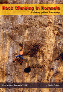
Romania - Rock Climbing
The Romania Rock-Climbing guide describes the 17 climbing areas around Brasov in central Romania - the guide describes over 700 routes, contains a comprehensive set of photo-topos as well as Rockfax style symbols giving the character of both the route and the climbing style. The guide also contains GPS coordinates for each crag, detailed approach maps and it contains a good selection of action shots.

Product Description
Reviews/Comments
Add New
Intelligent Comparison
Archived Product

Snowdonia Rock Climbing Stanfords
£3.99
Archived Product
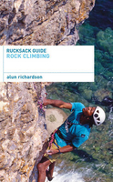
Rock Climbing Stanfords
£7.99
Archived Product
Rock Climbing Stanfords
£12.95
Vouchers
No voucher codes found.
Do you know a voucher code for this product or supplier? Add it to Insights for others to use.
Do you know a voucher code for this product or supplier? Add it to Insights for others to use.
 Denmark