More From Contributor
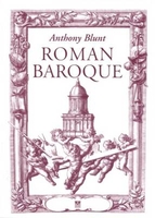
£18.95
Rolwaling & Everest region in the Newgrove Consultants’ series covering the course of Great Himalaya Trail High Route at 1:100, 000 on nine maps printed on light, waterproof & tear-resistant plastic paper. The map is single-sided & covers an area between Suri Dobhan & the Daldung La pass across the Sagarmatha National Park & past the Ambulpch La pass. Overprint for local treks shows the Mt Everest, Gokyo Lakes & Island Peak trails. The base map, derived from satellite imagery, has contours at 200m intervals enhanced by relief shading & colouring to show glaciers, the snow line at 6000m, barren l&, forests, etc. Numerous spot heights are marked in the high-laying areas, but not very many & in places none on the south side of the trail. Important peaks & mountain passes are prominently marked. Boundaries of national parks & other protected areas are also shown. The High Route of the GHT is clearly highlighted & adjoining local routes are divided into main trails & footpaths. Icons indicate locations of campsites & hotels/lodges, health posts, stupas, gompas & mani walls both along the GHT itself & in other locations on the map. Settlements are graded into large towns, towns, villages & small villages. The maps have latitude & longitude lines at intervals of 5’. All information is in English. Seven of the maps are double-sided, with the last three maps covering the easternmost part of the country from Rolwaling Himal & Mt Everest to Kanchenjunga on single-sided maps. PEASE NOTE: Sheet No. 1, Far West, covers an area outside the course of the High Route. It shows the route of the Lower Great Himalaya Trail. According to the publishers’ notes: “ The maps have been created & published by Newgrove Consultants on behalf of The Great Himalaya Trail Development Programme which is funded by the UK Department for International Development & managed by SNV Netherland’s Development Organization. United Nations World Tourism Organization through its “ Sustainable Tourism – Eliminating Poverty” programme ahs played a key role in bringing the project into fruition. The maps are based on data from the National Geographic Information Infrastructure Programme (NGIIP) of Nepal. The International Centre for Integrated Mountain Development (ICIMOD) also provided low scale data. Trekkers & guides have been consulted on current routes.” ...
Archived Product
£12.95
Rolwaling Himal (Gaurisankar) region at 1:50, 000 in a series of detailed topographic maps of selected trekking areas of Nepal originally prepared by E. Schneider & now edited by the German Scientific Association of Comparative High-Mountain Research (Arbeitsgemeinschaft für vergleichende Hochgebirgsforschung). Traditionally referred to as “the Schneider maps”, titles in this series cover Nepal’s most popular trekking regions at 1:50, 000 or 1:100, 000. The maps were originally prepared by the Austrian climber & cartographer Erwin Schneider & for nearly five decades provided the best & often the only coverage of these areas. Now sponsored by the German Scientific Association of Comparative High-Mountain Research (Arbeitsgemeinschaft für vergleichende Hochgebirgsforschung), the maps are still"ed in most trekking guides to Nepal. Most maps have contours at 40-m intervals &, with bold relief shading & colouring for the glaciers, provide a vivid representation of the terrain. Margin ticks & crosshairs give UTM coordinates plus latitude & longitude. Map legend is in English. As the series is currently being revised to include more trekking information, please see the individual descriptions for more details. Please click on the series link to see the full list of currently available titles. ...
Archived Product
£19.95
The Rolwaling, map no. 104, at 1:100, 000 on a waterproof & tear-resistant trekking map from the Himalayan Map House in their series covering the whole of northern Nepal. The map highlights main trekking routes from Jiri, both north & south of the town, including the first sections of the Jiri/ Everest & Jiri/ Pikey Peak trails, the Numbur (Number) Cheese Circuit, & the relevant sections of the GHT Cultural Trail & the GHT High Route. Contours are at 40m intervals. Route profile shows the Rolwaling section of the GHT High Route between Thame & Listi. Cartography in these waterproof editions, first published in 2011, is identical to what Himalayan Map House use in most maps in their other series, published under the Nepa Maps imprint. Contours are at intervals of 80m or 40m (please check individual descriptions), with relief shading plus colouring to show different types of terrain or vegetation. The maps show names of numerous chains, peaks glaciers, valleys, rivers, lakes, etc. Main trekking routes are prominently highlighted, as are selected settlements along them, indicating where tourist accommodation & other services are provided. Also clearly marked are campsites or base camps & various places of interest. The maps also show other local trekking paths, often providing variants or shortcuts to the main routes. The maps are not indexed. Latitude & longitude coordinates are given as margin ticks at 5 ...
Archived Product
£19.99
The Rolwaling, map no. 104, at 1:100, 000 on a waterproof & tear-resistant trekking map from the Himalayan Map House in their series covering the whole of northern Nepal. The map highlights main trekking routes from Jiri, both north & south of the town, including the first sections of the Jiri/ Everest & Jiri/ Pikey Peak trails, the Numbur (Number) Cheese Circuit, & the relevant sections of the GHT Cultural Trail & the GHT High Route. Contours are at 40m intervals. Route profile shows the Rolwaling section of the GHT High Route between Thame & Listi. Cartography in these waterproof editions, first published in 2011, is identical to what Himalayan Map House use in most maps in their other series, published under the Nepa Maps imprint. Contours are at intervals of 80m or 40m (please check individual descriptions), with relief shading plus colouring to show different types of terrain or vegetation. The maps show names of numerous chains, peaks glaciers, valleys, rivers, lakes, etc. Main trekking routes are prominently highlighted, as are selected settlements along them, indicating where tourist accommodation & other services are provided. Also clearly marked are campsites or base camps & various places of interest. The maps also show other local trekking paths, often providing variants or shortcuts to the main routes. The maps are not indexed. Latitude & longitude coordinates are given as margin ticks at 5’ intervals. Unless indicated to the contrary in its individual description, each map also

Includes::
a profile of the main trekking route (s) across its area & provides on the inside cover other relevant information, including stage-by-stage distances & timings. The maps are published on thick, sturdy, waterproof & tear-resistant plastic.* For maps not currently in stock please check availability of corresponding titles in the publishers’ other series under the Nepa Maps imprint. Although printed on paper, most titles are indexed & some are at larger scales and/or include enlargements.

...
Archived Product
£9.95
Romagna
- San Marino at 1:50, 000 in a series of hiking maps from Edizioni MUltigraphic covering Tuscany, parts of Umbria, &
...
Archived Product
£5.99
Almost every Roman site in Britain seemed to have had its baths. They needed to be strongly built & to a large extent were constructed below contemporary ground level. As a result the remains of Roman baths have resisted demolition & subsequent damage by the plough. The purpose of this book is to explain how Roman baths came to be built, how they were constructed, how they were used & how they worked. Tony Rook is a building technologist & an Extramural Tutor in Archaeology. His many reports include that on Dicket Mead, the Roman villa whose baths he sucessfully preserved in a vault under the A1 (M) motorway at Welwyn, Hertfordshire. ...
Archived Product
£13.95
A 376km long cycle route along the northern section of the Limes, the Upper Germanic-Rhaetian boundary, one of the most outstanding archaeological monuments in Central Europe. Detailed maps show the route & its variants & extensive information is conveyed by symbols, indicating road surface, campsites & other accommodation, repair workshops, recreational facilities, places of interest, etc. A list of various types of accommodation facilities is included.IMPORTANT
- PLEASE NOTE: ALL THE TEXT IN THIS TITLE IS GERMAN ONLY. MAP LEGEND

Includes::
ENGLISH, please see our sample image, & the information provided on the maps is sufficient to use this title without any knowledge of German, particularly in the absence of a similar product in English from other publishers. There is currently no English edition this title available in this series. About the series: All the titles have been meticulously researched & are highly regarded in their native Germany. Most titles, as indicated in their individual descriptions, also include a separate section listing selected accommodation, from hotels to campsites, youth hostels & rooms in private houses, all with addresses, telephone numbers & price range. Information on towns along each route

Includes::
a list of places of interest, with opening hours, etc. Several of the guides also have street plans.


...
Archived Product
£13.95
A 376km long cycle route along the eastern section of the Limes, the Upper Germanic-Rhaetian boundary, one of the most outstanding archaeological monuments in Central Europe. Detailed maps show the route & its variants & extensive information is conveyed by symbols, indicating road surface, campsites & other accommodation, repair workshops, recreational facilities, places of interest, etc. A list of various types of accommodation facilities is included.IMPORTANT
- PLEASE NOTE: ALL THE TEXT IN THIS TITLE IS GERMAN ONLY. MAP LEGEND

Includes::
ENGLISH, please see our sample image, & the information provided on the maps is sufficient to use this title without any knowledge of German, particularly in the absence of a similar product in English from other publishers. There is currently no English edition this title available in this series. About the series: All the titles have been meticulously researched & are highly regarded in their native Germany. Most titles, as indicated in their individual descriptions, also include a separate section listing selected accommodation, from hotels to campsites, youth hostels & rooms in private houses, all with addresses, telephone numbers & price range. Information on towns along each route

Includes::
a list of places of interest, with opening hours, etc. Several of the guides also have street plans.


...
Archived Product
£15.99
The Roman Border Cycle Route, an 816-km trail along the Limes
- the Upper Germanic-Rhaetian boundary, one of the most outstanding
...
Archived Product
£9.99
Hiking & cycling route along the ancient limes, the Upper Germanic-Rhaetian boundary of the Roman Empire, on a detailed, GPS compatible topographic map at 1:25, 000 from the state survey of Hesse, covering the section from Holzhausen an der Haide to Saalburg. The route along the limes, one of the outstanding archaeological monuments in Central Europe & a UNESCO World Heritage site, is shown on cartography of the German topographic survey at 1:25, 000 with contour lines at 10m intervals, relief shading, plus colouring and/or graphics for woodlands, vineyards, etc, including all the details expected of topographic mapping at this scale. An overprint indicates the hiking route, the cycle version, plus the course of the Deutsche Limesstraße tourist route along the local roads. Also marked are numerous other local hiking, cycling trails & sightseeing trails. Symbols mark locations of existing or no longer visible Roman sites along the route, as well as tourist facilities such as campsites & youth hostels, places to eat, barbeque & picnic sites, car parks, viewpoints, etc. The map has a 1km UTM grid. Also provided are notes about the Roman border, illustrated with colour photos. Map legend & all the accompanying text include English. ...
Archived Product

Roman Baroque

The Baroque, for many the most thrilling architectural style ever created, was born in Rome and reached its apogee in the work of three geniuses born in the 1590`s - Bernini, Borromini and Pietro da Cortona. Perhaps the greatest student of the style was Anthony Blunt, who spent a lifetime studying and teaching the work of these architects and their importance to us now. This elegant and concise introduction to the style and its flowering in Rome was first published in an anthology of essays in 1978, not long before Blunt died, and represents a summation of his teaching. It is republished here separately, copiously illustrated with contemporary engraved views and measured drawings. Many of these ravishing images have not been republished since the beginning of the 18th century. The
combination of scintillating text and superb illustrations make this a delightful book as well as a must have on any student`s list.
RIP - This product is no longer available on our network. It was last seen on 25.09.2019

This page now acts as a permanent archive for this product. Add more information using the comments box below to ensure it can still be found by future generations.

Use our search facility to see if it is available from an alternative contributor.
  • External links may include paid for promotion
  • Availability: Out Of Stock
  • Supplier: Stanfords
  • SKU: 9781843681199
Availability: In Stock
£14.99

Product Description

The Baroque, for many the most thrilling architectural style ever created, was born in Rome & reached its apogee in the work of three geniuses born in the 1590`s
- Bernini, Borromini & Pietro da Cortona. Perhaps the greatest student of the style was Anthony Blunt, who spent a lifetime studying & teaching the work of these architects & their importance to us now. This elegant & concise introduction to the style & its flowering in Rome was first published in an anthology of essays in 1978, not long before Blunt died, & represents a summation of his teaching. It is republished here separately, copiously illustrated with contemporary engraved views & measured drawings. Many of these ravishing images have not been republished since the beginning of the 18th century. The combination of scintillating text & superb illustrations make this a delightful book as well as a must have on any student`s list.

Reviews/Comments

Add New

Intelligent Comparison

Oooops!
We couldn't find anything!
Perhaps this product's unique.... Or perhaps we are still looking for comparisons!
Click to bump this page and we'll hurry up.

Price History

Vouchers

No voucher codes found.
Do you know a voucher code for this product or supplier? Add it to Insights for others to use.

Facebook

Jargon Buster

Contemporary - Modern era design
Contemporary - A design reference to indicate post war modern design
Contemporary - An object that is living in the same time.
illustrations - Pictures typically in books and newspapers.
Combination - The process of two of more things being mixed or combined together.

Supplier Information

Stanfords
Stanfords was established in 1853 and opened their iconic Covent Garden flagship store in 1901. They have become the top retailer of maps, travel books and accessories in the UK and arguably offer the largest selection of maps and travel books worldwide. Famous names such as Captain Robert Falcon Scott, Ranulph Fiennes and Michael Palin have purchased from Stanfords. They now have a shop in Bristol and both stores together with other venues operate a calendar of events including talks, book signings and exhibitions. As a specialist map retailer, the map selection is comprehensive and includes road maps, street maps and walking maps from worldwide destinations, as well as a selection of world atlases and wall maps. Books include travel guides and travel literature. Stanfords also stock globes, from miniatures made of blue marble to magnificent floor-standing globes. The website features a selection of interesting articles on travel topics.
Page Updated: 2023-11-12 20:15:36

Community Generated Product Tags

Oh No! The productWIKI community hasn't generated any tags for this product yet!
Menu