More From Contributor
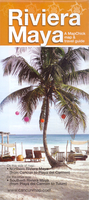
£9.95
Riviera degli Etruschi map at 1:50, 000 from Kompass, printed on durable, waterproof & tear-resistant synthetic paper. Coverage

Includes::
Rosignano, Cecina, San Vincenzo & Campiglia Marittima. Contours are at 40m intervals, with a 2-km UTM grid. Extensive overprint

Includes::
GEA
- Grande Escursione Appenninica, Sentiero Italia, Via Francigena, etc, cycling & selected mountain bike routes, plus a selection of horse riding trails. Accompanying booklet

Includes::
English.KOMPASS HIKING MAPS OF ITALY: This title is part of an extensive series of walking maps from Kompass covering selected areas of Italy at mainly 1:50, 000, with a GPS compatible, contoured topographic base, extensive overprint for hiking routes, various types of accommodation, numerous recreational facilities, places of interest, etc. COVERAGE: The series covers the northern part of the Italian Alps, the lake region of Lombardy, the Dolomites, Italian Riviera, selected parts of Tuscany & Umbria, the Sorrento Peninsula, & the islands of the Tyrrhenian Sea. From mid-2012 coverage of Tuscany is gradually being expanded. Coverage of the Dolomites by Kompass at more detailed scales (mainly 1:25, 000) is listed on our website in a separate series.CARTOGRAPHY: Contour interval varies according to the terrain from 100m to 25m. All the maps highlight local hiking paths &, where appropriate, long-distance routes or via ferrata trails. Symbols indicate various types of accommodation such as selected inns & hotels, campsites, mountain huts & refuges, etc. Most titles also show cycle or mountain bike trails and/or ski routes. Selected titles include on the reverse panorama drawings of the area, as indicated in the individual descriptions.GPS COMPATIBILITY: Unless indicated to the contrary in the individual description, all the titles are GPS compatible, with latest editions providing a 2-km UTM grid.MAP LEGEND: Map legend

Includes::
English.DURABILITY: New editions are now published on waterproof & tear-resistant synthetic paper, as indicated in the individual description.BOOKLETS: PLEASE NOTE BEFORE ORDERING! Many titles come with a booklet describing the area and/or various hiking routes. Unless indicated in the individual description that the booklet

Includes::
English, these booklets are in Italian & German only. The booklets are not necessary to use the maps since, as stated above, full English language map legend is provided. Kompass are Europe


...
Archived Product
£11.99
Map No. 103, covering at 1:25, 000 the coast of the Italian Riviera from Albisola Marina across Savona to Noli & inland to Altare. The map is part of a series of walking maps from Edizioni Multigraphic covering the Ligurian Alps & the coast, the crest of the Apennines along the border between Tuscany with the neighbouring regions, & parts of Tuscany itself. Cartography is rather old fashioned but provides a lot of local information. Contours are at 25-metre intervals with numerous spot heights. An overprint highlights hiking paths indicating their waymarking, & shows the course of Alta Via dei Monti Liguri long-distance trail. Picturesque towns & villages are also highlighted & symbols indicate other places of interest. The map has a 1-km grid but does not provide any coordinates. Map legend

Includes::
English.

...
Archived Product
£11.99
iviera di Ponente: Albegna to Diano Marina in a series of walking maps covering the Ligurian Alps & the coast, the crest of the Apennines along the border of Tuscany with its neighbouring regions, & parts of Tuscany itself. Most maps have contours at 25-metre intervals, with colouring for forests & some relief shading. The cartography is rather old fashioned & sometimes not as clear as in other map series but for many areas, especially for parts of Tuscany, these are the only hiking maps available. An overprint highlights hiking paths, including all the popular long-distance routes such as Garfagnana Trekking, Alta Via dei Monti Liguri & the GEA, Grande Escursione Appenninica, the main path over the crests of the Apennines. The overprint also shows campsites &, where appropriate, mountain refuges & other types of alpine accommodation. Most of the maps are double-sided, as indicated by the map number. Each map covers Approx. 26 x 17km / 16 x 11 miles per side. Some of the maps indicate latitude & longitude at the map corners, but with longitude sometimes based on Rome rather than Greenwich. Map legends vary, most maps include English. ...
Archived Product
£11.99
Map No. 104, covering at 1:25, 000 the coast of the Italian Riviera from Finale Ligure to Albenga & inland beyond Monte Carmo. The map is part of a series of walking maps from Edizioni Multigraphic covering the Ligurian Alps & the coast, the crest of the Apennines along the border between Tuscany with the neighbouring regions, & parts of Tuscany itself. Cartography is rather old fashioned but provides a lot of local information. Contours are at 25-metre intervals with numerous spot heights. An overprint highlights hiking paths indicating their waymarking, & shows the course of Alta Via dei Monti Liguri long-distance trail. Picturesque towns & villages are also highlighted & symbols indicate other places of interest including mountain refuges. The map has a 1-km grid but does not provide any coordinates. Map legend

Includes::
English.

...
Archived Product
£20.00
In 1926 Barry Dierks, a young American architect, arrived in Paris & fell in love with France... With his partner, an ex-officer in the British Army, he built a white, flat-roofed Modernist masterpiece that rested on the rocks below the Esterel, with views across the Mediterranean. They called it Le Trident. From the moment it was built, it captivated the Riviera. As commissions for more villas flooded in, Barry Dierks & Eric Sawyer, ”those two charmers”, flourished at the heart of Riviera society. Over the years, Dierks would design & build over 70 of the Riviera`s most recognisable villas for clients ranging from Somerset Maugham`s Villa Mauresque & Jack Warner`s Villa Aujourd`hui to the Marquess of Cholmondeley`s Villa Le Roc, & Maxine Elliott`s Chateau de l` Horizon, later the home of Aly Khan & Rita Hayworth. Riviera Dreaming tells the dazzling story of the lives, loves & adventures that played out behind the walls of these glamorous houses & provides an unparalleled portrait of life on the Cote d` Azur at the height of the Jazz Age. ...
Archived Product
£16.95
Riviera Maya Explorer Set from Can-Do Publishing with extensive tourist information. A guide rather than a conventional map, this title is filled with details of restaurants, bars & clubs, as well as various types of accommodation & numerous other tourist facilities. The Riviera Maya Explorer Set covers an area from Cancun to Punta Allen & is presented as a main 61 x 92cm map, plus five separate 61 x 43cm sheets. All are double-sided & contain maps with numerous enlargements showing various areas in greater detail, all annotated with extensive tourist information on accommodation, restaurants & bars, attractions, recreational facilities, etc. Panels provide more details with contact numbers, prices, publishers ...
Archived Product
£12.99
” The spread of the towns, the disforesting of the hills, & other causes are conspiring to destroy many of the conditions which made the Riviera of former days so happy a resort for the lovers of Nature. But there will always be much to observe & much to study in so favoured a region.” Quirky, erudite & eminently readable, the fifty-four essays comprising Riviera Nature Notes give an astonishingly clear picture of plant & animal life in the South of France at the turn of the twentieth century--not to mention a fascinating insight into the social mores of the time. A hundred years later the book is as fresh, topical & inviting as when it was first published. Preferring to remain anonymous as a naturalist, not only out of modesty but to guard the integrity of his liturgical writings, its clergyman author speaks of olives & pines, myrtles & figs, mosquitoes & rare butterflies--to name but a few of his subjects--with such passion & verve as to bring the land from the Ligurian coastline to the Maritime Alps vividly alive. Published first at the expense of Sir Thomas Hanbury, master of the famed gardens at La Mortola, Italy & benefactor of the Royal Horticultural Society`s sixty-acre estate at Wisley, a second edition incorporated photographs taken by the temperamental & extravagant heiress Ellen Wilmot, in many ways a greater figure in the plant world than her close contemporary Gertrude Jekyll. Our anonymous author moved in the best horticultural & botanical circles, wore his learning lightly, & unusually for the time, spoke to the common man & the general reader on equal terms. With an engaging, sometimes acerbic, always entertaining & informative voice speaking effortlessly across the years, he will once again garner admirers among nature lovers, gardeners & travellers alike. ...
Archived Product
£16.99
A lined journal, in an ingeniously printed faux leather cover which captures the flavour of finely wrought Renaissance-style leather bindings. It is intricately embellished with one of three designs to reproduce the delicate gold tooling which was brought to Europe via the flourishing trade routes with the east. Closes with a fold-over cover flap. Smythe sewn with 144 pages, plus memento pouch & ribbon page marker. 18x 23cm ...
Archived Product
£11.50
One of the titles in the topographic survey of the coastal part of French Guiana, published as an extension of IGN’s survey of France to its overseas departments. Contours are at 5m intervals & the maps indicate 13 different types of vegetation & land use, including rain forest, brushwood, savanna, high & low mangrove, rice fields, orchards & plantations, etc. The extent of changes in the coastline in the recent decades is indicated. The maps have a UTM grid & latitude/longitude lines at intervals of 5’. Map legend

Includes::
English.

...
Archived Product
£5.99
Administrative provinces of the Ukraine on indexed road maps at 1:250, 000, each with a town centre street plan of its capital city. All place names are in Cyrillic only, but the map legend

Includes::
English. Coverage of the larger provinces is divided between the two sides of the map. Road network is presented in great detail, from international roads, shown with their E numbers, to dirt roads & country paths. Driving distances are marked on main, secondary & selected local roads; the maps also show border crossings, fuel stations, car service stations, & traffic patrol service points. Railway lines are shown with stations & local airports are marked. The maps also show boundaries of districts into which each region (oblast) is subdivided, & indicate their administrative headquarters. Topography is indicated by spot height, plus boundaries of national parks & other protected areas, & colouring and/or graphics for forests, orchards, vineyards, swamps & salt marshes. The maps have latitude & longitude lines at 10’ & 15’ respectively, & are indexed. Map legend

Includes::
English. Each title also

Includes::
a local table of driving distances & a street plan of the region’s administrative capital annotated with locations of selected hotels, car parks & petrol stations, museums & monuments, etc. In some titles more street plans are included.IMPORTANT
- PLEASE NOTE: supplies of all maps published by the Kartografija in Kiev are irregular & we cannot guarantee a definite delivery time for titles currently not in stock. To see the list of other titles in this series please click on the series link.


...
Archived Product

Riviera Maya

Riviera Maya between Cancun, Tulum and Punta Allen on a map from Can-Do Publishing with extensive tourist information. A guide rather than a conventional map, this title is filled with details of restaurants, bars and clubs, as well as various types of accommodation and other tourist facilities.Presented in two separate, double-sided pieces, this title contains: * A 61 x 92cm main sheet covering on one side the area from the Cancun airport to Playa del Carmen, and extending on the reverse further south just beyond the Tulum beach. The map is accompanied by numerous enlargements showing various areas in greater detail. All are annotated with information on accommodation, restaurants and bars, attractions, recreational facilities, etc. Panels provide more details with contact
numbers, prices, publishers’ recommendations, etc. * A 61 x 43cm sheet providing on one side information on Tulum`s Mayan ruins and the nearby tourist develpment, and on the reverse maps and information panels for the area further south: the Sian Ka’an biosphere and Punta Allen.*Please note:* the same main map is also available as a *Riviera Maya Explorer Set* which, in addition to the Tulum Maya site/Sian Ka’an/Punta Allen sheet, also includes four more extra maps covering Tulum itself, Puerto Morelo, Playa del Carmen Day-trip Guide, and Akumal/Puerto Aventuras.
RIP - This product is no longer available on our network. It was last seen on 25.09.2019

This page now acts as a permanent archive for this product. Add more information using the comments box below to ensure it can still be found by future generations.

Use our search facility to see if it is available from an alternative contributor.
  • External links may include paid for promotion
  • Availability: Out Of Stock
  • Supplier: Stanfords
  • SKU: 9780966037715
Availability: In Stock
£18.99

Product Description

Riviera Maya between Cancun, Tulum & Punta Allen on a map from Can-Do Publishing with extensive tourist information. A guide rather than a conventional map, this title is filled with details of restaurants, bars & clubs, as well as various types of accommodation & other tourist facilities. Presented in two separate, double-sided pieces, this title contains: * A 61 x 92cm main sheet covering on one side the area from the Cancun airport to Playa del Carmen, & extending on the reverse further south just beyond the Tulum beach. The map is accompanied by numerous enlargements showing various areas in greater detail. All are annotated with information on accommodation, restaurants & bars, attractions, recreational facilities, etc. Panels provide more details with contact numbers, prices, publishers’ recommendations, etc. * A 61 x 43cm sheet providing on one side information on Tulum`s Mayan ruins & the nearby tourist develpment, & on the reverse maps & information panels for the area further south: the Sian Ka’an biosphere & Punta Allen.* Please note:* the same main map is also available as a * Riviera Maya Explorer Set* which, in addition to the Tulum Maya site/ Sian Ka’an/ Punta Allen sheet, also

Includes::
four more extra maps covering Tulum itself, Puerto Morelo, Playa del Carmen Day-trip Guide, & Akumal/ Puerto Aventuras.

Reviews/Comments

Add New

Price History

Vouchers

No voucher codes found.
Do you know a voucher code for this product or supplier? Add it to Insights for others to use.

Facebook

Jargon Buster

Beach - An area on the coast consisting of a sandy or pebbled area
Day - The time it takes a planet or other space objects to complete one rotation.
Set - a group of items usually related to one another. Some objects cannot function without the complete set of items.
Accommodation - A room in which someone can live in, for example in a hotel

Supplier Information

Stanfords
Stanfords was established in 1853 and opened their iconic Covent Garden flagship store in 1901. They have become the top retailer of maps, travel books and accessories in the UK and arguably offer the largest selection of maps and travel books worldwide. Famous names such as Captain Robert Falcon Scott, Ranulph Fiennes and Michael Palin have purchased from Stanfords. They now have a shop in Bristol and both stores together with other venues operate a calendar of events including talks, book signings and exhibitions. As a specialist map retailer, the map selection is comprehensive and includes road maps, street maps and walking maps from worldwide destinations, as well as a selection of world atlases and wall maps. Books include travel guides and travel literature. Stanfords also stock globes, from miniatures made of blue marble to magnificent floor-standing globes. The website features a selection of interesting articles on travel topics.
Page Updated: 2023-11-12 20:15:36

Community Generated Product Tags

Oh No! The productWIKI community hasn't generated any tags for this product yet!
Menu