-
Home
-
Contributors
-
International
-
Account
-
Information
More From Contributor
- including King Ludwig Way, different variants of the Way of St James, etc
- indicating, where appropriate, their waymarking designation. Symbols show various types of accommodation (campsites, youth hostels, refuges, etc), sport & recreational facilities, places of interest, ski & cable car lift, etc. The maps have UTM grid lines at 1-km UTM intervals. Map legend &, where included, additional text, are in German only. To see the other titles in this series please click on the series link. ...
- ...
Includes:: enlargements showing town centres at a more detailed scale, a general road map of the area, & diagrams of motorways with exits & service areas. The plans also show the postal divisions & have an extensive street index which, where appropriate, shows individual postal codes for each street. Map legend
Includes:: English. In this atlas: the area around Frankfurt, Offenbach, Mainz, Wiesbaden, Darmstadt, Limburg an der Lahn, Aschaffenburg, & Bad Kreuznach. ...
- Frankfurt Region Street Atlas in a series of detailed atlases covering the whole of Germany at 1:20, 000 with UTM ...
Includes:: enlargements showing town centres at a more detailed scale, a general road map of the area, & diagrams of motorways with exits & service areas. The plans also show the postal divisions & have an extensive street index which, where appropriate, shows individual postal codes for each street. Map legend
Includes:: English. In this atlas: the area around Mannheim & Ludwigshafen, including Karlsruhe, Heidelberg, Kaiserslautern, & Pforzheim. ...
- 1374)* Map legend in the language of the area covered by the map. Additional margin ticks show latitude & longitude in steps of 2`. The area covered by each map is 17 x 12 km (11 x 7 miles approx). * Special larger sheets (Nos. from 2501 onwards) – STANDARD editions:* No map legend is included but a separate leaflet can be provided instead. The area covered by each map is 25 x 17 km (15 x 11 miles approx).* Special larger sheets (Nos. from 2501 onwards) – HIKING editions:* An overprint highlights hiking, mountain & alpine paths, including regional & national long-distance trails. The maps also show bus routes with bus stops, plus inns in remote locations. The area covered by each map is 25 x 17 km (15 x 11 miles approx). ...
- West Taunus
- Rüdesheim
- Wiesbaden area of Germany at 1:35, 000 from Kümmerly+ Frey in a series GPS compatible, ...
- ...
Features: Selected titles include on the reverse panorama drawings of their area with names of villages, peaks, valleys, etc. and/or have a booklet with pictures of local wild flowers with their Latin names. Many titles are now published as competitively priced sets of two or more maps, offering a wider coverage.BOOKLETS: PLEASE NOTE BEFORE ORDERING! Many titles come with a booklet describing the area and/or various hiking routes. Unless indicated in the individual description that the booklet
Includes:: English, these booklets are IN GERMAN only. The booklets are not necessary to use the maps since, as stated above, full English language map legend is provided. ...

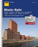
Rhein-Ruhr Region Street Atlas
1:200, 000. Map legends include English.*In this title:* the area around the towns of Bochum, Dortmund, Duisburg, Essen, Gelsenkirchen, Krefeld, Mülheim, Münster and Oberhausen.
This page now acts as a permanent archive for this product. Add more information using the comments box below to ensure it can still be found by future generations.
Use our search facility to see if it is available from an alternative contributor.
- Availability: Out Of Stock
- Supplier: Stanfords
- SKU: 9783826413551
Product Description
Rhein-Ruhr Region Street Atlas in a series of detailed atlases covering the whole of Germany at 1:20, 000 with UTM coordinates for GPS navigation, postal codes & public transport, published by ADAC, the country’s largest motoring organization. The plans name all the individual streets & indicate all the main landmarks & public buildings. All public transport facilities are shown: buses, trams, underground & overland rail lines, with separate plans of the rail networks. One way streets & car parks are marked. The plans also show postal divisions & have extensive street indexes which, where appropriate, show individual postal codes for each street. Enlargements cover central areas in main cities in greater detail. Each atlas also
Includes:: road maps at 1:100, 000 and/or 1:200, 000. Map legends include English.* In this title:* the area around the towns of Bochum, Dortmund, Duisburg, Essen, Gelsenkirchen, Krefeld, Mülheim, Münster & Oberhausen.
Reviews/Comments
Add New
Intelligent Comparison
We couldn't find anything!
Perhaps this product's unique.... Or perhaps we are still looking for comparisons!
Click to bump this page and we'll hurry up.
Price History
Vouchers
Do you know a voucher code for this product or supplier? Add it to Insights for others to use.


 United Kingdom
 France
 Germany
 Netherlands
 Sweden
 USA
USA
 Italy
Italy
 Spain
Spain


 Denmark