More From Contributor
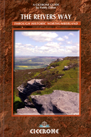
£6.95
Topographic coverage of mainland Spain at 1:50, 000 in the MTN50 (Mapa Topográfico Nacional) series from the Centro Nacional de Información Geografica, the country’s civilian survey organization. The maps have contours at 20m intervals, enhanced by relief shading, plus colouring and/or graphics to show different types of terrain, vegetation or land use. Boundaries of national parks & other protected areas are marked. In addition to all the usual information featured on topographic mapping at this scale, detailed presentation of the road & rail networks, rural tracks & paths, etc, the maps also show campsites & mountain refuges. On more recent editions some GRs, the official long-distance hiking routes, are also marked (although not as clearly as on hiking maps from other publishers). Each map covers 29.5x 18.5 km (with adjustments in the border or coastal areas). The maps have a 1-km UTM grid, plus margin ticks for latitude & longitude at 1` intervals. Map legend is in Spanish only.HOW TO CHOOSE THE RIGHT 50K MAP: all the titles in CNIG’s 200K Provincial Road Maps series at 1:200, 000 are overprinted with the grid for the 1:50, 000 maps & can be used to see the area covered by each 50K title. TO SEE THE LIST OF TITLES IN THIS SERIES PLEASE CLICK ON THE SERIES LINK.PLEASE NOTE
- MAP TITLES: the grids shown on our website serve both the civilian & the military 1:50, 000 topographic series. Although the areas covered by maps in both series are identical (apart from some border or coastal sheets), occasionally map titles differ – only one title is shown on the grid, usually the military one. In Galicia, the Basque country & in the Catalan speaking areas the tendency now is to use local place names rather than the often better known Castilian ones. Where possible, both versions are included in our titles. Map titles listed on our website are based on information received by us at the time of publication, but sometimes maps arrive showing a completely different title! As long as the map number is as ordered, the correct map has been supplied.
...
Archived Product
£17.99
One of the titles in the topographic survey of the Svalbard group published in a colour version, available for the western coast, central & southern part of Spitzbergen, plus two small islands of Svenskøya & Kongsøya. The map has contours at 25-metre intervals, bold relief shading & spot heights, & shows settlements, roads & tracks, working & disused mines, airfields, lighthouses & radio beacons, etc. A grid gives UTM co-ordinates plus latitude in steps of 10` & longitude in 20’. The rest of Spitzbergen, Nordaustlandet, Edgeøya & other small islands are covered by black & white maps with contours only. Most of these maps show no geographical names, as indicated in the individual descriptions of each title. ...
Archived Product
£11.50
GPS compatible recreational maps of the Bavarian topographic survey at 1:25, 000, with waymarked hiking trails & cycling routes, campsites & youth hostels, etc. Contours used in this map vary between 5 to 20m according to the terrain, with 20m interval predominantly used for hilly areas. Varied colouring show different types of landscape: woods, vineyards, fields etc. Maps in this series feature extensive overprint highlighting local & long-distance footpaths & cycle routes, including King Ludwig Way or different variants of the Way of St James, indicating their way marking. Symbols highlight different types of accommodation, sport & recreational facilities, various places of interest, etc. The maps have a 1-km UTM grid. Map legend & text in German only. ...
Archived Product
£17.99
The 1:50, 000 topographic map gives a more general picture of the ground features than a basic map. It shows settlements, houses, roads, cultivated areas, waterways, cutting areas, mires, rock exposures, & relief. One map sheet covers an area of 30 x 40 km & one centimetre corresponds to 500 metres on the ground. The 1:50, 000 topographic map is also an ideal complement to nautical charts as it provides useful information about the land areas adjacent to waterways. For example, all Finnish sea areas are covered by 1:50, 000 topographic map sheets. ...
Archived Product
£6.95
Reivers Cycle Route, a 275km/172 mile waymarked coast to coast cycle route between Tynemouth on the North Sea via Kielder Water, Carlisle & the northern part of the Lake District to Whitehaven on the Irish Sea, presented in six sections on a map from Footprint. The route is highlighted on mapping with altitude colouring at 1:100, 000 or on street plans of towns it passes through, & is annotated with mile markers, gradients, & symbols indicating difficult sections & points. Symbols mark locations of tourist information offices, youth hostels & campsites, pubs & cafes, grocery shops, cycle shops or hire, public toilets & historical sites or tourist attractions. No coordinates are provided for GSP users. Each panel is accompanied by a route profile & brief notes. Also provided is a list of useful addresses & website. The map is printed on light, waterproof & tear-resistant synthetic paper. ...
Archived Product
£25.00
Informative Material related to the CTU Code, the companion publication to the CTU Code, provides further practical guidance & background information, including:- consequences of improper packing procedures- typical documents related to transport- CTU types- species of concern regarding recontamination- quick lashing guides- intermodal load distribution- manual handling- transport of perishable cargo- CTU seals- testing CTUs for hazardous gases. The informative material does not form part of the CTU Code but provides additional information & is applicable to transport operations by all surface & water modes of transport & the whole intermodal transport chain. ...
Archived Product
£12.99
The most personal & tender novel yet from Patrick Ness, the twice Carnegie Medal-winning author of A Monster Calls. The most personal & tender novel yet from Patrick Ness, the twice Carnegie Medal-winning author of A Monster Calls. It`s Saturday, it`s summer &, although he doesn`t know it yet, everything in Adam Thorn`s life is going to fall apart. But maybe, just maybe, he`ll find freedom from the release. Time is running out though, because way across town, a ghost has risen from the lake... This uplifting coming-of-age novel will remind you what it`s like to fall in love. ...
Archived Product
£8.99
A guide to writing fiction by the Booker Prize-winning author of Vernon God Little. Part biography, part reflection & part practical guide, Release the Bats explores the mysteries of why & how we tell stories, & the craft of writing fiction. DBC Pierre reveals everything he learned the hard way. ...
Archived Product
£23.95
The World Marathon Challenge-seven marathons on seven continents in seven days-is the ultimate race for adventurous runners. It tests the athletes to their limits, going from biting cold Antarctic conditions one day to dry desert heat another. To survive the onslaught of sensations-fear, fatigue, depression, elation-takes a special sort of determination & strength of will. Few would voluntarily take on such a challenge, & fewer still would finish it. Relentless: Seven Marathons, Seven Continents, Seven Days is David Gething`s amazing story of his journey from a middle-aged couch potato to a World Marathon champion. Gething gives a deeply personal & candid view of what it is like to compete in one of the most demanding amateur sporting events on the planet, including the sacrifices made just to get to the start of the race & what it takes to win. He describes in detail each individual contest-originating in Antarctica & ending in Australia a week later-and the physical, emotional, & psychological sides of this grueling, multi-day stage race. Far from just depicting the event itself, Gething also delves into the interpersonal relationships, rivalries, & bonds that form on this adventure that is like no other. Featuring photographs taken during the event from Gething`s personal collection, & including private emails to & from the author & his family & friends, Relentless gives a truly unique & intimate view into the inner workings of this punishing ultra-endurance battle. Marathon runners, sporting enthusiasts, & anyone with a dream & a determination to succeed despite the odds will find Gething`s journey a fascinating & inspiring story. ...
Archived Product
£9.99
Alain de Botton`s ” Religion for Atheists” looks at the God debate with fresh eyes ” All of us”, whether religious, agnostic or atheist, are searching for meaning. & in this wise & life-affirming book, non-believer Alain de Botton both rejects the supernatural claims of religion & points out just how many good ideas they sometimes have about how we should live. & he suggests that non-believers can learn & steal from them. Picking & choosing from the thousands of years of advice assembled by the world`s great religions to get practical insights on art, community, love, friendship, work, life & death, Alain de Botton shows us a range of fascinating ideas on a range of topics, including relationships, work, culture, love & death
- & that could be of use to all of us, irrespective of whether we do or don`t believe. In the ” Sunday Times” top-ten bestseller ” Religion for Atheists”, Alain de Botton takes us one step further than Dawkins & Hitchens have ventured & into a world of ideas beyond the God debate...”A serious & optimistic set of practical ideas that could improve & alter the way we live”. (Jeanette Winterson, ” The Times”). ”A beautiful, inspiring book.. .offering a glimpse of a more enlightened path”. (” Sunday Telegraph”). ” Packed with tantalizing goads to thought & playful prompts to action”. (” Independent”). ” Smart, stimulating, sensitive. A timely & perceptive appreciation of how much wisdom is embodied in religious traditions & how we godless moderns might learn from it”. (” Financial Times”). ” There isn`t a page in this book that doesn`t contain a striking idea or a stimulating parallel”. (” Mail on Sunday”). ” Packed with tantalizing goads to thought & playful prompts to action”. (” Independent”). Alain de Botton was born in 1969 & is the author of non-fiction essays on themes ranging from love & travel to architecture & philosophy. His bestselling books include ” How Proust Can Change Your Life”, ” The Art of Travel”, ” The Consolations of Philosophy”, ” The Architecture of Happiness”, ” Status Anxiety”, ” Essays in Love”, ”A Week at the Airport” & ” The Pleasures & Sorrows of Work”. He lives in London & founded The School of Life & Living Architecture.
...
Archived Product

Reivers Way

Reivers Way is experienced walker Paddy Dillon’s Cicerone guide to walking through historic Northumberland. The guide covers the entire route, including suggested alternative routes, details of local facilities, background information on local history and heritage and also an optional excursion to the bird reserves of the Farne Islands. The guide is structured in 9 main sections, each reflecting a day’s walk along the route. Each walk is accompanied by a brief general overview of the route and an Information Box with details of starting and finishing points, distance, the relevant maps, terrain, refreshments and public transport. A detailed introduction provides information on geology and scenery, wildlife, getting to Northumberland and around, food and drink, Tourist
Information centres and rescue services. 4 Appendices include a Route Summary table, accommodation list and local history. Detailed route descriptions are accompanied by Ordnance Survey extracts mapping the route in addition to colour photographs illustrating some of the highlights of the region.
RIP - This product is no longer available on our network. It was last seen on 25.09.2019

This page now acts as a permanent archive for this product. Add more information using the comments box below to ensure it can still be found by future generations.

Use our search facility to see if it is available from an alternative contributor.
  • External links may include paid for promotion
  • Availability: Out Of Stock
  • Supplier: Stanfords
  • SKU: 9781852844981
Availability: In Stock
£10.00

Product Description

Reivers Way is experienced walker Paddy Dillon’s Cicerone guide to walking through historic Northumberl&. The guide covers the entire route, including suggested alternative routes, details of local facilities, background information on local history & heritage & also an optional excursion to the bird reserves of the Farne Islands. The guide is structured in 9 main sections, each reflecting a day’s walk along the route. Each walk is accompanied by a brief general overview of the route & an Information Box with details of starting & finishing points, distance, the relevant maps, terrain, refreshments & public transport. A detailed introduction provides information on geology & scenery, wildlife, getting to Northumberland & around, food & drink, Tourist Information centres & rescue services. 4 Appendices include a Route Summary table, accommodation list & local history. Detailed route descriptions are accompanied by Ordnance Survey extracts mapping the route in addition to colour photographs illustrating some of the highlights of the region.

Reviews/Comments

Add New

Intelligent Comparison

Oooops!
We couldn't find anything!
Perhaps this product's unique.... Or perhaps we are still looking for comparisons!
Click to bump this page and we'll hurry up.

Price History

Vouchers

No voucher codes found.
Do you know a voucher code for this product or supplier? Add it to Insights for others to use.

Facebook

Jargon Buster

History - Anything that happens in the past. An acedemic subject.
Colour - The categorised spectrum of light visable to humans
Day - The time it takes a planet or other space objects to complete one rotation.
Alternative - Another available choice or possibility
Accommodation - A room in which someone can live in, for example in a hotel
Transport - Something that carries people or goods.

Supplier Information

Stanfords
Stanfords was established in 1853 and opened their iconic Covent Garden flagship store in 1901. They have become the top retailer of maps, travel books and accessories in the UK and arguably offer the largest selection of maps and travel books worldwide. Famous names such as Captain Robert Falcon Scott, Ranulph Fiennes and Michael Palin have purchased from Stanfords. They now have a shop in Bristol and both stores together with other venues operate a calendar of events including talks, book signings and exhibitions. As a specialist map retailer, the map selection is comprehensive and includes road maps, street maps and walking maps from worldwide destinations, as well as a selection of world atlases and wall maps. Books include travel guides and travel literature. Stanfords also stock globes, from miniatures made of blue marble to magnificent floor-standing globes. The website features a selection of interesting articles on travel topics.
Page Updated: 2023-11-12 20:15:36

Community Generated Product Tags

Oh No! The productWIKI community hasn't generated any tags for this product yet!
Menu