More From Contributor

£11.99
Ardennes Recreational Maps at a scale of 1:25, 000 enable you to discover the Ardennes from junction to junction, each associated with a locality, through a network of hiking, cycling or riding paths. The network of mini walks consists of suggested routes with kilometre distance marked showing field boundaries & urbanised built up areas. Contour markings are at five metre intervals. The map legend is in English, French, Dutch & German. You can scan QR codes on the map for details about the respective locality or upload GPX files of the proposed routes via the provided website. ...
Archived Product
£9.99
Map No. 218, Redwood National Park, CA, in an extensive series of GPS compatible, contoured hiking maps of USA’s national & state parks or forests & other popular recreational areas. Cartography based on the national topographic survey, with additional tourist information. The maps, with most titles now printed on light, waterproof & tear-resistant plastic paper, highlight walking trails along with campsites & other accommodation, picnic sites, areas for various recreational pursuits such as horse riding or skiing, drinking water sources, & many other facilities of interest to the outdoor enthusiast. Cartography is based on information from the USGS (United States Geological Survey
- the country’s national survey organization), revised by the National Geographic Maps in cooperation with the National Park Service, USDA Forest Service, etc. Topography is excellently presented by contours (interval varies according to scale), enhanced by relief shading & colouring/graphics for wood cover, glaciers, etc. All heights are given in feet. The maps have a UTM grid plus latitude & longitude margin ticks & GPS waypoints for selected important locations. Each map is double-sided to give either maximum coverage of the chosen area or additional enlargements of its important sections. Accompanying notes provide useful information on relevant regulations, safety precautions, contact addresses, etc.* *IMPORTANT
- PLEASE NOTE: the series is very extensive, ranging in scale from 1:400, 000 for the vast national parks of Alaska to 1:25, 000 for local map in several states. We recommend, therefore, viewing the series by state rather than the whole list.*

...
Archived Product
£18.99
Life afloat suits some people, & with a business that`s made living & working all over the English waterways possible, it suits Giles Byford & Jill Parkinson so well they feel blessed. Everything, from the circumstances of finding their first narrowboat to rejecting academia, seems to bring rewards; so they`re not surprised that the same strange magic appears to be working its charm when they set about building Hawthorn, the barge they intend to spend the rest of their lives exploring Europe on. The future`s promising & wonderful. & then, quite suddenly, everything falls apart. Reedbound is largely about what followed: how the terrifying voyage across the Irish Sea became an act of faith that contrasted with a gentle westward wander along an empty canal to the River Shannon & the heart of Ireland`s waterways. & how, despite feeling vulnerable & nervous, they were determined the best way to recover their confidence in life afloat was to avoid doing any research & simply trust that all would be well. This unusual approach delivered constant surprises, adventures, unexpected spaces & the company of other misfits. Giles began to write
- initially a widely read blog, & then articles for waterways magazines
- & Jill finally had time to explore her interest in art; the success of which can be seen in the numerous illustrations that are a feature of Reedbound. Reedbound compares & contrasts two inland waterway systems
- England & Ireland
- & two boating cultures. It`s about Giles & Jill`s approach to travel & life, which is as rare as taking a barge across the Irish Sea. It`s also about the delight of experiencing the Irish landscape & culture through naive but willing eyes.


...
Archived Product
£30.00
Ship management has constantly had to evolve to take into account the advancements in technology as well as the demands of the shipping industry. Having internet access & email on board ship has meant that the ship manager has to possess certain sets of skills to function effectively in the post, including computer literacy. The emergence of large multi-national ship management companies has also changed how business is conducted & this is turn means that the ship manager & tiers of management within the organization have had to evolve to cope with the demands of working with a multi-national workforce. Furthermore, since the mid-1980s there has been an ever expanding raft of legislation that is more restrictive for companies to meet, & a shrinking of profit margins has seen a shift in how companies are required to operate to survive. This book addresses the demands of 21st century ship management with the focus of the book as much about the people who manage ships as about the theory & practice of ship management. ...
Archived Product
£25.00
Reeds Astro Navigation Tables is an established book of annual astro navigation tables compiled specifically for the needs of yachtsmen. It contains all the information the ocean-going sailor needs (without the bulk) in order to navigate by the sun, moon, planets & stars, using tables devised by practical ocean navigators. This book, together with a sextant, will enable sailors to navigate confidently & safely when out of the sight of l&. The book continues to feature the well-received recent additions, including forms to help determine True Altitude (for the sun, planets & stars), Calculated Altitude (using the versine formula) & Azimuth (using the ABC Tables), as well as a pro forma for calculating Intercept. With the extra pages & an enhanced layout, there is plenty of space for making notes & calculations. ...
Archived Product
£35.00
The Reeds Channel Almanac covers the south coast of England from the Scilly Isles to Dover, the Channel Islands & northern France from Calais to L` Aberildut, offering cruising & racing yachtsmen ready access to essential navigation information by virtue of its clear layout & user friendly format. Completely updated for 2019, topics include seamanship, pilotage, tide tables, safety procedures, navigation tips, radio, lights, waypoints, weather forecast information, communications, Mayday & distress procedures
- in fact everything the cruising yachtsman needs to know. The spiral binding allows the Almanac to be opened flat on the chart table & the large type size & clear layout makes information easy to read even in adverse conditions. This handy volume is ideal for anyone cruising the length of the English Channel.
Includes: a free Reeds Marina Guide. Also available: free supplements of up-to-date navigation changes from January to June at: www.reedsnauticalalmanac.co.uk` There are some things I would not go to sea without
- Reeds is one of them.` Sir Chay Blyth


...
Archived Product
£29.99
The Reeds Channel Almanac covers the south coast of England from the Scilly Isles to Dover, the Channel Islands & northern France from Calais to L' Aberildut, offering cruising & racing yachtsmen ready access to essential navigation information by virtue of its clear layout & user friendly format. Completely updated for 2014, topics include pilotage, tides, safety, navigation, radio, lights, waypoints, weather forecast information, communications, Mayday & distress procedures
- in fact everything the cruising yachtsman needs to know. The spiral binding allows the Almanac to be opened flat on the chart table & the large type size & clear layout makes information easy to read even in adverse conditions. This handy volume is ideal for anyone cruising the English Channel.

Includes::
a free Reeds Marina Guide. Also available: free supplements of up-to-date navigation changes from January to June at: www.reedsnauticalalmanac.co.uk ' There are some things I would not go to sea without
- Reeds is one of them.' Sir Chay Blyth


...
Archived Product
£35.00
The Reeds Channel Almanac covers the south coast of England from the Scilly Isles to Dover, the Channel Islands & northern France from Calais to L` Aberildut, offering cruising & racing yachtsmen ready access to essential navigation information by virtue of its clear layout & user friendly format. Completely updated for the current year, topics include seamanship, pilotage, tide tables, safety procedures, navigation tips, radio, lights, waypoints, weather forecast information, communications, Mayday & distress procedures
- in fact everything the cruising yachtsman needs to know. The spiral binding allows the Almanac to be opened flat on the chart table & the large type size & clear layout makes information easy to read even in adverse conditions. This handy volume is ideal for anyone cruising the length of the English Channel.

Includes::
a free Reeds Marina Guide. Also available: free supplements of up-to-date navigation changes from January to June at: www.reedsnauticalalmanac.co.uk ` There are some things I would not go to sea without
- Reeds is one of them.` Sir Chay Blyth


...
Archived Product
£8.99
Getting breakfast, lunch & dinner from tins quickly becomes boring, but it is relatively easy to prepare & cook interesting, varied & delicious meals with the minimum of space, equipment &
- most importantly
- hassle. This handy pocket-sized reference book is packed with invaluable advice for feeding a hungry crew for a weekend, a week, a month or even a long-term cruise or ocean passage. A third of the book contains simple but delicious recipe ideas, but most of the book is packed with tips, tricks & guidance from someone who learnt all the secrets (and the pitfalls) during a 2-year cruise with only a single paraffin burner. The book covers: cooking whilst underway; cooking in harbour; food storage tips; how to equip or modify the galley for weekend or long-term cruising; how to provision & plan for coastal cruises or ocean passages; preparing freshly caught fish; baking bread aboard; using a pressure cooker; speed cooking; different foods available in different climates; & much, much more. Keeping food interesting is important, & this colourful aide-memoire makes cooking at sea simpler, safer & more enjoyable for all aboard.

...
Archived Product
£7.99
Here is the Reeds Crew Handbook for skippers to hand to new & aspiring crew. It will give them all the essential knowledge they need to undertake the tasks traditionally handled by crew aboard any size of yacht, including: steering (both with a tiller & a wheel), raising, dropping & reefing a sail, boat handling (using tide, wind, etc), handling lines (throwing, coiling, lassoing, etc), tying up a boat on a pontoon & against a quay wall, attaching bow & stern lines & springs, handling an anchor, using the radio, basic first aid, essential knots & more ...
Archived Product

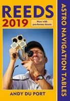
Reeds Astro Navigation Tables 2019

Reeds Astro Navigation Tables is an established book of annual astro-navigation tables compiled specifically for the needs of yachtsmen. It contains all the information the ocean-going sailor needs (without the bulk) in order to navigate by the sun, moon, planets and stars, using tables devised by practical ocean navigators. This book, together with a sextant, will enable sailors to navigate confidently and safely when out of the sight of land.The book continues to feature the well-received additions of the past couple of years, including forms to help determine True Altitude (for the sun, planets and stars), Calculated Altitude (using the versine formula) and Azimuth (using the ABC Tables), as well as a pro forma for calculating Intercept. With 8 extra pages and an improved
layout, there is plenty of space for making notes and calculations.
RIP - This product is no longer available on our network. It was last seen on 25.09.2019

This page now acts as a permanent archive for this product. Add more information using the comments box below to ensure it can still be found by future generations.

Use our search facility to see if it is available from an alternative contributor.
  • Availability: Out Of Stock
  • Supplier: Stanfords
  • SKU: 9781472956811
Availability: In Stock
£25.00

Product Description

Reeds Astro Navigation Tables is an established book of annual astro-navigation tables compiled specifically for the needs of yachtsmen. It contains all the information the ocean-going sailor needs (without the bulk) in order to navigate by the sun, moon, planets & stars, using tables devised by practical ocean navigators. This book, together with a sextant, will enable sailors to navigate confidently & safely when out of the sight of l&. The book continues to feature the well-received additions of the past couple of years, including forms to help determine True Altitude (for the sun, planets & stars), Calculated Altitude (using the versine formula) & Azimuth (using the ABC Tables), as well as a pro forma for calculating Intercept. With 8 extra pages & an enhanced layout, there is plenty of space for making notes & calculations.

Reviews/Comments

Add New

Intelligent Comparison

Oooops!
We couldn't find anything!
Perhaps this product's unique.... Or perhaps we are still looking for comparisons!
Click to bump this page and we'll hurry up.

Price History

Vouchers

No voucher codes found.
Do you know a voucher code for this product or supplier? Add it to Insights for others to use.

Facebook

Jargon Buster

sun - A star at the centre of the solar system.
Altitude - Something that can be quite high in relation to sea or ground level.
Practical - Weather a task is easy to carry out and realistically succeed.
Feature - An attribute that makes something stand out.

Supplier Information

Stanfords
Stanfords was established in 1853 and opened their iconic Covent Garden flagship store in 1901. They have become the top retailer of maps, travel books and accessories in the UK and arguably offer the largest selection of maps and travel books worldwide. Famous names such as Captain Robert Falcon Scott, Ranulph Fiennes and Michael Palin have purchased from Stanfords. They now have a shop in Bristol and both stores together with other venues operate a calendar of events including talks, book signings and exhibitions. As a specialist map retailer, the map selection is comprehensive and includes road maps, street maps and walking maps from worldwide destinations, as well as a selection of world atlases and wall maps. Books include travel guides and travel literature. Stanfords also stock globes, from miniatures made of blue marble to magnificent floor-standing globes. The website features a selection of interesting articles on travel topics.
Page Updated: 2023-11-12 20:15:36

Community Generated Product Tags

Oh No! The productWIKI community hasn't generated any tags for this product yet!
Menu