More From Contributor

£12.99
A beautiful apron by Temple Island & drawn by Matthew Cook: it features a beautifully illustrated design capturing some of the most famous landmarks in London. The print presents a cream background with blue illustrations. Made from 100% cotton this apron makes a great souvenir & a lovely addition to any kitchen. The apron can also be coordinated with other Temple Island item, like Matthew Cook’s tea towel. ...
Archived Product
£7.99
A beautiful tea towel by Temple Island & drawn by British illustrator Alice Tait: it features a beautifully illustrated map of central London capturing some of the most famous streets & landmarks. Made from 100% cotton this tea towel makes a great souvenir & a lovely addition to any kitchen. ...
Archived Product
£7.99
A beautiful handy little purse by British illustrator Alice Tait: it features London’s most iconic landmarks on a blue background & a red zip fastening. It is perfect for keeping your coins & cards safe & in order in one place & can be coordinated with other Alice Tait items. ...
Archived Product
£7.99
A set of four coasters featuring the wonderful London skyline. Each coaster has a different iconic landmark: the Tower of London, St Paul`s Cathedral, Tower Bridge, the Parliament & Westminster Abbey. The 4 coasters can all be aligned to show the full London skyline along the River Thames. ...
Archived Product
£12.00
War`s mess & muddle, the brutality & the inanity of fighting-few have better captured this than Isaac Babel, who was a journalist with the Soviet First Cavalry Army. His unflinching portrayal of the murderous havoc of battle is offset by an unexpected & wry humour: having seen the fighting up close, Babel is able to find the funny side of war while depicting its bloody side-in all its mesmerising & casual violence. The lyricism & bitterness that characterise the thirty-five short stories of Red Cavalry are stunningly reproduced in this new translation by the award-winning Boris Dralyuk. ...
Archived Product
£8.95
Southern part of Northern Territory, with the Mac Donnell Ranges & the route from Alice Springs to Uluru/ Ayers Rock. The map shows roads & 4WD tracks, indicating accommodation, general stores & meal facilities, fuel supplies, places of interest, etc. Topography is shown by subtle relief shading & names of mountain ranges & selected peaks. National parks & Aboriginal lands are highlighted. Latitude & longitude lines are drawn at 30' intervals with ticks at 5 ...
Archived Product
£20.00
We are able to source a wide range flags in many sizes, sewn or printed on 100% Ministry Of Defence Standard Woven & Knitted Polyester. Flags are supplied with rope & toggle. If you would like more information, have a custom size request or cannot find a desired product, please email us at maritime@stanfords.co.uk. We will be glad to help! ...
Archived Product
£14.99
Three young Irish people have come to Australia, running from the economic ruins of their home country & their own unhappy lives. In this promised l&, stunned by the heat & the vast arid space of the interior, they each try to escape their past in a chaotic world of backpacker hostels, huge fruit farms & squalid factories, surrounded by new friends who are even more damaged & dangerous than they are themselves. Endless supplies of cheap drink & drugs loosen what little sense of responsibility they have, & a spiral of self-destructive behaviour forces each of them to face up to the reality of their lives. This is a story of the consequences of impulsive choices & of the places where they lead. A vulnerable young man is left alone by his friends in a remote wilderness; a desperate girl puts herself into the hands of violent sex traffickers; a once-privileged favourite son lets a drunken quarrel escalate to murder. An utterly compelling, readable novel that hooks from the first page & immerses us in an all-too topical nightmare. ...
Archived Product
£7.99
A group of young Irish migrants leave a man called Hopper for dead on an outback road in Australia. They barely know him; no-one will miss him in their world of hostels, wild nights on cheap wine & grinding work on isolated farms. In this powerful novel about the discovery of responsibility, three young people
- Fiona, Murph & Hopper
- flee the collapse of their country`s economy. In the heat & endless spaces of Australia they try to escape their past, but impulsive cruelty, shame & guilt drag them down, & it is easy to make terrible choices.

...
Archived Product
£8.99
` In early 1998 I went to Perth in Western Australia in order to attend the literature festival, & part of the arrangement was that I should go to Karratha to do their first ever literary dinner. Karratha is a mining town a long way further north. The landscape is extraordinary, being composed of vast heaps of dark red earth & rock poking out of the never-ending bush. I imagine that Mars must have a similar feel to it. I went exploring & discovered the bronze statue to Red Dog outside the town of Dampier. I felt straight away that I had to find out more about this splendid dog. A few months later I returned to Western Australia & spent two glorious weeks driving around collecting Red Dog stories & visiting the places that he knew, writing up the text as I went along. I hope my cat never finds out that I have written a story to celebrate the life of a dog.` Louis de Bernieres ...
Archived Product

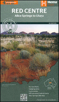
Red Centre - Alice Springs To Uluru/Ayers Rock NT Hema

The Red Centre, the southern part of Northern Territory with the MacDonnell Ranges and the route from Alice Springs to Uluru/Ayers Rock, on a road map at 1:750, 000 from Hema, with on the reverse a street plan of Alice Springs, maps of access to the Uluru/Ayers Rock and Kata Tjuta/The Olgas, a table of facilities in the national parks, etc.On one side is the main map at 1:750, 000, extending from well north of Alice Springs to the border with South Australia, west to include the Uluru – Kata Tjuta National Park, and east to the Old Andado Track across the Simpson Desert. Topography of this fascinating region is presented by relief shading with names of mountain rages, peaks, etc, plus graphics for sand ridges, seasonal lakes, salt flats, waterholes, areas subject to
inundation, etc. Colouring highlights national parks and the map also shows boundaries of Aboriginal Lands.Road information is divided into two groups: roads and tracks which were plotted by the publishers during fieldwork plus other tracks shown on the country’s 250K topographic survey maps and on other sources. Many road junctions and other important locations are annotated with their GPS coordinates. Four routes are specially highlighted: Explorers Way, Binns Track, Red Centre Way and Old Ghan Railway Heritage Trail. A wide range of icons indicates various facilities, including rest areas, fuel supplies, camping facilities, meals and general stores, etc. Many locations are annotated with notes and/or contact details. Latitude and longitude lines are drawn at 30` intervals.On
the reverse is a street plan Alice Springs, with accommodation facilities and main places of interest, an enlargement of the immediate environs of the town, plus maps of the Yulara tourist village, access from there to Uluru and Kata Tjuta, and walking tracks around the rocks. Also included are descriptions of places of interest throughout the area and a table showing tourist facilities in national parks and reserves.To see the list of other titles in Hema’s series of regional maps of Australia please click on the series link.
RIP - This product is no longer available on our network. It was last seen on 25.09.2019

This page now acts as a permanent archive for this product. Add more information using the comments box below to ensure it can still be found by future generations.

Use our search facility to see if it is available from an alternative contributor.
  • External links may include paid for promotion
  • Availability: Out Of Stock
  • Supplier: Stanfords
  • SKU: 9781865006833
Availability: In Stock
£10.99

Product Description

The Red Centre, the southern part of Northern Territory with the Mac Donnell Ranges & the route from Alice Springs to Uluru/ Ayers Rock, on a road map at 1:750, 000 from Hema, with on the reverse a street plan of Alice Springs, maps of access to the Uluru/ Ayers Rock & Kata Tjuta/ The Olgas, a table of facilities in the national parks, etc. On one side is the main map at 1:750, 000, extending from well north of Alice Springs to the border with South Australia, west to include the Uluru – Kata Tjuta National Park, & east to the Old Andado Track across the Simpson Desert. Topography of this fascinating region is presented by relief shading with names of mountain rages, peaks, etc, plus graphics for sand ridges, seasonal lakes, salt flats, waterholes, areas subject to inundation, etc. Colouring highlights national parks & the map also shows boundaries of Aboriginal Lands. Road information is divided into two groups: roads & tracks which were plotted by the publishers during fieldwork plus other tracks shown on the country’s 250K topographic survey maps & on other sources. Many road junctions & other important locations are annotated with their GPS coordinates. Four routes are specially highlighted: Explorers Way, Binns Track, Red Centre Way & Old Ghan Railway Heritage Trail. A wide range of icons indicates various facilities, including rest areas, fuel supplies, camping facilities, meals & general stores, etc. Many locations are annotated with notes and/or contact details. Latitude & longitude lines are drawn at 30` intervals. On the reverse is a street plan Alice Springs, with accommodation facilities & main places of interest, an enlargement of the immediate environs of the town, plus maps of the Yulara tourist village, access from there to Uluru & Kata Tjuta, & walking tracks around the rocks. Also included are descriptions of places of interest throughout the area & a table showing tourist facilities in national parks & reserves. To see the list of other titles in Hema’s series of regional maps of Australia please click on the series link.

Reviews/Comments

Add New

Intelligent Comparison

Oooops!
We couldn't find anything!
Perhaps this product's unique.... Or perhaps we are still looking for comparisons!
Click to bump this page and we'll hurry up.

Price History

Vouchers

No voucher codes found.
Do you know a voucher code for this product or supplier? Add it to Insights for others to use.

Facebook

Jargon Buster

GPS - Global Positioning System - Global position using satellites
fuel - A material used to generate energy.
Graphics - A general term for visual aspects of an item/display
Red - One of the three primary colours
Road - a manmade lane or a path that is used to speed up travel.
Wide - Something with a large width.
Accommodation - A room in which someone can live in, for example in a hotel
Regional - An adjective to describe a set geographic area.

Supplier Information

Stanfords
Stanfords was established in 1853 and opened their iconic Covent Garden flagship store in 1901. They have become the top retailer of maps, travel books and accessories in the UK and arguably offer the largest selection of maps and travel books worldwide. Famous names such as Captain Robert Falcon Scott, Ranulph Fiennes and Michael Palin have purchased from Stanfords. They now have a shop in Bristol and both stores together with other venues operate a calendar of events including talks, book signings and exhibitions. As a specialist map retailer, the map selection is comprehensive and includes road maps, street maps and walking maps from worldwide destinations, as well as a selection of world atlases and wall maps. Books include travel guides and travel literature. Stanfords also stock globes, from miniatures made of blue marble to magnificent floor-standing globes. The website features a selection of interesting articles on travel topics.
Page Updated: 2023-11-12 20:15:36

Community Generated Product Tags

Oh No! The productWIKI community hasn't generated any tags for this product yet!
Menu