More From Contributor
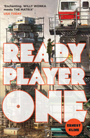
£6.39
A detailed topographic map of Reading from the Ordnance Survey Explorer series, covering Wokingham & Pangbourne (showing part of the Thames Path). Edition A3; Publication date May 2011 About this series: These highly detailed maps show all the administrative boundaries, settlements as small as isolated farms, the road network down to unfenced roads & country tracks, & field boundaries (hedges & drystone walls) which make navigation across the countryside much easier. Steep gradients on roads are indicated. Various landmarks, e.g. powerlines, archaeological sites, windmills, churches & lighthouses are shown & additional graphics indicate natural terrain features such as cliffs, scree, mud & vegetation variations. The contour interval is 5 metres in the lower parts of the country & 10 metres in the uplands, & spot heights are marked. Each map covers an area of 30 x 20km (i.e. approx. 19 x 12 miles), with some double-sided maps covering more, as indicated in the individual descriptions. The maps are fully GPS compatible, with the National Grid shown at 1km intervals & latitude & longitude indicated by margin ticks at 1'. The Explorer series has replaced the earlier, green-cover Pathfinder maps. The Explorer series is now complete & covers all of Engl&, Wales & Scotl&. Some sheets for popular areas like the National Parks are still branded as Outdoor Leisure (OL) maps, but are now included in this series as the cartography is the same as that in the Explorer Maps. The Explorer maps offer a substantial improvement on the Pathfinder series, with greater use of colour, larger area per map, & stronger emphasis on information for ramblers & tourists. This series is ideal for walking & other outdoor pursuits & each map shows a large amount of information for ramblers & tourists. Public rights of way are shown (except in Scotland), together with other routes with public access: National Trails & Recreational Paths, permitted paths & bridleways, & selected cycle routes. Open access land created under the Countryside & Rights of Way Act 2000 is marked. Tourist information

Includes::
caravan & camp sites, Park & Ride locations, recreation/leisure/sport centres, museums, historic buildings, English Heritage & National Trust sites, rural pubs, etc. The map legend is in English only, except for the tourist information content which is also in French & German.

...
Archived Product
£14.99
Reading, Wokingham & Pangbourne area on a detailed topographic & GPS compatible map No. 159, waterproof version, from the Ordnance Survey’s 1:25, 000 Explorer series.MOBILE DOWNLOADS: this title & all the other OS Explorer maps include a code for downloading after purchase the digital version onto your smartphone or tablet for viewing on the OS smartphone app.OS EXPLORER SERIES: to see the list of all the titles in the OS Explorer series, both paper & waterproof versions, please click on the series link. The Explorer series, Ordnance Survey’s most detailed maps recommended for anyone enjoying outdoor activities, provides topographic coverage of Great Britain at 1:25, 000 on GPS compatible maps with hiking trails, cycling routes & extensive tourist information. Each printed map is available either on paper or as a waterproof & tear-resistant OS Active Map, as indicated in its title. Britain’s National Parks & other areas of particular tourist interest are presented on often double-sided OL (Outdoor Leisure) maps, whilst most standard format Explorers cover an area of 30 x 20km (approx. 19 x 12 miles). All three versions (paper, waterproof & digital) are the same & provide plenty of recreational & tourist information, indicating the traditional public right of way paths (except in Scotland where different laws apply), including bridleways & byways. National Trails & other long-distance paths are marked, as well as permissive footpaths or bridleways & on-road or traffic-free cycle routes with, where appropriate, their National/ Regional Cycle Network numbers. Boundaries of access land are clearly marked. A wide range of symbols provides additional tourist information, highlighting camping & caravanning sites, information offices & visitors’ centres, parking & picnicking places, country pubs, sport & recreational facilities including cycle hire locations & mountain biking trails, historic buildings & museums, etc. Exceptionally clear presentation of the landscape is provided by contours at 5m or in the uplands at 10m intervals, with additional spot heights plus colouring and/or graphics for different types of woodlands, orchards, heath, marshl&, scree or boulders, & other topographic features. For GPS users the maps have British National Grid lines at 1km intervals, with latitude & longitude given by margin ticks at 1`. Clearly laid out map legend

Includes::
French & German translations for the tourist information symbols.

...
Archived Product
£8.99
Reading, Wokingham & Pangbourne area on a detailed topographic & GPS compatible map No. 159, paper version, from the Ordnance Survey’s 1:25, 000 Explorer series.MOBILE DOWNLOADS: this title & all the other OS Explorer maps include a code for downloading after purchase the digital version onto your smartphone or tablet for viewing on the OS smartphone app.OS EXPLORER SERIES: to see the list of all the titles in the OS Explorer series, both paper & waterproof versions, please click on the series link. The Explorer series, Ordnance Survey’s most detailed maps recommended for anyone enjoying outdoor activities, provides topographic coverage of Great Britain at 1:25, 000 on GPS compatible maps with hiking trails, cycling routes & extensive tourist information. Each printed map is available either on paper or as a waterproof & tear-resistant OS Active Map, as indicated in its title. Britain’s National Parks & other areas of particular tourist interest are presented on often double-sided OL (Outdoor Leisure) maps, whilst most standard format Explorers cover an area of 30 x 20km (approx. 19 x 12 miles). All three versions (paper, waterproof & digital) are the same & provide plenty of recreational & tourist information, indicating the traditional public right of way paths (except in Scotland where different laws apply), including bridleways & byways. National Trails & other long-distance paths are marked, as well as permissive footpaths or bridleways & on-road or traffic-free cycle routes with, where appropriate, their National/ Regional Cycle Network numbers. Boundaries of access land are clearly marked. A wide range of symbols provides additional tourist information, highlighting camping & caravanning sites, information offices & visitors’ centres, parking & picnicking places, country pubs, sport & recreational facilities including cycle hire locations & mountain biking trails, historic buildings & museums, etc. Exceptionally clear presentation of the landscape is provided by contours at 5m or in the uplands at 10m intervals, with additional spot heights plus colouring and/or graphics for different types of woodlands, orchards, heath, marshl&, scree or boulders, & other topographic features. For GPS users the maps have British National Grid lines at 1km intervals, with latitude & longitude given by margin ticks at 1`. Clearly laid out map legend

Includes::
French & German translations for the tourist information symbols.

...
Archived Product
£45.00
Geoplan Postcode Sector maps provide high-detail local mapping of the UK overlaid with postcode sectors, country boundaries & larger postcode groupings. They are durable & laminated, so you can draw on them in non-permanent markers & wipe them clean. They are the market-leader postcode maps for marketing, statistical display, route-planning, strategy & many other business uses. The base map uses the latest Ordnance Survey Landranger cartography, which provides detailed geographic data including motorways, A & B roads, streets, & detailed feature types such as airports, railway stations, cities, towns, geographic names, heights (using contour lines), information centres, parking facilities & much more. The base map is light & subtle but clear, readable & now in colour. Postcode/county boundaries & labels are overlaid in a bold red. The Postcode system divides the UK into Areas, Districts & Sectors. Geoplan publish maps covering all of these levels. These Sector maps cover 37 small areas of the UK, showing postcode Sectors (like HG3 1, B10 9, WC2 9 etc), their larger Districts (HG3, B10, WC2 etc) & the even larger Areas (HG, B, WC etc) ...
Archived Product
£16.99
A comprehensive textbook on how to prepare a yacht for extended cruising as well as for living aboard. The author considers the equipment, systems & modifications that will transform a basic yacht into a long-range cruiser. He covers a range of topics, from the bare essentials to improvements on deck & below deck, safety afloat, electronics & more. There is also a section on integrated energy systems for offshore cruising yachts. ...
Archived Product
£6.99
From Olympic gold medal winner, national treasure & father of four Mo Farah, bestselling author Kes Gray, & illustrator Marta Kissi comes Ready Steady Mo! The must-read picture book debut. With bright vibrant illustrations & rhyming text
- this is a fun & action-packed book that will get kids reading, & running too! So, what are you waiting for? Warm up, do the MOBOT, & then.. . Run on the pavement Run on the grass Run in the playground Perhaps not in class! The nation watched with bated breath as Mo Farah seized Olympic gold in London for the 10, 000m & 5000m & he`s been a national treasure ever since. In June 2016, he broke the British 3, 000metres record. Mo`s Rio Olympic preparations are firmly on track. & do look out for more children`s books by Mo Farah in 2017.
...
Archived Product
£8.99
It is 3 a.m. in The City, & in a dark corner of The Bar, two lovers collide in the beginnings of a passionate & violent affair. Boy: nineteen, beautiful, ready for anyone to take him home, & `O`: the Older Man, cynical, unpredictable, & at the mercy of his personal demons. Their romance is orchestrated & observed by the owner of The Bar, Madame, who looks after her boys & ensures that their haven remains inviolate. At once a joyful celebration of homosexual love & culture, & a devastating evocation of the homophobic climate which stemmed from the 80s AIDS crisis, Ready to Catch Him Should He Fall offers a decisively contemporary recasting of the traditional love story. First published in 1990 & immediately acclaimed as the work of a bold new voice in English fiction, Neil Bartlett`s powerful debut continues to shine with an ageless wisdom & wit. ...
Archived Product
£9.99
This title features cool gardening projects for kids, with the experts at the RHS. Get your child in the garden, get sowing & harvesting & they will learn to grow all kinds of plants, vegetables & fruits quickly & easily! No need to wait months for results: they`ll be able to follow the simple instructions to raise fantastic plants in twelve weeks or much less. Soon they`ll have tasty tomatoes & delicious strawberries, pretty marigolds & sprouting seeds ready to eat in a week. There are fun projects, too: from making a pizza garden & growing a fairy ring, to designing a wildlife windowbox. & you don`t even need a garden: there are lots of ideas for using containers, baskets & boxes. So get ready, get steady & get growing! ...
Archived Product
£9.99
Cask ale, real ale, bitter...whatever you want to call it, it`s thriving & this book is the perfect drinking companion. Written by acclaimed beer expert Adrian Tierney-Jones, this is an accessible & interactive guide to Britain`s finest beers with reviews of over 150 ales & 40 perfect pubs in which to try them. The unique journal format will help you record & rate every tasting as you work your way through beers of every hue & flavour from the nine regions of the British Isles; from the malty milds of the Midlands to the sweet, fruity golds of the South-West. With guides to beer tasting & styles, plus top ten lists of essential beers for every region, this is a must-have interactive guide to the greatest pints in Britain. ...
Archived Product
£6.95
Cider is a quite delicious drink which has been known for thousands of years & which has enjoyed a fashionable makeover in recent years. This practical book by Michael Pooley & John Lomax, both cidermakers of national repute for more than 20 years, explores both modern & traditional approaches, & has been designed to enable the enthusiast using any type of apples to make real cider with skill & confidence. The book covers the history of cidermaking, techniques for preserving apple juice for drinking, washing & crushing the apples, pressing the pulp, fermentation, blending & storing, cider-based recipes, the making of perry from pears & also

Includes::
instructions & a set of superb scaled plans for building an inexpensive cider press using hardwood or good quality softwood.

...
Archived Product

Ready Player One

It`s the year 2044, and the real world has become an ugly place. We`re out of oil. We`ve wrecked the climate. Famine, poverty, and disease are widespread. Like most of humanity, Wade Watts escapes this depressing reality by spending his waking hours jacked into the OASIS, a sprawling virtual utopia where you can be anything you want to be, where you can live and play and fall in love on any of ten thousand planets. And like most of humanity, Wade is obsessed by the ultimate lottery ticket that lies concealed within this alternate reality: OASIS founder James Halliday, who dies with no heir, has promised that control of the OASIS - and his massive fortune - will go to the person who can solve the riddles he has left scattered throughout his creation. For years, millions have
struggled fruitlessly to attain this prize, knowing only that the riddles are based in the culture of the late twentieth century. And then Wade stumbles onto the key to the first puzzle.Suddenly, he finds himself pitted against thousands of competitors in a desperate race to claim the ultimate prize, a chase that soon takes on terrifying real-world dimensions - and that will leave both Wade and his world profoundly changed.
RIP - This product is no longer available on our network. It was last seen on 25.09.2019

This page now acts as a permanent archive for this product. Add more information using the comments box below to ensure it can still be found by future generations.

Use our search facility to see if it is available from an alternative contributor.
  • Availability: Out Of Stock
  • Supplier: Stanfords
  • SKU: 9780099560432
Availability: In Stock
£8.99

Product Description

It`s the year 2044, & the real world has become an ugly place. We`re out of oil. We`ve wrecked the climate. Famine, poverty, & disease are widespread. Like most of humanity, Wade Watts escapes this depressing reality by spending his waking hours jacked into the OASIS, a sprawling virtual utopia where you can be anything you want to be, where you can live & play & fall in love on any of ten thousand planets. & like most of humanity, Wade is obsessed by the ultimate lottery ticket that lies concealed within this alternate reality: OASIS founder James Halliday, who dies with no heir, has promised that control of the OASIS
- & his massive fortune
- will go to the person who can solve the riddles he has left scattered throughout his creation. For years, millions have struggled fruitlessly to attain this prize, knowing only that the riddles are based in the culture of the late twentieth century. & then Wade stumbles onto the key to the first puzzle. Suddenly, he finds himself pitted against thousands of competitors in a desperate race to claim the ultimate prize, a chase that soon takes on terrifying real-world

Dimensions
- & that will leave both Wade & his world profoundly changed.

Reviews/Comments

Add New

Intelligent Comparison

Oooops!
We couldn't find anything!
Perhaps this product's unique.... Or perhaps we are still looking for comparisons!
Click to bump this page and we'll hurry up.

Price History

Vouchers

No voucher codes found.
Do you know a voucher code for this product or supplier? Add it to Insights for others to use.

Facebook

Jargon Buster

Oil - A hydrophobic liquid with high carbon and hydrogen content. Has many variations including; cooking oils, petrochemical oils, essential oils.
Key - A physical or virtual device or code used for opening something
World - A physical grouping, commonly used to describe earth and everything associated with ti
Year - The time it takes the planet earth to orbit the sun. This takes around 365.25 days.
Love - Someone who shows deep affection for someone else.
Puzzle - A problem usually in need of thought for a solution.
Dimensions - The shapes and angles of something or a situation.
Year - 365 days (366 days in a leap year), the time taken for planet earth to make one full revolution around the sun.

Supplier Information

Stanfords
Stanfords was established in 1853 and opened their iconic Covent Garden flagship store in 1901. They have become the top retailer of maps, travel books and accessories in the UK and arguably offer the largest selection of maps and travel books worldwide. Famous names such as Captain Robert Falcon Scott, Ranulph Fiennes and Michael Palin have purchased from Stanfords. They now have a shop in Bristol and both stores together with other venues operate a calendar of events including talks, book signings and exhibitions. As a specialist map retailer, the map selection is comprehensive and includes road maps, street maps and walking maps from worldwide destinations, as well as a selection of world atlases and wall maps. Books include travel guides and travel literature. Stanfords also stock globes, from miniatures made of blue marble to magnificent floor-standing globes. The website features a selection of interesting articles on travel topics.
Page Updated: 2023-11-12 20:15:36

Community Generated Product Tags

Oh No! The productWIKI community hasn't generated any tags for this product yet!
Menu