More From Contributor

£12.99
Set in a superficially romantic, between-wars Paris, ” Quartet” is a poignant tale of a lonely woman. Set against a background of winter-wet streets, Pernod in smoky cafes & cheap hotel rooms with mauve- flowered wallpaper, Marya tries to make something substantial of her life in order to withstand the unreality of her surroundings. Alone, her Polish husband in prison, she is taken up by an English couple who slowly overwhelm her with their passions. Jean Rhys` first novel is both poignant & disturbingly intimate in its vivid depiction of a woman on her own. ...
Archived Product
£8.99
With an introduction by Alexander Mc Call Smith One did not drink sherry before the evening, just as one did not read a novel in the morning. In 1970s London Edwin, Norman, Letty & Marcia work in the same office & suffer the same problem
- loneliness. Lovingly & with delightful humour, Pym conducts us through their day-to-day existence: their preoccupations, their irritations, their judgements, &
- perhaps most keenly felt
- their worries about having somehow missed out on life as post-war Britain shifted around them. Deliciously, blackly funny & full of obstinate optimism, Quartet in Autumn shows Barbara Pym`s sensitive artistry at its most sparkling. A classic from one of Britain`s most loved & highly acclaimed novelists, its world is both extraordinary & familiar, revealing the eccentricities of everyday life.


...
Archived Product
£20.50
Quartiers et histoires de Paris à pied, FFRP topo-guide Ref. No. VI14, with 12 walks across Paris highlighting various aspects of the city’s history & architecture. The routes, each around 7.5km / 4.7 miles long, are part of the Panamées scheme of free guided walks held every third Thursday of the month & organized by the Comité Départmental de la Randonnée Pédestre de Paris. Themes vary; 14 fountains from that splendid Fontaine de l` Observatoire at the very bottom of the Luxembourg Gardens to the Fontaine des Automates by the Pompidou Centre, 15 examples of interesting architecture in the 16th Arrondissement with many of the city’s best Art Nouveau & Art Deco buildings, etc. Each route is highlighted on an extract from Michelin’s excellent street plan of Paris at 1:10, 000. Current edition of this title was published in June 2013. The guide is part of an extensive series of walking guides from the FFRP, including more titles with walks in Paris or the environs of the capital
- please click on the series link to see the list of all the currently available guides.ABOUT THE FFRP (Fédération française de la randonée pédestre) TOPOGUIDES: published in a handy A5 paperback format, the guides are the best companions for hiking in France. In addition to their topo-guides to the long-distance GR routes FFRP also publish an extensive range of guides with local day walks. Each walk in presented on a colour extract from IGN`s 1:50, 000 or 1:25, 000 topographic survey mapping overprinted with the route, with important points cross-referenced to the accompanying text, in French only, placed on the adjoining page. For each walk the guides also indicate the degree of difficulty & provide information on length, time & change in altitude, waymarking signs, access by road & parking facilities. An “info practiques” section of the guide indicates where shops, restaurants & accommodation can be found. The guides are published on high quality paper & include descriptions of the most interesting aspects of the surrounding region: historical & cultural sites, local specialties, fauna & flora, etc, all illustrated with colour photos.
...
Archived Product
£10.99
Granite, a tough composite of quartz, feldspar & mica, is the stuff of Dartmoor, the most formidable of the five granite bosses punctuating Britain`s southwest peninsula. A miserable place of rain & bog or a sunny upland of exquisite natural beauty, here the elements are raw, the sky huge & nature seems ascendant. But it is no less a place made by human beings. Stone circles, crosses, dwellings & boundaries speak of the ancient, medieval & modern people that extracted a living from the moorscape & created what it is today. Where convicts are incarcerated, backpackers roam freely; where commoners graze livestock, the army is trained; where the National Park Authority exercises control, the Duchy of Cornwall claims ownership. & Dartmoor remains a place that provides. Reservoirs hold the water drunk by local people. China clay is extracted from its mineral reserves. Not long ago granite was quarried from its hillsides. What is modern Dartmoor & what should it be? Did druids officiate here? Can the bog be drained & crops grown? Is it the place for a prison? & what of its people`s future, & the fate of its ponies, cows & sheep? For three hundred years such questions have been asked of the moor. Quartz & Feldspar does not so much provide answers as unearth those who did & the arguments they provoked. ...
Archived Product
£25.00
Granite, a tough composite of quartz, feldspar & mica, is the stuff of Dartmoor, the most formidable of the five granite bosses punctuating Britain`s southwest peninsula. A miserable place of rain & bog or a sunny upland of exquisite natural beauty, here the elements are raw, the sky huge & nature seems ascendant. But it is no less a place made by human beings. Stone circles, stone crosses, dwellings & boundaries speak of the ancient, medieval & modern people that extracted a living from the moorscape & created what it is today. Where convicts are incarcerated, backpackers roam freely; where commoners graze livestock, the army is trained; where the National Park Authority exercises control, the Duchy of Cornwall claims ownership. & Dartmoor remains a place that provides. Reservoirs hold the water drunk by local people. China clay is extracted from its mineral reserves. Not long ago granite was quarried from its hillsides. What is modern Dartmoor & what it should be? Did druids officiate here? Can the bog be drained & crops grown? Is it the place for a prison? & what of its people`s future, & the fate of its ponies, cows & sheep? For three hundred years such questions have been asked of the moor. Quartz & Feldspar does not so much provide answers as unearth those who did & the arguments they provoked. ...
Archived Product
£11.99
See the City with a local! Sacha Jackson lives & works in Quebec. In this book, she shares what she loves about Quebec City with you, & presents the best experience by neighbourhoods, sights, food, nightlife & offers suggestions for day trips. Experience the life of the city in the best neighbourhoods, including the historic Quartier du Petit Champlain & the trendy Saint-Roch. Stroll the top of Les Fortifications & see stunning Chateau Frontenac. Find the best late-night poutine & the squeakiest cheese curds. Catch live music at a boite a chansons & quaff artisanal Quebecois beer at La Barberie. Make excursions to the Cote-de-Beaupre, Ile d` Orleans, & Charlevoix. The guide

Includes::
map insets to enable you to navigate the city on the go.

...
Archived Product
£10.99
Waterproof & tear-resistant Fast Track map covering in a handy-size format Quebec Province, presented on five panels at different scales according to the density of the road network. Each panel clearly shows where to find the adjoining area. The main part of the province, roughly from Montreal to Quebec City, is shown at 1:588, 000 indicating paved, loose surface & unimproved roads, with driving distances on main & many local routes. Railway lines are included & symbols indicate campsites, tourist information offices, etc. The map has no geographical coordinates. Four additional panels extend coverage to other parts of the province: Gaspé Peninsula
- St. Lawrence Estuary, Sanguanay region, & the Val-d’O region (all three at 1:1, 365, 000); plus the Ottawa – Mont-Laurier area (1:1, 450). One overall index covers all the panels. Also provided is an overview map of Quebec indicating locations in the northern part of the province with air services. To see the list of currently available Canadian province & regional maps form the Map Art / Canadian Cartographics Corporation / JDM Géo publishing group, including waterproof & tear-resistant Fast Track titles, please click on the series link.
...
Archived Product
£8.99
Quebec Province on an indexed, double-sided road map presenting its southern part in three panels. The main part of the province, from Montreal to Quebec City & Sherbooke, is covered at 1:500, 000. Two further panels at 1:1, 000, 000 extend coverage further west & east: westward to the Ontario border & eastwards to Saguenay & Rivière-du-Loup (so including Ottawa, Montreal & Quebec City) & northwards to the Assinica Nature Reserve, plus further eastwards along the St. Lawrence River beyond Rivière-du-Loup to include the Gaspé Peninsula & the northern coastline of the estuary. On the mapping at 1:500, 000 & 1, 000, 000 road & rail networks are presented on a base with colouring highlighting national/provincial parks. Road network indicates paved, loose surface & unimproved roads, & shows driving distances on main & many local roads. Symbols show locations of campsites, visitor information centre, ski areas & various places of interest. The panels have no geographical coordinates & are covered by one combined index. Enlargements present in greater detail the environs of Montreal, Quebec City & Ottawa (all at 1:200, 000) plus at more detailed scales Sanguenay, Trois-Rivières, Sherbrooke & Ramouski. Also provided is a map of the whole Quebec Province indicating northern locations accessible by air transport, plus a distance table. To see the list of currently available Canadian province & regional maps form the Map Art / Canadian Cartographics Corporation / JDM Géo publishing group, including waterproof & tear-resistant Fast Track titles, please click on the series link. ...
Archived Product
£9.50
Topographical survey of Belgium at 1:20, 000 from Nationaal Geografisch Instituut / Institut Géographique National, the country’s national survey organization. Each 20K map covers one quarter of the corresponding 1:50, 000 map (with adjustments in the border & coastal areas). The maps provide all the information expected of topographic mapping at this scale & in addition have an unusually large amount of vegetation and/or land use information (different types of woodlands, gardens, orchards, heath, etc). The maps have a 1-km UTM grid, with margin ticks for latitude & longitude at intervals of 1`. Map legend & a glossary of terms used on the maps include English. Stanfords keeps as regular stock 20K maps for the World War I battlefields around the Ypres, Messines & Passchendaele, & for the area of the Battle of Waterloo. The 1:20, 000 survey covers the whole of Belgium & maps for other regions can be supplied as special orders. To see the list of titles in this series please click on the series link.PLEASE NOTE: the Long-Distance Footpaths Map of Belgium at 1:300, 000 which shows the division of Belgium into the 50K survey sheets can also be used to see in more detail coverage by the 20K maps. ...
Archived Product
£12.99
This innovative box contains all you need for a cerebral challenge to your cortex! There are riddles, conundrums, games & puzzles to test your thinking power & bedazzle your brain! There are simple puzzles, strenuous but fun games, & all sorts of challenges to help improve your mind power. ...
Archived Product

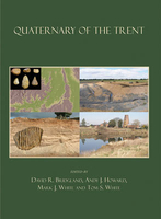
Quaternary Of The Trent

This volume is an integrated overview and synthesis of available data relating to the Quaternary evolution of the River Trent. It provides detailed descriptions of the Pleistocene sedimentary records from the Trent, its tributaries and related drainage systems - a sedimentary record that spans a period of approximately half a million years - and the biostratigraphical and archaeological material preserved therein. Significant new data are presented from recently discovered sites of geological and archaeological importance, including previously unrecognised fluvial deposits, as well as novel analyses, such as mathematical modelling of fluvial incision as recorded by the river terrace deposits. In combination with a thorough review of the literature on the Trent, these new data have
contributed to revised chronostratigraphical and palaeogeographical frameworks for central England and revealed the complexity of the Pleistocene fluvial and glacial records in this region. The fragmentary Trent terrace sequence is an important element of wider reconstructions of Pleistocene palaeodrainage in Britain, providing a link between the records preserved in the English Midlands and those in East Anglia.
RIP - This product is no longer available on our network. It was last seen on 25.09.2019

This page now acts as a permanent archive for this product. Add more information using the comments box below to ensure it can still be found by future generations.

Use our search facility to see if it is available from an alternative contributor.
  • Availability: Out Of Stock
  • Supplier: Stanfords
  • SKU: 9781842174616
Availability: In Stock
£30.00

Product Description

This volume is an integrated overview & synthesis of available data relating to the Quaternary evolution of the River Trent. It provides detailed descriptions of the Pleistocene sedimentary records from the Trent, its tributaries & related drainage systems
- a sedimentary record that spans a period of Approx. half a million years
- & the biostratigraphical & archaeological material preserved therein. Significant new data are presented from recently discovered sites of geological & archaeological importance, including previously unrecognised fluvial deposits, as well as novel analyses, such as mathematical modelling of fluvial incision as recorded by the river terrace deposits. In combination with a thorough review of the literature on the Trent, these new data have contributed to revised chronostratigraphical & palaeogeographical frameworks for central England & revealed the complexity of the Pleistocene fluvial & glacial records in this region. The fragmentary Trent terrace sequence is an important element of wider reconstructions of Pleistocene palaeodrainage in Britain, providing a link between the records preserved in the English Midlands & those in East Anglia.

Reviews/Comments

Add New

Intelligent Comparison

Oooops!
We couldn't find anything!
Perhaps this product's unique.... Or perhaps we are still looking for comparisons!
Click to bump this page and we'll hurry up.

Price History

Vouchers

No voucher codes found.
Do you know a voucher code for this product or supplier? Add it to Insights for others to use.

Facebook

Jargon Buster

England - A country within the United Kingdom.
Combination - The process of two of more things being mixed or combined together.

Supplier Information

Stanfords
Stanfords was established in 1853 and opened their iconic Covent Garden flagship store in 1901. They have become the top retailer of maps, travel books and accessories in the UK and arguably offer the largest selection of maps and travel books worldwide. Famous names such as Captain Robert Falcon Scott, Ranulph Fiennes and Michael Palin have purchased from Stanfords. They now have a shop in Bristol and both stores together with other venues operate a calendar of events including talks, book signings and exhibitions. As a specialist map retailer, the map selection is comprehensive and includes road maps, street maps and walking maps from worldwide destinations, as well as a selection of world atlases and wall maps. Books include travel guides and travel literature. Stanfords also stock globes, from miniatures made of blue marble to magnificent floor-standing globes. The website features a selection of interesting articles on travel topics.
Page Updated: 2023-11-12 20:15:36

Community Generated Product Tags

Oh No! The productWIKI community hasn't generated any tags for this product yet!
Menu