-
Home
-
Contributors
-
International
-
Account
-
Information
More From Contributor
Includes:: English is provided in a separate sheet. Saga’s topographic mapping of Greenland at 1:250, 000 is available either as 22 smaller sheets, sold separately or in sets of four maps, plus as three larger maps covering the western coast up to approx 65°. Selected titles are also published with a historical guide on the reverse illustrated with old photos, drawings & maps; all the text is in English. To see the full list of titles in this series please click on the series link. ...

Quail Railway Track Diagrams: Eastern
Gaelic names, yards to chains conversion table, a list of general, supplementary and level crossing abbreviations. The five titles covering Great Britain are in colour, the earlier atlas covering Ireland is in black and white only.In this title: lines forming most of LNE Territory of Network Rail, also parts of LNW and South Eastern. Current edition of this title was published in 2006.
This page now acts as a permanent archive for this product. Add more information using the comments box below to ensure it can still be found by future generations.
Use our search facility to see if it is available from an alternative contributor.
- Availability: Out Of Stock
- Supplier: Stanfords
- SKU: 9780954986629
Product Description
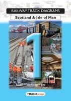
Quail Railway Track Diagrams: Eastern Region in a series of six titles divided into the original British Rail regions & showing the entire rail network together with a number of private railways, industrial layouts & London Underground lines. The information included in them is a combination of historical sources, kept up to date with reference to Network Rail & supplemented by field observers. The diagrams are highly detailed & show all line information such as type of rail, siding & running lines, plus, where appropriate, electrical voltage. Level crossings, tunnels, signal-boxes, distances, boundaries are all clearly marked. Each book in this series is fully indexed plus, in the four titles covering Great Britain, has separate indexes for engineer line references, Gaelic names, yards to chains conversion table, a list of general, supplementary & level crossing abbreviations. The five titles covering Great Britain are in colour, the earlier atlas covering Ireland is in black & white only. In this title: lines forming most of LNE Territory of Network Rail, also parts of LNW & South Eastern. Current edition of this title was published in 2006.
Reviews/Comments
Add New
Intelligent Comparison
Price History
Vouchers
Do you know a voucher code for this product or supplier? Add it to Insights for others to use.


 United Kingdom
 France
 Germany
 Netherlands
 Sweden
 USA
USA
 Italy
Italy
 Spain
Spain


 Denmark