More From Contributor
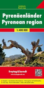
£12.99
Guy Delisle’s “ Pyongyang – A Journey in North Korea”, continues in the great tradition of non-fiction comic books looking at difficult subjects in difficult parts of the world, like Joe Sacco’s & Marjane Strapi’s work. Famously referred to as an ‘ Axis-of-Evil’ country, North Korea remains one of the most secretive & mysterious nations in the world today. A series of manmade & natural catastrophes have also left it one of the poorest. When the fortress-like country recently opened the door a crack to foreign investment, cartoonist Guy Delisle found himself in its capital Pyongyang on a work visa for a French film animation company, becoming one of the few Westerners to witness current conditions in the city. Armed with a smuggled radio & a copy of 1984, Delisle could only explore Pyongyang & its countryside while chaperoned by his translator & a guide. But among the statues, portraits & propaganda of leaders Kim Il-Sung & his son Kim Jong-Il – the world’s only Communist dynasty – Delisle was able to observe more than was intended of the culture & lives of the few North Koreans he encountered. His astute & wry musings on life in the austere & grim regime form the basis of this remarkable graphic novel. “ Pyongyang…” is an informative, personal & accessible look at an enigmatic country. ...
Archived Product
£21.99
Pyrénées Ariégeoises, FFRP topoguide, Ref. No. 1090, covering the third section of the GR10 along the Pyrenees from the Atlantic to the Mediterranean – a 335-km long walk from Bagnères-de-Luchon to Mérens-les-Vals. Given the mountainous terrain, the guide also provides a detailed route profile for this part of the GR10, annotated with timings in either direction plus locations of accommodation facilities. The guide also

Includes::
three variants along the main route (GR10B, D & E), plus four local tours from two to five days long. Current edition of this title was published in April 2016.ABOUT THE FFRP (Fédération française de la randonnée pédestre) TOPOGUIDES: published in a handy A5 paperback format, the guides are the best companions for hiking along the GR routes, France’s extensive network of long-distance footpaths. Each topo-guide covers either a whole route or a part of a longer path (e.g. four titles for the GR 10 along the Pyrenees). The guides have COLOUR extracts from IGN`s 1:50, 000 or 1:25, 000 topographic survey mapping overprinted with the route, with important points cross-referenced to the accompanying text placed on the adjoining page. The text is in French, but a large amount of information is conveyed by symbols (different types of accommodation, food shops, public transport links, etc). An important feature of each guide is a summary table showing what facilities can be found at each stage of the route, supported by an extensive “info practiques” section with more specific information & contact details for recommended accommodation, tourist offices, etc. The guides are published on high quality paper & include descriptions of the most interesting aspects of the surrounding region: historical & cultural sites, local specialties, fauna & flora, etc, all illustrated with colour photos. To see the list of all the titles in this series, please click on the series link.

...
Archived Product
£10.99
Selected tourist regions of the France on GPS compatible, contoured TOP 75 maps at 1:75, 000 from the IGN, highlighting local & long-distance hiking paths, cycling routes & sites for other recreational activities. Each title

Includes::
five large panels with mapping at 1:25, 000 to cover its most popular areas in greater detail. Cartography of the main map at 1:75, 000 is a direct enlargement of the mapping used in the IGN’s TOP100 series. Contours are at 40m intervals, enhanced by relief shading; additional colouring shows different types of vegetation (woods, brushwood, vineyards/orchards). Boundaries of national parks & other protected areas are marked. An overprint highlights long-distance GR hiking routes & cycling trails. Symbols
- more numerous than on the TOP100 maps
- indicate various places of interest including mountain refuges & gîtes d’etape (but not campsites, see below), areas for other recreational pursuits such as climbing, hand gliding or water & winter sports, historic or cultural sites, etc. The maps have a UTM grid & an index of communes. Map legend

Includes::
English. Each title also contains five enlargements of popular areas which benefit from presentation at a more detailed scale of 1:25, 000. These are extracts from IGN’s topographic survey maps & in addition to the GR routes also highlight local hiking paths & provide more information on tourist facilities including campsites.


...
Archived Product
£21.99
Pyrénées Orientales, FFRP topoguide, Ref. No. 1092, covering the fourth & last section of the GR10 along the Pyrenees from the Atlantic to the Mediterranean – a 196-km long walk from Mérens-les-Vals to Banyuls-sur-Mer. The guide also covers a 177-km trail along the GR 36 from St-Paul-de Feouillet to Bourg-Madame, plus three shorter local circuits in the Cerdagne
- Capcir area of the Pyrenees. Given the mountainous terrain, the guide also provides a detailed route profiles for this part of the GR10 & the three tours, annotated with timings in either direction plus locations of accommodation facilities. Current edition of this title was published in May 2013. To see other titles in this series please click on the series link.ABOUT THE FFRP (Fédération française de la randonnée pédestre) TOPOGUIDES: published in a handy A5 paperback format, the guides are the best companions for hiking along the GR routes, France’s extensive network of long-distance footpaths. Each topo-guide covers either a whole route or a part of a longer path (e.g. four titles for the GR 10 along the Pyrenees). The guides have COLOUR extracts from IGN`s 1:50, 000 or 1:25, 000 topographic survey mapping overprinted with the route, with important points cross-referenced to the accompanying text placed on the adjoining page. The text is in French, but a large amount of information is conveyed by symbols (different types of accommodation, food shops, public transport links, etc). An important feature of each guide is a summary table showing what facilities can be found at each stage of the route, supported by an extensive “info practiques” section with more specific information & contact details for recommended accommodation, tourist offices, etc. The guides are published on high quality paper & include descriptions of the most interesting aspects of the surrounding region: historical & cultural sites, local specialties, fauna & flora, etc, all illustrated with colour photos.
...
Archived Product
£9.50
Pyrenees in France & Spain at 1:250, 000 on a light waterproof & tear-resistant, indexed road map from Reise Know-How. The map, part of their highly acclaimed World Mapping Project, is double-sided to provide the best balance between a good scale & a convenient size sheet. The map divides the area east of the Luchon valley in France & Pico Aneto in Spain with a tiny overlap between the two sides. The area ...
Archived Product
£12.99
Pyrenees is the Sunflower Landscapes guide to exploring the best walking & touring possibilities in the mountain range. The guide covers a range of routes including walks in Vilajuiga, Pedraforca, the Anisclo Canyon & Roncesvalles. A double-sided, fold-out touring map at the back of the book gives an overview of the region & the locations of each walk. Detailed information about touring by hired car or public transport, as well as on foot, is provided, helping walkers to navigate & plan day-trips. Shorter strolls are also included as an alternative for each main route for those seeking more leisurely days out. The guide is structured in two main parts ...
Archived Product
£9.99
North-eastern Spain including most of the French side of the Pyrenees at 1:300, 000 on large, double-sided map from Mair Dumont, plus street plans of central Barcelona, Bilbao, San Sebastian/ Donostia & Zaragoza. A special feature of the “ Marco Polo” maps & atlases is a set of seven peel-on/peel-off stickers which can be placed on the maps to help with navigating & removed without damaging the surface. The map, with an overlap between its sides, divides the region west/east, extending west to Bilbao & Guadalajara, & south along the Mediterranean coast of Spain to just north of Castelló de la Plana. Also included is all but the westernmost part of the French Pyrenees with coverage extending north to Pau & Carcassonne. Topography is shown by relief shading with plenty of names of mountain ranges, etc. National parks & other protected areas are highlighted. Road network emphasizes main & secondary routes, both shown with driving distances, but also

Includes::
local road & selected tracks. Scenic roads are highlighted. Places of interest, including landscape features, are prominently highlighted. The map has no geographical coordinates. The index is in a separate booklet attached to the map cover. Map legend

Includes::
English. Also provided are street plans of central Barcelona, Bilbao, San Sebastian/ Donostia & Zaragoza, plus panels with road maps of the Balearic Islands, shown at the same scale as the main map. To see the other titles in this series please click on the series link.


...
Archived Product
£12.95
The 50 walks in this walking guide to the French Central Pyrenees can only offer a representative selection of the wealth of trails available, but they will hopefully make the choice much easier & give hikers the opportunity to discover the scenic richness of the French Central Pyrenees in whatever way they choose. With each route having an accompanying map at either 1:25, 000, 1:50, 000 or 1:75, 000 scales, there are detailed descriptions of the routes themselves & the guide itself has two overview maps (at 1:650, 000 & 1:900, 000 scales) that are ideal for planning your visit to such a diverse region. There are plenty of opportunities for you to become acquainted with & enjoy this region ...
Archived Product
£5.99
MICHELIN zoom map Pirineos Centrales is the ideal travel companion to fully explore the Spanish central Pyrenees thanks to its easy-to-use format & its scale of 1/150, 000. The Zoom collection are characterized by the high precision of their detailed scale, specially adapted for very touristy areas or with a high density road network, including new developments & industrial areas. In addition to clarity, reliability & up-to-date information, all Michelin cartography features include a wealth of practical information: places & monuments of tourist interest, picturesque tours, areas for sports & leisure activities... Useful plans of cities & a practical index of localities. Also the maps contain places of interest & signposting of tracks for bicycles & greenways. ...
Archived Product

Pyrenees

Pyrenees and their foothills both in France and Spain on a physical map at 1:400, 000 from the IGN clearly showing the regions topography through bright altitude colouring. Additional panels show main peaks, etc.Coverage north/south extends from Toulouse to Zaragoza and Barcelona. The pa highlights various places of interest including locations connected with the Way of St. James, the pilgrims' route to Santiago de Compostela, and other religious sites, listed villages and architectural heritage, recreational areas for skiing, etc. Additional panels provide and overview highlighting main peaks and national parks, provide a profile of the whole chain with peaks and passes, etc. The map has no geographical coordinates. Map legend includes English but all the additional text is in
French only.IMPORTANT PLEASE NOTE BEFORE ORDERING: CURRENT EDITION OF THIS MAP WAS PUBLISHED IN MID-1990s, so road network will not be up to date. The map has been reprinted by the IGN in 2011 without updating road information and is sold only as an excellent overview of the mountains
RIP - This product is no longer available on our network. It was last seen on 25.09.2019

This page now acts as a permanent archive for this product. Add more information using the comments box below to ensure it can still be found by future generations.

Use our search facility to see if it is available from an alternative contributor.
  • Availability: Out Of Stock
  • Supplier: Stanfords
  • SKU: 3282118301324
Availability: In Stock
£7.95

Product Description

Pyrenees & their foothills both in France & Spain on a physical map at 1:400, 000 from the IGN clearly showing the regions topography through bright altitude colouring. Additional panels show main peaks, etc. Coverage north/south extends from Toulouse to Zaragoza & Barcelona. The pa highlights various places of interest including locations connected with the Way of St. James, the pilgrims' route to Santiago de Compostela, & other religious sites, listed villages & architectural heritage, recreational areas for skiing, etc. Additional panels provide & overview highlighting main peaks & national parks, provide a profile of the whole chain with peaks & passes, etc. The map has no geographical coordinates. Map legend

Includes::
English but all the additional text is in French only.IMPORTANT PLEASE NOTE BEFORE ORDERING: CURRENT EDITION OF THIS MAP WAS PUBLISHED IN MID-1990s, so road network will not be up to date. The map has been reprinted by the IGN in 2011 without updating road information & is sold only as an excellent overview of the mountains

Reviews/Comments

Add New

Price History

Vouchers

No voucher codes found.
Do you know a voucher code for this product or supplier? Add it to Insights for others to use.

Facebook

Jargon Buster

Date - A day on a calendar
Date - A social activity whith a current or potential partner
Spain - A country within the EU.
France - A state situated in Western Europe with several overseas territories.
Physical - Used to describe strength or visual properties of an item
Network - A link and communication between things. Often computers or people.
Road - a manmade lane or a path that is used to speed up travel.
Altitude - Something that can be quite high in relation to sea or ground level.
Toulouse - A city on the south of France.

Supplier Information

Stanfords
Stanfords was established in 1853 and opened their iconic Covent Garden flagship store in 1901. They have become the top retailer of maps, travel books and accessories in the UK and arguably offer the largest selection of maps and travel books worldwide. Famous names such as Captain Robert Falcon Scott, Ranulph Fiennes and Michael Palin have purchased from Stanfords. They now have a shop in Bristol and both stores together with other venues operate a calendar of events including talks, book signings and exhibitions. As a specialist map retailer, the map selection is comprehensive and includes road maps, street maps and walking maps from worldwide destinations, as well as a selection of world atlases and wall maps. Books include travel guides and travel literature. Stanfords also stock globes, from miniatures made of blue marble to magnificent floor-standing globes. The website features a selection of interesting articles on travel topics.
Page Updated: 2023-11-12 20:15:36

Community Generated Product Tags

Oh No! The productWIKI community hasn't generated any tags for this product yet!
Menu