
 United Kingdom
 France
 Germany
 Netherlands
 Sweden
 USA
USA
 Italy
Italy
 Spain
Spain
More From Contributor


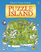
Puzzle Island
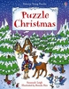
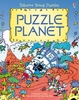
This is a fantastic, new padded hardback editions of these exciting, fun adventures, which challenge young children to answer a puzzle on every double page. Brightly coloured, detailed illustrations in a fun cartoon style, along with plenty of maps, guides and things to spot, help children become engrossed in these absorbing adventure stories. Answers and hints can be found in the last two pages of the book.

Product Description
Reviews/Comments
Add New
Vouchers
No voucher codes found.
Do you know a voucher code for this product or supplier? Add it to Insights for others to use.
Do you know a voucher code for this product or supplier? Add it to Insights for others to use.
 Denmark