
 United Kingdom
 France
 Germany
 Netherlands
 Sweden
 USA
USA
 Italy
Italy
 Spain
Spain
More From Contributor


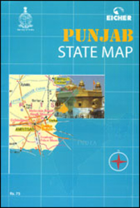
Punjab (India)
Punjab at 1:580, 000 approx. in a series of state maps of India from Eicher Goodearth reflecting a change in locally produced maps to a more modern style of cartography. The map shows the network of main and selected local road, railway connections and domestic airports. Driving distances are marked on main routes. Symbols indicate locations of forts, temples and other places of interest. The map has no geographical coordinates. The index, colour-coded to highlight places of interest, is next to the map. Coverage includes part of Himachal Pradesh with Shimla, Dharmshala and the Kulu Valley. On the reverse is a street plan of central Chandigarth, plus a general road map India. The accompanying 15-page booklet, illustrated with colour photos, provides general information about the
state and its attractions.To see the full list of all Indian state maps published by Eicher Goodearth please click on the series link.PLEASE NOTE: the various series of state maps of India often show different small villages, supplementing each other to provide a more detailed picture of each state.
state and its attractions.To see the full list of all Indian state maps published by Eicher Goodearth please click on the series link.PLEASE NOTE: the various series of state maps of India often show different small villages, supplementing each other to provide a more detailed picture of each state.
 "Pin It")
Product Description
Reviews/Comments
Add New
Vouchers
No voucher codes found.
Do you know a voucher code for this product or supplier? Add it to Insights for others to use.
Do you know a voucher code for this product or supplier? Add it to Insights for others to use.
 Denmark