More From Contributor
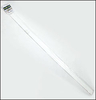
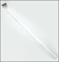
£40.00
Map showing the boundaries between the postcode areas
- the first two letters of the postcode (e.g. RG, NR). The map is fairly
...
Archived Product
£70.00
Great Britain & Northern Ireland in a hardback A4 Postcode atlas from Collins, with the main mapping at 1:263, 000 (4.15 miles to 1 inch). Cartography shows postcode boundaries, with central London mapping showing individual subdistricts & sectors. Road detail is subtly overprinted, including motorways, A & B roads, minor roads, & junctions; railway lines & stops, car ferry routes (with journey times), & airports are also marked. Areas of busy conurbation are enlarged to a scale of 1:100, 000 (1.6 miles to 1 inch), whilst central London is also enlarged to 1:20, 000 (3.2 miles to 1 inch); conurbation maps also indicate roundabouts, with London enlargements displaying DLR, London Underground & National Rail stations, & the congestion charging zone is prominently highlighted. As well as a 70 page index, the back of the atlas also contains information on unitary authorities, including information on population, local airports, rivers, & more. ...
Archived Product
£50.00
An essential business tool, this postcode atlas clearly shows the postcode boundaries (down to district level) for the whole country on detailed colour mapping. In central London postcodes are shown to sector level. Scale of main maps: 1:263, 000 (4.15 miles to 1 inch). This invaluable atlas shows postcode areas & districts for the whole of the UK & has been updated with all the latest boundary changes.

Includes::
* Postcode areas (e.g. SW) & postcode districts (e.g. SW8) for the whole of the UK. * Postcode sectors (e.g. SW8 4) for Central London. * Busy conurbation areas at an enlarged scale of 1.6 miles to 1 inch. * Information on the structure & uses of postcodes. * Full colour map & a gazetteer listing of the administrative areas incorporating administrative changes that occurred in April 2009. * Full index to place names. * Index to postcode abbreviations. * Comprehensive background map detail which means the atlas can also be used for route planning & navigation. AREA OF COVERAGE Covers the whole of Britain & Northern Irel&. This atlas is a valuable resource for the business user who will find it an invaluable tool for many applications including market analysis, distribution planning & sales territory organisation.

...
Archived Product
£24.99
Postcode Areas wall map of the United Kingdom, 83 x 120cm (33 x 47 approx)
- paper version, from Map Marketing showing postcode
...
Archived Product
£24.99
Postcode Areas wall map of the United Kingdom, 83 x 120cm (33 x 47 approx)
- paper version, from Map Marketing showing postcode
...
Archived Product
£4.99
Poster Hanging Bars with Hooks made from rigid white plastic, can easily be cut to size with a pair of scissors. Slide your poster between the two sides of the hanging strip, use one or both of the semi-transparent hooks clipped on the strip to hang the picture. Available

Sizes:
60 cm & 84 cm. Easy & neat these bars will make sure your poster or wall map displays nicely neat! Each pack contains two hanging strips, one for the top & one for the bottom of the poster, & 2 hanging hooks clipped on one bar.

...
Archived Product
£15.00
This full-colour poster showing the symbols related to life-saving appliances & arrangements recommended for use in accordance with regulation III/9 of the 1974 SOLAS Convention, as amended, indicating the location of emergency equipment & assembly & embarkation stations as adopted by resolution A.760 (18), & as amended by MSC.82 (70) & adopted by resolution A.1116 (30). As per resolution A.1111 (30), the signage in this poster should take effect on ships constructed on or after 1 January 2019 or ships which undergo repairs, alterations, modifications & outfitting within the scope of SOLAS chapters II-2 and/or III, as applicable, on or after 1 January 2019. ...
Archived Product
£29.99
Map No. 2822, Postmasburg, in South Africa’s official topographic survey at 1:250, 000 from the country’s national survey organization, the Chief Directorate of Surveys & Mapping. The maps have altitude colouring & contours at 50m or 100m intervals, depending on the map edition, plus spot heights. Deserts, marshes, dry pans, perennial & seasonal water features, etc, as well as protected areas are shown. The maps present the country’s road & rail networks & include the usual information expected on topographic mapping at this scale, although in more rapidly developing areas road information may not necessarily be up to date. Also indicated are magisterial district & provincial boundaries. Latitude & longitude values are shown in the margins at 5` intervals together with South African grid co-ordinates. Typically, each sheet covers an area of one degree of latitude & two degrees of longitude. The projection used is Gauss Conformal. The legend is in English & Afrikaans. ...
Archived Product
£14.99
Europe in 1945 was prostrate. Much of the continent was devastated by war, mass slaughter, bombing & chaos. Large areas of Eastern Europe were falling under Soviet control, exchanging one despotism for another. Today, the Soviet Union is no more & the democracies of the European Union reach as far as the borders of Russia itself. Postwar tells the rich & complex story of how we got from there to here. Running right up to the Iraq war & the election of Benedict XVI, Postwar makes sense of Europe`s recent history & identity, of what Europe is & has been. It is nothing less than a masterpiece. It is shortlisted for the Pulitzer & Samuel Johnson Prizes. It is the winner of the Arthur Ross Book Award. ...
Archived Product
£6.95
Map No. 135, Posumavi
- Klatovsko, in a series of GPS compatible topographic maps of the Czech Republic at 1:75.000 from Shocart
...
Archived Product

Poster Hanging Bars

Poster Hanging Bars with Hooks made of rigid white plastic, can easily be cut to size with a pair of scissors. Slide your poster between the two sides of the hanging strip, use one or both of the semi-transparent hooks clipped on the strip to hang the picture.Available sizes: 60 cm and 84 cm. Easy and neat these bars will make sure your poster or wall map displays nicely neat!Each pack contains two hanging strips, one for the top and one for the bottom of the poster, and 2 hanging hooks clipped on one bar.
RIP - This product is no longer available on our network. It was last seen on 25.09.2019

This page now acts as a permanent archive for this product. Add more information using the comments box below to ensure it can still be found by future generations.

Use our search facility to see if it is available from an alternative contributor.
  • External links may include paid for promotion
  • Availability: Out Of Stock
  • Supplier: Stanfords
  • SKU: 9780755810611
Availability: In Stock
£3.50

Product Description

Poster Hanging Bars with Hooks made from rigid white plastic, can easily be cut to size with a pair of scissors. Slide your poster between the two sides of the hanging strip, use one or both of the semi-transparent hooks clipped on the strip to hang the picture. Available

Sizes:
60 cm & 84 cm. Easy & neat these bars will make sure your poster or wall map displays nicely neat! Each pack contains two hanging strips, one for the top & one for the bottom of the poster, & 2 hanging hooks clipped on one bar.

Reviews/Comments

Add New

Intelligent Comparison

Oooops!
We couldn't find anything!
Perhaps this product's unique.... Or perhaps we are still looking for comparisons!
Click to bump this page and we'll hurry up.

Price History

Vouchers

No voucher codes found.
Do you know a voucher code for this product or supplier? Add it to Insights for others to use.

Facebook

Jargon Buster

Plastic - A generic term for a synthetic product used in the manufacture of products
White - A colour combining all colours
Scissors - A hand operated cutting instrument mainly for paper and textiles
Cm - Centimetres, one centimetre is equal to 10 milimetres
Wall - A physical barrier between two areas
Size - is the measurement of how big an object is in space.
Poster - A printed picture used for decoration or information.
Poster - A large picture usually used for decoration.

Supplier Information

Stanfords
Stanfords was established in 1853 and opened their iconic Covent Garden flagship store in 1901. They have become the top retailer of maps, travel books and accessories in the UK and arguably offer the largest selection of maps and travel books worldwide. Famous names such as Captain Robert Falcon Scott, Ranulph Fiennes and Michael Palin have purchased from Stanfords. They now have a shop in Bristol and both stores together with other venues operate a calendar of events including talks, book signings and exhibitions. As a specialist map retailer, the map selection is comprehensive and includes road maps, street maps and walking maps from worldwide destinations, as well as a selection of world atlases and wall maps. Books include travel guides and travel literature. Stanfords also stock globes, from miniatures made of blue marble to magnificent floor-standing globes. The website features a selection of interesting articles on travel topics.
Page Updated: 2023-11-12 20:15:36

Community Generated Product Tags

Oh No! The productWIKI community hasn't generated any tags for this product yet!
Menu