More From Contributor

£5.99
DK Eyewitness Top 10 Phuket leads you straight to the best attractions this region has to offer whether it's the tropical climate, the islands, bays, beaches, caves, water sports, shopping, nightlife, clubs, bars, sea food, lush tropical gardens, spectacular views or the unique mesmerizing environment, DK Eyewitness Top 10 Phuket will give you an unforgettable experience. DK Eyewitness Top 10 Phuket is packed with beautiful illustrations, providing the insider knowledge every visitor needs. Explore every corner effortlessly using the free pull-out map, plus many smaller maps included within the guide. Your guide to the Top 10 best of everything, in Phuket. ...
Archived Product
£29.99
Map No. 2828, Phuthaditjaba, in South Africa’s official topographic survey at 1:250, 000 from the country’s national survey organization, the Chief Directorate of Surveys & Mapping. The maps have altitude colouring & contours at 50m or 100m intervals, depending on the map edition, plus spot heights. Deserts, marshes, dry pans, perennial & seasonal water features, etc, as well as protected areas are shown. The maps present the country’s road & rail networks & include the usual information expected on topographic mapping at this scale, although in more rapidly developing areas road information may not necessarily be up to date. Also indicated are magisterial district & provincial boundaries. Latitude & longitude values are shown in the margins at 5` intervals together with South African grid co-ordinates. Typically, each sheet covers an area of one degree of latitude & two degrees of longitude. The projection used is Gauss Conformal. The legend is in English & Afrikaans. ...
Archived Product
£12.99
The Insight Physical 13cm (5) globe is a compact yet remarkably detailed illuminated desktop globe mounted on a black meridian & base. The physical detail is realistically executed in green & brown shades
- similar in appearance to some satellite-view maps of the world that show variations in vegetation from desert to forest
- set against a dark blue. The cartography reveals political boundaries, place names & bathymetric detail, which become more pronounced when illuminated.

...
Archived Product
£24.99
The new Physical/ Political Illuminated Globe is 13cm in diameter & rotates on one axis. The globe provides two levels of detail, when unlit Physical features can be seen, when illuminated Political mapping is visible. It is precision printed at a scale of 1:98 million &

Includes::
613 geographical names. It features a sturdy, anthracite coloured base & metal meridian. The globe height is 18.5cm & it comes in an eye-catching gift box with simple to follow instructions on replacing the bulb. The mains adaptor incorporates an on/off switch & detachable cord.

...
Archived Product
£56.50
The 23cm (9) Insight Physical World Time Globe is the ultimate quick-reference fact finder. Using micro-processor technology, this portable, battery operated, state-of-the-art globe offers instant access to a wealth of key information, simply at the touch of a button. The handy, in-built electronic spelling aid makes it easy to find desired locations. On the user's comm&, the LCD screen reveals key facts about 8, 000 world destinations. An ideal desk accessory & study aid, the unique World Time Globe identifies: local time in 5, 000 cities; location; area; currency; population; language; top sights; latitude & longitude; distance between cities; countries & capitals; government; average temperature & much more.

Includes::
3 x AAA batteries.

...
Archived Product
£7.95
Piacenza at 1: 10, 000 on an indexed street plan from Litografia Artistica Cartografica in their Globalmap imprint. 35 monuments including historic buildings & churches, cultural or educational institutions, & important municipal buildings or facilities are numbered & listed next to the plan. Litografia Artistica Cartografica (LAC) are Italy ...
Archived Product
£12.99
Piacenza Province at 1:150, 000 in a series of handy size provincial road maps from Litografia Artistica Cartografica (LAC) with more minor local roads & country tracks than can be found on most regional maps from other publishers. This title is now available in a digitally produced edition.LAC’s provincial series is gradually being changed to a new style of digitally derived cartography, so presentation of adjoining titles may vary. All the maps have hill shading to represent the general relief with spot heights for selected peaks, & show a few more local roads & rough tracks than the other road map series. Intermediate road distances are indicated. Regional, provincial & communal borders are marked, & railways, funiculars, airports, sea ferry links & campsites are shown. The legend is in Italian only. The new, digitally produced editions are indexed & have enhanced, more finely drawn cartography: the hill-shading is less bold, motorway service areas are marked, natural parks are highlighted & an expanded range of symbols indicates various landmarks & sites, e.g. antiquities, churches, etc. Two styles of the new cartography are produced, differing only in the colour of the predominant background shading: grey or yellow/green. Some of the new editions include geographical coordinates for the map corners. The index of localities is on the reverse. To see all the titles in this series please click on the series link. ...
Archived Product
£1395.00
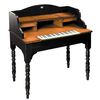
Rare & remarkable, this whimsical desk. A make believe set of clavichord keys

Includes::
one that magically

...
Archived Product
£9.99
The five mountain chains of the Carpathian Bend in Romania: Piatra Craiului, Bucegi, Postavarul, Piatra Mare & Ciucas at 1:70, 000 in a series of detailed contoured maps covering popular hiking areas of Transylvania published by Dimap, one of Hungary’s leading publishers specializing in mapping of that region. The map has contours at 100m intervals enhanced by relief shading. Several trails are marked, with symbols distinguishing between well & poorly signposted sections. Forested areas & nature reserves are marked & symbols show local caves & springs, accommodation (hotels, campsites & refuges) skiing areas & ski-lifts, various places of interest including churches & monasteries, etc. The map has a latitude & longitude grid at 2’ intervals. An inset shows the area of the map at 1:350, 000 with bold altitude colouring to provide a more vivid impression of local topography, main roads, & rail connections with Brasov. On the reverse are black & white street plans of Brasov & Sinaia, plus notes describing the region & the tourist paths identified on the map. Map legend & all the notes include English. To see all the titles in this series of hiking maps of Romania please click on the series link. ...
Archived Product
£5.00
Piatra Craiului Mountains at 1:30, 000 on a contoured map highlighting hiking routes. Topography is shown by contours at 50m intervals with additional relief shading & colouring for woodlands. An overprint highlights hiking routes, indicating their waymarking signs. Also marked are mountain huts & refuges. The map has no geographical coordinates. Map legend

Includes::
English. On the reverse are notes on the area, lists of chalets & refuges, plus detailed descriptions of 26 routes
- all the text

Includes::
English.


...
Archived Product

Physics In Minutes: 200 Key Concepts Explained In An Instant

Physics in Minutes covers everything you need to know about physics, condensed into 200 key topics. Each idea is explained in clear, accessible language, building from the basics, such as mechanics, waves and particles, to more complex topics, including neutrinos, string theory and dark matter. Based on scientific research proving that the brain best absorbs information visually, illustrations accompany the text to aid quick comprehension and easy recollection. This convenient and compact reference book is ideal for anyone interested in how our world works. Chapters include: Newton`s Laws of Motion, Schrodinger`s cat, Magnetism, Superconductivity, Fission and fusion, Higgs Boson, Entropy, Dark matter.
RIP - This product is no longer available on our network. It was last seen on 25.09.2019

This page now acts as a permanent archive for this product. Add more information using the comments box below to ensure it can still be found by future generations.

Use our search facility to see if it is available from an alternative contributor.
  • Availability: Out Of Stock
  • Supplier: Stanfords
  • SKU: 9781782066484
Availability: In Stock
£7.99

Product Description

Physics in Minutes covers everything you need to know about physics, condensed into 200 key topics. Each idea is explained in clear, accessible language, building from the basics, such as mechanics, waves & particles, to more complex topics, including neutrinos, string theory & dark matter. Based on scientific research proving that the brain best absorbs information visually, illustrations accompany the text to aid quick comprehension & easy recollection. This convenient & compact reference book is ideal for anyone interested in how our world works. Chapters include: Newton`s Laws of Motion, Schrodinger`s cat, Magnetism, Superconductivity, Fission & fusion, Higgs Boson, Entropy, Dark matter.

Reviews/Comments

Add New

Intelligent Comparison

Oooops!
We couldn't find anything!
Perhaps this product's unique.... Or perhaps we are still looking for comparisons!
Click to bump this page and we'll hurry up.

Price History

Vouchers

No voucher codes found.
Do you know a voucher code for this product or supplier? Add it to Insights for others to use.

Facebook

Jargon Buster

compact - Carefuly designed to ensure an item has a minimal physical size
Key - A physical or virtual device or code used for opening something
Dark - A colour which absorbs visable ligt so apears less light than objects that reflect light
World - A physical grouping, commonly used to describe earth and everything associated with ti
Quick - Something that is fast
Language - the method of communication used in different areas. Humans and computers have many different languages.
Compact - something that has a lot combined within a small space.
illustrations - Pictures typically in books and newspapers.
Reference - To prove evidence with a back up source.
Ideal - Something that satisfies a perfect criteria.
Convenient - Something that suits and fits well to other activities.
Language - The way humans communicate either written and spoken.

Supplier Information

Stanfords
Stanfords was established in 1853 and opened their iconic Covent Garden flagship store in 1901. They have become the top retailer of maps, travel books and accessories in the UK and arguably offer the largest selection of maps and travel books worldwide. Famous names such as Captain Robert Falcon Scott, Ranulph Fiennes and Michael Palin have purchased from Stanfords. They now have a shop in Bristol and both stores together with other venues operate a calendar of events including talks, book signings and exhibitions. As a specialist map retailer, the map selection is comprehensive and includes road maps, street maps and walking maps from worldwide destinations, as well as a selection of world atlases and wall maps. Books include travel guides and travel literature. Stanfords also stock globes, from miniatures made of blue marble to magnificent floor-standing globes. The website features a selection of interesting articles on travel topics.
Page Updated: 2023-11-12 20:15:36

Community Generated Product Tags

Oh No! The productWIKI community hasn't generated any tags for this product yet!
Menu