
 United Kingdom
 France
 Germany
 Netherlands
 Sweden
 USA
USA
 Italy
Italy
 Spain
Spain
More From Contributor


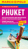
Phuket Flexi Map
Flexi Map Phuket is a laminated, tear-resistant map which has 8 separate maps, each one accompanied by its own index. It includes a list - with descriptions and some photographs - of 35 recommended sights, divided by theme and linked to the mapping by numbered markers. There is also a handy information section with concise details on getting around, tourist offices, money, tipping, opening times, public holidays, telecommunications, emergency telephone numbers and climate. On the main map of Phuket, shown at a scale of 1:100 000 (1cm = 1km), places of interest are highlighted, including wildlife parks and marine national parks, religious sights, diving areas and coral reefs. Ferry routes are also clearly marked. This map, along with the Phuket environs map, provides a
picture of the region's topography through the use of relief shading. There are also detailed maps of Phuket Town and Krabi on which streets are named and a selection of hotels, public buildings and key sights are prominently marked. The comprehensive indexes are divided into categories for ease of use.Ko Phi Phi, Krabi Beaches, Patong and Karon are depicted on separate maps at various scales, each one highlights places of interest, leisure facilities and selected hotels.
picture of the region's topography through the use of relief shading. There are also detailed maps of Phuket Town and Krabi on which streets are named and a selection of hotels, public buildings and key sights are prominently marked. The comprehensive indexes are divided into categories for ease of use.Ko Phi Phi, Krabi Beaches, Patong and Karon are depicted on separate maps at various scales, each one highlights places of interest, leisure facilities and selected hotels.
Product Description
Reviews/Comments
Add New
Vouchers
No voucher codes found.
Do you know a voucher code for this product or supplier? Add it to Insights for others to use.
Do you know a voucher code for this product or supplier? Add it to Insights for others to use.
 Denmark