
 United Kingdom
 France
 Germany
 Netherlands
 Sweden
 USA
USA
 Italy
Italy
 Spain
Spain
More From Contributor

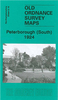

Peterborough South 1924
Peterborough South in 1924 in a fascinating series of reproductions of old Ordnance Survey plans in the Alan Godfrey Editions, ideal for anyone interested in the history of their neighbourhood or family. Selected towns in Great Britain and Ireland are covered by maps showing the extent of urban development in the last decades of the 19th and early 20th century.In this title: the map covers the southern part of Peterborough and includes most of map 8.15. Note that these give partial coverage only, and areas outside the city, i.e. parts of Cambridgeshire and Huntingdonshire, are left blank. Coverage includes Woodston and New Fletton. Features include Peterborough East station, sections of railway (shown in detail) including engine shed, engine repair works, several wagon works,
foundry, cattle pens etc. Other features include River Nene, electricity works, corset manufactory, football ground, engineering works. Coverage extends from Bishop's Road southward to the city boundary at Fletton Spring. About the Alan Godfrey Editions of the 25
foundry, cattle pens etc. Other features include River Nene, electricity works, corset manufactory, football ground, engineering works. Coverage extends from Bishop's Road southward to the city boundary at Fletton Spring. About the Alan Godfrey Editions of the 25
Product Description
Reviews/Comments
Add New
Intelligent Comparison
Archived Product

Peterborough South 1924 Stanfords
£3.50
Archived Product
Peterborough Central 1924 Stanfords
£2.95
Archived Product

Peterborough Central 1924 Stanfords
£3.50
Archived Product
Peterborough 1901 Stanfords
£9.99
Archived Product

Peterborough 1920-1922 Stanfords
£9.99
Archived Product

Peterborough 1824-1836 Stanfords
£9.99
Archived Product

Peterborough Central 1901 Stanfords
£3.50
Vouchers
No voucher codes found.
Do you know a voucher code for this product or supplier? Add it to Insights for others to use.
Do you know a voucher code for this product or supplier? Add it to Insights for others to use.
 Denmark