
 United Kingdom
 France
 Germany
 Netherlands
 Sweden
 USA
USA
 Italy
Italy
 Spain
Spain
More From Contributor


Peterborough Central 1924
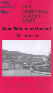
Central Peterborough in 1924 in a fascinating series of reproductions of old Ordnance Survey plans in the Alan Godfrey Editions, ideal for anyone interested in the history of their neighbourhood or family. Selected towns in Great Britain and Ireland are covered by maps showing the extent of urban development in the last decades of the 19th and early 20th century.In this title: two versions have been published for central Peterborogh. The maps cover the central area, stretching from Priestgate northward to Taverners Road, and from Westwood Park Road eastward to Crawthorne Road. The Cathedral is in the lower right corner. Other features include the main station, with track layout shown, and other railway features such as engine and wagon repair sheds; Westwood engineering works, Old
Gaol, Queen Street Iron Works, Market Hall, Infirmary, Poor Law Institution or Workhouse, St John the Baptist church, Deanery, St Peter's College, Guildhall, Westwood House, County Court, Westgate, Cowgate, Low Causeway, Theatre Royal, Kings School, All Saints church (top right corner), St Mark's church, St Barnabas church, tramways. Directory extracts are included on the reverse: the 1901 version has a list of private residents from a 1898 directory, the 1924 version has the A-D entries from the commercial entry of a 1920 directory. About the Alan Godfrey Editions of the 25
Gaol, Queen Street Iron Works, Market Hall, Infirmary, Poor Law Institution or Workhouse, St John the Baptist church, Deanery, St Peter's College, Guildhall, Westwood House, County Court, Westgate, Cowgate, Low Causeway, Theatre Royal, Kings School, All Saints church (top right corner), St Mark's church, St Barnabas church, tramways. Directory extracts are included on the reverse: the 1901 version has a list of private residents from a 1898 directory, the 1924 version has the A-D entries from the commercial entry of a 1920 directory. About the Alan Godfrey Editions of the 25
Product Description
Reviews/Comments
Add New
Intelligent Comparison
Archived Product

Peterborough Central 1924 Stanfords
£3.50
Archived Product

Peterborough Central 1901 Stanfords
£3.50
Archived Product
Peterborough South 1924 Stanfords
£2.95
Archived Product

Peterborough South 1924 Stanfords
£3.50
Archived Product

Scarborough Central 1910 Stanfords
£3.50
Archived Product

Peterborough 1901 Stanfords
£9.99
Archived Product
Portsmouth Central 1896 Stanfords
£3.50
Archived Product
Middlesbrough Central 1913 Stanfords
£2.95
Vouchers
No voucher codes found.
Do you know a voucher code for this product or supplier? Add it to Insights for others to use.
Do you know a voucher code for this product or supplier? Add it to Insights for others to use.
 Denmark