More From Contributor
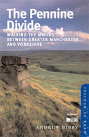
£15.95
Cycling the Pennine Bridleway guide from Cicerone Press covering the 145-km / 90 mile route through Lancashire & the Yorkshire Dales, with stage-by-stage descriptions, OS Landranger map extracts, route profiles, information about local facilities & services, etc. The guide covers the current northern section of the Pennine Bridleway route, from Summit (near Littleborough, Rochdale) across the Yorkshire Dales to Ravenstonedale, near Kirkby Stephen in Cumbria. Also covered is half of the Mary Towneley Loop at the southern end of this section, plus 11 additional circular day rides. Each stage of the route has a detailed description & is accompanied by an information panel showing the % off road, OS grid coordinates for the start & finish, distance & ascent, grading, etc, plus map extracts from the OS 1:50, 000 Landranger series & elevation profiles. Also provided are map numbers for the alternative, more detailed presentation of the terrain by the OS Explorer maps at 1:25, 000, all available from Stanfords’ website. An introductory section provides general information & advice; appendices offer route summary tables, tables with local facilities, accommodation recommendations, etc. ...
Archived Product
£12.99
The Pennine Bridleway, a 188-km/117 mile route from Middleton Top in the Peak District to the South Pennines on the Yorkshire-Lancashire border with a 76km/47m Mary Towneley Loop, in a series of walking guides to the National Trails in England & Wales with colour extracts from the Ordnance Survey`s Explorer series at 1:25, 000 showing points along the route cross-referenced to the text. The maps also indicate nearby places of interest & various facilities including campsites & caravan parks, youth hostels, water points, pubs, information or visitor centres, etc. Also shown are alternative sections of the route & stretches designated as bridleways or suitable for cycling. The guides are illustrated throughout with colour photos & include an introductory section on the path & the surrounding landscape, plus a chapter of useful information including access to various locations along the route by public transport, a list of tourist information offices & principal overnight stopping places, a bibliography, etc. This title also provides alternative routes for cyclists & horse-riders. To see other titles in the Aurum Press series of guides to the national trails & other long-distance footpaths, please click on the series link. ...
Archived Product
£18.99
The southern part of the Pennine Bridleway, a 118km / 74 mile section between Middleton in Derbyshire & the Mary Towneley Loop on the border of Lancashire & Yorkshire, presented at 1:40, 000 on a light, waterproof & tear-resistant map from Harvey Map Services. The Pennine Bridleway runs roughly parallel with the Pennine Way but is designed to provide access for horseback riders & cyclists as well as walkers. The map shows the Pennine Bridleway on six overlapping panels, with a separate panel covering the 76 km / 47 mile Mary Towneley Loop. Additional information

Includes::
lists of cycle repairs/hire points & local vets. Maps in the Harvey’s series covering Great Britain’s national trails & other long-distance footpaths are printed on light, waterproof & tear-resistant synthetic paper & cover the routes at 1:40, 000 or 1:60, 000. Topography is shown by contours at 15m intervals, with additional spot heights plus colouring and/or graphics to provide a very detailed picture of the terrain (boulder fields, scree, crags, etc) & vegetation / land use (pastures, moorl&, woodlands, etc). In Scotland peaks & hills classified as Munros, Corbetts & Donalds are marked. The overprint for the long-distance trail shows sections on local or main roads (highlighting danger points), on tracks, & on footpaths, indicating intermittent or not visible paths. The maps also show other right of way paths, including permissive paths & bridleways. Symbols indicate various facilities & accommodation options (including campsites & youth hostels), pubs & refreshments, food shops, banks, information points, etc, both along the route itself & in the nearby locations. All maps are GPS compatible, with the British National Grid overprinted on each panel. The maps also include useful contact details & general advice. To see other titles in this series please click on the series link.

...
Archived Product
£8.99
The official route map for the 209-mile (336km) northern part of the Pennine Cycleway from Settle to Berwick-upon-Tweed. The northern part of the Pennine Cycleway takes in some of the most spectacular landscapes & unspoilt countryside that England has to offer. The ride between Settle in North Yorkshire & Berwick-upon-Tweed on the border between England & Scotland takes you past over 60 tourist attractions, 85 villages & towns, national landmarks such as Hadrian`s Wall & the Northumberland National Park, not to mention the Eden Valley, the dramatic North Pennines, & the South Tyne Valley. Starting in historic Settle with its famous square, home to Ye Olde Naked Man which is believed to be the oldest cafe in the country, you enter the Yorkshire Dales National Park & ride through its western region with its glorious countryside of deep, grassy valleys & limestone crags. The Dales end at Appleby-in-Westmorl&, & you are immediately in the North Pennines AONB. At Alston you pick up the River South Tyne & ride to Haltwhistle where you can visit one of the most spectacular & complete sections of Hadrian`s Wall, before entering the fringes of Kielder Forest, the largest man-made woodland in Engl&. Bellingham on the banks of the River North Tyne is known as the gateway town to Kielder Water & Forest, & from here you ride across Northumberland National Park to the small town of Wooler which, in turn, is known as the Gateway to the Cheviots. A final, comparatively flat section then follows & the route ends on the magnificent Northumberland Coast (another AONB) at Berwick-upon-Tweed, the northernmost town in England
- or southernmost town in Scotland depending which period of history you are looking at, as it changed hands 13 times before finally falling into English hands in 1482, & the town`s Elizabethan walls were built to finally keep out invading Scots.
...
Archived Product
£9.99
The official route map for the 136-mile (219km) southern part of the Pennine Cycleway from Derby to Settle. The southern half of the Pennine Cycleway is a beautiful, yet challenging ride which takes you through the dramatic scenery of the Peak District & the South Pennines. The route takes you from the bustling railway city of Derby to the historic town of Settle, taking in the famous spa town of Buxton & the lovely Yorkshire town of Holmfirth, renowned location of the TV classic ” Last of the Summer Wine”. This section

Includes::
the popular traffic-free Tissington & Longdendale Trails &

Includes::
part of the renowned High Peak Trail. The ride takes you through a wide variety of landscapes, including a huge canal embankment, splendid examples of textile mills, delightful market towns, pastoral farmland & high open moorl&. Traffic-free sections include the green corridor of the Leeds & Liverpool Canal towpath, bridle tracks near Clapham, the path alongside Torside & Woodhead reservoirs & the glorious Tissington Trail which follows the line of former London & North Western railway line through the Peak District. You`ll find plenty to see & do along the route in places such as Ashbourne, Whaley Bridge & Hebden Bridge. If you want some bright lights there`s a route option which takes you to Burnley, or you take the picturesque way & ride to Colne as you wind your way towards Widdop Reservoir & out over Widdop Moor before you reach Settle, adjacent to the beautiful Forest of Bowland Area of Outstanding Natural Beauty.


...
Archived Product
£13.99
Edited by David Pitt, A Pennine Journey (from Settle to Hadrian`s Wall in Wainwright`s Footsteps) is a guide to Wainwight’s 247 miles long route, divided into 18 stages & with maps & illustrations inspired by the work of the great great man himself. In September 1938 when Wainwright made a solitary walk through the Pennines. The following year he wrote up an account of this walk, which was eventually published in 1986. This illustrated guide, written by members of the Wainwright Society, is a recreation of this walk adapted for today’s roads & rights-of-way, taking a route that Wainwright might have chosen if he was planning it today. ...
Archived Product
£5.99
Jack Keighley’s illustrated Cicerone guide to South Pennine Walks details thirty walks exploring the expanse of hill country that straddles the Lancashire/ Yorkshire border between the Yorkshire Dales & Peak National Parks. The guide covers some of the best hill-walking possibilities in the general South Pennine area. Each of the 30 walks described are circular & range from simple valley strolls to strenuous fell expeditions, making them suitable for walkers of all abilities. The guide has been h&-written & is distinctively illustrated by the author with sketches of some of the most interesting features
- including buildings, wildlife & caves
- found in the South Pennine region. Each chapter provides information on Parking, a general description of the terrain & notes on features of interest. An introduction gives information on Clothing & Equipment & Walking with Children & Dogs. Detailed route descriptions are also accompanied by carefully drawn sketch diagrams mapping the route.

...
Archived Product
£5.99
The original Boogie, reluctant hero of the South West Peninsular Path, was the Mongrel from hell. Mark Wallington`s New Boogie, like New Labour, appears a much trendier & more wholesome incarnation -until, that is, Mark gets him on the Pennine Way. This is the big one in every sense. Clearly Boogie will do fine -but will Mark be up to the task? ...
Archived Product
£12.95
Martin Collins’ Cicerone guide to The Pennine Way explores one of Britain’s best know national trails. Often challenging, the long distance walk has essential information designed to help you plan & complete the trip from Edale to Kirk Yetholm. 268 miles in total, the route takes 2-3 weeks to complete in one walk, though the guide also offers opportunities for those wanting to walk individual sections. A list of inter-connecting trails also makes it possible to devise circular or linear walks using part of the Pennine Way. The guide is organized in 16 sections, each detailing a different stage. Information on terrain, mileage, maps, accommodation & transport is provided at the start of each chapter. Detailed route descriptions are accompanied by extracts from Ordnance Survey mapping the route ahead as well as colour photographs illustrating some of the highlights of the route ahead. ...
Archived Product
£14.99
The Pennine Way, the whole 431-km/268 mile route from Edale in the Peak District to Kirk Yetholm in the Scottish Borders, in a series of walking guides to the National Trails in England & Wales with colour extracts from the Ordnance Survey's Explorer series at 1:25, 000 showing points along the route cross-referenced to the text. The maps also indicate nearby places of interest & various facilities including campsites & caravan parks, youth hostels, water points, pubs, information or visitor centres, etc. Also shown are alternative sections of the route & stretches designated as bridleways or suitable for cycling. The guides are illustrated throughout with colour photos & include an introductory section on the path & the surrounding landscape, plus a chapter of useful information including access to various locations along the route by public transport, a list of tourist information offices & principal overnight stopping places, a bibliography, etc. Current edition of this title, published in 2012, replaces the publishers ...
Archived Product

Pennine Divide

Pennine Divide is one of the titles in the Great Britain: Freedom to Roam Rambling Guides for England and Wales. The series was published in light of the ‘right to roam’ legislation, with the aim of creating a series of walking handbooks covering areas of mountains, moorland and heath newly opened up to walkers in England and Wales. An introduction is provided for the overall area, including details on natural history, cultural history and landscape. Selections of walks are provided, with on page OS mapping, for ramblers to choose their own difficulty levels. Special features and en-route points of interest are noted, as well as practical visitor related information.
RIP - This product is no longer available on our network. It was last seen on 25.09.2019

This page now acts as a permanent archive for this product. Add more information using the comments box below to ensure it can still be found by future generations.

Use our search facility to see if it is available from an alternative contributor.
  • External links may include paid for promotion
  • Availability: Out Of Stock
  • Supplier: Stanfords
  • SKU: 9780711225008
Availability: In Stock
£7.99

Product Description

Pennine Divide is one of the titles in the Great Britain: Freedom to Roam Rambling Guides for England & Wales. The series was published in light of the ‘right to roam’ legislation, with the aim of creating a series of walking handbooks covering areas of mountains, moorland & heath newly opened up to walkers in England & Wales. An introduction is provided for the overall area, including details on natural history, cultural history & landscape. Selections of walks are provided, with on page OS mapping, for ramblers to choose their own difficulty levels. Special features & en-route points of interest are noted, as well as practical visitor related information.

Reviews/Comments

Add New

Intelligent Comparison

Oooops!
We couldn't find anything!
Perhaps this product's unique.... Or perhaps we are still looking for comparisons!
Click to bump this page and we'll hurry up.

Price History

Vouchers

No voucher codes found.
Do you know a voucher code for this product or supplier? Add it to Insights for others to use.

Facebook

Jargon Buster

England - A country within the United Kingdom.
History - Anything that happens in the past. An acedemic subject.
Natural - not manmade
Practical - Weather a task is easy to carry out and realistically succeed.

Supplier Information

Stanfords
Stanfords was established in 1853 and opened their iconic Covent Garden flagship store in 1901. They have become the top retailer of maps, travel books and accessories in the UK and arguably offer the largest selection of maps and travel books worldwide. Famous names such as Captain Robert Falcon Scott, Ranulph Fiennes and Michael Palin have purchased from Stanfords. They now have a shop in Bristol and both stores together with other venues operate a calendar of events including talks, book signings and exhibitions. As a specialist map retailer, the map selection is comprehensive and includes road maps, street maps and walking maps from worldwide destinations, as well as a selection of world atlases and wall maps. Books include travel guides and travel literature. Stanfords also stock globes, from miniatures made of blue marble to magnificent floor-standing globes. The website features a selection of interesting articles on travel topics.
Page Updated: 2023-11-12 20:15:36

Community Generated Product Tags

Oh No! The productWIKI community hasn't generated any tags for this product yet!
Menu