More From Contributor

£9.95
The southern part of the Peak District at 1:40, 000 on a waterproof & tear-resistant, pocket-size Ultramap from Harvey Map Services with the same cartography as their Superwalker map of this area. Coverage extends southwards from the outskirts of Buxton & west/east between Leek & Matlock.PLEASE NOTE: this title is also available as a Superwalker map at 1:25, 000
- to see the list of titles available in this series please click on the series link. Maps in Harvey’s Superwalker series have contours at 15m intervals, with additional graphics for various types of terrain (crags, large boulders, scattered rocks) & colouring for different kinds of land use or vegetation (pastures, bogs, forests or woodl&, etc). The maps show local hiking paths, indicating where appropriate long-distance routes, & boundaries of national parks or other protected areas. Scottish titles also indicate Munro, Corbett & Graham hills. Some maps in addition highlight local cycle routes. A range of symbols mark various facilities for walkers including youth or independent hostels, campsites & caravan sites, information points, etc. Each map has a 1-km British or Irish national grid.
...
Archived Product
£7.99
Some folk prefer easy walks, & sometimes there`s just not time for an all-day trek. In either case, this is definitely a book to keep on your bookshelf. Norman Buckley has already had considerable success with ” On The Level” books for the Lake District & the Yorkshire Dales
- with each title in the series reprinted several times. The walks are ideal for family outings & the precise instructions ensure that there`s little chance of losing your way. Well-produced maps encourage everybody to try out the walks
- all of which are well scattered across the Peak District. One point of particular interest is that, by keeping to the valleys & gently sloping hills, you`re almost certain to have more impressive views of the surrounding hills than by standing on top of them! So photographers will find this to be an invaluable source of ideas
- & they are certain to be inspired by Norman`s excellent pictures.


...
Archived Product
£11.99
Peak District in the Pathfinder Guides series, produced in association with Ordnance Survey & published by Crimson; comprising a range of walking guides to popular British destinations. Each Pathfinder guide

Includes::
28 varied walks ranging from easy strolls to exhilarating hikes & is accompanied by 1:25, 000 Ordnance Survey mapping with marked, colour-coded routes. Introductory sections profile the county or region covered, with recommendations on the best time to visit & a brief explanation of GPS. An

...
Archived Product
£14.99
The southern, White Peak area of the Peak District National Park on a detailed topographic & GPS compatible map OL24, waterproof version, from the Ordnance Survey’s 1:25, 000 Explorer series. Centred on the area bordered by Buxton, Bakewell, Matlock & Leek, coverage

Includes::
Dove Dale, Wirksworth, Carsington Water, Tittesworth Reservoir, the Derwent Vally Heritage Way, a section of the Pennine Bridleway National Trail, etc. MOBILE DOWNLOADS: this title & all the other OS Explorer maps include a code for downloading after purchase the digital version onto your smartphone or tablet for viewing on the OS smartphone app.OS EXPLORER SERIES: to see the list of all the titles in the OS Explorer series, both paper & waterproof versions, please click on the series link. The Explorer series, Ordnance Survey’s most detailed maps recommended for anyone enjoying outdoor activities, provides topographic coverage of Great Britain at 1:25, 000 on GPS compatible maps with hiking trails, cycling routes & extensive tourist information. Each printed map is available either on paper or as a waterproof & tear-resistant OS Active Map, as indicated in its title. Britain’s National Parks & other areas of particular tourist interest are presented on often double-sided OL (Outdoor Leisure) maps, whilst most standard format Explorers cover an area of 30 x 20km (approx. 19 x 12 miles). All three versions (paper, waterproof & digital) are the same & provide plenty of recreational & tourist information, indicating the traditional public right of way paths (except in Scotland where different laws apply), including bridleways & byways. National Trails & other long-distance paths are marked, as well as permissive footpaths or bridleways & on-road or traffic-free cycle routes with, where appropriate, their National/ Regional Cycle Network numbers. Boundaries of access land are clearly marked. A wide range of symbols provides additional tourist information, highlighting camping & caravanning sites, information offices & visitors’ centres, parking & picnicking places, country pubs, sport & recreational facilities including cycle hire locations & mountain biking trails, historic buildings & museums, etc. Exceptionally clear presentation of the landscape is provided by contours at 5m or in the uplands at 10m intervals, with additional spot heights plus colouring and/or graphics for different types of woodlands, orchards, heath, marshl&, scree or boulders, & other topographic features. For GPS users the maps have British National Grid lines at 1km intervals, with latitude & longitude given by margin ticks at 1`. Clearly laid out map legend

Includes::
French & German translations for the tourist information symbols.


...
Archived Product
£8.99
The southern, White Peak area of the Peak District National Park on a detailed topographic & GPS compatible map OL24, paper version, from the Ordnance Survey’s 1:25, 000 Explorer series. Centred on the area bordered by Buxton, Bakewell, Matlock & Leek, coverage

Includes::
Dove Dale, Wirksworth, Carsington Water, Tittesworth Reservoir, the Derwent Vally Heritage Way, a section of the Pennine Bridleway National Trail, etc.MOBILE DOWNLOADS: this title & all the other OS Explorer maps include a code for downloading after purchase the digital version onto your smartphone or tablet for viewing on the OS smartphone app.OS EXPLORER SERIES: to see the list of all the titles in the OS Explorer series, both paper & waterproof versions, please click on the series link. The Explorer series, Ordnance Survey’s most detailed maps recommended for anyone enjoying outdoor activities, provides topographic coverage of Great Britain at 1:25, 000 on GPS compatible maps with hiking trails, cycling routes & extensive tourist information. Each printed map is available either on paper or as a waterproof & tear-resistant OS Active Map, as indicated in its title. Britain’s National Parks & other areas of particular tourist interest are presented on often double-sided OL (Outdoor Leisure) maps, whilst most standard format Explorers cover an area of 30 x 20km (approx. 19 x 12 miles). All three versions (paper, waterproof & digital) are the same & provide plenty of recreational & tourist information, indicating the traditional public right of way paths (except in Scotland where different laws apply), including bridleways & byways. National Trails & other long-distance paths are marked, as well as permissive footpaths or bridleways & on-road or traffic-free cycle routes with, where appropriate, their National/ Regional Cycle Network numbers. Boundaries of access land are clearly marked. A wide range of symbols provides additional tourist information, highlighting camping & caravanning sites, information offices & visitors’ centres, parking & picnicking places, country pubs, sport & recreational facilities including cycle hire locations & mountain biking trails, historic buildings & museums, etc. Exceptionally clear presentation of the landscape is provided by contours at 5m or in the uplands at 10m intervals, with additional spot heights plus colouring and/or graphics for different types of woodlands, orchards, heath, marshl&, scree or boulders, & other topographic features. For GPS users the maps have British National Grid lines at 1km intervals, with latitude & longitude given by margin ticks at 1`. Clearly laid out map legend

Includes::
French & German translations for the tourist information symbols.


...
Archived Product
£12.99
Pathfinder Peak District covering Eyam, the Chatsworth Estate & the Monk`s Dale Nature Reserve. This selection offers interest, regional variety & balance of routes in the Peak District providing the best walks in the area. From an easy stroll through Robin Hood`s Stride to the much more challenging walks in Thornhill this volume contains something for everyone. Covering walks through the whole of the Peak District both popular & little know scenic routes including Crowden, Eyam & Win Hill. -See walk locations by Looking Inside Inside: -28 great walks in the Peak District from 2 to 10 miles -Clear, large scale Ordnance Survey route maps -GPS reference for all Peak District waypoints -Where to park, good pubs & places of interest en route -All routes have been fully researched & written by expert outdoor writers -Beautiful photography of scenes from the walks Pathfinder Guides are Britain`s best loved walking guides. Made with durable covers, they are the perfect companion for countryside walks throughout Britain. Each title features circular walks with easy-to-follow route descriptions, large-scale Ordnance Survey route maps & GPS waypoints. With over 70 titles in the series, they offer essential information for walkers throughout the country. ...
Archived Product
£9.99
Peak District in the AA 50 Walks series; comprising an extensive range of walking guides helping you to explore the best walking routes in Great Britain. Each guide covers a total of 50 walks, many of which are circular, between 2-10 miles & also that are suitable for a range of different walking standards. Every walk in the guides has an information box showing clear details of distance, minimum time, level of difficulty, any ascents, the nature of the terrain & landscape, suggested Ordnance Survey map, grid references for starting & finishing points, dog friendliness, parking & any public toilets en route. There are also suggestions of what to look out for & recommended places to eat & drink. Detailed walk descriptions are accompanied by clear mapping of the route ahead, in addition to colour photographs illustrating the highlights of selected routes. ...
Archived Product
£11.99
Walking is one of Britain`s favourite leisure activities, & this fantastic walking guide to the Peak District features a variety of mapped walks to suit all abilities. The book features all the practical detail you need, accompanied by fascinating background reading on the history & wildlife of the area, as well as other local points of interest. All walks are annotated with local points of interest & places to stop for refreshments & every walk is given a summary of distance, time, gradient, level of difficulty, type of surface & access, landscape, dog friendliness, parking & public toilets. ...
Archived Product
£7.99
Peak District: East & South is one of the titles in the Great Britain: Freedom to Roam Rambling Guides for England & Wales. The series was published in light of the ‘right to roam’ legislation, with the aim of creating a series of walking handbooks covering areas of mountains, moorland & heath newly opened up to walkers in England & Wales. An introduction is provided for the overall area, including details on natural history, cultural history & landscape. Selections of walks are provided, with on page OS mapping, for ramblers to choose their own difficulty levels. Special features & en-route points of interest are noted, as well as practical visitor related information. ...
Archived Product
£12.99
Bradt`s Slow Travel Peak District brings a new perspective to this much-loved area. Slow down & let expert local author Helen Moat guide you to not just all the well known places, but away from the crowds to uncover the hidden corners of the Peak District. The author`s love of interesting & colourful story is linked to the natural & manmade features of the area, highlighting the quirky & unusual, places & points of interest off the beaten tourist track, from dales to abandoned mills, historical ruins, strange follies & irresistible pubs. Connect with the people who work & live in the National Park through first-hand accounts of their experiences, & discover great places to cook, eat & drink, with an emphasis on tasty, local & good quality food in atmospheric venues & locations. An emphasis on car-free travel throws up a range of options: walking, cycling, boating, buses & trains
- & some more unusual modes of transport as part of the sightseeing experience.
...
Archived Product

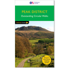
Peak District Year Round Walks

There just isn`t a bad time to walk in the Peak District, each season offers something new. The twenty circular walks in this book vary in length from 2 to 8 miles and are enjoyable all year round. The author has divided the routes into seasons to show each at its very best. In spring, the fields around Monyash are golden with cowslips and the woods near Hayfield are a sea of bluebells. On a fine day in summer there are wonderful views over the hilltops and the moorland around Edale is purple with heather. Autumn brings colour to the Tissington Trail and the reservoirs near Holme are a splendid place to see migrant birds. To appreciate the special atmosphere of the Derwent Valley you should visit in winter.All the walks include details of:* How to get to the start * Where to park*
Numbered route map and directions* Distance and terrain* Recommended local pubs and cafes * Points of interest along the wayWhenever you manage to pay a visit to the nation`s oldest national park, you`ll be rewarded with stunning scenery and some excellent pubs in its quaint villages. Peter Naldrett lives in Sheffield, on the edge of the Peak District, and is a geography teacher and journalist. He writes regularly for magazines and is the author or a number of successful walking books including Derbyshire & the Peak District - A Dog Walker`s Guide and The Lake District - A Dog Walker`s Guide.
RIP - This product is no longer available on our network. It was last seen on 25.09.2019

This page now acts as a permanent archive for this product. Add more information using the comments box below to ensure it can still be found by future generations.

Use our search facility to see if it is available from an alternative contributor.
  • External links may include paid for promotion
  • Availability: Out Of Stock
  • Supplier: Stanfords
  • SKU: 9781846743559
Availability: In Stock
£7.95

Product Description

There just isn`t a bad time to walk in the Peak District, each season offers something new. The twenty circular walks in this book vary in length from 2 to 8 miles & are enjoyable all year round. The author has divided the routes into seasons to show each at its very best. In spring, the fields around Monyash are golden with cowslips & the woods near Hayfield are a sea of bluebells. On a fine day in summer there are wonderful views over the hilltops & the moorland around Edale is violet with heather. Autumn brings colour to the Tissington Trail & the reservoirs near Holme are a splendid place to see migrant birds. To appreciate the special atmosphere of the Derwent Valley you should visit in winter. All the walks include details of:* How to get to the start * Where to park* Numbered route map & directions* Distance & terrain* Recommended local pubs & cafes * Points of interest along the way Whenever you manage to pay a visit to the nation`s oldest national park, you`ll be rewarded with stunning scenery & some excellent pubs in its quaint villages. Peter Naldrett lives in Sheffield, on the edge of the Peak District, & is a geography teacher & journalist. He writes regularly for magazines & is the author or a number of successful walking books including Derbyshire & the Peak District
- A Dog Walker`s Guide & The Lake District
- A Dog Walker`s Guide.

Reviews/Comments

Add New

Intelligent Comparison

Oooops!
We couldn't find anything!
Perhaps this product's unique.... Or perhaps we are still looking for comparisons!
Click to bump this page and we'll hurry up.

Price History

Vouchers

No voucher codes found.
Do you know a voucher code for this product or supplier? Add it to Insights for others to use.

Facebook

Jargon Buster

Purple - A colour between red and blue. Commonly associated with Cadburys
Summer - The season between Spring and Autumn. Usually the hottest season of the year
Colour - The categorised spectrum of light visable to humans
edge - Enhanced data rates for GSM evolution also known as enhanced GPRS. A mobile phone technology with improved data transmission rates.
edge - The point at which two surfaces meet
Day - The time it takes a planet or other space objects to complete one rotation.
Year - The time it takes the planet earth to orbit the sun. This takes around 365.25 days.
Season - The separation of four parts of the year into Spring, Summer, Autumn, Winter.
Autumn - A season which falls between summer and winter.
Winter - The fourth season of a year that comes between Spring and Autumn
Year - 365 days (366 days in a leap year), the time taken for planet earth to make one full revolution around the sun.
Wonderful - Another word for describing something that is extremely good, marvellous.

Supplier Information

Stanfords
Stanfords was established in 1853 and opened their iconic Covent Garden flagship store in 1901. They have become the top retailer of maps, travel books and accessories in the UK and arguably offer the largest selection of maps and travel books worldwide. Famous names such as Captain Robert Falcon Scott, Ranulph Fiennes and Michael Palin have purchased from Stanfords. They now have a shop in Bristol and both stores together with other venues operate a calendar of events including talks, book signings and exhibitions. As a specialist map retailer, the map selection is comprehensive and includes road maps, street maps and walking maps from worldwide destinations, as well as a selection of world atlases and wall maps. Books include travel guides and travel literature. Stanfords also stock globes, from miniatures made of blue marble to magnificent floor-standing globes. The website features a selection of interesting articles on travel topics.
Page Updated: 2023-11-12 20:15:36

Community Generated Product Tags

Oh No! The productWIKI community hasn't generated any tags for this product yet!
Menu