
 United Kingdom
 France
 Germany
 Netherlands
 Sweden
 USA
USA
 Italy
Italy
 Spain
Spain
More From Contributor


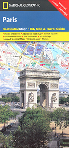
Paris
Tourist map of central Paris (roughly: Eifel Tower to the Bastille and Montmarte to Luxembourg Gardens) clearly showing famous tourist sights, public buildings and selected hotels. An inset of the the Les Halles area reveals the road tunnels layout, and another inset shows the arrondissements within the area of the main map. Detail includes one-way traffic restrictions, RER & Metro ststions, hotels, car parks, pedestrian areas, churches, sites of interest, notable buildings, hospitals.On the reverse: a diagram of the metro, plans showing access to the city`s two international airports and a general road map of the Paris region.Brief notes describe main places of interests and give useful tips. Street index includes places of interest, metro & RER stations and selected hotels.
Multilingual map legend includes English, and all the text is in English.Printed on durable waterproof paper.
Multilingual map legend includes English, and all the text is in English.Printed on durable waterproof paper.

Product Description
Reviews/Comments
Add New
Intelligent Comparison
Archived Product
Paris Stanfords
£3.99
Archived Product
Paris Stanfords
£86.99
Archived Product
Paris Stanfords
£5.50
Archived Product
Paris Stanfords
£4.99
Archived Product
Paris Stanfords
£10.39
Archived Product
Paris Stanfords
£15.95
Archived Product
Paris Stanfords
£12.99
Archived Product
Paris Stanfords
£4.99
Vouchers
No voucher codes found.
Do you know a voucher code for this product or supplier? Add it to Insights for others to use.
Do you know a voucher code for this product or supplier? Add it to Insights for others to use.
 Denmark