More From Contributor
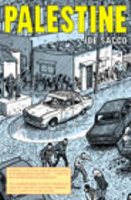
£7.95
Palermo Province in a series of handy size road maps from Litografia Artistica Cartografica (LAC) with more minor local roads & tracks than can be found on most regional maps. The series is gradually being changed to a new style of digitally derived cartography, so presentation of adjoining titles may vary. All the maps have hill shading to represent the general relief with spot heights for selected peaks, & show a few more local roads & rough tracks than the other road map series. Intermediate road distances are indicated. Regional, provincial & communal borders are marked, & railways, funiculars, airports, sea ferry links & campsites are shown. The legend is in Italian only. The new, digitally produced editions are indexed & have enhanced, more finely drawn cartography: the hill-shading is less bold, motorway service areas are marked, natural parks are highlighted & an expanded range of symbols indicates various landmarks & sites, e.g. antiquities, churches, etc. Two styles of the new cartography are produced, differing only in the colour of the predominant background shading: grey or yellow/green. Some of the new editions include geographical coordinates for the map corners. The index of localities is on the reverse. This title is still produced in the traditional cartographic style. ...
Archived Product
£9.50
Palermo in a series of street plans of Italian cities from Touring Club Italiano, with exceptionally clear & beautiful cartography. The plan is printed on very light, waterproof & tear-resistant plastic paper &

Includes::
a detailed road map of the city’s environs at 1:100, 000. The plan covers Palermo with the outer suburbs. Main traffic arteries across the city are highlighted & car parks around the city’s historic centre are marked. Metro stations are shown with their names. Churches & other important historic or municipal buildings are prominently marked & named. Unusually for street plans, in the outer suburbs there are contour lines at 50m intervals. Street index is on the reverse &

Includes::
lists of metro stations, car parks, car rental firms, ferry services, tourist information offices & other useful information. Map legend & all the text include English.


...
Archived Product
£4.95
Palermo in the Wallpaper City Guide series, published by Phaidon & encompassing a collection of pocket-size guides dedicated to the best design elements in major cities. Compiled by experts at the Wallpaper magazine, the guides are widely recognized for appealing to design-conscious travellers & are aimed at those interested in art, design & architecture. Each guide identifies the best bars, restaurants, hotels, places to shop, leisure activities & excursions with a unique emphasis on the finest examples of unusual architecture & design. Each Wallpaper City Guide has the same layout, with separate tabs allowing readers & travellers to access individual sections easily. The tabs consist of Landmarks, Hotels, 24 Hours, Urban Life, Architour, Shopping, Sports & Escapes. High quality colour photographs appear alongside brief descriptions of each hotel, bar or attraction, highlighting distinctive & unusual styles of architecture & design. Extra pages are provided at the back of each guide, allowing readers to record their own notes & sketches. ...
Archived Product
£6.95
Palermo in the Wallpaper* City Guide series, published by Phaidon & encompassing a collection of pocket-size guides dedicated to the best design elements in major cities. Compiled by experts at the Wallpaper* magazine, the guides are widely recognized for appealing to design-conscious travellers & are aimed at those interested in art, design & architecture. Each guide identifies the best bars, restaurants, hotels, places to shop, leisure activities & excursions with a unique emphasis on the finest examples of unusual architecture & design. Each Wallpaper* City Guide has the same layout, with separate tabs allowing readers & travellers to access individual sections easily. The tabs consist of Landmarks, Hotels, 24 Hours, Urban Life, Architour, Shopping, Sports & Escapes. High quality colour photographs appear alongside brief descriptions of each hotel, bar or attraction, highlighting distinctive & unusual styles of architecture & design. Extra pages are provided at the back of each guide, allowing readers to record their own notes & sketches. ...
Archived Product
£18.99
Palermo
- the capital of Sicily
- is a destination with a difference. The city is a treasure trove of original monuments & works

...
Archived Product
£9.99
Israel on an indexed, double-sided, waterproof & tear-resistant map from ITMB, with the southern part of the country shown at the same scale of 1:225, 000 as the north. The map

Includes::
an enlargement for the environs of Jerusalem, plus a street plan of the city. Bold altitude colouring shows the topography, with graphics for deserts, forests, salt lakes, & national parks or protected areas. Road network indicates names of selected crossroads, providing information very useful when driving in Israel. Locations of petrol stations are marked & distances are shown on main routes. Railway lines are included & local airports are marked. Symbols highlight various places of interest, including religious & archaeological sites, beaches & diving sites, etc. Also indicated are towns with tourist accommodation & locations of youth hostels. All place names are in Latin alphabet only, some with alternative transliterations. The map has a latitude & longitude grid at intervals of 10’. Each side of the map has a separate index. Please note: boundaries of the West Bank & the Gaza Strip are marked, but without the map showing areas under Palestinian or joint control, or the course of the separation barrier. On the Golan Heights only the current boundary is shown, without the UNDOF zone. Also provided are: an enlargement presenting in greater detail the environs of Jerusalem, including access to Bethlehem, Ramallah, Jericho & the Dead Sea, with the Separation Wall & crossing points clearly marked (the map was published in January 2014); plus a nice, clear street plan of Jerusalem’s central districts including the Old City, Mount Zion & the Mount of Olives sites (no Israel Museum or Yad Vashem). The plan highlights important sights & selected hotels.

...
Archived Product
£14.99
Palestine: A Traveller's Guide is an insider's look at where, & how, Palestinians live today. This remarkable tour through the historic Palestinian homeland is guided by some of the country's most gifted writers, journalists, academics & photographers. Intimate & honest, this guidebook offers an insider's key to understanding the Palestinians & their relationship to their homel&, past & present. Explore the monuments of the past, as well as the vibrant towns, cities, hamlets & refugee camps of an emerging nation. Palestine: A Traveller's Guide offers the visitor an authentic vision of why, despite lacking legal status as a state, Palestine is a real place on the world map. Mariam Shahin, journalist & author, has been living & working in the Arab world for two decades. She is co-author of Unheard Voices: Iraqi Women on Sanctions & War as well as guidebooks to Egypt & Jordan. Her work frequently appears on both television documentaries & special news programmes for the BBC. ...
Archived Product
£120.00
Palestine & Adjacent Countries, an original antique map by S.A. Mitchell, published in Philadelphia, 1846. Copperplate, original colour. Map size 32 x 39.5 cm, overall mounted size 48 x 55 cm. Samuel Augustus Mitchell's New Universal Atlas.. . comprised finely engraved & delicately h&-coloured maps & plans of all areas of the world. A detailed map of Israel & Lebanon with an inset, at top left, of the Environs of Jerusalem. Antique maps from various original publishers are presented on the Stanford ...
Archived Product
£59.50
After Napoleon`s invasion of Egypt in 1798, the West rediscovered Egypt & the Holy L&. Painters & artists, travellers & archaeologists flocked to the region during the 19th century & produced some of the most interesting records of cities & villages, topography, buildings & customs
- much of which has since disappeared or changed beyond recognition. The items featured in this work record this vanished world in fine detail. The book is based on a unique collection of art & printed material covering the 400 year period of Ottoman rule in the region. The extraordinarily diverse perspectives on the history & society of the Holy Land & Egypt as recorded in the writings, paintings & photography of Western travellers & observers make this an unusual source of reference for specialists & students of Middle Eastern history & for general readers alike.
...
Archived Product
£9.95
Israel on an indexed, double-sided map from ITMB, with the southern part of the country shown at the same scale of 1:225, 000 as the north. Bold altitude colouring shows the topography, with graphics indicating deserts, forests, salt lakes, & national parks or protected areas. The map shows Israel ...
Archived Product

Palestine

In late l991 and early 1992, at the time of the first Intifada, Joe Sacco spent two months with the Palestinians in the West Bank and Gaza Strip, travelling and taking notes. Upon returning to the United States he started writing and drawing Palestine, which combines the techniques of eyewitness reportage with the medium of comic-book storytelling to explore this complex, emotionally weighty situation. He captures the heart of the Palestinian experience in image after unforgettable image, with great insight and remarkable humour. The nine-issue comics series won a l996 American Book Award. It is now published for the first time in one volume, befitting its status as one of the great classics of graphic non-fiction.
RIP - This product is no longer available on our network. It was last seen on 25.09.2019

This page now acts as a permanent archive for this product. Add more information using the comments box below to ensure it can still be found by future generations.

Use our search facility to see if it is available from an alternative contributor.
  • External links may include paid for promotion
  • Availability: Out Of Stock
  • Supplier: Stanfords
  • SKU: 9780224069823
Availability: In Stock
£12.99

Product Description

In late l 991 & early 1992, at the time of the first Intifada, Joe Sacco spent two months with the Palestinians in the West Bank & Gaza Strip, travelling & taking notes. Upon returning to the United States he started writing & drawing Palestine, which combines the techniques of eyewitness reportage with the medium of comic-book storytelling to explore this complex, emotionally weighty situation. He captures the heart of the Palestinian experience in image after unforgettable image, with great insight & remarkable humour. The nine-issue comics series won a l 996 American Book Award. It is now published for the first time in one volume, befitting its status as one of the great classics of graphic non-fiction.

Reviews/Comments

Add New

Intelligent Comparison

Oooops!
We couldn't find anything!
Perhaps this product's unique.... Or perhaps we are still looking for comparisons!
Click to bump this page and we'll hurry up.

Price History

Vouchers

No voucher codes found.
Do you know a voucher code for this product or supplier? Add it to Insights for others to use.

Facebook

Jargon Buster

Humour - Something either verbal of physical that provides amusement and can provoke laughter
Heart - An organ that pumps blood around the body. Usually related to love.
Experience - To gain further knowledge by practising.

Supplier Information

Stanfords
Stanfords was established in 1853 and opened their iconic Covent Garden flagship store in 1901. They have become the top retailer of maps, travel books and accessories in the UK and arguably offer the largest selection of maps and travel books worldwide. Famous names such as Captain Robert Falcon Scott, Ranulph Fiennes and Michael Palin have purchased from Stanfords. They now have a shop in Bristol and both stores together with other venues operate a calendar of events including talks, book signings and exhibitions. As a specialist map retailer, the map selection is comprehensive and includes road maps, street maps and walking maps from worldwide destinations, as well as a selection of world atlases and wall maps. Books include travel guides and travel literature. Stanfords also stock globes, from miniatures made of blue marble to magnificent floor-standing globes. The website features a selection of interesting articles on travel topics.
Page Updated: 2023-11-12 20:15:36

Community Generated Product Tags

Oh No! The productWIKI community hasn't generated any tags for this product yet!
Menu