More From Contributor
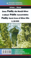
£6.99
Roddy Doyle`s Booker Prize-winning novel describes the world of ten-year-old Paddy Clarke, growing up in Barrytown, north Dublin. From fun & adventure on the streets, boredom in the classroom to increasing isolation at home, ” Paddy Clarke Ha Ha Ha” is the story of a boy who sees everything but understands less & less. ...
Archived Product
£8.99
Paddy Clarke is ten years old. Paddy Clarke lights fires. Paddy Clarke`s name is written in wet cement all over Barrytown, north Dublin. Paddy Clarke`s heroes are Father Damien (and the lepers), Geronimo & George Best. Paddy Clarke has a brother called Francis, but Paddy calls him Sinbad & hates him because that`s the rule. Paddy Clarke knows the exact moment to knock a dead scab from his knee. Paddy Clarke loves his Ma & Da, but it seems like they don`t love each other, & Paddy`s world is falling apart. ...
Archived Product
£5.50
ADAC, Germany's equivalent of the British Automobile Association publishes an extensive series of street plans which provide detailed high-quality mapping of all the major towns & cities, including their outer suburbs. The plans name all the individual streets & indicate all the main landmarks & public buildings. All public transport facilities are shown: buses, trams, underground & overland rail lines. One way streets & car parks are indicated. Plans of larger cities include an enlargement for the city centre. The plans also show the administrative & postal divisions & have an extensive street index which, where appropriate, shows individual postal codes for each street. On the reverse, each plan has a road map at 1:100, 000, covering a very wide area around the city. Map legend

Includes::
English.

...
Archived Product
£2.95
Padiham in 1909 in a fascinating series of reproductions of old Ordnance Survey plans in the Alan Godfrey Editions, ideal for anyone interested in the history of their neighbourhood or family. Selected towns in Great Britain & Ireland are covered by maps showing the extent of urban development in the last decades of the 19th & early 20th century. In this title: the map is double-sided. The main map covers the southern part of Padiham, & coverage extends southward to Shuttleworth Hall & westward to Simonstone Paper Mill. Features include the LYR Great Harwood Loop railway with Padiham station; part of Simonstone station is at the western edge of the map. Other features include Fenny Fold, River Calder, Stone Moor Bottom, Dean Brook Bridge, Albion Mill, Jubilee Mill, Holme Mill, Green Lane Mill, Green Bridge Mill, Levant Mill, Perseverance Mill, St Anne's church, Stone Moor. On the reverse is more than half of adjacent sheet 55.16 extending coverage northward; this

Includes::
Padiham Town Centre, where features include St Leonard's church, Britannia Mill, River Side Mill & several other mills, Victoria Foundry. Coverage extends northward to Old Orchard & Huntroyde. About the Alan Godfrey Editions of the 25

...
Archived Product
£3.50
Padiham in 1909 in a fascinating series of reproductions of old Ordnance Survey plans in the Alan Godfrey Editions, ideal for anyone interested in the history of their neighbourhood or family. The map is double-sided. The main map covers the southern part of Padiham, extending southward to Shuttleworth Hall & westward to Simonstone Paper Mill. Features include the LYR Great Harwood Loop railway with Padiham station; part of Simonstone station is at the western edge of the map. Other features include Fenny Fold, River Calder, Stone Moor Bottom, Dean Brook Bridge, Albion Mill, Jubilee Mill, Holme Mill, Green Lane Mill, Green Bridge Mill, Levant Mill, Perseverance Mill, St Anne`s church, Stone Moor, etc. On the reverse is more than half of adjacent sheet 55.16 extending coverage northward; this covers Padiham Town Centre, where features include St Leonard`s church, Britannia Mill, River Side Mill & several other mills, Victoria Foundry, etc. Coverage extends northward to Old Orchard & Huntroyde. About the Alan Godfrey Editions of the 25” OS Series: Selected towns in Great Britain & Ireland are covered by maps showing the extent of urban development in the last decades of the 19th & early 20th century. The plans have been taken from the Ordnance Survey mapping & reprinted at about 15 inches to one mile (1:4, 340). On the reverse most maps have historical notes & many also include extracts from contemporary directories. Most maps cover about one mile (1.6kms) north/south, one & a half miles (2.4kms) across; adjoining sheets can be combined to provide wider coverage.FOR MORE INFORMATION & A COMPLETE LIST OF ALL AVAILABLE TITLES PLEASE CLICK ON THE SERIES LINK. ...
Archived Product
£14.95
Map No. BD9, Padjelanta
- Sulitelma, in a series of detailed topographic survey maps for mountain areas of central & northern
...
Archived Product
£14.95
Map No. BD9, Padjelanta
- Sulitelma, in a series of detailed topographic survey maps for mountain areas of central & northern
...
Archived Product
£16.99
Mountain areas of central & northern Sweden on waterproof & tear-resistant, GPS compatible topographic “ Fjällkartan” maps at 1:100, 000 & 1:50, 000 from Lantmäteriet
- the country’s national survey organization, with hiking & ski routes, campsites & youth hostels, etc. Relief is shown by contours at 20m intervals & enhanced by relief shading, plus colouring and/or graphics to indicate different types of vegetation or land use. An overprint shows trails for hiking & cross-country skiing, indicating waymarked or unmarked & summer or winter only routes. Also shown are mandatory & recommended trails for snowmobiles & areas prohibited for cross-country vehicles. Symbols indicate locations of campsites, youth hostels, huts & wind shelters, mountain lodges & other types of tourist accommodation, emergency telephones, etc. The maps have both a 1-km UTM grid & a latitude/longitude grid in steps of 10`. Map legend

Includes::
English. On the reverse there are descriptions of the area in Swedish only, GPS coordinates for selected locations, etc. Most sheets also include a brief note in English on public access regulations. To see the list of titles in this series please click on the series link.


...
Archived Product
£6.95
Topographic coverage of mainland Spain at 1:50, 000 in the MTN50 (Mapa Topográfico Nacional) series from the Centro Nacional de Información Geografica, the country’s civilian survey organization. The maps have contours at 20m intervals, enhanced by relief shading, plus colouring and/or graphics to show different types of terrain, vegetation or land use. Boundaries of national parks & other protected areas are marked. In addition to all the usual information featured on topographic mapping at this scale, detailed presentation of the road & rail networks, rural tracks & paths, etc, the maps also show campsites & mountain refuges. On more recent editions some GRs, the official long-distance hiking routes, are also marked (although not as clearly as on hiking maps from other publishers). Each map covers 29.5x 18.5 km (with adjustments in the border or coastal areas). The maps have a 1-km UTM grid, plus margin ticks for latitude & longitude at 1` intervals. Map legend is in Spanish only.HOW TO CHOOSE THE RIGHT 50K MAP: all the titles in CNIG’s 200K Provincial Road Maps series at 1:200, 000 are overprinted with the grid for the 1:50, 000 maps & can be used to see the area covered by each 50K title. TO SEE THE LIST OF TITLES IN THIS SERIES PLEASE CLICK ON THE SERIES LINK.PLEASE NOTE
- MAP TITLES: the grids shown on our website serve both the civilian & the military 1:50, 000 topographic series. Although the areas covered by maps in both series are identical (apart from some border or coastal sheets), occasionally map titles differ – only one title is shown on the grid, usually the military one. In Galicia, the Basque country & in the Catalan speaking areas the tendency now is to use local place names rather than the often better known Castilian ones. Where possible, both versions are included in our titles. Map titles listed on our website are based on information received by us at the time of publication, but sometimes maps arrive showing a completely different title! As long as the map number is as ordered, the correct map has been supplied.
...
Archived Product
£7.95
Padua in a series of street plans of Italian cities from Touring Club Italiano, with exceptionally clear & beautiful cartography. The plan is printed on very light, waterproof & rear-resistant plastic paper &

Includes::
a detailed road map of the city

...
Archived Product

Padis

Padis area at 1:30, 000 in a series of detailed contoured maps covering popular hiking areas of Transylvania published by Dimap, one of Hungary’s leading publishers specializing in mapping of that region. The maps show local hiking routes and provide tourist information such as campsites, places of interest, etc. Many titles include street plans and/or English language descriptions of recommended hiking trails.*In this title:* hiking map with contours at 50m intervals, highlighting several local footpaths and trails indicating their waymarking signs. Symbols show local hotels, campsites, and mountain huts, springs and waterfalls, caves and rock faces, places of interest, etc. Three small insets show the Galbenei and Somesului Cald gorges and the Ponorului depression at enlarged
scales. The map has no geographical coordinates. On the reverse is a black and white road map at 1:400, 000 showing the surrounding region and notes, in Hungarian and German only, describing the area and the various hiking routes. *Map legend includes English.*
RIP - This product is no longer available on our network. It was last seen on 25.09.2019

This page now acts as a permanent archive for this product. Add more information using the comments box below to ensure it can still be found by future generations.

Use our search facility to see if it is available from an alternative contributor.
  • External links may include paid for promotion
  • Availability: Out Of Stock
  • Supplier: Stanfords
  • SKU: 9786155397011
Availability: In Stock
£9.99

Product Description

Padis area at 1:30, 000 in a series of detailed contoured maps covering popular hiking areas of Transylvania published by Dimap, one of Hungary’s leading publishers specializing in mapping of that region. The maps show local hiking routes & provide tourist information such as campsites, places of interest, etc. Many titles include street plans and/or English language descriptions of recommended hiking trails.* In this title:* hiking map with contours at 50m intervals, highlighting several local footpaths & trails indicating their waymarking signs. Symbols show local hotels, campsites, & mountain huts, springs & waterfalls, caves & rock faces, places of interest, etc. Three small insets show the Galbenei & Somesului Cald gorges & the Ponorului depression at enlarged scales. The map has no geographical coordinates. On the reverse is a black & white road map at 1:400, 000 showing the surrounding region & notes, in Hungarian & German only, describing the area & the various hiking routes. * Map legend

Includes::
English.*

Reviews/Comments

Add New

Intelligent Comparison

Oooops!
We couldn't find anything!
Perhaps this product's unique.... Or perhaps we are still looking for comparisons!
Click to bump this page and we'll hurry up.

Price History

Vouchers

No voucher codes found.
Do you know a voucher code for this product or supplier? Add it to Insights for others to use.

Facebook

Jargon Buster

Black - A colour which does not emit any colour of the spectrum. Black absorbs all frequencies of the spectrum.
Hiking - An outdoor activity envolving walking in nature
White - A colour combining all colours
Language - the method of communication used in different areas. Humans and computers have many different languages.
Small - something that takes up less space than normal.
Road - a manmade lane or a path that is used to speed up travel.
Popular - Something that is admired and liked by many people.
Language - The way humans communicate either written and spoken.

Supplier Information

Stanfords
Stanfords was established in 1853 and opened their iconic Covent Garden flagship store in 1901. They have become the top retailer of maps, travel books and accessories in the UK and arguably offer the largest selection of maps and travel books worldwide. Famous names such as Captain Robert Falcon Scott, Ranulph Fiennes and Michael Palin have purchased from Stanfords. They now have a shop in Bristol and both stores together with other venues operate a calendar of events including talks, book signings and exhibitions. As a specialist map retailer, the map selection is comprehensive and includes road maps, street maps and walking maps from worldwide destinations, as well as a selection of world atlases and wall maps. Books include travel guides and travel literature. Stanfords also stock globes, from miniatures made of blue marble to magnificent floor-standing globes. The website features a selection of interesting articles on travel topics.
Page Updated: 2023-11-12 20:15:36

Community Generated Product Tags

Oh No! The productWIKI community hasn't generated any tags for this product yet!
Menu