
 United Kingdom
 France
 Germany
 Netherlands
 Sweden
 USA
USA
 Italy
Italy
 Spain
Spain
More From Contributor


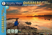
Overberg Whale Coast
Overberg Whale Coast on a very attractive and detailed, double-sided map from Slingsby Maps, with many additional street plans and area maps. Relief is depicted by elevation tinting, spot heights, and contours at 100m intervals. Road information includes minor gravel roads, private road, mountain passes and intermediate driving distances on most roads. Routes which are particularly attractive - or conversely, worth avoiding - are indicated. Railways are marked, showing local stations. Symbols depict an enormous range of features: accommodation and camping sites, farm stalls and other local produce shop (cheese, dried or fresh fish, olives, etc.), wine cellars, breweries, various outdoor recreation sites (golf, paragliding, etc), landmarks, monuments, nature reserves,
animal and bird watching sites, botanical sights, wheel-chair routes, etc. Latitude and longitude lines are drawn at 5
animal and bird watching sites, botanical sights, wheel-chair routes, etc. Latitude and longitude lines are drawn at 5
Product Description
Reviews/Comments
Add New
Intelligent Comparison
Archived Product
Overberg Whale Coast Stanfords
£17.99
Vouchers
No voucher codes found.
Do you know a voucher code for this product or supplier? Add it to Insights for others to use.
Do you know a voucher code for this product or supplier? Add it to Insights for others to use.
 Denmark