
 United Kingdom
 France
 Germany
 Netherlands
 Sweden
 USA
USA
 Italy
Italy
 Spain
Spain
More From Contributor


Ottoman Empire
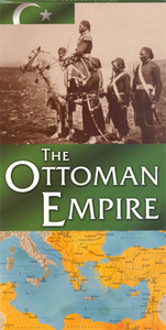
Historical map of the Ottoman Empire from New Holland, that dominated territories across the Middle East, North Africa and south-eastern Europe. The map explores the steady expansion of the Empire from 1299 to 1923 through military conquest; its vast religious, ethnic, linguistic and economic diversity; its political structures and hierarchies and ultimately, the steady erosion of it’s power during the 19th century, right up to it’s partition in the years after the Great War.Cartography sites of important battles, sieges, and main transport routes. Major cities and towns are highlighted, as are natural resources, rivers; topography is marked through relief shading. The map is surrounded by photographs and boxes of information highlighting the main events, people, and
cultural legacies of the Empire, with a complete timeline offering an overview of the region’s history.
cultural legacies of the Empire, with a complete timeline offering an overview of the region’s history.

Product Description
Reviews/Comments
Add New
Intelligent Comparison
Archived Product
The Roman Empire Stanfords
£7.99
Vouchers
No voucher codes found.
Do you know a voucher code for this product or supplier? Add it to Insights for others to use.
Do you know a voucher code for this product or supplier? Add it to Insights for others to use.
 Denmark