More From Contributor

£3.99
Oslo Pop-Out Map from Compass Maps in a series designed to provide two street plans, the city centre plus a wider area around it, in a handy format to fit neatly all but the smallest pockets, with, as appropriate, transport network diagrams, additional useful maps, etc. Each title ...
Archived Product
£23.99
Street Atlas of Oslo in a spiral-bound format from Norway’s leading cartographic publishers Cappelen, presenting the capital & its environs at several scales, with additional diagrams of its metro, railways & tram networks. The city with its suburbs is covered at 1:20, 000; the centres of Oslo itself plus of Drammen, Asker, Sandvika & Drøbak are also shown in greater detail at 1:10, 000. The maps very clearly present the city’s road & rail/tram infrastructures, highlighting main traffic routes & showing one way streets, tramlines with stops, etc. Streets are annotated with selected house numbers for easier identification of addresses. A very wide range of symbols indicate various facilities, including hotels, restaurants, etc. The city’s northern suburbs are covered at 1:40, 000 or 1:50, 000; the whole of the Oslo region is also presented at 1:150, 000 on maps indicating which areas are shown in greater detail on other pages of the atlas. Map legend

Includes::
English.

...
Archived Product
£23.99
Oslo Vestmark area in Norway in a series of GPS compatible recreational maps at 1:25, 000 with cartography based on the country’s topographic survey & additional tourist information. The base map is an enlargement of the standard 1:50, 000 topographic survey series. Contours lines are drawn at 20m intervals. The overprint varies from title to title, but

Includes::
local footpaths, in some cases distinguishing between easy & more difficult trails, as well as mountain huts & campsites. Many titles also indicate cycle, ski or canoeing routes, other accommodation possibilities, sport & recreational facilities, including alpine skiing slopes, places of interest, etc. The maps have a UTM grid & margin ticks giving latitude & longitude. Map legend

Includes::
English. Several titles have on the reverse additional tourist information, although in most cases in Norwegian only. To see the list of Turkart maps at 1:25, 000 & links to Turkart series at 50K, 100K & Hiking Sets please click on the series link above.


...
Archived Product
£5.95
Oslo in the Wallpaper City Guide series, published by Phaidon & encompassing a collection of pocket-size guides dedicated to the best design elements in major cities. Compiled by experts at the Wallpaper magazine, the guides are widely recognized for appealing to design-conscious travellers & are aimed at those interested in art, design & architecture. Each guide identifies the best bars, restaurants, hotels, places to shop, leisure activities & excursions with a unique emphasis on the finest examples of unusual architecture & design. Each Wallpaper City Guide has the same layout, with separate tabs allowing readers & travellers to access individual sections easily. The tabs consist of Landmarks, Hotels, 24 Hours, Urban Life, Architour, Shopping, Sports & Escapes. High quality colour photographs appear alongside brief descriptions of each hotel, bar or attraction, highlighting distinctive & unusual styles of architecture & design. Extra pages are provided at the back of each guide, allowing readers to record their own notes & sketches. ...
Archived Product
£20.99
Oslo’s famous Holmenkollen ski jumping hill with the surrounding facilities & places of interest on a folded map-cum-poster & three large postcards from Nordeca, presented in a special card wallet. The poster contains on one side a 26x 41cm map of the area (scale not indicated) highlighting locations of 19 sites which are illustrated by the surrounding photos, some accompanied by descriptions. On the reverse are large photos of the ski jumping hill, accompanied by a time line showing its development from 1930 to 2016. The set also contains three colour 25x 13.5 postcards of the ski jumping hill. All the text is in Norwegian, German & English. ...
Archived Product
£17.99
The 1:50, 000 topographic map gives a more general picture of the ground features than a basic map. It shows settlements, houses, roads, cultivated areas, waterways, cutting areas, mires, rock exposures, & relief. One map sheet covers an area of 30 x 40 km & one centimetre corresponds to 500 metres on the ground. The 1:50, 000 topographic map is also an ideal complement to nautical charts as it provides useful information about the land areas adjacent to waterways. For example, all Finnish sea areas are covered by 1:50, 000 topographic map sheets. ...
Archived Product
£14.99
The Ottoman chronicles recount that the first sultan, Osman, dreamt of the dynasty he would found
- a tree, fully-formed, emerged
...
Archived Product
£5.50
ADAC, Germany's equivalent of the British Automobile Association publishes an extensive series of street plans which provide detailed high-quality mapping of all the major towns & cities, including their outer suburbs. The plans name all the individual streets & indicate all the main landmarks & public buildings. All public transport facilities are shown: buses, trams, underground & overland rail lines. One way streets & car parks are indicated. Plans of larger cities include an enlargement for the city centre. The plans also show the administrative & postal divisions & have an extensive street index which, where appropriate, shows individual postal codes for each street. On the reverse, each plan has a road map at 1:100, 000, covering a very wide area around the city. Map legend

Includes::
English.

...
Archived Product
£7.99
Falk, one of Germany`s leading publishers of street plans, produce their town plans in two different formats. Falk Extra plans are folded in a standard way, where the whole map can be opened to view the entire area it covers. For larger cities, the same mapping is also published with a special folding system designed to show only a small section of the map at one time. The whole map can be opened but it will be cut in several places. Many find these street plans very user-friendly & easier to handle than conventional maps. The plans, which cover towns with their outer suburbs, indicate main landmarks & public buildings & show all the public transport facilities, one way streets & car parks. Plans of lager cities include a separate map of the town centre at a more detailed scale & a diagram of the underground & the suburban rail network. The plans also show the postal divisions & have an extensive street index which, where appropriate, shows individual postal codes for each street. Map legend

Includes::
English. Falk Extra plans also include on the reverse a road map of the surrounding area.

...
Archived Product
£11.99
Osnabrücker Land
- Bielefeld
- Wiehengebirge (No. 750), a detailed, GPS compatible map at 1:50, 000 from Kompass with local

...
Archived Product

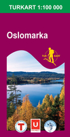
Oslomarka Nordeca 2718

Oslomarka area in Norway in a series of GPS compatible recreational Turkart maps at 1:100, 000 with cartography from Norway’s topographic survey and additional tourist information. Contours lines are drawn at 20m intervals. The overprint varies from title to title, but includes local footpaths, in some cases distinguishing between easy and more difficult trails, as well as mountain huts and campsites. Many titles also indicate cycle or ski routes, other accommodation possibilities, sport and recreational facilities, including alpine skiing slopes, places of interest, etc. The maps have a UTM grid and margin ticks giving latitude and longitude. Map legend includes English. Several titles have on the reverse additional tourist information, although in most cases in Norwegian
only.To see the list of Turkart maps at 1:100, 000 and links to Turkart series at 25K, 50K and Hiking Sets please click on the series link above.
RIP - This product is no longer available on our network. It was last seen on 25.09.2019

This page now acts as a permanent archive for this product. Add more information using the comments box below to ensure it can still be found by future generations.

Use our search facility to see if it is available from an alternative contributor.
  • Availability: Out Of Stock
  • Supplier: Stanfords
  • SKU: 7046660027189
Availability: In Stock
£23.99

Product Description

Oslomarka area in Norway in a series of GPS compatible recreational Turkart maps at 1:100, 000 with cartography from Norway’s topographic survey & additional tourist information. Contours lines are drawn at 20m intervals. The overprint varies from title to title, but

Includes::
local footpaths, in some cases distinguishing between easy & more difficult trails, as well as mountain huts & campsites. Many titles also indicate cycle or ski routes, other accommodation possibilities, sport & recreational facilities, including alpine skiing slopes, places of interest, etc. The maps have a UTM grid & margin ticks giving latitude & longitude. Map legend

Includes::
English. Several titles have on the reverse additional tourist information, although in most cases in Norwegian only. To see the list of Turkart maps at 1:100, 000 & links to Turkart series at 25K, 50K & Hiking Sets please click on the series link above.

Reviews/Comments

Add New

Intelligent Comparison

Oooops!
We couldn't find anything!
Perhaps this product's unique.... Or perhaps we are still looking for comparisons!
Click to bump this page and we'll hurry up.

Price History

Vouchers

No voucher codes found.
Do you know a voucher code for this product or supplier? Add it to Insights for others to use.

Facebook

Jargon Buster

GPS - Global Positioning System - Global position using satellites
Hiking - An outdoor activity envolving walking in nature
Accommodation - A room in which someone can live in, for example in a hotel

Supplier Information

Stanfords
Stanfords was established in 1853 and opened their iconic Covent Garden flagship store in 1901. They have become the top retailer of maps, travel books and accessories in the UK and arguably offer the largest selection of maps and travel books worldwide. Famous names such as Captain Robert Falcon Scott, Ranulph Fiennes and Michael Palin have purchased from Stanfords. They now have a shop in Bristol and both stores together with other venues operate a calendar of events including talks, book signings and exhibitions. As a specialist map retailer, the map selection is comprehensive and includes road maps, street maps and walking maps from worldwide destinations, as well as a selection of world atlases and wall maps. Books include travel guides and travel literature. Stanfords also stock globes, from miniatures made of blue marble to magnificent floor-standing globes. The website features a selection of interesting articles on travel topics.
Page Updated: 2023-11-12 20:15:36

Community Generated Product Tags

Oh No! The productWIKI community hasn't generated any tags for this product yet!
Menu