More From Contributor
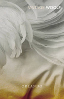
£8.99
Orkney: the western part of Mainland with Stromness, plus the island of Graemsay on a detailed topographic & GPS compatible map No. 463, paper version, from the Ordnance Survey’s 1:25, 000 Explorer series. MOBILE DOWNLOADS: this title & all the other OS Explorer maps include a code for downloading after purchase the digital version onto your smartphone or tablet for viewing on the OS smartphone app.OS EXPLORER SERIES: to see the list of all the titles in the OS Explorer series, both paper & waterproof versions, please click on the series link. The Explorer series, Ordnance Survey’s most detailed maps recommended for anyone enjoying outdoor activities, provides topographic coverage of Great Britain at 1:25, 000 on GPS compatible maps with hiking trails, cycling routes & extensive tourist information. Each printed map is available either on paper or as a waterproof & tear-resistant OS Active Map, as indicated in its title. Britain’s National Parks & other areas of particular tourist interest are presented on often double-sided OL (Outdoor Leisure) maps, whilst most standard format Explorers cover an area of 30 x 20km (approx. 19 x 12 miles). All three versions (paper, waterproof & digital) are the same & provide plenty of recreational & tourist information, indicating the traditional public right of way paths (except in Scotland where different laws apply), including bridleways & byways. National Trails & other long-distance paths are marked, as well as permissive footpaths or bridleways & on-road or traffic-free cycle routes with, where appropriate, their National/ Regional Cycle Network numbers. Boundaries of access land are clearly marked. A wide range of symbols provides additional tourist information, highlighting camping & caravanning sites, information offices & visitors’ centres, parking & picnicking places, country pubs, sport & recreational facilities including cycle hire locations & mountain biking trails, historic buildings & museums, etc. Exceptionally clear presentation of the landscape is provided by contours at 5m or in the uplands at 10m intervals, with additional spot heights plus colouring and/or graphics for different types of woodlands, orchards, heath, marshl&, scree or boulders, & other topographic features. For GPS users the maps have British National Grid lines at 1km intervals, with latitude & longitude given by margin ticks at 1`. Clearly laid out map legend

Includes::
French & German translations for the tourist information symbols.

...
Archived Product
£14.99
Orkney: the islands of Westray, Papa Westray, Rousay, Egilsay & Wyre with the nearby smaller islands on a detailed topographic & GPS compatible map No. 464, waterproof version, from the Ordnance Survey’s 1:25, 000 Explorer series.MOBILE DOWNLOADS: this title & all the other OS Explorer maps include a code for downloading after purchase the digital version onto your smartphone or tablet for viewing on the OS smartphone app.OS EXPLORER SERIES: to see the list of all the titles in the OS Explorer series, both paper & waterproof versions, please click on the series link. The Explorer series, Ordnance Survey’s most detailed maps recommended for anyone enjoying outdoor activities, provides topographic coverage of Great Britain at 1:25, 000 on GPS compatible maps with hiking trails, cycling routes & extensive tourist information. Each printed map is available either on paper or as a waterproof & tear-resistant OS Active Map, as indicated in its title. Britain’s National Parks & other areas of particular tourist interest are presented on often double-sided OL (Outdoor Leisure) maps, whilst most standard format Explorers cover an area of 30 x 20km (approx. 19 x 12 miles). All three versions (paper, waterproof & digital) are the same & provide plenty of recreational & tourist information, indicating the traditional public right of way paths (except in Scotland where different laws apply), including bridleways & byways. National Trails & other long-distance paths are marked, as well as permissive footpaths or bridleways & on-road or traffic-free cycle routes with, where appropriate, their National/ Regional Cycle Network numbers. Boundaries of access land are clearly marked. A wide range of symbols provides additional tourist information, highlighting camping & caravanning sites, information offices & visitors’ centres, parking & picnicking places, country pubs, sport & recreational facilities including cycle hire locations & mountain biking trails, historic buildings & museums, etc. Exceptionally clear presentation of the landscape is provided by contours at 5m or in the uplands at 10m intervals, with additional spot heights plus colouring and/or graphics for different types of woodlands, orchards, heath, marshl&, scree or boulders, & other topographic features. For GPS users the maps have British National Grid lines at 1km intervals, with latitude & longitude given by margin ticks at 1`. Clearly laid out map legend

Includes::
French & German translations for the tourist information symbols.

...
Archived Product
£8.99
Orkney: the islands of Westray, Papa Westray, Rousay, Egilsay & Wyre with the nearby smaller islands on a detailed topographic & GPS compatible map No. 464, paper version, from the Ordnance Survey’s 1:25, 000 Explorer series.MOBILE DOWNLOADS: this title & all the other OS Explorer maps include a code for downloading after purchase the digital version onto your smartphone or tablet for viewing on the OS smartphone app.OS EXPLORER SERIES: to see the list of all the titles in the OS Explorer series, both paper & waterproof versions, please click on the series link. The Explorer series, Ordnance Survey’s most detailed maps recommended for anyone enjoying outdoor activities, provides topographic coverage of Great Britain at 1:25, 000 on GPS compatible maps with hiking trails, cycling routes & extensive tourist information. Each printed map is available either on paper or as a waterproof & tear-resistant OS Active Map, as indicated in its title. Britain’s National Parks & other areas of particular tourist interest are presented on often double-sided OL (Outdoor Leisure) maps, whilst most standard format Explorers cover an area of 30 x 20km (approx. 19 x 12 miles). All three versions (paper, waterproof & digital) are the same & provide plenty of recreational & tourist information, indicating the traditional public right of way paths (except in Scotland where different laws apply), including bridleways & byways. National Trails & other long-distance paths are marked, as well as permissive footpaths or bridleways & on-road or traffic-free cycle routes with, where appropriate, their National/ Regional Cycle Network numbers. Boundaries of access land are clearly marked. A wide range of symbols provides additional tourist information, highlighting camping & caravanning sites, information offices & visitors’ centres, parking & picnicking places, country pubs, sport & recreational facilities including cycle hire locations & mountain biking trails, historic buildings & museums, etc. Exceptionally clear presentation of the landscape is provided by contours at 5m or in the uplands at 10m intervals, with additional spot heights plus colouring and/or graphics for different types of woodlands, orchards, heath, marshl&, scree or boulders, & other topographic features. For GPS users the maps have British National Grid lines at 1km intervals, with latitude & longitude given by margin ticks at 1`. Clearly laid out map legend

Includes::
French & German translations for the tourist information symbols.

...
Archived Product
£6.99
The National Geographic map of Orlando is a durable waterproof city map & transport guide designed for tourism. Clear & easy-to-read street mapping has main attractions highlighted & 3D illustrations of top sights. Hotels, churches, theatres & information points are among the tourist features marked on the map. One-way streets & pedestrian areas are indicated. The map is actually divided into 3 main areas:* A small street map of * Downtown Orlando* at 1:23, 000, showing Approx. 4x 4.5km (approx. 2.5x 2.8 miles) of the city centre* A main roads/streets map of * International Drive* at 1:33, 200, showing Universal Studios, many of the top hotels, & Sea World Orlando (shown in Stanfords` cartography sample image)* A main roads/streets map of the complete * Walt Disney World Resort* area at 1:28, 500.A city overview map is also included, showing main roads across the entire Orlando area at 1:200, 000. The reverse of the map features background information, top sights & activities, basic essential tourist info & city transport details, as well as a small map of Orlando International Airport terminals & transport connections. The map is indexed for streets, points of interest & hotels, &

Includes::
regional & national overview maps. This map is printed on a surprisingly strong rip-proof, waterproof paper.

...
Archived Product
£4.99
Orlando with Disneyworld at 1:62, 500 on a laminated, waterproof & tear-resistant map from the AA with on the reverse a mini guide to the area highlighting its top 25 sights, recommendations for eating out, shopping & entertainment, plus general tourist information. The main map covers the area south of Orlando, with the International Drive, Universal Studios & the various Disneyworld sites. A separate inset shows downtown Orlando. Recommended sights are highlighted. Street/road index is next to the map. Another inset shows Orlando ...
Archived Product
£9.99
ITMB’s Orlando & Central Florida combines a coast-to-coast road map of the central part of the state with four more detailed maps: Disney World, International Drive with the Sea World, a large plan of central Orlando, & a map of the wider region of the city including access to Disney World. On one side is a road map at 1:400, 000 of the central part of Florida covering the Space Coast & the Treasure Coast between Edgewater & Jupiter on the Atlantic side, & the Sun Coast plus the Nature Coast on the Gulf of Mexico, including Saint Petersburg, Tampa & Sarasota. Road network is neatly presented with road numbers on all roads & driving distance on federal & state highways. Toll plazas, services & rest areas are indicated & exits from main highways are clearly numbered. The map also shows railway lines & local airports, plus indicates locations of numerous places of interest, including the area’s main attractions, with some places annotated with brief descriptions, national parks & state forest or other protected areas, Indian Reservations & military zones, etc. The map is indexed, but has no geographical coordinates. Two thirds of the reverse side are taken up by a clear, indexed street plan of the central districts of Orlando at 1:12, 500, extending from the theatres in the Orlando Loch Haven Park to Kaley Street on the south & from Sunset Lake in the west to the Orlando Festival Park. Hotels, places of worship, etc. are highlighted. A wider region around the city is presented on a road map at 1:150, 000 with main highways & connecting roads to the area’s numerous attractions. Also included is a plan of the Walt Disney World Resort at 1:44, 000 & a map of the International Drive area including the Sea World, both annotated with hotels & sights. To see other regional titles from ITMB covering USA please click on the series link. ...
Archived Product
£7.99
WITH AN INTRODUCTION BY HELEN DUNMOREAs his tale begins, Orlando is a passionate young nobleman whose days are spent in rowdy revelry, filled with the colourful delights of Queen Elizabeth`s court. By the close, he will have transformed into a modern, 36-year-old woman & three centuries will have passed. Orlando will not only witness the making of history from its edge, but will find that his unique position as a woman who knows what it is to be a man will give him insight into matters of the heart. ...
Archived Product
£8.99
Road map of the Orlando
- Kissimmee
- Disney World area of Florida from Orlando Maps, designed to highlight best road connections

...
Archived Product
£7.99
Quick to read, light to carry with expert advice in all price ranges, Frommer's Easy Guide to Orlando & Walt Disney World 2014 is the complete up-to-date reference for travelers who want to maximize their stay in the smartest, most efficient way. With Frommer's trademark candid & accessible expertise, this invaluable guide offers reviews in a wide array of choices available including lodging, sightseeing, shopping, dining & entertainment. It

Includes::
insider tips covering all major theme parks while keeping the fun factor high along with Orlando's best shopping.

...
Archived Product
£8.99
Very clear, indexed street plan on durable laminated paper showing downtown Orlando at 1:11, 000, plus the local attractions of the International Drive area & Disney World. Detail

Includes::
one-way streets, notable buildings, hotels, shopping malls & railway lines. Symbols denote information centres, monuments, places of worship, theatres, sites of interest, car parks, bus stations, etc. The Downtown map coverage extends from Lake Doone district in the southwest to Lake Estelle & Lake Rowena in the north east, thus including the CBD & Expo Centre. The International Drive Area inset at 1:25, 000 extends from Universal Studios to Sea World & shows all the tourist sites in between. On the reverse is the 1;25, 000 map of Disney World & surrounding resorts, including Magic Kingdom. There is also a road map at 1:200, 000 of the greater Orlando area (including the airport) & a 1:1, 200, 000 map of central Florida from coast to coast, including the Tampa Bay area. Thirty recommended attractions are highlighted on the maps. All the maps are indexed for streets, locations & places of interest.

...
Archived Product

Orlando

As his tale begins, Orlando is a passionate young nobleman whose days are spent in rowdy revelry, filled with the colourful delights of Queen Elizabeth`s court. By the close, he will have transformed into a modern, thirty-six-year-old woman and three centuries will have passed. Orlando will not only witness the making of history from its edge, but will find that his unique position as a woman who knows what it is to be a man will give him insight into matters of the heart.The Vintage Classics Virginia Woolf series has been curated by Jeanette Winterson and Margaret Reynolds, and the texts used are based on the original Hogarth Press editions published by Leonard and Virginia Woolf.
RIP - This product is no longer available on our network. It was last seen on 25.09.2019

This page now acts as a permanent archive for this product. Add more information using the comments box below to ensure it can still be found by future generations.

Use our search facility to see if it is available from an alternative contributor.
  • External links may include paid for promotion
  • Availability: Out Of Stock
  • Supplier: Stanfords
  • SKU: 9780099478287
Availability: In Stock
£7.99

Product Description

As his tale begins, Orlando is a passionate young nobleman whose days are spent in rowdy revelry, filled with the colourful delights of Queen Elizabeth`s court. By the close, he will have transformed into a modern, thirty-six-year-old woman & three centuries will have passed. Orlando will not only witness the making of history from its edge, but will find that his unique position as a woman who knows what it is to be a man will give him insight into matters of the heart. The Vintage Classics Virginia Woolf series has been curated by Jeanette Winterson & Margaret Reynolds, & the texts used are based on the original Hogarth Press editions published by Leonard & Virginia Woolf.

Reviews/Comments

Add New

Intelligent Comparison

Oooops!
We couldn't find anything!
Perhaps this product's unique.... Or perhaps we are still looking for comparisons!
Click to bump this page and we'll hurry up.

Price History

Vouchers

No voucher codes found.
Do you know a voucher code for this product or supplier? Add it to Insights for others to use.

Facebook

Jargon Buster

History - Anything that happens in the past. An acedemic subject.
edge - Enhanced data rates for GSM evolution also known as enhanced GPRS. A mobile phone technology with improved data transmission rates.
edge - The point at which two surfaces meet
Year - The time it takes the planet earth to orbit the sun. This takes around 365.25 days.
Heart - An organ that pumps blood around the body. Usually related to love.
Year - 365 days (366 days in a leap year), the time taken for planet earth to make one full revolution around the sun.
Vintage - An older product that has become more quirky with time.

Supplier Information

Stanfords
Stanfords was established in 1853 and opened their iconic Covent Garden flagship store in 1901. They have become the top retailer of maps, travel books and accessories in the UK and arguably offer the largest selection of maps and travel books worldwide. Famous names such as Captain Robert Falcon Scott, Ranulph Fiennes and Michael Palin have purchased from Stanfords. They now have a shop in Bristol and both stores together with other venues operate a calendar of events including talks, book signings and exhibitions. As a specialist map retailer, the map selection is comprehensive and includes road maps, street maps and walking maps from worldwide destinations, as well as a selection of world atlases and wall maps. Books include travel guides and travel literature. Stanfords also stock globes, from miniatures made of blue marble to magnificent floor-standing globes. The website features a selection of interesting articles on travel topics.
Page Updated: 2023-11-12 20:15:36

Community Generated Product Tags

Oh No! The productWIKI community hasn't generated any tags for this product yet!
Menu