More From Contributor
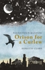
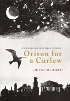
£18.99
Why do so many of us eat cereal for breakfast? Is it because we like the taste? Or because 20 millions years ago, a certain species of plant colonised the same hospitable land that humanity did? Why is the world the way it is? If we follow chains of explanation as far back as they go
- & keep asking, like a curious child, ` Why? Why? But WHY?`
- the answers become more & more amazing. We reach the point where history becomes science. In this ultimate origin story, Professor Lewis Dartnell investigates how the fabric & activity of our planet have governed our evolution, influenced civilisations over millennia, & continue to shape our lives today. Plate tectonics & ancient climate change, atmospheric circulation & ocean currents
- Origins unravels the human story by exposing vast webs of connections that stretch deep into the past, underwrite our modern world & help us face the challenges of the future.


...
Archived Product
£6.95
Topographic coverage of mainland Spain at 1:50, 000 in the MTN50 (Mapa Topográfico Nacional) series from the Centro Nacional de Información Geografica, the country’s civilian survey organization. The maps have contours at 20m intervals, enhanced by relief shading, plus colouring and/or graphics to show different types of terrain, vegetation or land use. Boundaries of national parks & other protected areas are marked. In addition to all the usual information featured on topographic mapping at this scale, detailed presentation of the road & rail networks, rural tracks & paths, etc, the maps also show campsites & mountain refuges. On more recent editions some GRs, the official long-distance hiking routes, are also marked (although not as clearly as on hiking maps from other publishers). Each map covers 29.5x 18.5 km (with adjustments in the border or coastal areas). The maps have a 1-km UTM grid, plus margin ticks for latitude & longitude at 1` intervals. Map legend is in Spanish only.HOW TO CHOOSE THE RIGHT 50K MAP: all the titles in CNIG’s 200K Provincial Road Maps series at 1:200, 000 are overprinted with the grid for the 1:50, 000 maps & can be used to see the area covered by each 50K title. TO SEE THE LIST OF TITLES IN THIS SERIES PLEASE CLICK ON THE SERIES LINK.PLEASE NOTE
- MAP TITLES: the grids shown on our website serve both the civilian & the military 1:50, 000 topographic series. Although the areas covered by maps in both series are identical (apart from some border or coastal sheets), occasionally map titles differ – only one title is shown on the grid, usually the military one. In Galicia, the Basque country & in the Catalan speaking areas the tendency now is to use local place names rather than the often better known Castilian ones. Where possible, both versions are included in our titles. Map titles listed on our website are based on information received by us at the time of publication, but sometimes maps arrive showing a completely different title! As long as the map number is as ordered, the correct map has been supplied.
...
Archived Product
£17.99
The 1:50, 000 topographic map gives a more general picture of the ground features than a basic map. It shows settlements, houses, roads, cultivated areas, waterways, cutting areas, mires, rock exposures, & relief. One map sheet covers an area of 30 x 40 km & one centimetre corresponds to 500 metres on the ground. The 1:50, 000 topographic map is also an ideal complement to nautical charts as it provides useful information about the land areas adjacent to waterways. For example, all Finnish sea areas are covered by 1:50, 000 topographic map sheets. ...
Archived Product
£150.00
There's just something about black-ocean globes. Reoplogle's 30cm (12) Orion black ocean globe, with its illuminated sphere, solid steel base, & die-cast semi-meridian, is no exception. & just as Orion blazes in the night sky, this Orion lights at the flip of a switch. ...
Archived Product
£6.99
Orion is scared of A LOT of things, but most of all he`s scared of the dark. So one night Dark decides to take Orion on an adventure. Emma Yarlett`s second picture book combines incredible illustrations & spell-binding storytelling with inventive die-cut pages that make Dark come to life in the hands of the reader! ...
Archived Product
£8.00
The Slender-billed Curlew, Numenius tenuirostris, `the slim beak of the new moon`, is one of the world`s rarest birds. It once bred in Siberia & wintered in the Mediterranean basin, passing through the wetlands & estuaries of Italy, Greece, the Balkans & Central Asia. Today the Slender-billed Curlew exists as a rumour, a ghost species surrounded by unconfirmed sightings & speculation. The only certainty is that it now stands on the brink of extinction. Birds are key environmental indicators. Their health or hardship has a message for us about the planet, & our future. What does the fate of the Slender-billed Curlew mean for us, & for the natural world? What happened to it, & why? In Orison for a Curlew Horatio Clare journeys through a fractured Europe in search of the Slender-billed Curlew, following the bird`s migratory path on an odyssey that takes us into the lives of the men & women who have fought to save the landscapes to which the bird belongs. This is a story of beauty, triumph, & the struggles of conservation. It is a homage to a bird which may never be seen again. ...
Archived Product
£5.25
Orissa in a series of locally produced administrative maps of Indian states, each with a booklet providing a guide to the area. The maps show the division of each state into districts & have more small towns & villages than on more general maps of India available from other publishers. Presentation is now considerably enhanced with the districts shown in different colours. The maps indicate each district ...
Archived Product
£12.99
Oristano Province at 1:150, 000 in a series of handy size provincial road maps from Litografia Artistica Cartografica (LAC) with more minor local roads & country tracks than can be found on most regional maps from other publishers. This title is published with the traditional style LAC cartography.LAC’s provincial series is gradually being changed to a new style of digitally derived cartography, so presentation of adjoining titles may vary. All the maps have hill shading to represent the general relief with spot heights for selected peaks, & show a few more local roads & rough tracks than the other road map series. Intermediate road distances are indicated. Regional, provincial & communal borders are marked, & railways, funiculars, airports, sea ferry links & campsites are shown. The legend is in Italian only. The new, digitally produced editions are indexed & have enhanced, more finely drawn cartography: the hill-shading is less bold, motorway service areas are marked, natural parks are highlighted & an expanded range of symbols indicates various landmarks & sites, e.g. antiquities, churches, etc. Two styles of the new cartography are produced, differing only in the colour of the predominant background shading: grey or yellow/green. Some of the new editions include geographical coordinates for the map corners. The index of localities is on the reverse. To see all the titles in this series please click on the series link. ...
Archived Product
£17.99
The 1:50, 000 topographic map gives a more general picture of the ground features than a basic map. It shows settlements, houses, roads, cultivated areas, waterways, cutting areas, mires, rock exposures, & relief. One map sheet covers an area of 30 x 40 km & one centimetre corresponds to 500 metres on the ground. The 1:50, 000 topographic map is also an ideal complement to nautical charts as it provides useful information about the land areas adjacent to waterways. For example, all Finnish sea areas are covered by 1:50, 000 topographic map sheets. ...
Archived Product
£17.99
Topographic mapping from Mexico’s national survey agency, Instituto Nacional de Estadística, Geografía e Informática. The maps have contours at 20m intervals with relief shading & indicate various types of terrain & vegetation, e.g. dense vegetation, cultivated areas, swamps, sand dunes, salt pans, etc. UTM grid is at 10km intervals, with latitude & longitude shown by margin ticks at intervals of 5`. Map legend is in Spanish only. To see the other titles in this series please click on the series link. ...
Archived Product

Orison For A Curlew

The Slender-billed curlew is one of the world`s rarest birds. A beautiful, fragile creature, it bredin Siberia and wintered in the Mediterraneanbasin, passing through the wetlands and estuariesof Italy, Greece, the Balkans and cental Asiatwice a year. Then, for mysterious reasons, thepopulation crashed. The Slender-billed curlewnow exists as rumour, hope, unconfirmedsightings and speculation. The only certainty of its story is that it now stands at the brink of extinction.Birds are key environmental indicators - their health or hardship has a message for us about theplanet, and our future. But we do not know what the fate of the Slender-billed curlew means for us, or what happened to it, or why. Orison for a Curlew is the story of a journey into that mystery. Following the
bird`s migratory path takes the award-winning writer Horatio Clare on an odyssey through a fractured Europe, to the edges of the land, and into the lives of the men and women who have fought to save and preserve the worlds to which the bird belonged.We travel with soldiers, beggars, students and green superheroes, including the father of ornithology in Greece, an extinction myth-buster in Romania, a Hungarian who invented the Danube delta biosphere reserve, and a bird watcher who drew the preservation map of Bulgaria.This is a story of beauty, triumph, mystery and struggle, and a homage to a creature that may never be seen again.
RIP - This product is no longer available on our network. It was last seen on 25.09.2019

This page now acts as a permanent archive for this product. Add more information using the comments box below to ensure it can still be found by future generations.

Use our search facility to see if it is available from an alternative contributor.
  • External links may include paid for promotion
  • Availability: Out Of Stock
  • Supplier: Stanfords
  • SKU: 9781908213334
Availability: In Stock
£12.00

Product Description

The Slender-billed curlew is one of the world`s rarest birds. A beautiful, fragile creature, it bredin Siberia & wintered in the Mediterraneanbasin, passing through the wetlands & estuariesof Italy, Greece, the Balkans & cental Asiatwice a year. Then, for mysterious reasons, thepopulation crashed. The Slender-billed curlewnow exists as rumour, hope, unconfirmedsightings & speculation. The only certainty of its story is that it now stands at the brink of extinction. Birds are key environmental indicators
- their health or hardship has a message for us about theplanet, & our future. But we do not know what the fate of the Slender-billed curlew means for us, or what happened to it, or why. Orison for a Curlew is the story of a journey into that mystery. Following the bird`s migratory path takes the award-winning writer Horatio Clare on an odyssey through a fractured Europe, to the edges of the l&, & into the lives of the men & women who have fought to save & preserve the worlds to which the bird belonged. We travel with soldiers, beggars, students & green superheroes, including the father of ornithology in Greece, an extinction myth-buster in Romania, a Hungarian who invented the Danube delta biosphere reserve, & a bird watcher who drew the preservation map of Bulgaria. This is a story of beauty, triumph, mystery & struggle, & a homage to a creature that may never be seen again.

Reviews/Comments

Add New

Intelligent Comparison

Oooops!
We couldn't find anything!
Perhaps this product's unique.... Or perhaps we are still looking for comparisons!
Click to bump this page and we'll hurry up.

Price History

Vouchers

No voucher codes found.
Do you know a voucher code for this product or supplier? Add it to Insights for others to use.

Facebook

Jargon Buster

Students - A group of humans who are still in full time education
Key - A physical or virtual device or code used for opening something
World - A physical grouping, commonly used to describe earth and everything associated with ti
Year - The time it takes the planet earth to orbit the sun. This takes around 365.25 days.
Italy - a country in Europe.
Preserve - To maintain something to its complete state
Year - 365 days (366 days in a leap year), the time taken for planet earth to make one full revolution around the sun.

Supplier Information

Stanfords
Stanfords was established in 1853 and opened their iconic Covent Garden flagship store in 1901. They have become the top retailer of maps, travel books and accessories in the UK and arguably offer the largest selection of maps and travel books worldwide. Famous names such as Captain Robert Falcon Scott, Ranulph Fiennes and Michael Palin have purchased from Stanfords. They now have a shop in Bristol and both stores together with other venues operate a calendar of events including talks, book signings and exhibitions. As a specialist map retailer, the map selection is comprehensive and includes road maps, street maps and walking maps from worldwide destinations, as well as a selection of world atlases and wall maps. Books include travel guides and travel literature. Stanfords also stock globes, from miniatures made of blue marble to magnificent floor-standing globes. The website features a selection of interesting articles on travel topics.
Page Updated: 2023-11-12 20:15:36

Community Generated Product Tags

Oh No! The productWIKI community hasn't generated any tags for this product yet!
Menu